Day 1 - 6/3/2013 - Roan Mountain to Moreland Gap Shelter (18.9 miles)
I woke up early, checked my pack again, and was anxious to hit the road. Ginny also wanted to get on the road, and since breakfast was not being served until eight, we both decided to forego it. I grabbed a little snack, took some pics, and chatted with a hiker from NY, who told me he was to be featured in an article in the Wall Street Journal. His trail name is 'Turtle'. I will need to keep an eye out for the article. If anyone reading this sees the article, please let me know, and I will try and provide a link here.
It was a good day of hiking. It had been threatening to rain, but mostly held off. There were not too many big hills, and I passed a couple of nice waterfalls, as well as a few good views. There was a group of Mennonites who began hiking shortly after me. They were packing light and moving fast, and quickly passed me. I spoke with one who told me they were on a two week hike north, and were planning twenty-four miles that day!
 |
| Mountaineer Falls |
 |
Fog Covered Mountain
These always generate a musical soundtrack in my mind! |
I took lunch at a campsite just past a gravel road, and there was a bench at a nice view spot in memory of someone - probably a former thru-hiker.
 |
| A Bench With a View |
 |
| View From the Memorial Bench |
I arrived at Moreland Gap Shelter about 4:30 p.m. and pitched my tent to the left of the shelter. About four other hikers arrived shortly after me, and I visited with two from Louisiana, who were roughly my age or maybe a little older, trail names- 'Jeff Boyardee' and 'Potlicker'. Every hiker goes by their trail name out here.
 |
| My First Campsite Outside Moreland Gap Shelter |
Day 2 - 6/4/2013 - Moreland Gap to Watauga Lake Shelter (16.3
miles)
This was to be a very interesting day of hiking, with some extreme 'ups', and extreme 'downs'. I broke camp around 8:30, and was the last one out. As I came down towards Laurel Fork, I had my first bear sighting in four years of hiking, which was very exciting. I just caught a glimpse of the back end of it about fifty yards ahead of me moving across the trail and up the hill. It startled me more than frightened, as I've come to believe that bears generally want to avoid people as much as we want to avoid them.
It was a difficult climb down to Laurel Falls - very rocky and steep. The falls were magnificent, though, by far the nicest ones I have seen on the trail, and I took a little break at the bottom.
 |
| Approaching the Rocky Section Above the Falls |
 |
| Taking a Break At Laurel Falls |
I want to caution people hiking through here that the trail is not very well marked, especially when you leave the falls area. You need to backtrack a little. The trail north then follows the river, reaching a point where it appears to stop at a sheer rock wall. Upon reaching this point, I could see no blazes, and stared around for awhile until two girls took pity on me, and showed me the way forward. The trail actually goes around a cliff at the river's edge!
 |
| Recrossing Laurel Fork After the Falls |
There is a long climb up Pond Mountain, and I was amazed to find campsites on the summit, and a spring that must've been a sort of artesian well because of the elevation. I stopped for some of this excellent cool spring water.
Coming down the opposite side of Pond mountain to Watauga Lake was nice, and I could see the lake and the dam in the distance. Once I reached the lake, I thought it would be a short hike to the shelter, but it turned out to be longer than the guide book seemed to indicate.
 |
| Descent from Pond Mountain - View of Lake Watauga |
When I arrived at the shelter, one of the thru hikers from the previous evening, 'Hickory', was already there. He was a little older than me, but was already on his fourth complete trail hike since 2009! Another older hiker from Texas, 'Small Stuff' ( as in 'don't sweat it), showed up shortly after me. I made my supper, and tried to hang my bear bag on a strange pole contraption, but it proved harder than it looked, so I decided to just bag it in a nearby tree instead.
 |
| Odd Bear Bag Pole at Watauga Lake Shelter |
After we had settled into the shelter, another young thru-hiker from NC, 'Nigel', showed up, and around 7:30, yet another one, 'Swayze' stopped by. 'Swayze' was planning to attempt a twenty four hour hike to Damascus. I thought he was a little crazed to try it, but he said he enjoyed challenging himself. I mentioned that I had done a 50K trail ultra marathon, and he seemed interested in learning about ultra running. He was also taking a cigarette break, and I frankly couldn't think of too many runners who are also smokers, but I didn't tell him that. On the other hand, I have seen many hikers who also smoke.
'Nigel' and I had a discussion about the differences between running and hiking, and why hiking seems so difficult to those of us who also enjoy and work at other sports like running. He mentioned slow twitch muscle fibers, and suddenly it made sense. The body recruits muscle fibers for particular activities according to need and training. Running generally uses more fast twitch fibers, which really don't serve the requirements of the trail as much as the slow twitch variety, so those need to be developed.
Day 3 - 6/5/2013 - Watauga Lake to Iron Mountain Shelter (14
miles)
 |
| Ready to Depart on Day 3- good look at my fully loaded pack |
This was a relatively short fourteen mile day. It was a very nice start, and a pleasant walk to the Lake Watauga dam. I took a few nice photos of the dam along the way. I knew that the next part of the hike was to be a long steep climb to the top of Iron Mountain.
 |
| The Road Across Lake Watauga Dam - Not Well Blazed |
 |
| View From the Dam Back Toward Pond Moutain |
 |
| Plaque on the Dam |
I passed 'Small Stuff' on the way up the mountain, and stopped for lunch at the Vandeventer Shelter, which was at the summit, and had a spectacular view from right behind the shelter, and view of the lake below.
 |
| View From Vandeventer Shelter |
I stopped for water at a spring in a gap, and was so thirsty I think I must've drunk an entire liter. I checked my guidebook for the remaining distance and terrain, and reached the shelter a little after 4 p.m. There was another hiker, 'Blitz', from Sarasota, Florida, there, and I pitched my tent, fearing it might be a full shelter.
While I was setting up camp, and preparing my dinner, several other hikers showed up, but they all just were stopping to rest, and were on their way to somewhere else. One group of three or four southbound men about my age stopped by, and commented on how great it was that we were all on the trail. I couldn't disagree with that. I wanted to use my wood burning
Solo Stove to cook supper, and some of the younger guys who were resting there were curious about how it worked, so I was happy to show them.
A little while later, a trail work crew showed up. Their task was to relocate part of the trail, and all were carrying seventy pound packs loaded with pick axes and other tools. They were planning to spend a couple of nights on the trail. It was interesting chatting with them. I also took time to visit with 'Blitz'. He was a retired engineer, who attended a large Episcopal church in Sarasota. He was well informed about music, and particularly knowledgeable and appreciative of church choral music. This is not something I expected to encounter, and we had a very invigorating discussion.
Day 4 - 6/6/2013 - Iron Mountain to Abingdon Gap Shelter (15.9
miles)
It had rained the previous evening, and everything was still wet when I got up. I have found that, when preparing to leave camp, the order things are done impacts how quickly and efficiently the day's hike can begin. This is really important when there is a long day ahead. I have found it preferable to start early and end early when possible. Today I packed up my tent and sleeping gear first, and concluded my packing order with breakfast. I didn't go for water until I was ready to leave for good.
I said farewell to 'Blitz' and took off. It was fairly smooth hiking in the beginning - no big hills. I passed the monument and gravesite of 'Uncle' Nick Grindstaff. It was a gravestone embedded in the remains of the chimney of a house in which he had lived the life of a hermit. The sad epitaph on the gravestone read, "He lived alone, he suffered alone, he died alone." There was a bench in front of the marker, so I sat down and said a little prayer.
 |
| Monument and Gravesite of 'Uncle Nick Grindstaff' |
The trail passes through some low, swampy ground before coming to a highway and an entry point to a small section of trail that is handicap accessible. 'Blitz', who was southbound, had told me about it, so it was something I was looking forward to. This accessible portion of trail passed through a farmer's field, and I encountered the farmer calling out to his livestock, who were visible in a hollow far below down. There were some very nice views from this spot.
 |
| Little Bridges Over Swampy Sections of Trail |
 |
| Gate Into Handicap Accessible Trail |
 |
| Smooth Going! |
 |
| Nice View from the Farm and Livestock in the Distance |
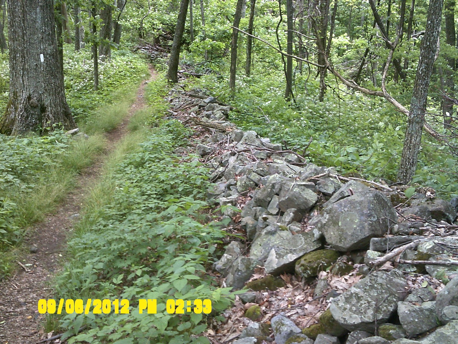
The trail reentered the forest and I startled some sort of big dark bird - maybe a wild turkey - which ran or flew a complete 360 degree circle around me before flying off. I passed through some nice sections of trail including a portion of an ancient stone wall probably constructed by the earliest settlers. I knew it was inevitable, but it began to rain, and before long my feet were wet. The expensive waterproofing of my boots didn't last long. I stopped for lunch at Double Spring Shelter.
 |
| Beautiful Flowering Tree |
 |
| Clear View of the Misty Path Ahead |
 |
| Section of Stone Wall Along the Trail |
Today was unusual in that I encountered few other hikers. So far, I had run into many late starting thru hikers, but I think they were rushing to get to Damascus, the next trail town. I arrived at Abingdon Gap Shelter, my destination for the day, and found I was the only one there. I cleaned up, had dinner of leftover Mountain House spaghetti and delicious Swiss Miss Dark Chocolate Sensations (pure nectar!). I was proud of being able to rig a bear bag and clothesline together, as my stuff needed to dry out. Tomorrow is a short ten miles to Damascus and a 'hostel environment'. :-)
 |
| Combo Bear Bag/Clothes Line |
Day 5 - 6/7/2013 - Abingdon Gap to Damascus, VA -Dave's Place hostel (10.4 miles)
This was a less difficult day - I never want to say 'easy', because there doesn't seem to be such a thing on the trail. It was a short ten miles, and mostly downhill to Damascus. Of course, my mind was on a possible hot shower and non-trail food, which helped me push the pace just a bit. My plan was to stay in a hiker hostel, and there are several to choose from in Damascus, which is also an official 'trail town'. I hadn't called ahead to reserve hostel space, which made me a little nervous, but I decided to chance it since I knew I would probably be getting into town early.
It started out a little misty, but it wasn't raining, which was a blessing. Along the way, I also crossed over the Tennessee/Virginia state line. Another state down felt great, and Virginia is the longest one of all, but it felt good to be back on native soil, so to speak, since I still consider Roanoke to be my home town.
 |
| Misty Path Up the Trail in the Morning |
 |
| Trail Crossing into Virginia |
I arrived in Damascus about noon. The identity of Damascus is closely linked to the trail, and the town hosts the annual 'Trail Days' in May, which is a kind of reunion for long distance hikers.
I checked into Dave's Place hiker hostel at the Mount Rogers Outfitters which is right across the street. I was lucky they still had two rooms available, and I was able to claim one of them...yea!!
 |
| Sign over the Trail into Damascus |
 |
| 'Dave's Place' - Right Across from Mt. Rogers Outfitters |
After taking a shower, I gathered my laundry and walked down the street to the laundromat. I did laundry, ate a fried chicken dinner at Cowboys Cafe/Exxon station across the street, and bought some supplies and fuel at the outfitters. My boots were soaked, so I laid them by the fan in my room to dry out overnight, and sprayed them thoroughly with waterproofing. There is absolutely NOTHING worse than hiking in wet boots. Later, I walked down to the Subway, and ate another huge meal trying to get my calories back up. I ran into 'Hickory', who I had met earlier on the trail.
Day 6 - 6/8/2013 - Damascus, VA to Lost Mountain Shelter (15.6 miles)
I woke up at 6 a.m., as my biological clock seems to do every day, and walked down to Cowboys for breakfast. I had the 'Hiker's Special' - 2 eggs, sausage, biscuits w/ gravy, and coffee - yum! I've noticed when I come off the trail, my body seems to crave foods I might not normally eat. The general enjoyment of eating definitely seems to be heightened.
 |
| Cowboys in Damascus - I had the 'Hiker's Special' Breakfast |
After packing up, and checking out, I hit the trail north. Part of the trail follows the Virginia Creeper Trail, which is a rails to trails project most popular as a bicycle route, because it is almost all downhill. On the first big climb, 'Hickory' caught up to me, and we hiked together for a while. I stopped for a water break, and he kept going. That was the last I saw of him, as he was a very fast thru hiker.
 |
| Part of the Virginia Creeper Trail |
 |
| Up..up... and Away! Love the Flowers, too! |
I stopped for lunch at Saunder's Shelter, a really clean and beautiful little shelter not far off the trail. I can definitely see the difference between Virginia and Tennessee. Right before reaching the shelter, I encountered a person who looked like a ranger, or just someone who loved hiking. I think he might've been cleaning up around the shelter. This particular shelter also has a privy, and none of the ones in Tennessee do, so it was a step up.
 |
| The privy behind Saunder's Shelter - Definitely an Improvement. |
 |
| Saunder's Shelter For Lunch |
A young southbound section hiker showed up, and we visited a little. He was much like me in feeling the need for time alone on the trail to refresh and recharge. We both felt fortunate to have families that are understanding about this. He said is wife is always glad to have a new and improved husband when he comes home after a hike. As we were sitting there chatting, we spotted a large black snake climbing into a tree next to the shelter, and that is not something you see every day!
 |
| We Spotted a Black Snake Climbing a Tree |
The trail north rejoins the Virginia Creeper trail at one point. I felt a little like a salmon swimming upstream against a wave of crazy tourist bicyclists screaming down the hill at breakneck speeds in the opposite direction. Many of them paid little or no attention to possible pedestrian hikers and needed to swerve to avoid me. Fortunately this section is not long, and I was very glad to get off it, but there was a nice long bridge across a scenic river.
 |
| The Luther Hassinger Memorial Bridge on the Virginia Creeper Trail |
I reached the Lost Mountain Shelter shortly after 4 p.m.. There was no one there, so I decided to stay in the shelter, and made a dinner of Mountain House Chili Mac with my
solo stove. I thought I might be alone, but a young guy and two girls showed up at 6:30, and by 7:30 there were ten or twelve other people in and around the shelter. These were the thru-hikers who had stopped in Damacus for two days, and had brought their mobile fraternity party to this shelter. I really wished I had decided to pitch my tent. I tried to curl up, ignore, and sleep through it, which was hard, but things finally settled down around 11:30.
Day 7 - 6/9/2013 - Lost Mountain to Thomas Knob Shelter (12.2
miles)
I woke up early to get a quick start and try to stay ahead of the party. Most everyone was still sound asleep. Each day is getting a little faster, and I was able to leave around 7:45 for a relatively short, but rigorous day of hiking.
 |
| Through an Old Orchard |
I took a break at a nice peak called, 'Buzzard's Knob', and got cell service, so I placed a call to Ginny. She was just getting ready for church. I had forgotten it was Sunday, but I thought it couldn't be much more inspiring than this place. There were some fantastic views. This was all part of the Mount Rogers National Recreation Area, with Mount Rogers still to come.
 |
| Looking North From Buzzard's Knob |
 |
| View From the Knob |
 |
| Another View |
 |
| One More View |
I hiked on through the Lewis Fork Wilderness, and came to a highway where I saw a girl hiker outside the public restroom cleaning her feet. She did not look too happy, and I felt a little sorry for her. After crossing the road, I passed through a fence and up to the top of a grassy knob, where I sat to have lunch. The next stretch was the approach to Mount Rogers, the highest point in Virginia.
 |
| The Approach to Mt. Rogers |
I had been remembering a hike I had taken with a group from my church when I was sixteen. We had started in Marion, VA, and had intended to finish in Damascus, but ended up concluding the hike at Mount Rogers instead. On the approach I passed the girl I had seen at the road and a male companion she was hiking with. I also decided to take a side trail down to a really nice piped spring. If I can find one, I always prefer a spring to a stream as a place to get water.
 |
| Piped Spring Below Mt. Rogers |
It was still early in the day when I came to the side trail to the summit of Mt. Rogers. It was only half a mile to the top, so I decided to take it. I reached the summit, which was marked by a survey marker. It was wooded, so no views unfortunately. :-( There was a family of day hikers up there, and they asked me to snap their picture, which I gladly did.
 |
| Blue Blazed Side Trail to Mt. Rogers (Peak in the Distance) |
When I descended from Mt. Rogers, I could see my shelter destination visible across the gap. The Thomas Knob shelter was a double decker one, and had a completely enclosed loft, which I had never seen before. The young couple I had passed earlier were already there, so I put my stuff in the loft. I conversed with the girl, and found that she was from Charleston, and had graduated from Winthrop. Her boyfriend had always wanted to hike the trail, so they were attempting a thru-hike together. They had been hiking since April. She hadn't really hiked before, and I could tell she was no longer thrilled about it.
 |
| Returning From the Summit of Mt. Rogers |
 |
| Thomas Knob Shelter - Fully Enclosed Loft Area (Nice!!) |
A few thru-hikers showed up, but they were moving on to the next shelter. It looked like a big storm was blowing in. I was grateful to be in the fully enclosed loft as the rain came down hard, and the wind was howling all night.
Day 8 - 6/10/2013 - Thomas Knob to Old Orchard Shelter (11 miles)
I decided to sleep in a little since this was going to be a shorter day, plus it was relatively cozy up in the loft. The day started out very windy and rainy, with lots of fog as I crossed Rhododendron Gap. This is a spot I recalled from that memorable hike of my youth. It looked like something out of the west, with many rugged and rocky places throughout this section.
 |
| Rocky Outcroppings Near Rhododendron Gap |
 |
| Foggy and Rainy Day |
I entered into the Grayson Highlands State Park, and took a break on a nice high spot around 10:30. At 11:45, I reached the Wise Shelter for lunch. This was a significant stop as it is exactly 500 miles from Springer Mountain - a real milestone on my overall hike!
 |
| In the Grayson Highlands State Park |
 |
| View From My Lunch Spot in the Grayson Highlands SP |
I kept on hiking over some varied terrain - pretty streams and bridges, a few waterfalls, and pastureland. On the way up one hill, I passed a mother who was hiking with her two daughters. I didn't take time to talk, but this was the first of four times I would pass this little group before the last day of my hike.
 |
| Stream Crossing and Footbridge |
I crossed one pasture with some grazing ponies, one of whom nudged my pack. I think he might've thought I had some food, but no such luck. At the bottom of the hill beyond this pasture, I came to a coral, parking lot, and scale where livestock are weighed.
 |
| Entering the Pastureland an Grazing Ponies |
On the climb up Pine Mountain, I passed a guy taking a break on the trail. I reached the summit of Pine Mountain, with an elevation of 5000 feet, and sat down for a brief respite myself. It was a long downhill to Old Orchard Shelter, but I was glad to arrive. The guy I had passed on the trail arrived shortly after me, and we conversed a little while, before he took off for the next shelter. He had been laid off from his job as a computer graphic designer for an architectural firm, and decided to thru-hike the trail. This is a story I've heard more than once. Shortly after he departed, a young couple - 'Salamander' and 'Poptart' - showed up. I had met them earlier, but they also took off. Before they left, they bestowed me with another hiker anagram. A northbound thru-hiker is a 'NOBO', a southbound thru-hiker is a 'SOBO'. I found out I am what is known as a 'LASHER' - '
Long
A**
Section
Hik
er'. I like that since I really do go further than most AT section hikers.
I decided to settle into the shelter, and made a supper of loaded potatoes and tuna. The mother and two daughters I had passed earlier arrived at the shelter. I found out they were from Nashville, TN, and we discussed our common connections. They had started at Damascus, and were planning to hike the entire state of Virginia. Then the male portion of the thru-hiking couple I had met yesterday arrived. They had decided that they would hike at their own speed, so he went fast, while she was going slow. His female partner was still up the mountain somewhere. It was suggested that he might want to go up and help her with her pack, but he was not inclined to do that. I offered that if he started a fire, "she would love him", so he did that.
It was a full shelter now, and when several other folks arrived, they needed to pitch their tents. It was also starting to rain steadily.
 |
| A Full Old Orchard Shelter |
Day 9 - 6/11/2013 - Old Orchard to Trimpi Shelter (14.1 miles)
I packed up very efficiently, having decided that cold oatmeal was just as good as the hot variety, which meant I could save time not having to heat up water for breakfast. I was able to hit the trail right at 7:30 a.m.
This day was a sort of nostalgic flashback for me, as I was hiking a section of trail I had done with the church group years before. On that particular hike, I was trailblazing with a couple of others ahead of the main group, and took a wrong turn at an unmarked cross trail. I ended up at the wrong shelter, which was two miles off the main trail. At sixteen years of age, I was the eldest of several hikers who were with me. By the time we discovered our mistake, we were not able to catch up to the main group before darkness, and ended up spending an anxious, rainy night under our ponchos
in the middle of the trail. The next morning we started out early, and found the rest of our group just getting up and having breakfast at the Old Orchard Shelter - just where I stayed last evening. I decided I would try to look for the spots where these events may have occured.
 |
| Somewhere Along Here is Where I May Have Spent the Night on the Trail as a Teenager |
 |
I think this is where I made the wrong turn years ago
(Unfortunately, this sign was not here in 1972) |
The hiking was relatively easy and uneventful. The rain had cleared, and as I came down the path, I crossed paths with the same AT club member/caretaker I had encountered several days earlier near Damascus. I mentioned where I was headed, and he told me to look for some nice campsites beyond the privy at Trimpi Shelter. He also said the weather forecast was dry and hot for the next several days.
I arrived at the shelter very early around 2:30, which was really early, and I did find a nice secluded campsite beyond the privy to pitch my tent. The tent was still a little wet from the rain before, so I fully opened the fly, and tried to dry it out with my camp towel.
 |
| The Trimpi Shelter |
 |
| Airing Out my Things at My Hidden Campsite Beyond the Privy |
I used my
solo stove to boil water, and had a GREAT meal of
Mountain Chili by AlpineAire Foods . It was the best tasting freeze dried trail food I had eaten. I need to try more of their stuff. I heard some noisy people turn up at the shelter, and I was very glad I had decided to pitch my tent. Since the weather was also dry, I could hang my things up to air out and dry without worry.
Day 10 - 6/12/2013 - Trimpi Shelter to Chatfield Shelter (17.7 miles)
I packed up and left my camp behind the privy, surprising the guys up in the shelter, who had no idea I had been camping back there. I hiked through a cow pasture, and passed a few cows who were kind enough to move for me. Beyond the cow pasture, there was a little portable gazebo, cooler, chest, and chairs set up. This must've been an example of 'trail magic' - random acts of kindness intended for hikers left by people and/or groups who live along the trail. I wish I would have stopped to enjoy it, but I kept on going.
It was a long climb following the little stand, and I reached the Partnership Shelter about 12:30. This shelter was almost like a little cabin, completely self-contained. There were people in the shelter, who I found out later, might've actually been living there, so I proceeded to the Mt. Rogers NRA Visitors Center a short distance further.
I was surprised to see the mother and two daughters I had met earlier in front of the center. I said they must've flown to get past me without me seeing them, but they had actually hitched a ride, and were waiting for a shuttle into Marion. I decided to sit down for lunch, and drank a couple of Mt. Dews out of a machine in the center. All I had left for lunch was a single packet of tuna salad, but the mom was kind to offer me a tortilla and a pack of mayo, which made it a little more palatable. There were a bunch of guys also there waiting for a pizza.
I called ahead to the Relax Inn in Atkins to reserve a room for the day after tomorrow, and headed on to the Chatfield Shelter, my next destination. It was a good climb up the next hill, and my legs were starting to feel a bit sore. I saw a deer at the top of one mountain, who obviously had no fear of humans. It didn't move at all. I guess it must never be deer season in this part of the forest.
 |
| There is a Bold Deer in This Photo |
 |
| Just an Interesting Twisted Tree |
Glade Mountain was the last big climb of the day, and it had a long flat area along the top. I passed a few hikers, and reached Chatfield Shelter about 4:30 p.m. Two guys showed up, and then three more. They had been hiking together. They were all twenty something, mostly male, and called themselves, 'The Fellowship'. They were signing the registers as a group. Later, 'Nigel' and 'Swayze' arrived. They always seemed to be behind me and then ahead of me. I had some good conversation with a few of the guys. It was a full shelter that evening, and not too many places to camp around the perimeter. The next day was a very short hike to Atkins. 'The Fellowship' was planning to get up early to go into Atkins for breakfast at The Barn Restaurant. I was just looking forward to my second 'Nero' day of the hike.
 |
| From Glade Mountain |
 |
| The Chatfield Shelter |
Day 11 - 6/13/2013 - Chatfield to Atkins, VA -Relax Inn (4.5
miles)
Today is to be my second Nero (Near Zero) day of my hike - just a short four miles to Atkins, and an evening in the Relax Inn Motel, right next to I-81. After five days on the trail, I am looking forward to a shower, laundry, food, and a little resupply. The 'Fellowship' got up early to pack and get to Atkins in time for breakfast at The Barn. Since I was not in a big hurry, I took my time. Besides, I couldn't check into the motel until after 11 a.m. anyway.
It was an easy hike to Atkins. On the way, I passed by the Davis' Farm, an 1890's settlers historic site, also an historic one room schoolhouse that was open to hikers. I stopped in to look around. All this was part of the
Settlers Museum of Southwest Virginia.
 |
| The Trail Passes the Lindamood School - an early settlers one room schoolhouse |
 |
| Inside the Lindamood School |
 |
| Rules for Teachers in 1872 |
After looking around the old schoolhouse, I passed through what appeared to be an old abandoned apple orchard and/or fruit farm, with many varieties of fruit trees. It is too bad that it is early in the year for any ripened fruit. I could hear the traffic from the interstate highway in the distance long before I finally caught my first glimpse of it.
The trail comes out almost directly in front of the motel, which had obviously been there since before the interstate was constructed. It was a very nostalgic looking 1950ish style motel that had once been called, "The Village", which had had a restaurant in front of it (long gone), and also a covered pedestrian bridge (closed) over a small creek. This bridge had once been adorned with the word, 'WELCOME' in big letters on the roof, but now only bore the 'W', 'M', and 'E'.
 |
| The Aptly Named, 'Relax Inn' |
The Relax Inn is not the most elegant of places, but a VAST improvement over trail shelters and hiker hostels. I checked in, soaked in the bath, and did laundry. After awhile, I walked over to the Barn Restaurant and ordered chicken breast smothered in mushroom gravy, with green beans and pintos - mmm....:-) While I was in the restaurant enjoying good home cooking and guzzling sweet tea, a huge storm blew through, and I was grateful not to be on the trail. After lunch, I did a little resupply at a nearby truck stop.
 |
| The Barn Restaurant - Home of 'The Hiker Burger' |
Five hours later, I was starving again, so I returned to the Barn for dinner and ordered The Hiker Burger, a veritable mountain of ground beef - two half pound patties between buns. On top of that, I ordered it 'all the way', with tater tots on the side. I don't think I have ever eaten anything bigger at one sitting in my entire life. I don't know how, but I managed to eat it all, and felt terribly guilty for doing so.
While I waited on my meal of half a ground cow, I passed the time studying the behavior of a group of other cows lying on the hillside across the highway. As I pondered what goes through a cow's mind, one of them in the center suddenly stood up. I thought, great...we will now see if this cow is truly a leader among cows. After several minutes of being the only cow standing, it turned around, took a few nibbles of grass, and laid down again. None of the other cows reacted at all to this astounding display of independence! At this moment, I remembered a music critic once describing
Ralph Vaughan Williams Symp. no. 3 (Pastoral) as "like a cow looking over a fence", and the meaning suddenly became crystal clear.
 |
| ...and That Ain't no Bull!! |
Day 12 - 6/14/2013 - Atkins, VA to Selected Campsite (14.4 miles)
In spite of being in a comfy motel bed, I did not sleep very well - not certain why. Perhaps it was the 'Hiker Burger' trying to make its way through my digestive system. I decided that, after feasting on a good portion of a cow at The Barn, I really did not need to return there for breakfast, so I stayed in my room and ate my customary oatmeal. I returned to the store for a couple items, and also drank a quart of Fuze Green Tea, which I thought should keep me hydrated. I headed out at about 8 a.m..
 |
| Proceeding Under I-81 Overpass at Atkins |
It was a beautiful, sunny day as I started out and followed the trail under the I-81 overpass. I hiked through some nice farmland, and past more cows. It was fairly flat to begin with, but got to some nice hills later on in the day.
 |
| Trail Heading Through Pasture Land |
 |
| Cows and Calfs on the Trail |
I decided, as I was going along, that since this was a short hike to Knot Maul Shelter, I would try to look for a campsite beyond the shelter. My guidebook indicated a campsite and water source in a gap about a mile beyond the shelter, and I thought that was a good goal. Besides, I was really not comfortable with full shelters and crowded, noisy campsites, which I had already encountered several times. I would be happy to find someplace a little more secluded and quiet.
After crossing Big Walker Mountain, I encountered the mother and two daughters resting on the hill again. Their trail names were, 'Navigator' (the elder daughter who was good with directions), 'Robe' (the younger daughter actually known as 'Socks' at this point), and 'Moma Bear' (dubbed by her daughters). I took a short break to visit, and told them of my intent to camp beyond the shelter, and they indicated that they may do that as well. This was the third time I had passed them!
 |
| Trail Easement through Private Pastureland |
As I headed down the mountain, I encountered and greeted a slow moving couple from Colorado. I passed through more fences and pasture land, and encountered two good examples of 'trail magic' - an unopened bag of tropical trail mix hanging on a gate, which I decided to take since I wasn't carrying any snacks; and later- a cooler of soda and oatmeal creme cookies left by two former thru-hikers. I was glad to sit down and enjoy these, since there was one more mountain ahead of me before the shelter. In the cooler, there was also a register, in which I expressed my appreciation to these 'trail angels' for their magical gifts to fellow hikers.
 |
| 'Trail Magic' Cooler Containing Soda and Oatmeal Creme Cookies |
I arrived at the shelter about 2:30, and stopped briefly to visit with a man, 'Slowpoke', who was staying in the shelter an extra day because of a sore knee. I headed down beyond the shelter, and came to a gap next to a stream and a campsite. I pitched my tent, cooked my dinner, made a cozy campfire, hung my bear bag, and finally retreated to my tent to read my book, and await blissful sleep.
 |
| My Tent In a Quiet and Secluded Campsite along the Trail |
 |
| My Own Personal Little Campfire |
Day 13 - 6/15/2013 - Campsite to Jenkins Shelter (18.6 miles)
It was a rather cold night in the tent, so I slept in my rain jacket to keep warm, and actually slept better than I have at any time on the hike so far. I awoke at 6:20, packed, ate breakfast, and left around 8 a.m. This was to be my last long day of about nineteen miles to Jenkins Shelter.
It was uphill to start, but I was energetic early on, as I am almost every morning on the trail. It's the afternoons that seem the longest and most difficult. After an initial up and down, there was a long climb to the top of Chestnut Knob, where I hoped to stop for lunch.
 |
| Opening Atop Chestnut Ridge |
It was open at the top, and I came to a nice spring on the southern end of the ridge. The spring emptied into a small pond, and I stopped to pump some water at the source, as this kind of spring is always the best.
 |
| Pond and Spring On Chestnut Knob |
 |
| Wildflowers Along the Ridge Top |
The ridge atop Chestnut Knob rises gradually, and the Shelter is located at the northern end. It was a great shelter, fully enclosed with a door. I wished that I had planned to stay in it, but at least I could stop for lunch. There was another hiker, 'Runaway', in the shelter doing the same thing, and I visited with him for a time. He was a young thru-hiker, who had dropped off the trail for a while because of family issues, but was now back and trying to make up for lost time. He wondered how I hiked so fast, not hiking all the time. I mentioned my running/workout routines, how different I found them from hiking, but how I thought they must be helping me. He was not a runner, but sounded interested in taking it up after his hike, so I was happy to encourage him and give him some pointers.
 |
| The Fully Enclosed Chestnut Knob Shelter |
I checked my guidebook, and left the shelter about 12:30, expecting an easy ten mile hike to Jenkins Shelter, but it turned out to be anything BUT easy. Much of the trail north of here follows a rocky ridge, which was very difficult to negotiate, concluding with a steep downhill. To top it off, water sources through this section are scarce, and it was bone dry.
 |
| View From the Northern End of Chestnut Knob |
I arrived at the shelter after 5 p.m. It appeared that there were already a bunch of people (all unfamiliar) camped in it, so I pitched my tent on a bad angle behind the shelter, not the happiest camper.
Day 14 - 6/16/2013 - Jenkins to Helvey's Mill Shelter (14 miles)
Today is a fourteen mile hike to the next shelter. I got up at 6 a.m., and broke camp at 7:15 - my earliest start yet! I decided that I needed a break from my tent, and would try to arrive sooner at the shelter to be assured of getting space in the shelter.
 |
| A Picture of an Unusual Red Flower |
I had a good climb to start the day, but the trail throughout this section was really in GREAT shape. I found out that the
Piedmont Appalachian Trail Hikers (PATH) maintain this section of AT- thanks and bravo to them!! The hiking went relatively smooth - a big contrast from yesterday. I encountered 'Runaway' several times on the trail. He usually stayed ahead of me, but I caught him when he stopped to rest. The second time I encountered him, he was making a call on the trail, and mentioned having excellent cell service there. He was placing a call to his dad for Father's Day. I had almost forgotten what day it was, so I decided to have lunch and placed a call to my dad and daughter.
 |
| Approaching the I-77 Crossing at Bland-Bastian |
After that, I came very quickly to the trail crossing of I-77 at the Bland-Bastian, VA interchange. The trail was a little confused after crossing the interstate, but I encountered another thru-hiker, 'Hummingbird', who had taken a zero day at the hostel near there, and we managed to find it together. I stopped at a stream near there for water. It was definitely not the best tasting water I have had, but I have been making a habit of loading up on water somewhere close to my next campsite, so I don't need to get any before leaving the next day. This seems to make things run a little more efficiently and less hectic.
I reached the shelter at about 1:30, which is the earliest I have ever gotten into camp. I thought briefly about maybe going on, but the next shelter was ten miles, and I didn't feel like going farther. The shelter was 1/4 mile off the trail, and maybe not the most trafficked since it was relatively close to the interstate. An usual feature was the nearly open moldering privy. It had a little wooden fence which didn't surround the entire thing. I set up in the shelter, cooked supper, and hung my bear bag. I am thinking, since I should be well rested, of taking an extra long day (twenty four miles) tomorrow, which will cut a day off the end of my hike.
 |
| The Helvey's Mill Shelter |
No one showed up at the shelter, except a couple of local yokels with a little yappy dog. I think they were surprised to see me there, and were just looking to take a cigarette break. I saw many butts scattered around the perimeter, and they took off as quickly as they showed up. Towards evening, a young couple came and camped outside the shelter, and after that another hiker showed up in the shelter. I was intending an early start the next day, and was already curled up in my sleep gear, so I did not visit with him.
Day 15 - 6/17/2013 - Helvey's Mill Shelter to Wapiti Shelter (24 miles)
I decided to combine two of my originally planned days into an extra long day today, since I was feeling good, and had a very short day yesterday. I woke up early, and got ready quickly. There was another guy in the shelter, but he didn't budge as I made preparations to leave. It was a long climb down the hill to get water. Beware future hikers - this is a good reason to try to get to camp topped off with water. Water sources at the shelters can often be some distance away.
I hit the trail at 7:30 a.m., and the trail headed east at first, so I was going into the sunrise. I made good time initially, and stopped for lunch at the Jenny Knob Shelter. I called ahead to the Woods Hole Hostel to let them know I was coming. I also made reservations for dinner at the hostel, which sounded very good. I tried to call the motel in Pearisburg as well, but the service was intermittent.
 |
| Rays of Morning Sunlight as the Trail turns Eastward for aTime |
Hiking on, I stopped for water at a stream a short way down the trail, and continued across a road. After the road crossing, there was a huge climb, which flattened out at the top, and then a long descent on the other side. I stopped at Kimberling Creek about 2 p.m. just before a trail suspension bridge crosses over it.
 |
| Poweline and View on the Climb Up |
I was expecting Dismal Falls to be not too far, and I had heard it was something not to be missed. After another forty minutes of uphill hiking, I finally arrived at the cutoff trail to the falls. Despite the long day, I decided to check out the falls. I encountered a bunch of people coming from the falls, at least one of whom smelled like a vat of whiskey. When I got to the falls, I saw a few of the hikers I had been running into along the way, including 'Salamander' and 'Poptart'; and 'Moma Bear' and her two cubs - 'Navigator' and 'Robe'. They'd been skipping across Virginia so fast, it seemed like they might finish the entire state in a week! They were thinking that they might get to the Wapiti Shelter as well. As to the falls...well... IMO they did not live up to expectations- definitely overhyped.
I continued on, and even though the trail from the falls was fairly flat, the soles of my feet were starting to hurt. This was a new pain that I figured was due to the extra long distance this day. It was only about five miles to the shelter, but it seemed much longer. It was also hotter than it had been, so I stopped twice for water. I passed three young guys I had seen coming from the falls, including a particularly obnoxious (obviously drunk) one, who was using foul language, and followed close behind me singing at the top of his lungs. I hiked faster, hoping to lose him, or maybe wishing that an equally annoyed bear might show up. For a time he seemed determined to keep up with me, but finally slowed down, probably realizing that his friends were way behind him. This is exactly the kind of thing I don't understand, and REALLY do not want to be around when I am hiking. If someone wants to be a drunk and wild party animal, there are plenty of places to join in with like-minded people. Why does this need to come to one of the few remaining peaceful places on earth?!
I finally reached the shelter about 5:15. There were two guys already in the shelter, so I found a nice tent site and a fire ring some distance in front of the shelter. I pitched my tent, cleaned up from head to toe, and ate an entire Mountain House Lasagna dinner. I noticed a little while later that 'Moma Bear' and her little brood had arrived and were scouting places to put up their hammocks. I invited them to explore the options near my campsite, and away from any possible commotion at the shelter. They were also planning to go to
Woods Hole Hostel the next day. I told them that there might be a big group there, and it was first come, first serve in the bunkhouse. There are also private rooms available in the house itself.
I built a little campfire and visited with 'Moma Bear'. I then helped them hang their bear bag, and sat down to wait for the fire to die down before I retired. While the fire was dying away, I visited with 'Robe', and we joked about staying up way past my bedtime. It was only 9:30, but any time past dusk is bedtime when hiking - usually 8:30!
Day 16 - 6/18/2013 - Wapiti Shelter to Woods Hole Hostel (7.2 miles)
I got up at 6, packed up my tent and sleeping gear and ate breakfast. It was starting to drizzle, and l was happy to get my tent down before the rain came. I left the shelter before 8, and shortly afterwards it really started raining hard.
My water was completely gone, so I stopped for water at the 2nd stream crossing. I knew there was a big hill ahead, with few choices after that. It was a long climb (of course). The guidebook indicated an observation/lookout tower at the top, but I never saw the cutoff. Besides, the weather was such that there would have been nothing to see anyway.
I crossed the top and came down through some wet and treacherous rocky areas. I crossed a gravel mountain road, and the guide showed the Woods Hole Hostel further on, on the next gravel road to the right. The left side of the trail was very muddy. It gave way at one point, and I slipped down the side of the mountain. I had a hard time climbing back up, and got rather more wet and muddy.
I finally reached the 2nd gravel road, and saw another hiker, 'Seeker', heading to the same place, so we hiked together the half mile down to the hostel. We arrived at the hostel about 11:30 a.m., and I saw 'Nigel' heading out, with another larger group at the bunkhouse waiting for a shuttle into town. The proprietor, Neville, was away, so I put my stuff in the loft of the bunkhouse, and awaited her return. When she returned, I checked in, gave her my laundry, and arranged to do communal dinner at the house that evening and breakfast the next morning.
 |
| The Bunkhouse At Woods Hole Hostel |
As I was waiting for my laundry to dry, I sat down on the front porch of the house, and visited with 'Seeker'. He was a retired college biology professor from Florida - a very interesting and well-traveled guy. 'Robe' arrived at the shelter at about noon, and said that 'Moma Bear' and Navigator' were still on the trail. They finally arrived about 2 p.m., and claimed one of the rooms in the house.
 |
| The Woods Hole Hostel - A Renovated 1880s Cabin |
After I collected my clean laundry, it was great to change into some dry clothes. This hostel is a neat place, many animals roaming around the grounds - a dog who liked to play fetch, several cats, chickens, ducks, and goats - plus an organic garden.
Everything that is prepared and eaten is organic and/or locally produced. Dinner in the house is communal, and they ask help with the preparation and cleanup. It was a GREAT dinner. As a pre-meal blessing, everyone joins hands, and says one thing they are thankful for, which is really neat. The food was plentiful and healthy - salad, with three homemade dressings, and a tasty soup of beans and vegetables. For desert, we were offered Amish ice cream in cones. We all helped with the cleanup. When Neville found out I was planning to hike to Pearisburg in the morning, and stay in the motel, she tried to convince me to move to a room in the house, and have Ginny meet me there. It was very tempting, especially after I heard disconcerting stories about the motel I was thinking of staying in.
 |
| The Organic Garden At the Hostel |
After dinner, Neville invited anyone who wanted to join her in thirty minutes of meditation. I asked her if it was like a prayer, and since I do that all the time, I wanted to try it. No one else wanted to do it, but I am always interested in new experiences. It was an interesting experience - thirty minutes of focused silence - just staying in the moment, and focussing on the breath. I thought it was good practice for when I am doing my yoga exercises, plus I like peace and quiet whenever and wherever I can find it. The thirty minutes went by in a flash, and I felt a sense of peaceful calm as I headed to the bunkhouse. I ended up sleeping better too!
Day 17 - 6/19/2013 - Woods Hole to Pearisburg, VA Plaza motel (10.4 miles)
LAST DAY!! It was a great stay at Woods Hole Hostel - definitely one of the best off trail places I've stayed in four years of hiking, and a must for any hikers hiking through this area. Neville and Michael are great hosts, and it is such a peaceful and familial place to be. I had breakfast in the house with Neville and three other hikers. Coffee was brewed early, and a bell rang about 7 a.m. to announce that the coffee was ready.
As I awaited breakfast, I sat in the parlor, and looked through a photo book about hiking the AT by Ben Benvie called, "Tell Mom Not To Worry"
. Of all the books I have seen, this one really seems to tell the story of it is really like being on the trail for a time. You can watch a short video and order a copy at this link,
Ben Benvie Trail Photo Book Project . I also scanned a book on the history of Woods Hole Hostel - interesting reading. Neville's grandparents found and renovated the cabin in the '40s, and began running it as a hiker hostel in the '80s. Neville took it on after her grandmother's death, with the help of Michael, a former thru-hiker with a common vision whom she met and married.
Breakfast was wonderful - two eggs, sausage, crepes with homemade peach and strawberry toppings, yogurt and OJ. After helping clean up, I paid my bill, packed up my stuff, and said goodbye to 'Moma Bear', 'Navigator', and 'Robe'. 'Seeker' had departed earlier, but returned saying his wallet was missing. He was shuttling into town instead of hiking.
 |
| A Large Moth Lying on the Road |
I headed up the trail with good energy. I saw a huge and colorful green moth laying on the road. I think it was dead, but it was interesting to see. It was a fairly easy hike to Pearisburg. The climb was gradual, and the trail mostly smooth. I passed by Doc's Knob Shelter, and two other hikers I had seen at Helvey's Mill Shelter a few days before. There was a long, broad ridge at the top of the climb, and I passed some power lines, with a good views to the east and west.
 |
| View From the Power line Crossing the Ridge |
Further up the ridge, I came to another nice view point to the east, and called The Plaza Motel to reserve a room for this evening. I had just heard a bad report about the other motel I had intended to stay in - The Holiday - that a hiker had died there just the week before of a drug overdose. I am really not very choosy about where I stay off the trail, but this time I had second thoughts. The Plaza is right next door to the other, so I called Ginny to notify her of the change in plans.
 |
| View to the East from the Ridge |
 |
| Another Great View |
I kept on to yet another view spot - Angel View Rock. From there I could see the town of Pearisburg, and the New River valley down below. It was a long and sometimes steep climb down the mountain. I finally came to Cross Road (the 1st road), and should've turned there, but kept going down to Lane Street, where the trail enters right behind two residences. I took a right turn to Main Street, and walked up the hill to the motel. I checked into room 12 - not bad - nothing fancy, but clean.
 |
| So Many Interesting and Unusual Flowers on the Trail |
 |
| Pearisburg and the New River from 'Angel View Rock' |
I took a bath which felt great. I saw 'Seeker' downstairs, and visited with him briefly, before walking to the Rite Aid, where I bought shaving equipment. I usually never shave for the duration of my hikes, and after seventeen days, I looked a little like Grizzly Adams, but scruffier. I looked around the town a little, and then went to the 'Lucky Star' AYCE Chinese buffet. It was VERY good, and I actually ate more than I could eat.
 |
| Finally at the Plaza Motel - the Better of the Two |
This year's hike has been a great 'pilgrimage', which is the kind of trail experience I look for every year. The point of a pilgrimage is to go from where you are, and end up in a different place. This is not necessarily in a physical sense only, but comes from the total experience - the solitary times, the unknown encounters, and the coincidences which can be cleansing to the mind, body, and spirit. I have personally found this to be transformative, and I thank God for it, and pray that the experience will remain with me throughout the coming year. I have also put 240 more miles of AT into the books, and my mind is already on the possibilities for next year - perhaps from Pearisburg up to Rockfish Gap (Waynesboro, VA). I have started thinking of it, and planning for it. Thanks, again, for reading my blog. I hope you've enjoyed it, and perhaps have felt a little connection to the magic of the AT.
 |
| Getting Ready to Leave for Home after a GREAT Hike |


Hiking from Damascus to Waynesboro and took info from your writings that do give me some insight on this part of the trail.Thanx toolumpy
ReplyDeleteThanks for reading, and the good feed back. I am glad you found it helpful, and happy hiking to you!
Delete