2022 AT Year 12 section- Gorham, NH to US Hwy 2- Grafton Notch, Me- 31.1 miles
I finally have gotten around to adding details to this hike, and apologize for the delay. Just to let you know, though, there are no pictures to share, as I lost my camera along the way. I will try to compensate with added details where possible, and getting pics from public internet sources where possible.
This year's hike was challenging on a number of levels. I first want to give a little background for those who may not be aware. I retired three years ago and moved to Waynesville, NC.. My daughter lives in Waynesville with her two children, and moved together with my parents to be closer to her. A situation with my aging parents necessitated me leaving the trail earlier than planned.
In addition to the family situation, I struggled mightily with the physical difficulties of this section. Surveys of past thru-hikers have listed Mahoosuc Notch and Mahoosuc Arm as the two most challenging sections of of the entire AT. Mahoosuc Notch, known as the single most difficult mile, is a 'jungle gym' of huge boulders, while Mahoosuc Arm is a brutal hand to knee climb following the notch.
My plan was to leave my car at Shaw's Hiker Hostel in Monson,ME, at the southern end of the 100 mile wilderness. I would then be shuttled to Gorham, NH, where I would begin my hike.
Friday, June 3 - Day 0 minus 1 -Waynesville to Magron, NY. I left Waynesville around 9:30 a.m. with the goal of getting as far north as possible. I anticipated driving long and stopping late. I took I-26 to I-81, which I followed all the way into NY. I wanted to avoid traffic and toll roads around New York City, so my route took me into upstate NY. I stopped around 10:30 p.m. at a motel in Magron. It was still an 11 hour drive remaining to Monson.
Saturday, June 4 - Day 0 - Magron to Shaw's Hiker Hostel - I got up early and checked my pack before checking out of the motel. I stopped for a quick bite to eat and coffee at Dunkin Donuts. It was a beautiful day to resume my journey. I headed north, and crossed a lake into Vermont right next to the Canadian border. After many twists and turns I arrived in Gorham, NH, where I had concluded the previous year's hike. I called the hostel to let them know where I was and when I might be arriving. It was still three hours away. After many more twists and turns I arrived at Shaw's Hiker Hostel, the last stop on the trail before the 100 mile wilderness. I met Kim "Hippy Chick" Hester, a 2008 thru-hiker, and got a private room for the evening. I reloaded my pack to create more space and called Ginny to let her know I had arrived. I was excited and nervous to be getting back on the trail.

Sunday, June 5- Day 1 - US 2 Gorham, NH to Trident Col Campsite- 6.9 miles
I arose early and checked my pack once more. I wanted to create a little more space. The hostel provides a fantastic breakfast, which was prepared by Kim's husband, Jarod -'Poet'. I chatted with other hikers around the table, as well as additional hostel staff and a few ancillary children of the staff. I met my shuttle driver, 'Buddy', who was an experienced and knowledgable local. We departed the hostel around 7:45 a.m. for the three hour trip to Gorham. We chatted the entire way, which made the trip feel somewhat shorter.
The trail crossing on Hwy 2 is a bit confusing, as it follows the road to the west for a ways. He took my pic where I ended the previous year's hike, but alas, my camera was lost on day 5 in the ravenous maw of Mahoosuc Notch! I started down the trail around 10:30 a.m.. Again, there is a bit of a road walk on Hwy 2, and down another perpendicular road before it reenters the woods. The weather this day was great, but I was a bit nervous since it had rained hard the previous day.
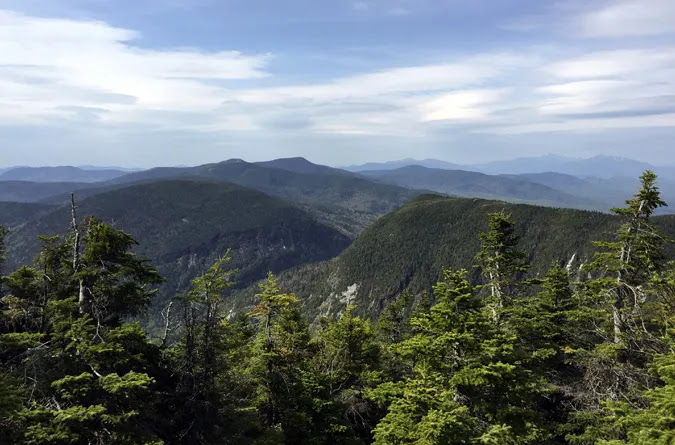
I headed into the woods and up Mt. Hayes for the first climb north. The climb was not bad, and there were nice views to be had on the way up and on the summit. I saw just a couple of day hikers, and no long distance hikers. I rested briefly for lunch at the top before heading down the trail. As I descended Mt. Hayes, I suddenly realized that I was hiking a trail with NO white blazes. This is unusual for the AT, as blazes or generally plentiful in my experience. I backtracked to be certain, but decided I must be on the correct path.
 |
| Mt. Hayes View |
I passed over Cascade Mt. , which was a more difficult climb, but again with nice views to pass the time. The descent was worse, and I began to feel the strain in my feet and ankles. I arrived at the Trident Col Campsites, and found a nice site near the bear box. I went for water, and cooked up some Beef Stroganoff for supper. After supper I climbed into my tent to enjoy my new 32 degree sleeping bag, which was very toasty indeed. It was a good first day back on the trail.
June 6- Day 2 - Trident Col Campsite to Carlo Col Shelter/Campsite -10.1 miles
Today was a very tough day of hiking. It was a sunny day to start. I got started early, which is my preference, since it is my preference to end early if possible. I shortly arrived at Page Pond, and had to double and triple check the guide, as the trail direction was very unclear. The trail takes an obscure and unmarked sharp turn to the right around the lower end of the pond.
I then followed a steady climb to Dream Lake (love the name). I heard noisy people (undoubtedly the noisiest animals in the woods) cavorting in and around the lake, but managed to avoid detection. I later arrived at the Gentian Pond Shelter and took lunch.
 |
| Dream Lake |
It was to be another 5.4 difficult miles to the Carlo Col Shelter/campsite. I stopped for water at the first stream crossing. There were many nearly vertical climbs and descents. I successfully summited the long climb to Mt. Success, and chatted with a female NOBO thru-hiker, 'Traps'. I arrived at the Maine/New Hampshire border , and celebrated my arrival in the last state of my AT odyssey.
 |
| AT Border Sign Last State...Yay!! |
The guide indicated another 1.5 miles to my shelter destination. Again, the trail is not well marked or blazed through here. I began to worry that I had missed the shelter, and backtracked at one point. I set my GPS watch to check the distance. There was a very treacherous descent to a valley (col), with trail heading to the left.
I finally arrived at the shelter after 8 p.m., very low on water, sore, and dead tired. There were six people in the shelter, so I decided to pitch my tent on an adjacent platform. I made the decision to skip getting water or cooking and went right to bed; deciding I would regroup in the morning. These trails make for a slow slog.
June 7- Day 3 - Carlo Col Shelter/Campsite to Full Goose Shelter/Campsite- 4.4 miles
This was a short, but difficult hike. I had contemplated taking a 'zero' day at my previous campsite, but wanted to get a little closer to what I knew would be the most difficult section of my entire trek. I was in no hurry to get going, and visited briefly with a SOBO hiker who mentioned the terrain going north, and how hard Mahoosuc Notch was. He also commented on the insects north of Rangely.
I finally got going around 9 a.m.. There were some tough climbs, of course, but nice views over Mt. Carlo and all the Goose Eye peaks. I stopped frequently along the way, much of which was above the tree line. There were treacherous descents on rebar steps, and I needed to be extra careful with my foot placement. I arrived at the shelter around 3:30 p.m., making the determination that tomorrow would be a 'zero' day. I wanted to regain energy and confidence for the imminent section ahead.
 |
| Carlo Col Shelter |
I claimed a tent platform behind the shelter, got water, and cooked up a Macaroni and Cheese supper, after which I laid in my tent, called home, and read my book before drifting off to sleep.
June 8- Day 4 - Zero Day -Full Goose Shelter/Campsite
 |
| Ladder Assisted Climb to the Full Goose Shelter |
The shelter was vacant, so I decided to move my stuff there for the night, also to let my tent dry out. The weather cleared later in the day, and a NOBO thru-hiker, 'Moron', came by. This was his second thru-hike, the first being in 2019. We chatted for a while before he moved on.
I laid down to read my book. Later, another NOBO hiker, 'Gimlet', stopped by and decided to stay. He was a retired software developer from Nashville, and we had a good visit.
June 9- Day 5 - Full Goose Shelter/Campsite to Bull Branch Campsite- 2.7 miles
Well, I have to say that this was the toughest and worst day of hiking in my entire 12 years of hiking the AT. I knew that it would be difficult, and started very early with the intent of getting through Mahoosuc Notch before the rains returned. It was a beautiful morning as I climbed Fulling Mill Mt. It was a extremely tough climb, typical of this area, and I was passed by 'Gimlet' as I neared the top.

After the steep descent from Fulling Mill Mt, I arrived at a trail intersection, and the entrance to Mahoosuc Notch. Ahead of me was what is considered the most difficult one mile on the entire AT. I am not very confident, and/or adept at rock hopping, and this is what is required. It took all my energy and willpower just to discern the best path forward. Multiple options were often available, but the possibility a mistake resulting in a serious slip or fall required my full attention. There were many snow deposits in the lower crevices, making it even more problematic.
 |
| Over, Under, or Through Mahoosuc Notch |
 |
| Snow and Ice All Year |
On top of all this, I was began having physical problems with lightheadedness and disorientation. I don't know the reasons for this, especially since I taken a 'zero' day to prepare, but it was worrisome. I remember feeling this way at the beginning of last year's hike. Taking more water and food bars seemed to do the trick then. Anyway, I began hiking in the wrong direction, which I quickly discovered as I encountered two NOBOs, 'Simba' and 'Nala', who had been with me in the shelter the previous evening.
It was a providential encounter, as we hiked together through the notch. They were both from Freiburg, Germany, and had both previously and independently completed a thru-hike in 2018. They had not previously known one another until they met on the trail. They subsequently became a couple, and decided to do another thru-hike together. They were of tremendous assistance as we negotiated this maze of rocks and tunnels together. 'Nala' was actually a nurse, which was an added advantage.
We needed to take off our packs a couple times in order to crawl through small holes and crevices. As I was hoisting my pack over a boulder, the frame sheet at the top of my pack suddenly snapped at the shoulder strap connection point. The pack was still wearable, but there was no longer any way to hang it, and the straps were out of line with my body. In addition, my camera fell out of my pocket somewhere along the way, and my sunglasses disappeared as well.
 |
| Hole Crawl Example in Mahoosuc Notch |
I want to comment a little more on my physical state at the time. This is hard to admit, because I have generally been proud of my physical conditioning. Maybe it's a 'guy thing', but I don't like to admit weakness, especially after so many years of hiking and running. I have learned to listen to my physical body, though, and although it is still in relatively good shape, is not as young or strong as it once was. My body was sending signals that something was amiss. In such a situation I needed to have the good sense to pay attention.
I had intended to get to Speck Pond Shelter, which was 2.4 miles hence, but Mahoosuc Arm (the next BIG climb) intervened. After being thoroughly beat up and drained by Mahoosuc Notch, I knew there was no way I could make it, and began to rethink my options going forward. I am reasonably certain I am not the first hiker to have this experience. I decided to stop at a campsite just before Mahoosuc Arm. I would most likely take a day at Grafton Notch in two days to recover and resupply, and thought it possible that I would not make it to Monson this year.
June 10- Day 6 - Bull Branch Campsite to Speck Pond Shelter/Campsite- 2.4 miles
I awoke after a rainy night in the tent, happy that the rain subsided as the morning broke, but still sad that the notch had snatched my sunglasses and camera. The camera was cheap, but the pics were invaluable. Oh well...in the words of an immortal anonymous philosopher, "It is what it is". I will do my best to describe the events. Mahoosuc Arm is widely considered to be the most difficult climb on the AT, although I don't completely understand the comparison criteria.
I got up around 6 a.m. after a damp night in a damp tent. Some water seeped into the floor of the tent, and my sleeping bag also got a little moist. I strung out a line and hung my rainfly, bag, and sleeping pad. It was a cloudy blustery morning, with occasional bursts of sunshine. I took my time with breakfast and breaking camp to allow things to dry out a little, and broke camp around 8:30.
The climb at first was not bad, with many little springs and stream crossings. My guidebook indicated a spring about three quarters of the way on the ascent, but I never found that one. The climb soon became almost vertical, with seemingly nothing but sheer flat rock on the trail itself. I moved to the side of the trail, which was mostly covered in moss, to grab onto trees to pull myself up the hill.
 |
| Climb up the Mahoosuc Arm of Old Speck Mt. |
After much struggle, I made it to the top, with about 1600 feet of elevation gain in one and a half miles. This may not seem like much, but most of it was at a severe incline, stopping every 15 minutes or so to rest and hydrate. I encountered only two other hikers all day - two females, one of whom was on her final 30 miles of completing the entire trail.
 |
| Summit of Mahoosuc Arm |
I came down the steep and rocky north side of Mahoosuc Arm, and arrived at Speck Pond, which I could see below me on the descent. I needed to cross Speck Pond Brook. This was a challenge that I suspect was due to the lake level being high because of the recent rain. There was nowhere to cross without getting wet, but this is par for the course on most hikes.
 |
| Speck Pond |
 |
| Speck Pond Shelter |
June 11- Day 7- Speck Pond Shelter/Campsite to Grafton Notch- Hwy 26- 4.6 miles
Today was to be my last day of hiking for this trip. I planned to call the hostel from the top of Old Speck Mt. to give an ETA for the shuttle driver. I got up around 5:30 a.m.. The other person with me in the shelter was set to take off, and it didn't take long for me to set aside my gear.
I went to make breakfast in the designated cooking area under a tarp, and visited with the four young SOBO section hikers who had camped here. All of them had met while attending the University of Maine, and currently lived in Maine or New Hampshire. They were pleasant young guys. I told them of my difficulties in Mahoosuc Notch, and asked if they might keep an eye out for my camera and sunglasses when they passed through there. They were happy to do that, and I gave them my cell number just in case.
I broke camp before 8 a.m. and headed up the mountain for another difficult climb to start the day. I reached the summit of Old Speck, and placed a call to the hostel. It was nice to get the climb out of the way while I was fresh, but a long descent to Grafton Notch followed. I estimated my arrival around noon. The driver was making a stop in Bangor before heading my direction.
I encountered many day hikers on the way down, including several loose dogs which always makes me a little nervous. Buddy, the driver who had shuttled me on day one, was waiting for my as I arrived at the notch, and we drove back to the hostel in Monson. I spent the evening at the hostel before driving back to North Carolina.
Summary
I need to say that, in my opinion, this short section was much more difficult than the White Mountains. For one thing, the Whites have the advantage of the hut system, where it one can find safety from the elements, and thoroughly recharge. I was disappointed I needed to exit early, because I felt I would've adapted and become stronger if I had the time. I do feel a measure of success in traversing what is possibly the most difficult few miles on the entire trail, but I know there are many challenges ahead. My current circumstance in life has made it somewhat difficult to prepare physically for the trail. It is not something tanyone can do on a whim, but I feel I can almost see Mt. Katahdin, which is motivating me continue to drive toward the 'finish line'. Thanks for reading, and may God bless you on your journey!
Sorry to hear of your interrupted hike last year and the circumstances that caused it. Hoping you get out there again and finish off the AT - you are so close. Best wishes.
ReplyDeleteHi Highlander,
DeleteThank you for reading. I unfortunately had another interrupted hike this year (2023), this time for personal heath reasons, which turned out to be unexpectedly serious. I had intended to go 150 miles, which I felt trained and ready for, but had to drop off after only 20 miles. I am being currently evaluated and treated, with potential surgery in the future. I do hope to be back to finish, especially since I am so close to the finish end, but my hiking major adventures are currently on hold. 😒. Thanks, again, for taking time to read and follow. “Triple m…mmm”