Various Day Hikes in the Western Carolinas for 2021I have come to realize that the best way to get and keep in physical shape for hiking the trail is to hike. Although I do weekly aerobic and strength cross training, there is no substitute for hitting the trail equipped similarly for what one might actually carry on an extended trip. This page is a compendium of preparatory day hikes.
I purchased a book entitled,
Hiking the Carolina Mountains, by Danny Bernstein. This book details 57 day hikes in the mountains of Western North Carolina, and upstate South Carolina. The hikes are of varying distances and difficulties, through a variety of terrains and scenery. With a flexible daily schedule, I decided to set aside one day each week for hiking excursions. This would also give me an opportunity at times to add one or two days for possible overnight adventures.
Thursday, Jan. 7, 2021 - Great Smoky Mountains NP - Shuckstack Mt. Loop - 11.0 miles
I have mentioned on occasion the connection I feel with God and with myself when I am hiking. I also find at times of stress, that intense physical activity focusses my attention, and helps me to find balance and peace of mind. This hike was a 'spur of the moment' decision, but I had to move quickly to be done before dark.
 |
| At the Trailhead |
I left my home in Waynesville late morning to make the drive to the trailhead on the other side of Fontana Lake. This is a location I had previously hiked on my year 2 AT adventure, which I painfully recalled due to the fact that my feet were in such terrible shape. On that hike, I had joined with a slow moving Boy Scout Troop in making the trek to the top of Shuckstack Mountain. I drove across the Fontana Dam to the trailhead at the end of the road.
 |
| Pointing the Way |
I headed up the mountain, which was a steady climb for three or four miles. On the way, I had some good wintertime views of the lake below. The water levels in the wintertime are lowered, but it was still an impressive sight. There are a number of ridge tops on the ascent, and I encountered a hikers resting on one. These were the only other hikers I encountered all day, and I always love the solitude.
 |
| Wintertime Glimpse of Fontana Lake |
 |
| Chimney Remains of the Caretaker's House |
I reached the side trail to the Shuckstack Mt. Fire Tower, and climbed up the steep trail to have a look. I sat down for lunch on the remains of the caretaker's house. I started up the fire tower, but decided against going all the way up. A hand railing was missing, and I became a little nervous, especially since I was alone. There were still some great views, and I took a few pics before heading down.
 |
| Fire Tower on Shuckstack Mt. |
 |
| Missing Railing on the Fire Tower |
 |
| View From the Top - Lake in the Distance |
I returned to the AT, and headed down a short distance to the intersection with the Lost Cove Trail. This trail would take me down the opposite ridge to the Lakeshore Trail, which would then take me all the way back to my car. I headed down the ridge, looking back occasionally to where I had come from. In a couple miles I came to a large campsite and the Lakeshore trail.
 |
Trail Intersection
(Good Signage) |
 |
| Creek Crossings |
I headed to the right down the Lakeshore trail, which followed a creek for a time, crossing and recrossing it in the process. These crossings were unbridged, and getting wet was unavoidable. Fortunately, it wasn't TOO cold, and I was able to dry off as I continued hiking. The trail climbs the ridge along the lake eventually turns onto a former road or highway. This road connected the community that once inhabited this area before the founding of the park. It was a bit spooky as I passed the shells of old abandoned cars from the thirties that were left behind. I reached my car at dusk, but before it became too dark, feeling more peaceful, calm, and refreshed.
 |
| Graveyard of Rusted Automobiles |
Friday, Jan. 15, 2021 - Jones Gap SP, SC - Rim of the Gap Loop - 11.1 miles
I wanted to get out for another hike with my friend and hiking buddy, Matt, so I offered a few possibilities, this being one of them. I had previously tried to hike in the Jones Gap State Park in upstate South Carolina, but lacked the day use fee. This time I was prepared. I met Matt at his home in West Asheville, and rode together to the park to begin the hike.
 |
| First Bridge |
 |
| Fish Hatching Pond |
Jones Gap State Park is situated in a narrow valley below the steep escarpment of the Blue Ridge. The weather was misty as we located the trailhead. We registered our hike at the Jones Gap trailhead, and after half a mile or so, turned on to the Rim of the Gap Trail. Neither one of us noticed the warning signs about ice conditions on part of the trail, but we weren't really worried. We headed down past a fish pond to the trailhead.
 |
| Middle Saluda River |
 |
| Where We Are Going |
The trail climbs gradually away from the Middle Saluda River. The gradual climb gives way to a steep and rocky climb on the escarpment. There are a number of connecting trails, but we continued heading west. We came to a clear sign warning that the path head was 'closed' due to icy conditions, but we decided to press on anyway. The temps on this day were warmer, and we felt confident we could negotiate the passage.
 |
| A Squeezer! |
 |
| The Icy Path |
There many difficult snowy and rocky passages, and sometimes the trail was unclear. At one point we needed to climb up and over a narrow rock overhang. We took a couple breaks along the way to hydrate and/or refuel. I was worried about possible slippery stream crossings, but there none that were too difficult. It was a few miles of very challenging and strenuous hiking. I felt that this might be the challenge I would need in preparation for the White Mountains.
 |
Back to the River
|
We finally arrived at the gap, and took the Coldspring Branch and Jones Gap trails across the river and back to the car. It was an easier trip down in the valley on the opposite side of the escarpment. I must say that this hike was probably the most difficult of all the day hikes I have done in the past year, but I felt very good about the accomplishment. It was also nice having a hiking partner, especially over somewhat treacherous terrain, along with the great conversation.
Sunday, Jan. 24, 2021 - SMNP - Purchase Knob Out and Back - 3 miles
This hike is not in my book. I just googled for information on hikes in or near Waynesville, and this one popped up. I have been thinking of how to introduce my grandson, Bradley, to outdoor hiking experiences. Since this was close by, and a short out and back, I decided take him on a Sunday afternoon hike with me. I packed a few snacks for both of us, and wanted to just relax and take our time. The trail begins at the entrance to the GSMNP off Hemphill Road in the Jonathon Valley, only about a twenty minute drive from my house.
 |
| Sign at Gate Entrance to Purchase Knob |
We drove up and parked in front of the gate to walk the gravel road up to the knob. It was a cool day, but we dressed for the occasion. I gave Bradley one of my stocking caps to wear. The sign at the gate vehicular traffic was restricted to education and research groups of the Appalachian Highlands Science Learning Center. This center is at the summit of Purchase Knob
It was a fairly steady climb on the road, but not steep at all. Bradley wanted to try out my trekking poles at one point, so I folded them to their lowest setting for him to use. We reached a little animal pen with a side trail to a little peek. Bradley wanted to check it out, and I was happy to encourage his spirit of adventure. We hiked up until the trail petered out, but there were some slightly obscured views of the valley below. We backtracked to the main road, and continued our walk.
 |
| An Adventurous Spirit |
 |
| A Little View |
There was another gate just past this point, and we began to see snow and ice on the road - not surprising given the elevation. We came to an open area, and I could see the Learning Center on the summit. The past the intersection with the Cataloochee Divide Trail, and continued straight as the road curved around to the left. We arrived at the closed building, with a large wrap-around porch and deck.
 |
| A Snowy Traverse |
 |
| Where We Are Going! |
The panoramic views were phenomenal. We sat down on a bench to eat our snack and enjoy the scenery. Someone had recently constructed a little snowman, which was still standing sentinel in the grassy area below the center. After a while, we followed a different and more direct path back down to the road and back to my car. I was proud of my little grandson, and grateful for the time outdoors together.
 |
| A Great Reward! |
Tuesday, Feb. 9, 2021 - Great Smoky Mountains NP - Smokemont Loop - 6.5 miles
I decided to head back into the Smokies for a shorter loop hike. We had had some snow recently, so I was trying to find a place that would not be accessible and not too difficult. This trail began at a campground just off of Highway 441. I had originally considered Clingman's Dome, but thought this might be a better possibility. I drove into the park by way of Cherokee. The road was closed just beyond the entrance to the campground, so I knew I had made the right decision.
 |
| Entrance to the Bradley Fork Trail |
The back end of the campground, where the trail began, was closed, so I parked in the parking area closest to it, and walked to the trailhead. The Bradley Fork Trail. The trail here follows a service road, which was covered with snow, but was not too difficult. I took a couple pictures, and then discovered that my camera batteries were low, so no more pics on this trip.
 |
| The Initial Hike |
The Bradley fork follows the creek for a few miles before intersecting the Smokemont Loop Trail. This goes to the left across the creek and ascends through coves and up to the top of a ridge. There are a couple of summits with nice views. The trail descends back to the valley, and past the Bradley Cemetery.
Smokemont was a logging community that existed in this area prior to the establishment of the park. It was a very active community, with a mill owned by the Champion Fibre Company, schools and churches. Almost all the structures are gone, but the Smokemont Baptist Church, and the Bradley Cemetery remain as evidence of the community that once existed. I arrived back at the road into the campground and hiked back to my car to close the loop,
Tuesday, Feb. 16, 2021 - Nantahala National Forest - Panthertown Loop - 11.2 miles
This was probably one of the most interesting and enjoyable day hikes I have done. It was in a very interesting area - a self-contained and hidden valley high in the Nantahala highlands near Cashiers, NC. There were so many great things to see in this tiny little area: vistas, interesting plutonic peaks, many waterfalls, campsites, etc. I also felt fortunate to practically have the entire trail to myself this day, although I could tell it was a generally well-traveled and popular area. This is the site of another former logging boom town that has disappeared.
 |
| Entrance to the Panthertown Valley Trail |
 |
| Wide Trail to Begin |
I drove up Hwy 107 through Cullowhee to Cashiers, making a left on US 64. It was a long, winding trip up. There was much high-end and upscale development in the area. I finally arrived at the Panthertown Valley trailhead, where I would begin my hike. There were a few cars in the lot as I started out. The trail headed downhill along a rocky, but wide dirt path. I soon intersected another trail leading to a waterfall, but kept going. In a short distance I arrived at an open area with good views across the valley.
 |
Wonderful View Across the Panthertown Valley
Little Green Mt. To the Left |
The trail initial heads downhill. It passes through nice open campsites in peaceful pine groves before reaching the intersection with the Macs Gap Trail. I took a short side excursion to Granny Burrell Falls. It looked like a good place for sliding in the summertime. I backtracked and continued along the creek, with many possible campsites on either side of the trail.
 |
| A Nice Campsite in a Pine Grove |
 |
| Granny Burrell Falls |
Little Green Mountain is one of the plutons visible across the valley, and I made a little loop hike to the top. There was a stair assisted climb in one place. I reached the summit, with an open rocky face, where I briefly paused for lunch. I took some pics before backtracking to the Macs Gap trail to continue the hike.
 |
| Stair Assisted Climb Up Little Green Mt. |
 |
| View From Little Green Mt. |
The Macs Gap Trail continues steeply up and over a ridge, and then heads back to the valley. There is a wet crossing at Greenland Creek, and I turned to follow the Greenland Creek Trail. I unfortunately missed the side trail to Greenland, but didn't realized it until I was well away from the creek. I crossed a powerline clearing and came to another parking area with a road access.
 |
| Warden Falls |
I took Panthertown Valley Trail past a private religious retreat center, and back down a long stretch of forest road with many switchbacks. I arrived in the valley and took a right turn to explore the Warden's Falls, which were rather difficult to find on a rather obscure side trail. After visiting the falls, I backtracked to the North Road Trail to the Panthertown Valley trail to close the lollipop loop. This was an exceptional hike in a VERY interesting region of the Nantahala National Forest.
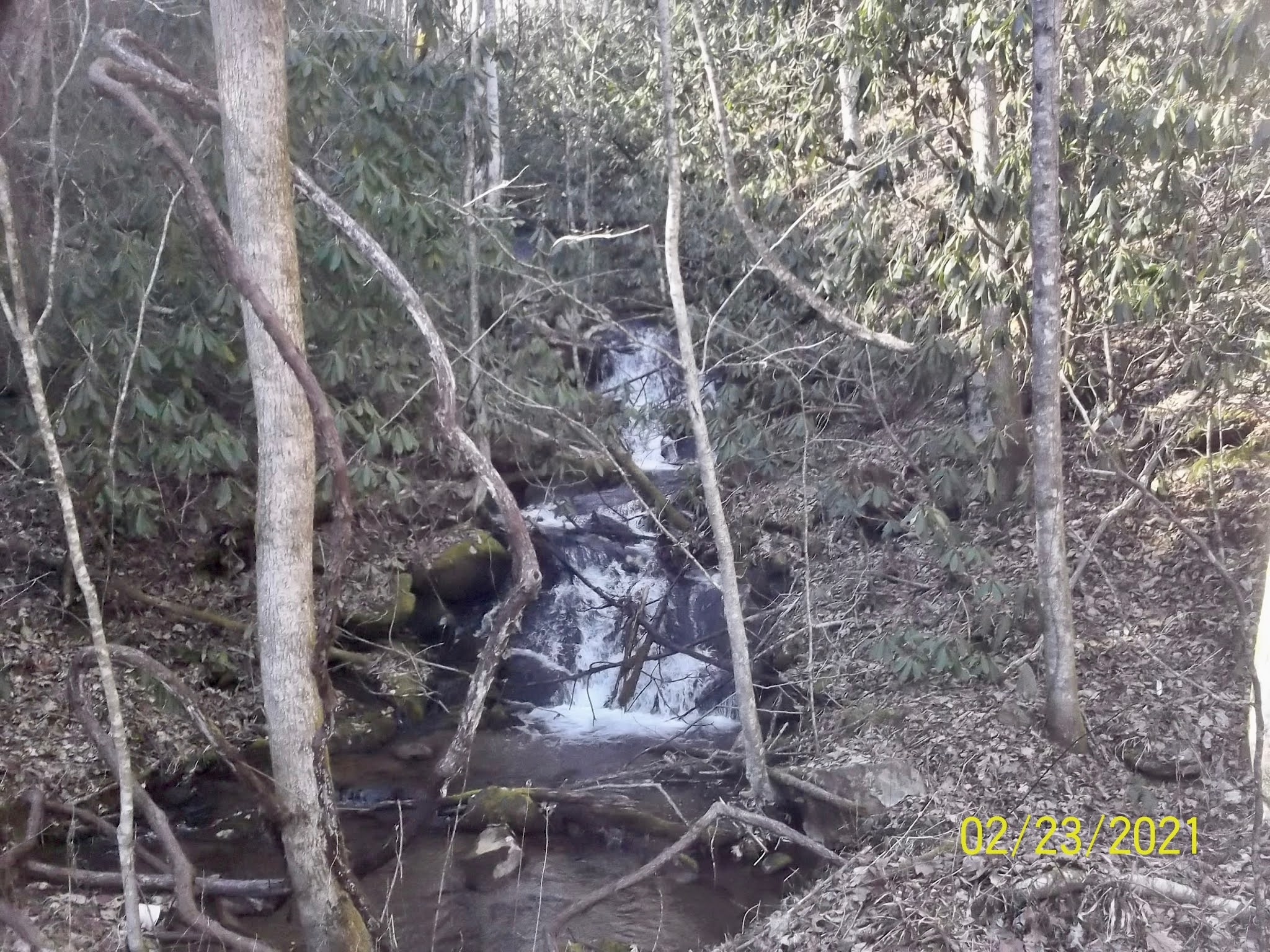
Wednesday, Feb. 24, 2021 - Nantahala National Forest - Appletree Loop - 12.25 miles
This is a hike that I had unsuccessfully attempted last year, but the weather that day was not good, and I found the trail to be unmarked and virtually impassable in spots. I decided to try it again in good weather, and loop it in the opposite direction of what I had tried to do before. I managed to complete it, but it was very challenging, and the good weather did not improve the lack of maintenance of the trails in the Nantahala Forest in the vicinity of the Appletree Group. I had to make use of, and be confident in my wilderness navigation skills this day. I feel good about the accomplishment, but I don't think I want to do it again soon.
 |
| Parking Spot Near the County Line |
 |
| Heading Up the London Bald Trail |
I drove down Hwy 74 and 19 past the NOC and took a left on Wayah Road past the many cascades of the Upper Nantahala River to Junaluska Road. The trailhead is on Junaluska Road on the border between Swain and Macon counties. I parked in a wide area just before the county line and headed up the trail. I took the London Bald Trail straight ahead rather the Junaluska Trail I had taken on previous attend.
 |
| Spotting the Occasional Faded Blue Blaze |
 |
| Better Condition? |
The trail was not bad initially, although it obviously did not receive much traffic. It climbed up and to the left for some distance There were occasional views through the trees, but I soon discovered the overgrown and cluttered nature of the trail. It seemed like I was bushwhacking for the next seven miles. There were visible stretches followed by long areas of blow downs and thorn thickets. The occasional long faded blue blazes told me I was heading in the right direction. I could also see occasional boot prints, indicating someone besides me had gone before.
 |
Views to the Left
(Above and Below) |
 |
| Faded Blaze and Brush Covered Path |
I passed an orange blazed trail to my right that further confirmed my direction. I recognized that as the trail that I taken on my previous hike in an effort to shorten the loop. When in doubt, I checked my compass and map. I finally came to an old wooden sign indicating the Appletree Trail, but it was very unclear which direction this trail went.
 |
| A Place I Had Been Before? |
After briefly checking to the right and left, I decided that forward was the correct direction. I knew I was heading east in the direction of the Appletree Camp, and would get there eventually anyway. I hiked over a ridge line followed by a long descent. I saw faded yellow blazes and an occasional faint path telling me I was going the right way. There were many occasions that I was not at all certain.
I finally arrived at a service road, with signage in the campground.
 |
| Navigating the Yellow Blazed Appletree Trail |
 |
| Exiting the Group Camp |
I came to the group camp, and decided to do the road hike back to my car. There was no way I was going to try and do the Junaluska Trail, which ostensibly parallels the road. Given what I had already experienced, I was sure it had been virtually consumed by the forest. It was about a three mile hike down the road. I stopped briefly to look at waterfall along the road, and arrived at my car with a feeling of accomplishment in doing twelve and a half miles through difficult conditions.
 |
| Pausing to Enjoy a Small Waterfall |
Sunday, Feb. 28, 2021 - Great Smoky Mountains NP - Swag Loop - 6.25 miles
This is another hike that I found through a local Google search. The Swag is a resort lodge and restaurant on top of a mountain right on the edge of the Great Smoky Mountains National Park. The access to the Swag is off Hemphill Road near where I parked for my hike up to Purchase Knob a few weeks ago.
 |
| From the Road to Purchase Knob |
I downloaded a map and used my GPS to drive to the Swag. The gate to the top was locked, probably for the season. In looking at my map, I realized I could create my own loop hike to the Swag by way of Purchase Knob. The Cataloochee Divide Trail intersects the road, and I figured I hike it to the intersection with the trail that would take me to the Swag. From there, I thought I should be able to take the access road to Hemphill Road and back to my car, which is what I did.
 |
| Path to the Ferguson Cabin |
The road to Purchase Knob is fairly easy. I caught the side trail to the Ferguson Cabin. This is another historical settlers cabin rebuilt and/or restored to its original form. This particular cabin/homestead was built at the highest elevation of any in the park, making it a very unique spot. I checked out the cabin and the spring house nearby, trying to imagine what life must've been like for the inhabitants.
 |
| Spring House |
 |
| Ferguson Cabin |
I caught the Cataloochee Divide trail, which ascends gently along a creek bed to a Gap below purchase knob. I reached an intersection with another trail indicating the Swag to the left. I briefly chatted with another hiker who was passing by, and who was coming from the direction I was heading. He mentioned just a few cars parked at the Swag, which he assumed were preparing for the upcoming season.
 |
| Trail at the Park Boundary |
 |
| Rental Cabin? |
I took the left turn and headed up the ridge line. The trail traveled right along the park boundary, and I soon came to a cabin, which I assumed was a rental. It looked fairly fancy, with incredible views of the valley below. Heading on, I came upon an open field on Gooseberry Knob, with a building on one end, an observation platform, with a sign that said Rogers Hideaway, and a gazebo. I enjoyed the 180 degree vista. This appeared to be part of the Swag complex.
 |
| Description |
 |
| View From the Platform |
 |
| Gazebo with Cataloochee Ski Area Visible |
I arrived at a series of larger buildings with construction equipment laying around. The path would've eventually gone to Hemphill Knob, which I had hiked from the opposite direction once before. I walked to around to the front of the builds and headed back down the road, which I assumed would take me back to Hemphill Road. It was a long, winding, gravel road walk, with occasional creeks and the original Swag trail. I finally arrived back at the gate, and walked back up the road a mile or so to my car, being harassed once by a loose dog, whom I tried to ignore.
 |
| One of the Swag Buildings |
 |
| Original Swag Trail |
 |
| A Little Waterfall on Hemphill Road |
Thursday, March 4, 2021 - Dupont State Forest - Stone Mountain Loop - 9.5 miles
I've been exploring in all directions of the compass from where I live. Since I am often traveling some distance to get to some of these hiking destinations, I want it to be worth my time. Therefore, I am choosing longer hiking choices. The Dupont State Forest is a popular and interesting destination, and not extremely far from where I live. I first learned of it from its many waterfalls, but there are also several peaks worth exploring, which is what I did on this day.
 |
| Parking at the Guion Farm Access Area |
This hike began at the Guion Farm Access area. The trails in this area are popular with both mountain bikers and horseback riders. They are relatively smooth and easy to follow. It was, however, a bit of a complicated route I was to follow. It was basically two loop hikes, with an intervening hike from two separate directions. It was a bit daunting, but I wasn't at all worried about getting lost, as the trails are well marked and interconnected.
 |
| A Nice Way To Open the Day |
 |
| Well-Marked Trail Crossings |
It was a beautiful day to hike, and I had no trouble finding the large parking area at the Guion farm. I hiked down the road past the farmhouse and ranger station, taking a right on the Hikory Mt. Road trail. My destination was Hickory Mt, and the trail loops up, over, and around it. It starts out as a smooth, flat, gravel road through pleasant pine groves. I was a little confused at the intersection with the Ridgeline Trail, but I actually could've gone either way. I took a right turn past the former rifle range and climbed up Hickory Mt.
 |
| Around The Former Rifle Range |
 |
| Either Direction is Possible |
It was an open forest, but the views at the summit were not as wonderful as I had hoped. I continued down the other side to the intersection with the Ridgeline trail, and backtracked a little. I took a left on the Boundary Trail, and was supposed to follow the Guion Trail to the road. I couldn't immediately find it, but found a disused trail that I assumed to be the correct one. The trail was overgrown, but not hard to follow. It did take me to the road, which I then walked a short distance to the Rocky Ridge Trail, which would take me to the Stone Mountain Trail.
 |
| Going Up Hickory Mountain |
 |
| Not A Great View |
I had already encountered a larger group of day hikers, and I encountered another group on the way up, as well as some mountain bikers on the way down. It was a long winding path. Just when I thought I might have missed the turn, I arrived at the Stone Mountain Trail intersection and took it to the summit. This was a more difficult, steeper, and rockier path. I went through a clearing with some views, and then the last rocky push to the open summit. There were viewpoints on either side, and I rested for lunch.
 |
Views From Stone Mountain
(Above and Below) |
I backtracked all the way to Sky Valley Road, which I walked a ways to pick up the Shoal Creek Trail. This parallels the road along the creek, with several side trail access points. I stayed with it until it returned to the road, and then back to my car to complete the hike.
Tuesday, March 9, 2021 - Nantahala NF - Tsali Recreation Area - Loop with extensions - 14.5 miles
 |
Parking in the Biker Parking Area
of the Tsali Recreation Area |
This was another trail adventure in the Nantahala National Forest in the Tsali Recreation Area next to Fontana Lake. It mostly traveled along the shoreline, and part of it was directly across from where I had hiked in the Smokies. This was the longest day hike I have done so far, but the trails were extremely easy, and most of it was fairly level. Practically the entire recreation area is designated for bikes, so the path was mainly smooth and compressed.
 |
| A Smooth Path |
 |
| Trail Distance at Half Mile Intervals |
I had traveled this direction on other occasions, so it was fairly easy to find down Highway 28 west of Bryson City. I drove to the trailhead bikers parking lot. There is a day-use fee for bikers, but it is free for hikers, so I parked and headed out. This was a big, winding loop hike. There is a Right Loop Trail, and a Left Loop Trail, but I also added to extensions to view spots. I took the Right Loop Trail to start. The lakeshore was almost always visible down to my right. The water levels were extremely low, but the levels are controlled, and generally lowered during the winter months. I could see and hear fishing boats plying the lake.
 |
| Low Water Levels |
The trail headed downhill at first, and I noticed mileage posts every half mile. I marveled at how low the water levels were. Some of the branches into the coves were completely dry. I used my GPS watch to monitor my pace. I was hiking very fast for me at about two and a half miles per hour. The trails were well-marked with large color-coded maps at important intersections.
 |
| Color Coded Trail System Maps |
I took the side loop trail to the Windy Gap Overlook. It led to a bluff on the lakeshore, with decent views of the lake below. I had lunch at an open spot and headed around the back side of the loop to the intersection with the Right Loop Trail. The trail roughened slightly as it descended through an open area, along an old road and across a bridge.
 |
| Lunch at Windy Gap Overlook |
 |
| View of the Lake From Windy Gap |
I took another loop trail to the best observation point at a cliff overlook, and highest elevation point of the hike. I returned around the back side to the intersection and took the County Line Road Trail. This trail ascended again over a ridge away from the lake on an old dirt roadway, finally exiting to the right of the parking lot where I had begun the hike. This was an opportunity to stretch my legs, do a longer hike, and move fairly quickly. I had mostly had the trail to myself, even though I could tell they were well-used by bikers and horses.
 |
| Another Loop Excursion |
 |
| Looking Towards the Smokies from Cliff Overlook |
 |
| The County Line Road Trail |
Monday, March 22, 2021 - Joyce Kilmer Memorial Forest - Haoe Lead Loop - 10.4 miles
I returned to the pristine woods of the Joyce Kilmer Memorial Forest for this hike. It is little farther away from where I live, but I enjoyed the drive up through Robbinsville to the trailhead on Maple Valley Road. My goal was to hike the Haoe Lead trail to the Deep Creek Trail and on up to Hangover Ridge. I would then follow the Hangover Trail over to the Haoe Lead Trail, and back down to complete the loop. This was a more difficult and strenuous hike than recent adventures, cresting at almost 3000 feet of elevation gain.
 |
| In the Haoe Lead Trailhead Parking Area |
I parked in the nice parking area with a view and hit the trail. It begins across the road, and immediately climbs. The climb is fairly steady, with a few view spots to the left. I passed a marker on a rock indicating that the trail was constructed in 1979 by the Young Adult Conservation Corps. I reached the top of the ridge and the trail leveled out. It became much rockier, with scattered rock falls over moss covered rocks.
 |
| The Trail Begins Across the Road |
 |
| Commemorative Plaque |
 |
| Views on the Climb |
I arrived at the intersection with the Deep Creek trail, and too a right turn. This is where I would return at the conclusion of the loop. The Deep Creek Trail continued along the side of Haoe Ridge, and continued to have technical rocky areas alternating with smoother paths. I crossed a few small creeks and slowly descended to Deep Creek. There were little scattered cascades, and I noticed a nice campsite below me by the creek. I was thinking this might be a good place to plan an overnight sometime.
 |
| A Rocky Passage |
 |
| Several Changes In Trail |
 |
| A Small Cascade |
After crossing Deep Creek, the trail makes a right turn, heading down along the creek bank. It turns back to the left and follows the creek towards Saddle Gap and Hangover Ridge. It was a gentle uphill grade for a mile or two. I could see Haoe Ridge across the valley, and knew I would be hiking on it on the way back. It sure seemed like a long ways off. The trail left the creek and began to go steeply uphill. I saw a few more nice campsites at this juncture.
 |
| Where I am Going |
 |
| Crossing Deep Creek |
This climb seemed interminable, with the gap was always a little further. It was discouraging, and getting past lunch time, but I was determined to get to the top of the ridge before stopping. I did stop for water a couple of times. For a time, the trail seemed to cut away from the gap, but this was just a very long switchback. I finally reached the T intersection with the Hangover/Haoe Lead Trail, and the terminus of the Deep Creek Trail. I sat down for lunch, and noticed evidence of more foot traffic. This is the trail leading to the Naked Ground Gap, which is an extremely popular area.
 |
| Hiking Along the Creek |
 |
| From Saddle Gap Hangover Ridge |
After lunch I trekked along the ridge line over a couple peaks, with nice views of the bowl-shaped Deep Creek valley. I arrived at the intersection with the Haoe Lead Trail and took a left. I had hiked this portion Haoe Lead Trail coming from the other direction when I did Naked Ground Loop. I hiked down the Haoe ridge for four miles up and over peaks, but no huge climbs. The Jenkins Meadow Trail came in from the right. I had taken this trail before, but I continued on the HL trail. There were views of the valley and Santeetlah Lake. I also spotted the dam that formed the lake from a distance.
 |
| A Little Snow at the Higher Elevation |
 |
| Santeetlah Lake |
 |
| The Dam in the Distance |
The trail loops around the final peak and begins heading back to the valley. I crossed a stream, with the mountain peak visible above. I wished I had thought to bring my water filter, because I knew it had to be clean and that I was near the source. I continued on down past a rock face to the trail intersection, and the stem of the lollipop, which I took back to my car. This was a good, challenging hike that felt good to complete, and all without seeing a single soul the entire day! :-)
 |
| The End in Sight! |
Friday, April 30, 2021 - Mountain Bridge Wilderness - Raven Cliff Falls Loop - 8 miles
I journeyed back to upstate South Carolina for this interesting loop hike. The hike starts off Hwy 276 just south of Brevard, NC, and because Hwy 276 also runs to Waynesville, I thought it would be fairly simple to find. I drove all the way on 276 over the mountain through the Pisgah NF all the way to Brevard. I drove right through downtown Brevard about 14 miles over the NC state line to the Raven Cliff Falls Parking area. There is a three dollar day use fee, which I paid at the 'iron ranger'. I crossed the highway, and took the red blazed Raven Cliff Falls trail, registering my hike at the information kiosk. It's always a good idea to do this just in case.

The Raven Cliff Falls trail is the step of the lollipop loop that I will do to complete this hike. The trail descends at first, before traversing the edge of a deep gorge. The Blue Ridge escarpment is often visible across the valley. I stopped briefly at an outcropping with winter time views, but things were now beginning to leaf out. The trail turned and steeply descended some wooden steps. I passed the intersection of the Gum Gap Trail, which I would eventually follow to complete the loop.
 |
| A Spur Trail of the Foothills Trail |
 |
| Obscured Viewpoint |
 |
| Trail Direction |
In another mile or so I came to a three way intersection with the Dismal Trail heading down to the left. I carried on straight ahead for another .2 miles to the Raven Cliff Falls observation platform. The falls are some of the highest in this part of the country, and I paused to enjoy the view of the falls on the other side of the gorge. My guide indicated that I would eventually be crossing a suspension bridge over the falls, but I could not make it out from this distance.
 |
| Raven Cliff Falls |
I backtracked to the trail intersection and tool the Dismal Trail. There was a warning sign indicating the strenuous nature of the trail, and to be prepared. At this point in my hiking career, I feel prepared for most contingencies, so I wasn't too worried. I know some casual day hikers do not always heed these warnings, which sometimes gets them in trouble. The trail snakes down into the gorge for over one thousand feet of elevation change within a mile.
 |
| Dismal Trail Warning! |
I reached the bottom of the gorge at Matthews Creek, and took the Natureland Trust Trail to the right. This trail would take me along the creek for a ways, and up the steep slope of the Blue Ridge Escarpment. I paralleled the creek for a while through groves of Rhododendron. My guidebook indicated that I would cross the creek on two chains suspended over it. This is a little dated, as there is a wooden bridge spanning it. I stopped here to rest for lunch, knowing the climb ahead would be tough.
 |
| A Safer Option? |
 |
| The Rocky Mathews Creek |
After resting briefly for lunch, I crossed the creek and started up the trail. It was a gentle climb at first before turning away from the creek and heading relentlessly up the side of Raven Cliff Mt. It was a severe and rocky climb in spots, but nothing I hadn't encountered before. I knew I was gaining all the elevation lost coming down the Dismal Trail. I finally arrived at one of the very coolest spots I have ever seen. It was a sheer concave 200X120 foot vertical rock wall known as 'The Cathedral'. There were light streams of water coming down the face of the cliff, and shady at the base. I lingered to take a few pictures.
 |
| Dry Flow |
 |
| Trail Along the Wall |
 |
| Inside 'The Cathedral' |
After enjoying the awesome grandeur of the 'cathedral', I continued over rocks along the face of the wall. I gradually began to hear the roar of the creek to my right as I approached Raven Cliff Falls.
I climbed and descended several ladders built into the rock before reaching the suspension bridge over the upper end of the falls. I stopped to take a few pics on the bridge and just beyond,
 |
| A Little Ladder Help |
 |
| Skirting a Rock Face |
 |
Above the Bridge
|
 |
Crossing the Suspension Bridge
|
I crossed the bridge and turned left. The trail went beside the creek before intersecting the Gum Gap Trail and heading back over the ridge. The path here was mainly over an old carriage road, very smooth and wide, which was nice for a change. I reached another intersection, taking a right turn heading towards the Raven Cliff Falls Trail and closing the loop. This was an interesting hike in that there were easy many areas along with very challenging climbs. The nice thing about encountering challenges are the rewards that often follow.
 |
| Closing the Loop |

Thursday, May 20 - Great Smoky Mountain NP - Snake Den Ridge Trail - 11 Miles
I have been looking for 'strenuous' local hikes to help prepare for my imminent AT section hike in the White Mountains. Recent health issues in my immediate family have made it impossible for me to get out for any multiple day backpacking trips, so I needed to look for day hikes that might fit the bill. I have enjoyed hiking in the Smokies, and many areas of the park are easily accessible from where I live in Waynesville. This trail was described in one of my books,
Smoky Mountain Hiking and Camping by Lee Barnes. In the book, the trail is described as 'very strenuous'. It was a strenuous, but I didn't find t excessively so.
I drove down I-40 to Exit 477, just beyond the Tennessee border to begin the hike. The trailhead is located in the Cosby Campground in the GSMNP. I had a little trouble finding the campground, but the entrance road was in my GPS. The trail begins just opposite campsite B-51. I parked in the hiker lot just outside the gatehouse and walked in. I passed rows of prepared campsites, some occupied and some not. My plan was to do an out and back hike up to the intersection with the AT. It was close to 6 miles one way, so this would be an 11 or 12 mile day.
The trail starts at a gate and up a gravel road. After a quarter mile or so, I passed an old family cemetery on my right - a remnant of one of the communities that once existed within the park boundaries. The trail enters a single track alongside a bubbling creek, crossing on a log footbridge. It is here that the trail begins to ascend, recrossing the creek next to a small waterfall.
I headed up the ridge, with occasional switchbacks. The trail was in good shape, not extremely rocky, no blowdowns, and easy to follow. On the way up, I passed a gentleman resting by the side of the trail. He was obviously having difficulty with the climb, and inquired if I had hiked this trail before, to which I answered, 'no'. I also passed a small group of hikers coming down the trail. Later, as I was deciding to where and when to pause for lunch, I encountered a rather jovial female hiker descending. She asked how far to the campground, to which I could only guesstimate.
I stopped for lunch just before the intersection with the Maddron Bald Trail. I continued
Thursday, May 27 - Pisgah National Forest - Graveyard Fields Loop - 7.5 miles.


No comments:
Post a Comment