Year 6- Dragon's Tooth Parking to Thornton Gap - Luray, VA (242.1 miles)
This year was my longest section hike to date, and probably one of the most enjoyable. In planning the itinerary starting in Roanoke, the earliest resupply would be in Buena Vista - at least a seven day hike north. This is about as long I wanted to be on the trail before taking a break. After last year, I was somewhat cautious with my overall planning in terms of daily milage, resupply, etc. I had the minimal goal of Elkton, Virginia in the lower end of the Shenandoah National Park, and a maximal goal of Front Royal at the northern end of the park. I ended up in Luray, which is in between these two goals. I also believe I did somewhat better with nutrition, carrying a little more food at the start, and taking in more calories, especially the first few days. My breakfasts and lunches were especially more substantial.
Ginny and I left on the afternoon of June 28 to drive to Roanoke. We checked in at the Super Eight motel in Salem, which is where I ended my hike last year. Salem is also my 'home town', and it is always nice to return and be in familiar surroundings. Before dark, I took a little time to drive up to the trailhead, which was about 12 miles away, so I had an idea of where I was to go in the morning. Later, we went to dinner at Mac and Bob's restaurant on Main Street, which has become a landmark in Salem. After returning to the motel, I rechecked and reloaded my pack several times to make sure I had not forgotten anything. Also, since this was a new pack, and smaller (60 liters) than my previous one, I wanted to make sure I was packing as efficiently as possible.
Day 1- Monday, June 29- Dragon's Tooth parking to Lambert's Meadow campsite (16.9 miles)
We arose early on the morning of the 29th, checked out of the motel, and went for breakfast at the Omelette Shop, right across the street. I ate a big breakfast knowing that it would be nothing but trail food for the next week. We drove up Hwy 311 to the parking lot just below Dragon's Tooth. Dragon's Tooth is a peak marking the first of the so-called 'triple crown' of the AT. The second and third are McAfee Knob, and Tinker Cliffs, respectively. My goal was to cross both of these today.
 |
| Preparing to Depart at the Trailhead |
I said farewell to Ginny, and headed up the Scout trail, which intersects the AT 1.7 miles up. The weather was perfect for hiking, relatively cool, and it remained so throughout most of my trip. It was a good day of hiking, and I encountered MANY people on the first part of the hike to McAfee Knob. McAfee Knob is probably one of the most popular destinations on the entire AT. It receives much day hiker traffic, and most long distance hikers like to have their pictures taken there. As I hiked, I recalled many day trips to McAfee Knob when I was in high school in Roanoke. At that time, it was not as well known, and far less popular. Because it is so popular, there are shelters on the north and south approaches, which were not there before. I arrived at the summit before lunch, rested briefly, did the obligatory picture, and headed on.
 |
| A Blaze Through Pastureland |
 |
| The Trail Between DT and MK |
 |
| Looking back from Whence I had Come |
 |
| Colorful Flowers |
 |
| McAfee Knob is a Popular Spot |
 |
| Every Hiker Wants a Pic on McAfee Knob |
Coming off from McAfee Knob I encountered a Box Turtle in the middle of the trail. He hissed at me as I carefully picked him up to place him off the path. As I made the steep descent, I passed a southbound ascending hiker, who carried a small hydration pack, with side pouches containing Pringles potato chips. He greeted me by asking if I wanted some Pringles. This greeting seemed a little odd to me, so I politely declined. Little did I know I would be encountering this man several more times over the course of my trek.
 |
| Box Turtle Who was not Happy to Be Moved |
 |
| Bright Red Flowers on the Trail |
 |
| Trail Turn on the Ascent to Tinker Cliffs |
 |
| Steep Climb on the Way up |
I hiked on to the next destination in the 'triple crown' - Tinker Cliffs. I actually preferred Tinker Cliffs to McAfee Knob, mostly because no one else was there, and I couldn't remember ever having been there before. It is a steep climb to the top and, at the summit, the trail follows just a few feet from the cliff, which was a little unnerving. The heights were a bit dizzying, but the fantastic view more than compensated
 |
| A view From Tinker Cliffs |
 |
| Looking North Along the Cliff |
 |
| Down in the Valley |
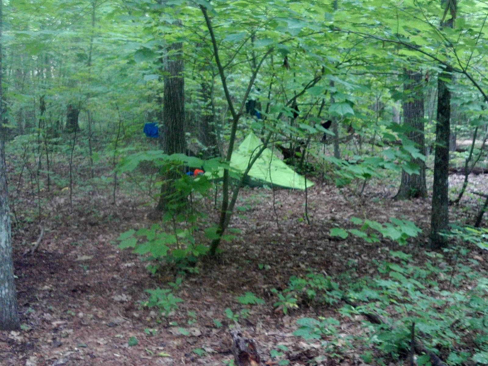
The remainder of the hike was all downhill. I decided to bypass the Lambert's Meadow Shelter for a campsite just beyond. I generally prefer seclusion, especially when I first start out, but the shelter and many of the sites were occupied. I found a quiet spot to pitch my tent, set-up camp, and cooked a dinner of AlpineAire Thai Chicken and noodles, which was very filling. I've gotten pretty good over the years at hanging a bear bag, and I often try to do a combo clothes line. I have a theory that bears don't like the smell of humans, and may stay away from your food if there are smelly clothes nearby. I don't know if this is true, but it has worked so far! It's been a good first day.
 |
| My First Tent Pitch at Lambert's Meadow Campsite |
 |
| I am Proud of My Bear Bag/Clothes Line Combo |
Day 2- Tuesday, June 30 -
Lambert's Meadow campsite to Fullhardt Knob Shelter (14.4 miles)
The day started well. I slept in a little, having had a longer hike the previous day, and broke camp around 9:30 a.m. There were some GREAT views all along the route before crossing Hwy 220 at Daleville. The terrain was also fairly smooth. Unfortunately, there were not any water sources indicated along the route to Fullhardt Knob, which was my next destination. I had decided to pack less water to save weight, but that was probably not the wisest decision, at least on this day.
 |
| View to the West from Hay Rock |
 |
| Another View |
 |
| Trail alongside a Rock Wall |
 |
| Smith Mountain Lake as Seen from on High |
Highway 220 at Daleville is a very busy crossing, so I needed to wait and be careful. There was a convenience store on the opposite side, and I was half tempted to stop, but hiked on. The trail follows a public green space for a ways, with a mowed grass buffer on either side, before it veers to the right and passes under Va highway 779. It is an attractive open stretch of trail.
 |
| Greenway and the AT |
 |
| A Man was Mowing this with a Push Mower |
 |
| Trail under Va. Hwy 779 |
I arrived at Fullardt Knob Shelter a little after 6 p.m. This shelter is unusual in that the only water source was a padlocked concrete cistern immediately behind the shelter. The cistern is supplied from gutters surrounding the shelter, with a pipe running through the ground in back to a spigot. I thought this was a rather creative setup, and wondered why I had never seen it before, especially at shelters that may have an unreliable (or non-existent) water source. I was almost 'bone dry' by the time I arrived at the shelter, so I was very grateful to find water in the cistern. In order to treat the water, I had to pump filter it from my cooking pot, which took a little time. The water had a brownish tint to it, but I figured this was the tannin from the leaves. It tasted good to me.
I was the first one at the shelter, but a little later two other hikers -a male and female - showed up.
I pitched my tent to the left of the shelter, and they also pitched their tents nearby. After dinner, I visited with them briefly, and discovered that they were thru-hikers. The man was from Maine, and was thinking of doing a 'flip flop' at Harper's Ferry. The woman was from Memphis and, like me, just liked to have time alone, and the trail was a great way to do it.
It gets dark early in the mountains, so I retired to my tent to read my book around 8:30 p.m. I was just in the knick of time, as a huge thunderstorm blew through around 9. Since we were on top of a mountain, it felt as though the storm was right on top of us, which it probably was. My tent was also surrounded by trees, and at every lightening bolt, I feared that one of them might come crashing down on my tent. Thankfully, this did not happen, but the rain continued to fall for most of the night. Since it had been somewhat dry recently, the rain was a blessing, and I knew the chances were good that I would not run into dried up water sources further north.
In the morning, I awoke to discover three other late arriving hikers were in the shelter.
Day 3- Wednesday, July 1- Fullhardt Knob Shelter to Bobblets Gap Shelter (13.5 miles)
This seemed like one of the best days of hiking ever- only thirteen miles over relatively gentle terrain, with few climbs. Shortly after starting out, I was passed by three fast moving through-hikers. The three who had come late to the shelter the previous evening. They saw another Box Turtle on the trail, and asked me if I had seen the wild cherries. Unfortunately, I missed that, but we joked about having 'turtle soup', and living off the trail. At Wilson Creek, I passed an interesting historical site - a Colliers pit, which was a place to make charcoal to fire the iron furnaces in the 18th and 19th centuries. I took a break at Wilson's Creek Shelter about 11 a.m., and placed a call to Ginny.
 |
| Trail Eye View |
 |
| Colliers Pit Historical Marker |
 |
| Taking a Break at Wilson Creek Shelter |
I began to notice wild blueberries growing alongside the trail, and these were a treat that I would take full advantage of for the remainder of the hike. This was especially true whenever I was in the midst of a big climb! I was a little too focused on a full blueberry bush at one point, and almost put my hand in a bee hive just to the left of it. One of the bees guarding the hive stung me on the stomach, so I hurried away before the entire colony was upon me - lesson learned. I saw several snakes along the trail, but none of the poisonous variety.
 |
| Lunch Break Foot Selfie |
The trail parallels the Blue Ridge Parkway, and criss-crosses over several BRP overlooks. At the first overlook (Taylor Mountain), I was stopped by a lady from Texas, who was traveling with her daughter, and happened to be driving by. Her 'bucket list' included meeting an AT hiker, and I was happy to oblige. We had a lengthy conversation about hiking, equipment, etc. I wasn't in a big hurry, so it was a nice break.
 |
| Taylor Mountain Overlook on the Blue Ridge Parkway |
 |
| Stopping for a Pic at Harvey Knob Overlook |
I arrived at the side trail to Bobblets Gap Shelter a little before 4:30, and noticed a hand written sign indicating
'trail magic' to the right. I wanted to get to the shelter, and was pondering whether to investigate, when the
'trail angel' responsible for the 'trail magic' invited me to come up to a picnic area next to the Parkway. His name was Steven, a teacher from Roanoke who often came to supply 'trail magic' to hungry hikers. He had a cooler full of canned drinks and water, and bags of Wendy's chicken sandwiches and hamburgers to share. I immediately drank three cans of Mountain Dew, and ate a chicken sandwich. Even though this was only my third day out, this was a welcomed treat, plus I wouldn't need to cook supper !
 |
| 'Trail Angel' Steven, with GREAT 'Trail Magic' |
He said the water source at the shelter was bad, and wanted to leave the cooler of food, drink, and jugs of water at the shelter. He said he would come and pick by and it up the next day. We carried it down the hill, and met two other hikers at the turnoff who helped carry the rest of the way.
The three other hikers at the shelter and I enjoyed the mother lode of 'trail magic' provided by Steven. I pitched my tent just outside the shelter, and got to know my hiking comrades. I was delighted to meet and talk with Vince, who was an elementary music teacher teacher in Gastonia, NC. The other two had been with me the previous evening at Fullhardt Knob: 'Maine man', who's name I didn't get, and Nicky from Memphis, who enjoyed being on the trail for the space it provided, which I could relate to.
 |
| My Tent Pitch Right Next to the Shelter |
 |
| Fellow Hikers at Bobletts Gap Shelter |
Day 4-Thursday, July 2-
Bobblets Gap to unmarked campsite beyond Bryant Ridge (16.6 miles)
I awoke at 6 a.m., as my biological clock seems to dictate, packed up, and ate a breakfast of oatmeal, and my 'rocket fuel' of Swiss Miss chocolate mixed with Starbucks Via instant coffee. I wanted to get started early, as I had the slightly more ambitious goal of an unmarked campsite next to a 'signed' spring (a sign on the trail) marking the blue blazed trail to the water source. This was three miles beyond the second shelter north (Bryant Ridge), but before the third shelter, which was almost two miles further. It was also an uphill climb to the campsite, and I knew what that would feel like at the end of the day.
 |
| Peaks of Otter Overlook |
 |
| Crossing a Parkway Overlook |
 |
| Second Overlook |
Vince, the music teacher, left early. He was stopping in Buchanan to pick up a mail drop. I was next to leave. The trail initially continued to follow the parkway, criss-crossing at several points over gentle terrain, before descending to Bearswallow Gap-Va. hwy 43, with a little stream and footbridge. I stopped briefly at the Cove Mountain Shelter, which had a newly constructed privy and picnic table. Piles of newly sawn wood were still laying near the shelter, and I could smell the sawdust. I arrived at Jennings Creek - Va hwy 614 around 1 p.m., and stopped for lunch at a large 'swimming hole' under the bridge.
 |
| Cove Mountain Shelter - Brand New Picnic Table |
 |
| The Brand New Privy at the Cove Mt. Shelter - I had to try it out! |
 |
| Lunch by the 'Swimming Hole' at Jennings Creek - I didn't try it out |
After that, it was a steep climb up Fork Mountain, and stopped for water near the Bryant Ridge Shelter. It was another very long, steep climb to the campsite, where I arrived around 5 p.m. I set up camp in a nice secluded spot off the trail, but near a fire ring and some logs where I cook and sit. I made a supper of ApineAire Three Cheese Chicken Pasta, which wasn't bad. The 'Maine Man' and Nicky came by and took a little break, but they were heading to the Cornelius Shelter further on. I went down to check out the water source, and it was a nice little spring.
 |
| Nice Forest Ground Cover |
 |
| My Secluded Campsite |
Day 5-Friday, July 3-
Unmarked campsite to Marble Spring campsite (14 miles)
It was a fitful night of interrupted sleep in my tent. About 2 a.m., I was awakened by a loud banging sound close by, as if someone or something was hitting a tree with a baseball bat. I had no idea what it was, but thought it might be after my bear bag. I got up early, and was grateful to see that my bag was still there, as were my clothes hanging below it. I was efficient in breaking camp, and had a breakfast of Mountain House Western Style Scrambled Eggs. It felt good to hit the trail north about 8 a.m.
 |
| The Trail North |
 |
| A Bit of Color on a Gloomy Day |
I needed to fill up on water, but didn't feel like climbing down the hill to get it, so I decided to refill at a stream just south of the Cornelius Shelter about two miles up the trail. The stream by the trail was shallow and silty, so I walked downstream a ways to find a suitable place to pump. I filled up my Nalgene bottles and the hydration reservoir in my pack which, thanks to my hydro-link adaptor, never needed to be physically removed from the pack. My optimal goal today was to make it to the Matts Creek Shelter, which would be about 19 miles. I thought this was doable since I was leaving relatively early. But as often happens, events would dictate otherwise.
After stopping for water, I continued to hike another mile or so, when I suddenly realized that my prescription sunglasses, which had been hanging around my neck, were no longer there. I thought that they might've pulled off when I put my pack back on after pumping water. I made the quick decision to backtrack and look for them along the trail since it was still early, and I did not want to lose these expensive glasses. I backtracked to the stream, looking carefully along the way, and found them sitting on the rock where I had sat to pump water, as though someone had placed them there for me. I said a prayer of gratitude, and got back to the trail, knowing I would probably need to adjust my distance goal for the day.
 |
| Sign at the Summit of Apple Orchard Mountain |
At the cutoff trail to Apple Orchard Falls, I encountered a father and young daughter who were out for a day hike. We chatted briefly, and even though I love waterfalls, I decided not to make the trip down to look. The weather was overcast and cool as I climbed Apple Orchard Mountain, and did not see anyone. My trail guidebook indicated an FAA tower at the summit. I was expecting something similar to what I had seen at Snowbird Mountain. There was an open bald at the top, but it was very foggy, so I couldn't see very far. Slowly I began to see a gigantic, ghostly white image looming eerily through the mist. Even though I knew it was man made, this FAA installation was an awesome sight!
 |
| Foggy Summit of Apple Orchard Mountain |
 |
| Another View of the Trail |
 |
| The 'Ghostly' FAA Tower |
I must say I have had some very strange and/or providential encounters on my hikes. Many things have happened that I cannot explain. I had only encountered two people (the father and daughter) so far this day, but I was about to encounter one who seemingly came out of nowhere, but at exactly the right moment in time. The descent from Apple Orchard Mountain was rocky and steep, and the rocks were a little wet and slick. I slipped hard and almost fell sideways down an embankment. Fortunately I caught myself, and stood up, but I did not look to see if anything had dropped off my pack. About twenty feet further was a geologic formation called 'the guillotine'. It was a triangular rock wedged between two rock walls directly over the trail as though it was about to fall - hence the name.
 |
| The So-Called 'Guillotine' over the Trail |
I paused to get a picture when I heard a light voice behind me - "This is your water bottle.". It was a youngish girl dressed in very light clothes, and this was an unseasonably cool day, in which I had not felt compelled to remove my rain jacket all morning. One of my blue one-liter Nalgene water bottles had apparently popped out the side pouch on my pack when I had fallen. I had not known it was missing, and asked her if she had seen me fall. She said no, and handed me the water bottle. I thanked her, and she disappeared down the trail - never to be seen by me again. I know from experience that losing ANY kind of water container on the trail can be serious, and it is unlikely I would have discovered it was missing until I needed it. I cannot explain where this person had come from, or where she had gone, but I do believe in angels, and I may have actually been blessed to see one.
 |
| Misty Path Through Much of the Day |
 |
| The Thunder Ridge Wilderness |
At the bottom of the hill, the trail crossed the parkway, and moved past several overlooks, but it remained too foggy to see anything. I stopped for lunch at the Thunder Hill Shelter, and placed a call to my daughter, Josie. The 'Maine Man' hiker came by just as I was leaving the shelter. It was a hard climb up to the top of High Cock Knob. I met a fast moving day-hiker who passed me on the way up, and was coming back down while I was still climbing. He inquired about my hike, and we chatted a bit. I had already decided to head for the Marble Spring campsite, which was in the gap just beyond the knob. On the way down, I encountered two girls who told me that the spring was dry. It began to rain just as I reached the campsite. I scouted around for a level spot, and pitched my tent. The 'Maine Man' and Nicky arrived a short time later, and also decided to make camp here.
 |
| My Campsite at Marble Spring |
It began to rain hard, and I was grateful that had arrived in camp at just the right time. It subsided a little, and I was able to cook supper at the fire ring, but the rain picked up again, and came down hard for most of the night.
Day 6-Saturday, July 4-
Marble Spring campsite to John's Hollow Shelter (9.4 miles)
Just a short hike today, so I took my time getting up in the morning. I did eventually pull myself out of bed around 7:30. I usually pack up my tent first, but since it was fairly wet, I decided to leave it up a little longer in the hope that it might dry out. The 'Maine Man' left early, but I sat down to make breakfast, and had a nice conversation with Nicky about personality types, etc. She had been on the trail since April, and loved it, but was considering ending her hike. We both had trail blogs, and she expressed an interest in using hers-
Blue Ridge Girl - to inspire others to hike, which is partially the goal of this blog. After we exchanged blog information, she took off, and this was the last I saw of her.
As I was finishing my breakfast, Vince from Gastonia came through. He had gotten caught in the rain the previous evening, and had to pitch his tent up the hill in not great conditions. Just after he left, about eight or ten trail runners came by and took a break. Some went down to get water, and I visited briefly with one who appeared to be a leader. He told me that they were doing a twelve mile loop. I told him that I also liked to run trails, and that if I wasn't hiking, I would probably be doing what they were doing. I wished them well, and they left.
 |
| Entering the James River Wilderness |
 |
| Lunch at Matts Creek Shelter |
I broke camp around 10:30 a.m. even though my tent was still not completely dried out. The blueberries were ripe almost all along the trail, which really made the hill climbs more pleasant. I was glad just to take my time and enjoy the feast. I crossed into the James River Wilderness, and began the descent to the James River valley. I was looking forward to crossing the James River on the longest foot traffic only bridge on the AT. I reached the Matts Creek Shelter a little after noon, and had a lunch of ramen noodles and Lipton chicken noodle cup-a-soup. This is a trail lunch that requires stopping to boil water, but I am finding that I do not get tired of it, and it gives me plenty of nutritious energy: carbs and sodium to get me through the second half of the day.
 |
| Trail along the James River |
 |
| Foot Bridge Dedication Plaque |
 |
| View Below the Bridge |
 |
| Getting Ready to Cross the James River |
Vince was there when I first arrived at the shelter. He apparently had gone 'skinny dipping' in the creek, but left fairly quickly. Two
slackpackers showed up. They had been section hiking the trail for many years, but no longer cared to do the full backpacking adventure. They did give me some idea of the trail ahead. The trail parallels the James River for about one mile before crossing on the long footbridge which comes out at the parking lot at US hwy 501. There were people kayaking on the river, and a hydro electric dam downstream. I asked a couple who were crossing the bridge if they would snap my picture, but after six days on the trail, I was beginning to look and feel a little grungy.
 |
| On the Bridge and Slightly Scruffy! |
I crossed the highway, and the trail followed a pretty little stream for over a mile. I finally arrived at the Johns Hollow Shelter, and pitched my tent. Vince from Gastonia was already at the shelter.
 |
| A Smaller Bridge |
 |
| Following a Pretty Stream |
Day 7- Sunday, July 5- John's Hollow Shelter to Brown Mountain Creek Shelter (18.3 miles)
Today was to be the longest day so far on my trip. My shelter destination is only 2 miles from US 60, and I was looking forward to a 'nero day' in Buena Vista tomorrow to resupply and re-energize.
 |
| All Packed and Ready to Go! |
 |
| Getting Water for the Day |
There was a steep climb to begin the day up Little Rocky Row and Big Rocky Row. I really don't mind the climbs so much at the beginning of a day. I am generally more energetic in the mornings. Still, there were plenty of goodies along the trail - blueberries, raspberries, blackberries, along with many colorful flowers- to take my attention off of the hills, so I slowed way down. There were some nice views at the top, which is always a nice reward for a strenuous climb.
 |
| A Tough Climb in Spots |
 |
| Samples of Different Colored Flowers (Here and Below) |
 |
| Many Natural Trail Treats |
The trail leveled out, but there was another climb to come up Bluff Mountain. I crossed paths with a
ridge runner, Regina, below Bluff Mountain. Regina was responsible for sixty miles of trail, and had also done a complete thru-hike in 2007. She was very helpful in giving me information concerning water sources up ahead, and distance to the Punchbowl Shelter, where I would stop for lunch. She also gave me the number of a shuttle driver, who might be able to shuttle me into Buena Vista.
 |
| Memorial Marker To Ottie Cline Powell on top of Bluff Mountain |
On the summit of Bluff Mountain there was a memorial marker to Ottie Cline Powell, a four year old boy who had been found dead on this spot in 1891, seven miles from where he had disappeared - very strange indeed, and it gave me chill bumps to read the marker. Since I had cell service, I called to make a reservation at the Buena Vista Motel for tomorrow, and also called the shuttle driver to arrange for pickup at the US 60 trail head. I figured I could be at the trailhead by 10:30 since it was a short hike, and check-in to the motel was not until 11.
 |
| Cutoff Trail to the Punchbowl Shelter |
I stopped for lunch at the Punchbowl Shelter, which is actually down in a punchbowl shaped hollow next to a manmade pond. I am thinking that there was probably an early settlers cabin here at one time, as there is also a separate boxed spring water source below the pond. Shortly beyond the shelter, I crossed the Blue Ridge Parkway and was happy to dump my trash bag in a bin at the parking lot.
 |
| Old Sign for the National Forest |
I continued across a nice little river, and up a hill next to a reservoir, with nice views of the water and dam below. I was still pigging out on blueberries, but decided to quicken my pace since it was getting later in the day, and I still had a ways to go. There were also some nice springs along the way. I've noticed that every water spot almost becomes an obsession when one is hiking. After a time, I crossed Brown Creek, and continued to follow the creek up a draw until I arrived at the shelter around 7:30. I was tired, and it was late in the day. I had the shelter to myself, so I decided to stay in it rather than pitch my tent. This was the only time on the entire trip that I did not stay in my tent. It also started to rain just after I arrived. The rain came down fairly hard, so I had to wait a while to cook supper. By the time I finished, it was after dark, and I could not find a suitable place to hang a bear bag.
 |
| Crossing a Nice Little River |
 |
| Brown Mountain Creek |
 |
| Trail along the Creek |
It was not a great night's sleep in the shelter. I tried to read my book, but the headlamp attracted too many insects. I was also a little anxious since I hadn't been able to hang my food, and I felt like I was hearing voices in night, but it was probably only the sound of the creek nearby. Fortunately, this shelter appeared to have NO mice in it, which was a blessing, and very unusual for AT shelters. I was definitely looking forward to having most of the day off the trail tomorrow.
 |
| Taking Over the Shelter |
Day 8- Monday, July 6- Brown Mountain Creek Shelter to U.S. 60 Buena Vista, VA (1.8 miles)
After a fitful night in the shelter, I got up at 6 a.m. and went to the creek to get water for breakfast. Some of the freeze dried Mountain House breakfasts I was carrying gave the option of putting them in a tortilla as a breakfast wrap. I had been carrying some soft tortillas for my lunches with tuna salad, but I had never used them in this way. I had a few left, so I decided to try it, and it was REALLY good! (note to self - do this next time) It was only two miles to the highway, and the shuttle was coming at 10:30, so I did not need to rush.
 |
| My Mountain House Breakfast Skillet Wrap and Coffee/Cocoa Rocket Fuel - Yum! |
 |
| Info. About the Brown Mountain Creek Community |
I walked very slowly, and stopped briefly to read a sign about the 'Brown Mountain Creek Community'. Following the Civil War, there had been an active community of share-cropping ex slaves along the corridor of this creek. The sign contained a remembrance of this community by someone who had lived here and grown up in it. There was little evidence, other than fragments of an occasional stone wall, that this thriving community had ever existed.
Despite walking very slowly, I arrived early (about 9:45 a.m.) at the road crossing. There was a small wayside on the opposite side, with a picnic table, so I crossed over and sat down to read my book and await the shuttle. No sooner had I settled down than the driver arrived. His name was, Aubrey 'Piney' Taylor, and he had been shuttling AT hikers for almost fifty years. He was a friendly native of the area who, in addition to shuttling hikers, looked after property for people while they were away. Buena Vista is nine miles west, and since I was early and not in any big hurry, he drove around a little to check on some places, and showed me around the town a little. We turned a corner, and happened to see Vince, the music teacher from Gastonia. We beeped and waved, and I never saw him again after that.
I was dropped off at the Buena Vista Motel around 10:30 a.m., and made arrangements for 'Piney' to pick me up at 9 the next day. Though I was early, I could check into my room. The motel was a nostalgic looking plaza style motel. It reminded me a little of the Relax Inn in Atkins, Va, where I had stayed in on my AT year 4 adventure. It had obviously seen its heyday, but the room was comfortable, and the AC worked! The first thing I did was soak in the bath for a long time and read my book. Afterwards, I decided to walk into town to get something to eat, resupply, and do laundry. The motel proprietor gave me a map, and showed me where things were located.
 |
| The Buena Vista Motel |
Buena Vista is not really a 'trail town', so hiker resupply options are limited. It is also a good walk into town from the motel, but after a hundred miles, what's another mile or two! I went to the local Hardees first, which seemed to operate on the 'chaos system' of management. After a long wait for my two hot dogs, I walked down to the laundromat, which was probably another mile into town. I collected a few supplies at the Dollar General - ramen, oatmeal, and Swiss Miss. I figured this was enough to get me to Waynesboro, which IS an official AT 'trail town', where I could do a major resupply. I looked around a little for fuel for my alcohol stove, and got some Heet at the Advance Auto store. By this time, I was hungry again, so I went to the Canton Chinese restaurant, where I had the broccoli and chicken, which was really good.
I walked back to the motel, and was hungry again a short time later, but the streets in Buena Vista roll up after dark, so I stopped at a convenience store and bought an array of junk food, which I eagerly and promptly devoured. It always amazes me what a partial day off the trail can do.
Day 9- Tuesday, July 7- Buena Vista to Seeley-Woodworth Shelter (14 miles)
I slept well in a comfortable bed. I got up around 7:30, and started packing up my stuff. I had my instant oat meal for breakfast, along with really bad motel coffee. The shuttle driver, 'Piney' Taylor, picked me up at 9, and we rode to the trailhead. I told him I was planning to take another resupply day in Waynesboro, and he gave me the name and number of another shuttle driver, Dubose 'Yellow Truck' Eggleston, who covered the Waynesboro area and northward.
 |
| Aubrey 'Piney' Taylor - My Shuttle Driver in Buena Vista |
It was only a thirteen or fourteen mile hike to the Seeley-Woodworth Shelter, where I planned to camp this evening, so it was nice again to not feel the need to push hard. I generally do not like to hike past five or six o'clock in the evening, so depending on the distance, I start earlier or later. It was a tough climb to begin, and I was passed in a little while by a fast moving thru-hiker. I passed him a little later when he stopped to consult his map, and we talked a little. I gathered from his accent, that he was from Europe. He passed me again, and I could tell he was planning to go much farther than me today, and would probably not see him again.
 |
| A Nice View from Cole Mountain |
I took my time, passed the Cow Camp Shelter, and stopped for lunch at Hog Camp Gap. There was a nice grassy area with a many campsites, and a tree swing. I cooked my lunch near the swing, and sat in it to eat. I crossed some nice open balds, with great views, which is always a treat. This was the first time on this trek that I have seen this kind of open terrain at higher elevations. This seems to be more common further south.
 |
| An Open Path - Many Fruit Trees |
 |
| High Pasture |
 |
| Signed Tree Swing at Hog Camp Gap |
The terrain was fairly easy and smooth after that. Between here and the shelter is where I encountered the pringles man again, whom I had encountered on my very first day just below McAfee Knob. He offered me Pringles again, and this time I accepted. I found out that his name was Gerard, but his trail name was 'Pringles' (naturally). He was doing a thru-hike by doing a series of long day hikes, parking at a trailhead, and always hiking from north to south, and then shuttling back to his car to drive to the next spot north. This explains why I had seen him before, and would see him every day until I arrived in Waynesboro.
I stopped for water at Piney River north fork, which looked to be more of a creek than a river, and headed onward to the shelter. I arrived at the shelter about 5 p.m. There was someone in the shelter, but there were plenty of good campsites around the perimeter. I found a place behind the shelter to pitch my tent, and set up camp. I made supper at the picnic table by the shelter, and met the hiker there. It was woman, probably in her mid to late forties, from Berlin, Germany. Her English was not much better than my German, but she carried an English phrase book to help communicate. It did not always translate well, but I found out she was a thru-hiker, who had decided to hike the AT after hiking the Camino de Santiago in Spain. She wanted to do something longer. I thought her brave to do this on her own, but she had read many books, and had planned well. She was to meet a friend in Harper's Ferry on the 28, but I thought she would have no problem getting there by then.
Day 10- Wednesday, July 8- Seeley-Woodworth Shelter to Harpers Creek Shelter (14.2 miles)
I got up at 6, broke camp, went down to a VERY nice piped spring to pump water. I love to see springs on the trail, because the water is cleaner and colder. Often a pipe is inserted to improve the flow. In my experience, water sources can sometimes be pitiful and/or silty, but I found mostly excellent sources throughout the entire hike. At breakfast, I chatted with the German lady again. The rain seemed to be threatening once again, but it held off, and she left a little before I did.
 |
| A Nice Piped Spring |
 |
| A Bent Tree over the Trail |
This was a GREAT day of hiking, with cooler weather. I have seen many great sites and view spots, and am rarely at a loss for words, but I came to a memorable location early on this day. It was a short hike from the shelter to Spy Rock, and there is a short side trail to the rock. It is a very tough scramble to the top, and I recommend NOT trying to do it with a pack on. I left my pack down below, and climbed up to the top. I don't know that the pictures do it justice, but all I can say is 'wow'! It was definitely a high point of the entire trek so far. It was a solid rock dome, with 360 degree views. Coming down the mountain, I crossed paths with a couple other hikers, and recommended it to them.
 |
| Side Trail to Spy Rock |
 |
| Looking Up from Below |
 |
| Making the Ascent |
 |
| Views from the Top |
 |
| Another View |
 |
| One More |
I entered 'The Priest' wilderness, named for the tallest mountain in the area, which the trail crosses. I had lunch at The Priest Shelter, which is on a side trail to the right before the summit. At the trail intersection, I saw and greeted the German lady, who had just finished her lunch. There was another beautiful spring at the shelter, with water coming right out of the ground.
 |
| Entering The Priest Wilderness |
 |
| Lunch at the Shelter |
 |
| Great Ground Spring |
The south approach to The Priest is not a bad climb, but there is a long descent on the northern side. There were some more great views at the summit. I encountered a few hikers on the long descent from the mountain, including Mr. Pringles once again.
 |
| View From The Priest |
I crossed the Tye River on a nice suspension bridge, and then up a ridge to reach the shelter. There were some kids (noisy) playing in the creek, and camping across from the shelter, and the German lady was in the shelter. I decided to look for a campsite down the ridge line to the left of the shelter, and found a nice secluded spot next to the creek. It was a little too far back from the shelter to cook there, but there were come nice rocks next to the creek I could sit on and spread out.
 |
| Bridge over the River Tye - :-) |
 |
| The River Tye (I love the name) |
 |
| Harper's Creek |
 |
| My Campsite Near the Creek |
Day 11- Thursday, July 9- Harpers Creek Shelter to View spot campsite (14.7 miles)
I got up at 6 a.m., and got an unusually early start around 8 a.m. On the way out I passed the shelter and spoke with the German lady, whose name was Brigitte, along with another hiker (male) who was there. I was uncertain of the way back to the AT. The sign pointing to the shelter off the trail, instead of saying something like...Oh, I don't know..."shelter", instead was a low post, with some kind of glyph drawing of a shelter on it - like a cave dweller might create. After asking directions, I did get a vague idea of where to go, and bid 'Auf Wiedersehen'. I still wasn't completely sure, however, so I asked one of the kids down by the creek, and got an even more confusing answer, which seemed to direct me back in the direction from whence I had come.
I later discovered the reason for this confusion. Just south of where I currently was, the AT intersects a trail called 'Mau-Har'. This trail bypasses Three Ridges Mountain, just north of where I was, and reconnects with the AT at the Maupin Field Shelter. The sign at the trail intersection indicates 'AT 3 miles', so apparently many AT hikers blindly go that way. Fortunately I didn't know this at the time, and wound up ignoring all this confusing advice and going in the right direction anyway. Sometimes it is best to ignore what you hear or see, and just trust your instincts.
The climb up Three Ridges Mountain was probably the most strenuous of my entire hike. It is very long, and the trail seems to actually plateau in three different places before you finally arrive at the summit. There were some really good views to be had on the way up, though, and also on the descent.
I stopped for lunch at Maupin Field Shelter, and discovered the 'kids' from the Harpers Creek Shelter were already there. It was actually a father and two sons out for a two day trip. One of them was the person I had asked directions from that morning, and they had not been close to leaving at that time. This is when I figured out that they had done the Mau Har trail bypass, which was evidently also a shortcut.
 |
| On the Way up Three Ridges Mountain |
 |
| Another Great View |
 |
| Just a Nice Lilly |
I started to cook lunch, but ended up spilling my entire pot of hot water. Rather than waste fuel and time, I just decided to have a protein bar instead. Shortly after leaving the shelter, I ran into "Pringles" again. This time decided to take his picture. He asked me if he could have a copy of the pic, so I gave him my email address, and asked him to email me or friend me on FB, and I would give him a copy.
 |
| Gerard - a.k.a. "Pringles" |
The trail between the Maupin Field Shelter and Dripping Rock Spring is very boring and tedious - flat and mostly uninteresting. The trail does move alongside a retaining wall for the parkway, which is kind of neat. I was passed by a pair of fast moving thru-hikers, and presently came to the Dripping Rock spring, which was just adjacent to the Blue Ridge Parkway. The thru-hikers were resting at the spring, and I visited a little with them. It was a nice looking spring, but I didn't stop for water. Less than a mile beyond this spring was another spring at Laurel Springs Gap. It was definitely NOT a good water source, but a trail angel had left several half gallon containers that said, 'Wintergreen tap water'. I wasn't sure what 'Wintergreen' was, but I went ahead and replenished my bottles.
 |
| Trail Alongside BRP Retaining Wall |
 |
| This Old Farm Implement Was also Interesting |
My destination for the evening was on Humpback Mountain, at a campsite with a view, but no water source. I reached the campsite a little after 5 p.m., and there was one other guy camped there. He was from Ireland, but was married to an American woman from West Virginia, and he took hiking trips when they came over to visit her family. The campsite was one of the most beautiful spots I have ever camped in. I was on top of a mountain, with great views across a broad valley. Visible across this valley, on the side of a mountain, was a large complex of buildings. I found out that this was the Wintergreen ski resort, where the trail angel tap water had come from.
 |
| View From Humpback Mountain, Adjacent to my Campsite |
 |
| The Wintergreen Ski Resort Across the Valley |
 |
| Capturing the Sunset from the Mountain |
 |
| My Mountaintop Campsite - Finally Drying Out! |
There was distant thunder, and clouds started rolling in. I thought we might be in for another storm, but it seemed to have bypassed us this time. It was a windy night on top of the mountain, but no rain, so I was able to finally dry out some of my stuff. After I retired to my tent for the evening, some other people showed up in camp, and pitched their tents nearby.
Day 12- Friday, July 10- View spot campsite to Rockfish Gap, Waynesboro, Va (12.4 miles)
I felt no need to rush in the morning, and laid in my tent until 7:30. Everyone was gone by the time I got up. As I was packing to leave, an older thru-hiker came through, and we talked a little. He was hiking to raise funds and awareness for Parkinson's Disease. He gave me one of his cards -
Donald Havener - Solitary Through Hiker . I said I would spread the word on my blog, and also shared my blog information with him.
 |
| An Old Stone Wall |
 |
| View on the Way to Waynesboro |
It was a fairly smooth day of hiking, and mostly downhill to the Paul Wolfe Shelter. There was a nice marble memorial bench in front of the shelter where I sat down to rest. I refilled my water bottles from the creek in front and hiked on. I crossed paths with "Pringles" for fourth and final time on my hike. After a while, I came to a small cemetery, with stone grave markers, but no discernible writing on them. Flowers had been placed next to some of the markers, so it had been cared for. The guidebook indicated an old cabin ruins up ahead. I assumed that this area must've been a family farm or homestead at one time.
 |
| Memorial Bench in Front of the Paul Wolfe Shelter |
Further on, I passed an area with some scattered circular piles of stone, and remembered seeing something similar on my hike last year. It suddenly dawned on my what these piles of stone might be. Naturally the early farmers and/or settlers would've needed to clear rocks from sections of their property to create spaces for grazing and/or cultivation. I believe that these organized piles were simply places where they had stacked the stones. They could have also served as boundary markers. I came to the cabin ruins, which were right alongside the trail. The chimney was the only obvious remnant of the structure remaining.
 |
| Stone Piles |
 |
| Cabin Ruins and Chimney Remnant |
I stopped by a nice spring to place a call ahead to the Colony Motel in Waynesboro, where I was planning to stay two evenings. I needed to do a major resupply, and had decided to make Waynesboro my first complete 'zero' day off the trail in six years of section hikes. The Colony was about a half mile down the road into Waynesboro, so I wouldn't need to shuttle to it.
Waynesboro has recieved official 'trail town' status, but it is four miles off the trail down a busy highway. Fortunately, I encountered Regina, the helpful ridge runner I had seen several days earlier, and she told me about the 'trail angel' network who could supply free shuttles into town for AT hikers. She told me to look for a laminated list that was posted at Rockfish Gap.
I arrived at Rockfish Gap about 3 p.m., and saw the posted list of trail angels. Since the screen on my camera had cracked several days before, I did not snap a picture, which would've been the simplest thing to do. Instead, I wrote down four or five of the names and contact numbers. I crossed the parkway, and hiked down the hill to the King's Gormet Kettle Corn truck, and got a couple hotdogs and drinks. I then proceeded to walk the half mile down highway 250 to the Colony House Motel. It was not the greatest place. I was thinking that the hostel in town might've been the better option, but I had a private room, and the AC worked! I took a shower, cleaned up, and called one of the angels on my list, who's name was Tom Reider. He graciously agreed to pick me up and shuttle me into town the next morning at 9 a.m. There were no restaurants nearby, so I made a supper of ramen noodles.
Day 13- Saturday, July 11- Zero day- Waynesboro, Va
I woke up early, and inventoried all my food and equipment to make a list for resupply. I waited outside the motel at 9 a.m. for the 'trail angel', Tom. I waited about half an hour, and finally called his number again. He had forgotten, but came by and took me into town about 10 a.m., dropping me off at the laundromat. It was very nice getting to know him, and he was flexible with his time, so I said I would call him back in the late afternoon when I was ready to return to the motel.
It was a rainy day from the start, so I was wearing my rain suit in the morning, but took it off when the rain subsided later in the day. I did my laundry, and walked over to the Kroger store to pick up a few things. The outfitters was on the road back to the motel, so I thought I might ask to stop there on the way back. I needed to pickup some freeze dried trail food, and some other specialty items. I had plenty of time, so I walked around town to scout places to eat, etc. I ate lunch at the Ming Garden AYCE Chinese buffet. It was wonderful, and I did have all I could eat!
 |
| Crossing the South River Bridge into Town |
 |
| The Ming Garden AYCE Chinese Buffet - GREAT buffet!! |
After lunch I walked around town again, and crossed a bridge over the South River, where I could see people fly fishing down below. I went down Main Street, and back up Broad Street, and bought some Heet at the Advance Auto Store. I came back down to the river, and sat a while in the park down below where the people had been fishing. I called Tom for pickup around 3 p.m.. On the way back up the motel we stopped at the outfitters, and purchased enough freeze dried dinners to last another week, and some camp soap. After returning to the motel, I loaded up my pack, and prepped for an early departure tomorrow. It was nice having one complete day off the trail to myself - my first one ever, but the overall plan for the trip seemed to be working.
 |
| Fisherman Fly Fishing on the South River |
 |
| Down in the Park By the River |
 |
| A Fly Fishing Sculpture in the Park |
Day 14-Sunday, July 12- Rockfish Gap, Waynesboro to Blackrock Hut, SNP (20.7 miles)
I got up at 6, ate breakfast in my room, checked out of the motel, and walked back up the hill along the highway to Rockfish Gap. It was a pleasant morning, with not much traffic. I followed the Blue Ridge Parkway from Rockfish Gap until it entered the Shenandoah National Park, from there is becomes 'Skyline Drive'. The trail turns into the woods to the right, and up a hill to the park self-registration Kiosk. As in the Smokies, all hikers are required to register, and submit their planned itinerary. The difference is that hikers are encouraged, but not required to stay in the shelters. It also doesn't cost anything to register, but if you don't have a back country camping permit, you could be fined. I filled out the registration form, deposited a copy in the box, and attached another copy to the outside of my pack.
Hiking through SNP on the trail is a different experience from almost every other place I have hiked. The trail is well-traveled, and generally follows the Skyline Drive through the park. There are very few big climbs, and it is relatively level hiking in many places. The shelters are called, 'huts' in the SNP, and most of them have designated and marked campsites nearby. There are also wayside shops, restaurants, and improved campgrounds with laundry and shower facilities adjacent to Skyline Drive and the AT. All these amenities made for an unusually smooth and pleasant hiking experience. I call the trail through here, 'domesticated'.
 |
| Crossing Skyline Drive at McCormick Gap |
 |
| Communications Tower on Bears Den Mountain |
 |
| Tractor Seat on Bears Den Mountain |
At first I was thinking of maybe just hiking from shelter to shelter, but the first shelter (Calf Mountain) was only eight miles, so I decided early in the day to aim for the second shelter (Blackrock). Though this was to be the longest hiking day of my entire trip, it was probably the easiest - no really big climbs and a smooth path- plus I was feeling rested and energized after a complete day off the trail. I crossed skyline drive, and came to a big communications array on top on top of Bears Den Mountain. There were several little tractor seats embedded in the ground in front of the site - like a misplaced children's playground. Past Bears Den Mountain was Little Calf and Calf Mountains, with some nice meadows and open bald areas at the summits.
 |
| Heading Towards Little Calf Mountain |
 |
| Little Calf Mountain |
 |
| Nice Open Bald |
I could see that water sources up ahead were limited, so I stopped near a spring just past Calf Mountain for lunch, and refilled my bottles. The remainder of the day was relatively uneventful. I criss-crossed Skyline Drive, encountered a few day hikers, and feasted on wild blueberries, which were in abundance, arriving at the hut about 6 p.m. The shelter was occupied, as were campsites adjacent to it, so I set up camp on a designated site some distance behind the shelter. I was relishing the seclusion.
 |
| Wild Blueberries - Yum!! |
Day 15- Monday, July 13- Blackrock Hut to Pinefield Hut, SNP (13.2 miles)
It was only 13 miles or so to Pinefield Hut, so I didn't rush to get up after another rainy night in my tent. There were other people in the shelter, and camped beside it, but most of them left before me. I loaded up with water from the nice spring in front of the shelter, and took off about 9 a.m. The weather was cool and foggy as I departed, and made the climb up Blackrock Mountain. The trail crossed some open rock slide areas on the way up which were difficult to navigate. If it hadn't been so foggy, I am sure there would have also been some nice views. Two of the people who had been in the shelter passed me, and I also ran into some day hikers coming up the opposite direction.
 |
| Treacherous Rock Slide Areas on Blackrock Mountain |
 |
| Trail On the Rocks |
I thought about stopping at the Loft Mountain camp store for lunch, but decided to shoot for the Loft Mountain wayside instead, which is about a half mile off the trail. There is a restaurant at the wayside. I crossed paths with a couple who recommended the blackberry milkshakes, and I was sold - no need to do trail food today!
 |
| A Very Foggy Morning |
I took the blue blazed Frazier Discovery trail down the hill to Skyline Drive, and the wayside was across the road to the south. The fog was so thick when I arrived at the road that I could barely see ten feet in front of me, and couldn't even make out where the building was. I managed to get there, and enjoyed a GREAT burger w/ fries, and the blackberry milkshake. I left feeling full and satisfied.
 |
| Poor Visibility on Skyline Drive |
 |
| The Loft Mountain Wayside |
I took water at Ivy Spring. The weather cleared, and I got a couple nice views. I reached the hut about 4:30. There were a bunch of guys in the shelter, so I went up the hill to look for a campsite, and found a nice elevated spot to pitch my wet tent, which I tried to dry out a little with my camp towel.
 |
| Great View to West Past Ivy Creek |
Day 16- Tuesday, July 14-Pinefield Hut to Hightop Hut, SNP (8.2 miles)
This was the shortest day of the entire hike - just an eight mile jaunt to Hightop Shelter. I took my time getting started. There were a few good climbs along the way, and a very nice view towards Powell Gap. I took a break there about 11, and placed a call to my daughter Josie, who is a college student. She sounded a bit groggy, and I could tell that I had woken her up, but it was good to talk with her. :-)
 |
| View Spot Towards Powell Gap Hollow |
 |
| Powell Gap Skyline Drive |
One significant milestone of this day was passing the 200 mile mark for the overall trip. This is my new goal each year, so anything beyond this goal seems like 'gravy'. I stopped along the trail for lunch, and saw something I had never seen before. I heard a squeaking sound, and looked to see a brown toad hopping up the trail. He passed me and continued up the hill, never deviating from the trail. I thought he must've been a day hiker since I didn't see a pack!
I arrived at Hightop Hut at the early time of 2:30. There was no one there, so I had my choice of campsites. I found a flat one, and since it was sunny, I pitched my tent, and opened it up to dry out. The ground was not too rough, so I inflated my sleeping pad, and laid down on it outside the tent to read my book. Others arrived at the shelter, some staying it it, while others pitched tents or hammocks. I went down the hill to check out the water source, and it was one of the best piped springs I had ever seen - definitely in the spring 'hall of fame'. Around 6 p.m., another rainstorm blew through, so everything was wet again - oh well!
Day 17- Wednesday, July 15- Hightop Hut to Bearfence Mountain Hut, SNP (12.4 miles)
I woke up at 6, ate breakfast in front of the shelter, and chatted with a man from Oregon, who was hiking with his two grown sons who lived in Cartersville, GA. They had a pattern of doing an extended hike together every five years, but were considering shortening the interval to every other year instead. They were also hiking from shelter to shelter, so we had been paralleling one another. We talked about edible plants on the AT. I said I had been eating many blueberries, raspberries, blackberries, and huckleberries. He told me about
Lamb's-Quarters, an edible green, and pointed out some growing next to the shelter. I thought I would keep an eye out for it.
It was an uphill to Hightop Mountain with a good view to the west on the flank, and then a downhill hike up to Swift Run Gap. On the way down I was passed by a hiker who had been in the shelter. I crossed the bridge over US Highway 33, the crossroads to Elkton, Va. - the minimal goal on my hike. I took a lunch break at the South River Falls picnic area. The falls were 1.2 miles off the trail downhill, so I decided not to go down and look. Actually, I think I may have been to these falls once when I was younger. Other than Hightop, there were no great sights along the way.
 |
| I Think This is From Hightop Mountain |
 |
| Open Path Near Lewis Campground |
 |
| Strange Mushrooms Shaped like little golf balls |
 |
| South River Falls Picnic Area |
I passed the side trail to the Lewis Mountain Campground, which is another improved campground in the park. I passed the hiker who had passed up me earlier. He was sleeping in a gap just beyond the campground. I tried not to disturb him as I walked by. I reached the shelter about 4 p.m. and, again, I was the first one there. I chose a really nice wooded campsite back behind the shelter. As I was setting up camp, an older gentleman stopped by. He had parked up by Skyline Drive, and just came down to look at the shelter; reminiscing about hikes he had taken years before, and seeing how things had changed. Other people showed up later.
Day 18- Thursday, July 16- Bearfence Mountain Hut to Rock Spring Hut, SNP (11.5 miles)
It was a cold night in the tent, but NO rain, so all my stuff dried out!! - yay!! It was an unusually cold morning, so I wore my rain jacket to stay warm. I ate breakfast down by the shelter, and had some conversation with a couple of thru-hikers. The section-hiking man and his two sons had also camped there. I mentioned stopping my hike at Thornton Gap, Luray, and they said they were thinking of doing the same thing. I suggested possibly getting a shuttle together. They needed a long distance shuttle back to Waynesboro, but I just needed a short lift into town, which I didn't think would be difficult to arrange. Since we were planning to camp at the same shelters, I said I would check on the possibilities, and let them know what I found out. Before departing for the day, I asked the father if he would take my picture, and introduced myself. His name was Wilson, and his two sons were Jonathan and Aaron.
 |
| My Bear bag Hanging on the Pole Contraption by the Shelter |
 |
| My 'Three Quarter Grizzle' Pic in Front of Bearfence Mountain Hut |
It was only an 11 mile trip today, with another wayside lunch planned at Big Meadows in between - what a treat! I was starting to feel a little spoiled on this hike! I arrived at Big Meadows about noon, and went up to eat at the restaurant. I had the fried chicken dinner with mashed potatoes and cole slaw, and followed that up with the very best blackberry milkshake on earth. I thought I had died and gone to heaven!
 |
| Big Meadows on Skyline Drive- The Wayside is Just Up and to the Left |
Afterwards, I walked back down the road to a place where I could get cell service, and placed some calls. I made a motel reservation in Luray, and then made some inquiries about possible shuttles at the gap - both for myself, and for the three others who were going back to Waynesboro. I checked with an outfitters in Luray to get names of shuttle drivers. They gave me a few names, but were not hopeful of finding someone on the weekend, especially for the trip to Waynesboro. I placed a few more calls, but without success. I decided I would hike on, and try again where I could get better cell service.
I hiked on and stopped for a rest, and a great view at Franklin Cliffs. This was a good place to make a call, so I decided to call the driver that 'Piney' had suggested in Buena Vista, Dubose 'Yellow Truck' Eggleston. He was VERY helpful. Unfortunately he had a conflict, could not personally do it, but he did provide me the names of several other potential drivers. The first person I called was unavailable, but the second one, Roy Hopkins, WAS available. I asked him what he would charge to take three to Waynesboro, and me to Luray. He gave me the quote for me to Luray, and for the other three to Waynesboro. I said would get back to him with an answer this evening after I had the chance to check with them.
 |
| Stopping Place at Franklin Cliffs |
I arrived at the Rock Spring Hut about 4:30. It was down in an amphitheater shaped hollow, with designated campsites around the upper rim. Since I was the first one there, I got a nice flat 'penthouse suite' on the upper edge.
As I was setting up camp, I made the disturbing discovery my clothes bag, which had been in a green dry sack, was not in the pack. Whenever I break camp, I normally set things aside and together as they are ready to go in the pack, and apparently had missed the clothes bag. I now remembered that the pack had seemed a little easier to load, but I attributed that to my growing efficiency at loading it. I went down to the shelter, and left a note in the register for any SOBO hikers to look for it at the Bearfence Hut site. I also asked a couple of hikers who were heading in that direction if they would please look for it, and put it in the shelter with a note if they found it. Since Bearfence hut is not far off Skyline Drive, I thought I might stop there on the way home in a couple days.
Later on, as I was eating supper by the shelter, I visited with Brigitte (the German lady) along with another young and gregarious female thru-hiker, who was also staying there. Brigitte gave me some left over instant mashed potatoes, which I mixed with my leftover freeze dried lasagna - which was surprisingly good. Wilson and his two sons showed up in camp around 6 p.m., and I told him the price quote I was given for the shuttle from Thornton Gap. He had already checked with a cab company, but the shuttle was a good bit cheaper, so he gave me the go ahead. I went up to sit by my tent to place the call since there was very good cell service. As I was sitting there a grazing deer non-chalantly walked by eight feet in front of me. Hunting is illegal in the park, and the deer have absolutely no fear.
 |
| Grazing Deer Who Walked By My Tent |
Day 19- Friday, July 17- Rock Spring Hut to Byrd's Nest no. 3 Shelter, SNP (10.9 miles)
I slept in my clothes since my regular camp clothes were in the bag left at Bearfence, but grunginess is a fact of life in long-distance hiking, plus it was only one more day to end of my hike, so I figured I could stand myself. I ate breakfast in front of the shelter, and had a great long conversation with Jonathan, who is a runner and ultra-runner. We talked about all things running - training, nutrition, race experiences, etc. It is always nice to meet someone who shares a passion, and it was obvious we both shared this one.
It wasn't a long hike today, as most of the days in the Shenandoah have been, but I was just enjoying taking my time. Wilson and his two sons left before I did, and I finally headed down the trail around 10:30. After a while, the two sons, Jonathan and Aaron, came up behind me. I wondered how they had ended up there, but they had paused at an overlook. They asked me if I had had any new experiences since I had left camp, and I answered 'no'. I had related to them that I had only seen one bear in six years of hiking, and no rattlesnakes even though almost everyone had run into them. Well, apparently they had just encountered a mother bear and her cubs just off the trail, and figured I must've seen them - but no such luck. My record is intact!
In between the hut and Skyland Resort, I ran into two south bounders. I told them about my lost bag of clothes, and asked them if they would check for it if they were going that way. They told me they would probably be there on Sunday, but would be happy to look. They also told me a strange story about finding a fully loaded pack, poles, and cell phone in the woods off the trail, which had a name and information from last October. They told me they had left them lying against a tree by the trail, and had informed the rangers of the location, and that I would probably pass it in a mile or so. This was very odd, and my mind went to stories of strange disappearances in national parks.
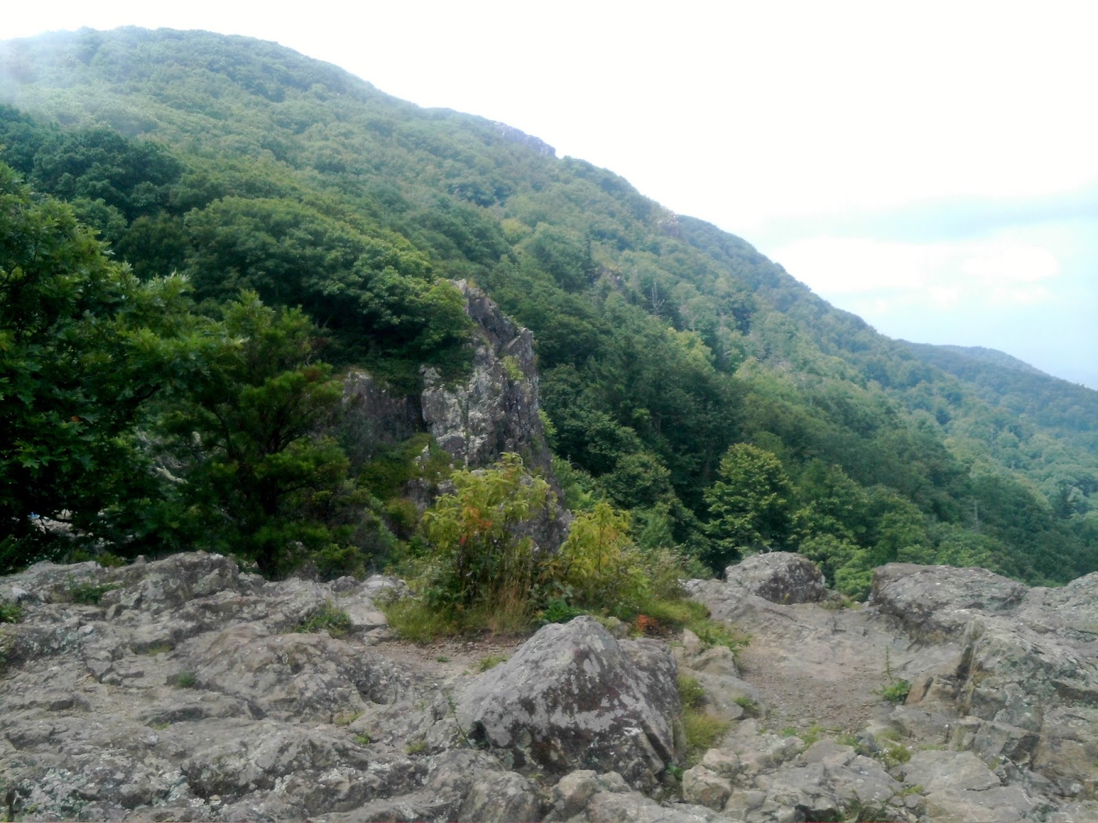
I passed the Skyland stables, and the cutoff to Skyland Resort, but never saw the pack or poles. I came to Stony Man - the highest point on the AT in the Shenandoah, and had lunch at Little Stony Man Cliffs. The cliffs were very steep, and some people were rappelling down the side of them. It was a nice place to stop, and there were great views to the west and back up towards Stony Man.
 |
| View From Stony Man |
 |
| View of Stony Man From Little Stony Man Cliffs |
 |
| Lunch Spot on Little Stony Man Cliffs |
There was a little climb up to Pinnacles, and I stopped at Pinnacles picnic area to fill up with water from a wonderful cold water fountain. On the way down from Pinnacles, I was fortunate to cross paths with another ridge runner, who I think was
Lauralee Bliss, the ridge runner who covers the park, although I did not get her name. I told her about my clothes bag, and she said she would be at Bearfence on Sunday, and would check. I gave her my cell number, she said would call me if she found them, and leave them for me in the hut with a note. I said I didn't think anyone would want a bag of stinky hiker clothes, but she said that I would 'be surprised'.
 |
| From The Pinnacle |
I arrived at the shelter a little after 4 p.m. The designated tent sites were a little difficult to find, as they were not immediately adjacent to the shelter, but there was a map on the shelter wall that helped me locate them. I found a nice site completely surrounded by brush. Wilson, Aaron, and Jonathan arrived later, along with two other section hikers, and we a good conversation around the picnic table.
Day 20- Saturday, July 18- Byrd's Nest no. 3 Shelter to US211-Thornton Gap, VA (3.2 miles)
This is the last day of hiking on this trip, and it is just a short mostly downhill hike to Thornton Gap. The shuttle driver, Mr. Hopkins, was supposed to meet us there at 10:30. I got up around 6 a.m., and packed up my tent, sleeping bag, etc. before heading over to the shelter for breakfast. I was glad I had packed first, because a big thunderstorm blew through. As I was putting the rain cover on my pack, I received a painful bite on the wrist by a spider. I flicked it off, and didn't really see what kind of spider it was, but my wrist started to swell where it had bitten me.
 |
| Shelter Eye View of An Early Morning Storm |
 |
| Waiting out the Storm |
I sat in the shelter and visited with the other hikers as the storm thundered by. It blew through in about twenty or thirty minutes, and I was able to hit the trail. I encountered many day hikers as I came down the trail, and there were some really nice post-storm views on the way to the gap.
 |
| Great View from Mary's Rock |
 |
| Clouds On the Mountains |
 |
| One More Nice 'Framed' Shot |
Aaron and Wilson were ahead of me, and Jonathan was behind, but when I arrived at the gap, I did not see any of them. I thought there might've been some confusion about where to meet for the the shuttle pick-up. I wasn't sure whether it was at highway intersection or the parking lot above it, so I circled around once, and then came back to the parking lot restroom where I saw the three of them with the shuttle driver.
 |
| The Budget Inn in Luray |
We drove the nine miles to Luray, and I was dropped off at the Budget Inn on West Main Street. I said farewell to my SNP hiking companions, and checked in to my luxury accommodations, with a view of the dumpster.
|
|
View of My Room with a View (just behind the Dumpster)
|
I had been wearing the same clothes for two days, and had no change, so I immediately washed them in the bathtub. Fortunately the synthetic materials dried fairly quickly. Afterwards I walked down the street to Genaro's Italian Restaurant. The food was very good, and the waitress was VERY friendly. She told me she could sense things about people, and sensed that I was "an interesting person". I knew it couldn't be the smell, as I had had a bath and my clothes were clean. I was definitely in 'full grizzle' mode, though, since I had not shaved in three weeks. 'Interesting' might actually have been a good description!
After dinner, I walked the opposite direction through town on Main Street to the Dollar General. On the way I checked out the times of worship at both the Methodist and Lutheran churches. I work in a Presbyterian church, but I was raised a Lutheran. I don't get many opportunities to go as a regular worshipper, and thought I might like to attend the early service in the morning. At the DG, I bought some shaving equipment and snacks to take back to the motel. As a rule I don't shave while I am hiking, and it took three blades to get the beard off, but it felt good to be unshorn again!
Day 21 - Sunday, July 19 - Last Day in Luray
I got up early, and walked all the way through Luray to the Hardees on the other end of town for breakfast. Hardees was about the only place open at 7 a.m. on a Sunday morning. Ginny was coming up from Rock Hill, but would not be able to leave until after 1 p.m., so I knew that I had virtually the entire day to myself. We were planning to drive back tomorrow.
 |
| Early Morning View of Main Street in Luray |
The early service at Saint John's Lutheran church was at 8:30. It was a pretty little historic church with a nice sanctuary, and a good looking pipe organ installation to the side of the chancel. I was a little disappointed that this service had NO music whatsoever - even the hymns were read, although the sermon was very good - and on the subject of getting away, which seemed appropriate. I was invited to return for the 11:00 service, where there would be singing, and I would be able to hear the organ, so I decided to come back
I had plenty of time to look around town before 11, so I walked down main street to where the road crosses a river with a park and the Hawksbill Greenway down below. It was a beautiful little greenway about a mile or two in length. There were little sitting areas along the way, mini-parks to either side, and plenty of ducks. It seemed to terminate at a display of farm implements.
 |
| Above the Park |
 |
| Greenway Entrance |
 |
| Path Along the River |
 |
| Mother Duck and Ducklings |
 |
| Display of Old Farm Implements |
I headed back up to the church. The people were very friendly, and we did sing, but the organist was a 'no show' that day, so everything was a capella. Fortunately, the minister was also a trained musician and pitched the music well, and the congregation sang well. I was happy just to clear some of the dust off my vocal chords! After church, I walked down the street and had lunch at Uncle Buck's Restaurant. Uncle Buck must've been a jockey, because the restaurant seemed to have an equestrian theme.
I spent the rest of the afternoon and evening resting at the motel. I was overjoyed to hear from the ridge runner, Lauralee, that she had found my clothes bag, and left them in the shelter for me to pick up on the way home tomorrow. The AC in my room stopped working, so when Ginny arrived late, we moved to another room.
Postscript: This has been longest hike yet, but probably my most enjoyable. There were no killer days in terms of distance, and I felt no compulsion to hike any faster or farther than I wanted to. Although I did get on the trail with a plan, it was flexible. I found myself alternating longer days with shorter days, which helped me feel recovered and refreshed.
In terms of food and equipment, I was breaking in a new pack - the Granite Gear Blaze AC 60. It was smaller than my previous pack, but far more comfortable. I had absolutely no chafing. I also went with thinner smart wool socks without the liners which really helped my feet. I know that some people prefer to use trail running shoes, but I really like the boots for the support, especially over rocky terrain, and as long as my feet are happy, I am happy!
I took more variety of food for breakfasts and lunches. Next year I will plan to take more of the Mountain House breakfast wraps with soft tortillas, along with my usual oatmeal. I also used my stove frequently to boil water for lunches. Surprisingly I never got tired of ramen noodles and Lipton cup a soups. I never used my wood burning solo stove the entire trip, so I am thinking of ditching it next year, and taking a smaller, lighter titanium alcohol stove, with fuel tabs as a backup. This will save both space and weight.
Finally, I took one half day, and one full day off the trail in a motel. I cannot overstate the benefits of these stops. I felt completely recharged, energized, and recovered when I returned to the trail. I enjoy seeing and meeting other hikers along the trail and at the shelters, when I choose to stay in or around one. I think that, whenever I get off the trail, I prefer the privacy and amenities of the motels, even though they weren't the greatest places. I am aware that I may miss some 'trail culture' by not staying in hostels, not that I never will, but I know this time really helped my overall hike.
 |
| At Thornton Gap, VA - End of Year 6 AT Adventure |
Well, here ends year 6 of my AT adventures. Thanks for reading my blog, and as always, I appreciate any thoughts, comments, and/or suggestions you may have. I look forward to next year, and likely passing the halfway point in my journey. Beginning next year, I will need to see about finding other means of getting on and off trail, as I am getting a little too far north for Ginny to drop me off and pick up. Oh well, that's a nice problem to have! Peace and blessings to all!!
-'Triple M...mmm'


No comments:
Post a Comment