Year 7- Thornton Gap - Luray, VA to Swatara Gap - Lickdale, PA (240.3 miles)
This year turned out to be the second longest hike in terms of northbound mileage. My goal at the beginning was to finish in Pine Grove, PA, ten miles beyond where I finally stopped, but this goal was compromised by having to backtrack eight miles from Duncannon, PA, to retrieve my trail journal, which I had left at a shelter. Factoring this extra mileage then, the total hiking distance was 248 miles, making this a record! I also wanted to 'play it by ear' a bit more, not planning as many of the daily details, and just letting the hike unfold. I believe my extended time on the trail is similar to what many thru-hikers experience on a smaller scale. I did have a basic plan, since I needed to have an idea of where I wanted to ultimately end up, and I had also made prior arrangements to meet two people along the way.
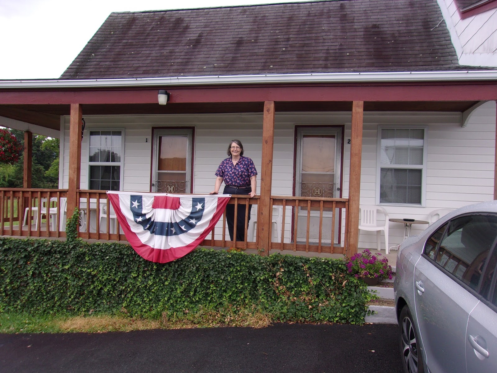
Ginny and I left Rock Hill at about 11:30 on Monday, July 4th, to travel to Luray, Virginia, to begin my hike. This being a holiday, the roads were relatively clear, but traffic on I-81 was heavy as usual. We were a little concerned about finding a place to eat, but stopped at an Arby's along the way for lunch, and once more for coffee. I was fighting a slight head cold, Memories of being sick on my year five trek caused me concern. To fight it off the cold, I drank large quantities of water, and also periodically partook of my favorite cold remedy concoction of apple cider vinegar, honey and lemon juice. I have found that this works wonders if taken early, but it is also important to brush teeth immediately afterwards, as the acid in the vinegar will weaken the tooth enamel. After taking the exit to Luray, we stopped briefly for frozen custard (not something you often see), and finally arrived at the
Hillside Motel on Hwy 311.
 |
| Ginny in Front of Our Room at the Hillside Motel in Luray, VA |
The preceding year I had stayed in the Budget Inn, but Ginny requested I find someplace a little more 'elegant' as a condition of her coming this year. I assume she did not appreciate our beautiful 'dumpster-eye' view, the gnat infestation in the bathroom, and the broken AC unit. Anyway, I did a little research and found the
Hillside Motel- not fancy, but convenient to the trailhead, inexpensive, and many good online guest reviews. It is a family-run, nostalgic looking place, with knotty pine paneling in the rooms. After settling in, I unloaded and reloaded my pack to double check my supplies, nervous and excited for whatever might come. Later, we went to eat at the Brookside Inn down the road toward the gap, and drove up to the trailhead just to check distance and location.
 |
| Our Simple, Clean, and Nostalgic Room at the Hillside Motel |
Day 1- Tuesday, July 5- Thornton Gap- Luray, Va to Gravel Springs Hut (14.3 miles)
I woke up around 6:30, excited and ready to get started. I was relieved to find that my head cold was on the wane, and wanted to get going. First I had to wake Ginny up, and I could tell she would've preferred to stay in the bed. My sunglasses were missing, so we made the decision to have breakfast in town, and stop by the local Walmart on the way to the trailhead. We had a nice breakfast with great coffee at the
The Gathering Grounds in Luray. I picked up a cheap pair of 'fit-over' sunglasses at Walmart, and headed to the trailhead at Thornton Gap. It had rained hard the previous evening, but the weather this day was clear. Ginny snapped my pic in the parking lot near where I finished my hike last year, we said our goodbyes, and I headed up the trail.
 |
| Ready to Go at Thornton Gap |
It was smooth hiking at first, as is most of the Shenandoah National Park. I hoped to be out of the park in two days. At the first view spot I encountered another hiker who snapped my pic. She told me to be on the lookout for two identical twin eighty year old female hikers who were on their final section before completing the entire trail! I passed and greeted the twins three or four miles on. Later, I was passed by a fast moving thru-hiker, whose trail name was 'Strider'. We conversed a little, and headed on. I stopped for lunch at a picnic table at the Elkwallow Wayside on Skyline Drive before getting back on the trail.
 |
| Iconic Trail Marker in the Shenandoah National Park |
 |
| My First Trailside View! |
 |
| My First Trailside Lunch at the Elkwallow Wayside |
I paused for pictures where the trail crosses Skyline Drive at Rattlesnake Point Overlook. As I was snapping a pic, 'Strider' appeared right behind me. He had stopped for lunch at the Elkwallow Wayside, but had gone inside to eat in the restaurant, while I dined outside. We hiked together for a time, and I discovered he was from Pine Grove, PA, which is where I hoped to end up in three weeks. He was a graduate of Liberty University who had recently served in the Army in Afghanistan.
Many, if not most, thru-hikers seem to be in various states of transition: between jobs, the military, school, etc. Others have suffered recent traumatic events their lives, and get on the trail to clear their minds. There are also a few retirees, and/or those who have jobs from which they can take an extended leave of absence. 'Strider' had been on the trail since April 26, and I thought he was hiking fast to be at this place. We conversed, and shared a few stories of unusual things that have happened to us on along the way. He wanted to be in Harper's Ferry by Friday, so he surged ahead of me.
 |
| Trail Crossing Skyline Drive at the Rattlesnake Point Overlook |
 |
| Nice View from Rattlesnake Point |
I hiked at a leisurely pace, not wanting to push speed or distance the first day out. My destination for the evening was Gravel Springs Hut, and I arrived there around 4:30 p.m. 'Strider' had taken a break, and was just leaving as I arrived. I looked around for a suitable campsite and found one in front of the shelter. After setting up, I prepared dinner at the hut, and visited with two hikers. One was a section hiker and the other a thru-hiker with similar trail names - 'Mosin' and 'Mosie'. They were also close in age, and these similarities factored into why they were hiking together. I conversed mainly with 'Mosin', the section hiker. He was a retired military engineer, who now worked part time for a defense contractor. He was a creative guy who in his spare time worked with stained glass, and also sang in his church choir - something he had never done before. He showed me a few pics of his stained glass work. As a musician and choir director myself, I commended him on both his artistic talent and his initiative in joining the choir. It rained a little bit after supper, and I checked out the water source by the shelter, which was a very nice spring. It was a good first day.
 |
| My First Campsite in Front of Gravel Springs Hut |
 |
| The Spring at Gravel Springs Hut |
Day 2- Wednesday, July 6- Gravel Springs Hut to Sealock Spring, Mosby Campsite (16.8 miles)
This was an exhausting day, with hot and dry weather, along with some serious climbs. It was slightly different in that I encountered few other hikers, and had my second bear encounter in seven years. It was a small bear, off in the woods to the left, that ran off as I approached. I was concerned that it might be a cub, so I kept a keen lookout for a possible mama close by. Later in the morning I traversed some nice view spots on South and North Marshall mountains.
 |
| View to the West from South Marshall Mountain |
 |
| View from North Marshall Mountain |
As the day progressed I became increasingly concerned with hydration, so I took a 'longish' side trip to Indian Run Springs, where I tanked up with water and ate lunch. I reached the park boundary later in the afternoon, and came to a confusing spot. The trail markings were unclear, and I briefly made a wrong turn. I encountered another hiker who was having the same difficulty, but together we managed to relocate the path. It is difficult to get completely lost on the AT. I have made it a habit to always scan ahead for the next white blaze, and if I think I've lost track of the trail I immediately stop, get my bearings, and backtrack to the last sighted blaze before moving on. The trail descends steeply beyond the park boundary. It was very hot and humid, so I stopped again for water at a spring near the John Floyd Shelter. Beyond this the trail enters a valley, and parallels a large fenced area. I thought it might be a government installation (Area 51!?), but no definite indication, and no flying saucers. There were also residential areas to the right.
 |
Examples of Interesting Flora Along the Way
(Above and Below) |
 |
| Indian Run Springs Where I Stopped For Water and Lunch |
It was getting late in day, and I considered stopping, but could find no suitable campsites. I checked my trail guide, and decided to head for the Mosby designated campsite at Sealock Spring, which was a mile of two short of the next shelter. I ascended a hill that appeared to have no summit (Why do these always seem to come at the end of a long day?), and arrived at the campsite about 6:30 p.m. No other campers were there, so I found a good place to pitch my tent near a fire ring with wooden memorial benches around it. I cleaned up, and made a supper of creamed beef, noodles, and mushrooms. My stomach was slightly upset, and I was also feeling a little light headed. It occurred to me that these might be symptoms of dehydration, and I drank a lot of water before settling into my tent to read my book. About 9 p.m., I was startled awake from a semi-slumber, to hear people coming loudly into camp. Thankfully they seemed to quiet down when they saw my campsite.
 |
| Trail Beside Fenced Area |
 |
| Mosby Campsite - I Pitched My Tent Just Beyond This Log |
 |
| My Kitchen at the Mosby Campsite |
Day 3- Thursday, July 7- Sealock Spring, Mosby Campsite to Dick's Dome Shelter (11.8 miles)
I slept well, but two ibuprofen PMs helped. I awoke around 6 a.m., and immediately started breaking camp. I ate half of my Mountain House granola cereal, which contained MANY dried blueberries. This was the first cold Mountain House breakfast I have eaten, and it was quite good. I refilled with water at the spring, and hit the trail about 8:15. This was a relatively short hike of about 12 miles. I was grateful for the shorter distance, as I had gone longer yesterday. I think that alternating longer with shorter days helps keep the body, mind, and spirit fresh.
 |
| Nice Day to Start |
Not long after leaving camp I saw my second bear in two days!! It crossed the trail about seventy yards ahead of me, and like the one yesterday, scampered off when it saw me approaching. The jinx of not seeing bears must finally be broken! I was concerned with bears when I first began hiking the trail in 2010, but I've come to believe that they would prefer to avoid encounters with humans. Right after this I crossed paths with a southbound ridge runner, who was surprised when I mentioned the bear, as in her experience they were rare north of the park. She then suggested I check out the Denton Shelter a little ways ahead. She said it was the 'nicest shelter' on the AT, although her enthusiasm may have been grounded in the fact that she was caretaker of it. Since it was only a short distance off the trail, I decided to stop and have a look, and I must say it WAS definitely posh by AT standards.
 |
| The Jim and Molly Denton Shelter - luxurious! |
 |
| A Separate Pavilion at the Denton Shelter |
I continued on through meadows and small hills, crossing one busy railroad track, and a busy highway, before passing under I-66. There was a big climb to the top of Manassas Mountain, and I arrived at the Manassas Gap Shelter around noon where I stopped for lunch. I visited with a couple of other hikers in the shelter, and refilled my water bottles at a really nice piped spring.
 |
| A Real Green Tunnel! |
 |
| A Variety of Colorful Flowers |
 |
| Mountain Meadows |
Shortly after resuming my hike, I was passed by a not too friendly thru-hiker, and then by an older hiker with a gray ponytail, who was hiking in sandals. His pack was embellished with little flags and other ornaments, and '70's rock-n-roll music emanating from somewhere. One does encounter a wide variety of people on the AT!!
 |
| Hiking Through the Land of the 'Grey Ghost' |
 |
| A Nice Footbridge |
This was a short hiking day, but my feet were sore, and I was anxious to get to the shelter. I arrived early at around 3 p.m., and began to scout for a campsite. The first one I passed was on the opposite side of a creek from the shelter. It was an acceptable site, but just a little rocky, so I decided to look around in the vicinity of the shelter. I saw people in the shelter, and walked up a hill to the right where I passed one occupied campsite before coming to a place where a new shelter was being constructed. There were chairs in the shelter, and construction equipment lying around, so I decided to return to the first site.
 |
| My Campsite Magic! |
Upon returning I noticed an unopened bottle of Mountain Dew sitting on a rock. I didn't remember seeing it when I first arrived. Mt. Dew has always been a favorite soft drink of mine, and I can't imagine how I would've missed it. I assumed that someone had laid claim to the campsite while I was looking elsewhere, and I decided to check with the people at the shelter. One of them asked me if there was a 'tent there', and if not, the site was unclaimed. When I mentioned the unopened bottle of Mt. Dew, I was told to accept it as 'trail magic'. I am grateful for this small blessing, and joyfully laid claim to the campsite while enjoying the bottle of Mt. Dew.
Day 4- Friday, July 8- Dick's Dome Shelter to Campsite south of Sam Moore Shelter (14.4 miles)
I started this day with the goal of going longer, but ended up a little shorter. I broke camp about 8:20, and filled up with water at the stream before leaving. The temperature was cooler, and a little windy, which felt very nice, but it warmed up quickly as the morning progressed. I entered Big Sky Meadows State Park, and was passed by a girl who had seen a copperhead snake on the trail - another near miss!
 |
| Nice Flowers |
 |
| Entering the Big Sky Meadows State Park |
 |
| Open Areas in the Park |
As I was approaching the Rod Hollow shelter, where I planned to stop for lunch, I heard a grunt in the woods to my right, and was startled as two bears charged down the hill, and across the trail barely twenty-five yards behind me! This is definitely one of the more adrenaline raising hiking experiences I've had. The weather by this time was significantly more hot and humid, so I uttered a little prayer for rain to cool things off. After arriving at the shelter, I visited with a female section hiker in the process of section hiking the state of Virginia, and as we were sitting, chatting in the shelter pavilion, the rain came down. The shelter privy was out of commission, so I was forced to use more primitive methods. When I first began hiking the AT as a teenager, there were no privies at shelters anywhere on the trail, but now they are ubiquitous. It still seems like somewhat of a luxury to me, but I'm not complaining. The female section hiker departed, and two VERY young thru-hikers- 'DS' and 'Sunflower' - soon arrived. They looked as if they couldn't have been more than 13 years old. I wondered later if they might be runaways, but couldn't imagine how they would've made it this far up the trail without being found if that were so.
 |
| A Long Stretch of Boardwalk on the Trail |
Before leaving the shelter I put the rain cover over my pack, but the rain had mostly stopped by this time. I quickly entered an illustrious twelve mile long section known as the 'roller coaster', which is NOT as fun as the name implies. The trail only has a narrow corridor to follow through this section because of development on either side. By necessity the path designers routed it up and over six or seven PUDS (Pointless Ups and DownS). The difficult terrain added to my foot woes, especially on the downhills, and the six miles to the Sam Moore shelter started to seem like twenty.
 |
| Hiker Warning! |
 |
The First 'Roller Coaster' Climb!
I Could Almost Hear the 'Clickety Clack' |
I started looking for a place to stop short, and found an old campsite just off the trail near a creek. It was a decent campsite, but very buggy. After pitching my tent, I immediately went to the creek to let my feet soak a while, which felt wonderful.
 |
| My Campsite Near a Little Stream |
I took time to look ahead at the upcoming itinerary. My initial plans were to meet my brother in-law, Tom, in Harper's Ferry on Sunday afternoon, but I decided instead to get a motel room on Sunday, and take a 'zero' day on Monday. Tom lived not too far away in Poolesville, MD. His work schedule was flexible, so I thought he might be able to pick me up at the motel on Monday morning, and we could look around Harper's Ferry. I could then stay with him on Monday evening, and he could take me back to the trail Tuesday morning. I called Tom to confirm these plans. I've been amazed to have cell phone service everywhere so far, which is rather unusual.
Day 5- Saturday, July 9- Campsite south of Sam Moore Shelter to David Lesser Memorial Shelter (15.1 miles)
I broke camp and headed out just after 9 a.m. I crossed a significant marker at the 1000 mile point. This is something I could hardly imagine when I began section hiking in 2010.
 |
| Nice Path Ahead |
 |
| The 1000 Mile Mark - Yay!!! |
I stopped for a nice view at Bears Den Rock, and chatted with a day hiker and family who expressed an interest in my hike. I decided to take a side trail up to the Bear's Den Hostel to see if I could get a cold drink, but was disappointed to discover that they were only open from 5-9 p.m.. :-(
 |
| View From Bear's Den Rocks |
 |
| The Bear's Den Hostel - A Converted Mountain Mansion |
I took a few pics around the hostel, and headed back to the trail. I crossed the border from Virginia to West Virginia. It felt good to have finally completed the longest state on the trail. I stopped at a nice spring to tank up with water, and came to the end of the 'roller coaster'.
 |
| Out of Virginia...Whew! That was a Long One |
 |
| Nothing Like Cold Mountain Spring Water |
Beyond that, it was a long, slow hike to the David Lesser Memorial Shelter. My feet were aching with every step, and I arrived after 8 p.m., which is much later than I like to hike. There were MANY people hanging out around the shelter. Most of them were weekenders, and almost all of them planned to use the perimeter campsites, so I decided to stay in the shelter for the evening. There was only one other hiker in the shelter with me. Her trail name was 'Thistle', for a tattoo on her leg in honor of her Scottish heritage. I mentioned that I worked in a Presbyterian Church, and Presbyterians are generally proud of their Scottish heritage as well.
 |
| Another Good View Along the Way |
 |
| My Hiking Debris in the David Lesser Memorial Shelter |
It was getting dark, and I was forced to use my headlamp to cook dinner and hang my bear bag, which is always an adventure. Before settling down for the evening, I placed a call to the Econo Lodge in Harper's Ferry to arrange a room for tomorrow - looking forward to a little time off of the trail.
Day 6- Sunday, July 10- David Lesser Memorial Shelter to Harper's Ferry- motel re supply (9.3 miles)
It was not that far to Harper's Ferry, and I wouldn't be able to check into the motel much before 3 p.m. 'Thistle' left early, at around 7:30, but I was in no hurry, and took a VERY long walk down to the spring in front of the shelter. I asked a hiker how far it was to the spring, and he answered, "How far do you want it to be?" ..ha ha... Maybe a dumb question on my part, but a bit shorter would've been nice, especially since walking downhill in Crocs over rocks can be a challenge.
 |
| The David Lesser Shelter Deck with the Pavilion in the Background |
I had breakfast in the shelter pavilion, and visited with two thru-hikers - 'Crispi and Mayo'. 'Mayo' had a traveling guitar he pulled out, and started playing. It always warms my heart to hear other hikers indulge in some natural music, and 'Mayo' had a small, portable 'hiking guitar'. My main instrument is trombone, but I don't think REI has a hiking version. There is something called a p-bone, which is made out of plastic. I don't think it would be well received by other hikers, but it might make a good bear repellent!
 |
| A Brief Trailside Pic Stop |
Even though I felt like I was taking my time, I still managed to leave before 9 a.m.. It was smooth hiking most of the way to Harper's Ferry, but I stopped a couple of times for water breaks. Although water is not abundant, the sources are usually nice springs. I always prefer a spring to a stream, because spring water is the cleanest, coolest, and best. I crossed a busy road, and shortly afterwards entered the Harper's Ferry National Historic Park on Loudoun Heights.
 |
| A Powerline View |
 |
| Entering History On Loudoun Heights |
 |
| Trail Descent from Loudoun Heights |
I ran into several day hikers on the on the long descent from Loudoun Heights. The presence of day hikers is a sure sign that one is nearing civilization, and I liken it to seeing small pleasure craft after a long voyage at sea. Finally, I caught my first glimpse of the Shenandoah River down below, and knew I was nearing my destination. The trail parallels the river for awhile, and then goes under and over a highway bridge crossing the river, before heading back into the woods, and up a hill. I finally arrived at the intersection with a blue-blazed trail to the ATC headquarters.
 |
| The Trail First Goes Under... |
 |
| ...and then Over The Shenandoah River Bridge |
The side trail to the ATC headquarters goes through the former campus of Storer College - one of the first colleges established for African Americans. The headquarters of the Appalachian Trail Conservancy is a flat, unpretentious one story white building with porch out front. This is where many hikers have their pics taken, and another hiker snapped my pic before I went inside. I was thrilled to reach this milestone in my overall trip, as it is the psychological halfway point of the entire AT- a place where thru-hikers and section hikers can register, and maybe send a postcard with their picture home. Just inside was a check-in desk in with AT items for sale, a little museum section with model map of the trail, information, and other memorabilia. In back was a hiker lounge, with a refrigerator and sofa.
 |
| My 'Official' Pic in Front of the ATC Headquarters |
I was parched, and went to the hiker lounge for a drink. A ranger checked me in and took my official picture on the porch. The ATC keeps a photographic record book each year of every hiker that reaches this point on the trail. I felt real satisfaction as I filled out the page under my picture, which included my real name, trail name, along with a listing of each section I had completed up to this point. In addition, I had the option of sending the picture home as a postcard, so I wrote one to Ginny. 'Thistle' came into the hiker lounge, and I visited with her a bit before heading down the hill to the motel.
 |
The Historic St. John's Lutheran Church
(The cannon ball strike is visible on the corner of the building) |
 |
| Grant Street in Harper's Ferry |
 |
| The Harper's Ferry Town Hall |
On the way down the hill, I paused briefly to look at the historic St. John's Lutheran Church, which had been involved in Civil War action, and a corner of the building still bore the scar of a cannon ball strike. I walked down Grant Street and checked into a room at the Econo Lodge, placed a call to my brother in-law, Tom, took a bath, and did laundry. Later, I walked back up the hill and had a GREAT dinner of Tilapia with a wonderful salad at Mena's Italian Restaurant.
Day 7- Monday, July 11- Zero Day in Harper's Ferry, WV
I had made arrangements for Tom to pick me up at the motel at 11 a.m., which was the checkout time. Before checking out, however, I got up and ate a big breakfast, took another long bath, and packed up. It felt very nice just to relax in a comfy air conditioned motel room, and not worry about having to prepare for a long day of hiking.
Tom arrived a little after 11 a.m.. We drove back up the hill to Washington Street, parked near the ATC headquarters. Since the AT north goes directly through the historic lower town district, my idea was that we would take the blue-blaze trail back to the trail, and follow it on into town. So this day was not really a 'zero day' after all. Tom could say that he hiked a portion of the trail with me, while I could get some of it done, while leaving my pack in Tom's car!
We looked around the ATC headquarters, and I showed Tom my picture in the official ATC register. I was alarmed at first that it wasn't there, but one of the rangers had taken it out temporarily to enter into the computer database. We walked back through Storer College, and down to the the trail. We followed the trail north through the woods past Camp Hill, and the Jefferson Rock, where Thomas Jefferson had once commented on the beautiful view of of the countryside below. We saw the ruins of the St. John's Episcopal Church, and visited Harper Mansion, the oldest surviving structure in Harper's Ferry.
 |
| My Brother In-Law, Tom at Jefferson Rock Overlook |
 |
| The Jefferson Rock - Propped Up to Preserve it |
 |
| Ruins of the former St. John's Episcopal Church |
We walked up High Street and had lunch at the '1840s Cafe'. I was served one of the biggest hamburgers I have ever eaten - rivaling the 'Hiker Burger' in Atkins, VA on year 4 AT adventure. My calorie intake has been generally higher on this trip, but I still managed to eat the whole thing, and had some fries and two beers to boot.
 |
| The AT North on High Street in Lower Town Harper's Ferry |
After lunch, we walked down to Potomac St., and saw the famous armory firehouse building, where abolitionist leader, John Brown had made his final stand at the end of his raid. I had never been to Harper's Ferry, but as a Civil War history buff, I am very interested in learning everything about it. I was especially interested to learn more about John Brown the man, not just the commonly held caricatures. I decided I needed to look for a good, balanced biography when I got home. (I found this excellent one:
To Purge This Land With Blood, by Stephen Oates) We visited some of the preserved buildings, along with museums, and took time to go over the Potomac River footbridge which follows the AT. On the other side is the former Chesapeake and Ohio Canal and towpath, with a road just beyond it. I thought this would be a good place for Tom to drop me off in the morning.
 |
| The Confluence of the Potomac and Shenandoah Rivers |
 |
| AT on the Walking Bridge Over the Potomac River |
We walked back up High Street, which becomes Washington Street where the ATC headquarters is located, and back to Tom's car. On the way to Tom's house in Poolesville, we stopped for gas and I bought Tom a couple Arizona Ice Teas. We also made a side stop to the reconstructed Monocacy aqueduct over the Monocacy River- the largest aqueduct on the former C&O canal. This was a really GREAT day off the trail.
Day 8- Tuesday, July 12- Harper's Ferry to Rocky Run Shelters (15.4 miles)
I awoke from a good night's sleep in a very comfortable bed at Tom's house, got up, showered, ate breakfast, and re checked my supplies. Tom was kind enough to give me few protein bars, instant oatmeal packs, and some hot cocoa drink mix. On the way back to Harper's Ferry, we made a little detour to a Walmart, where I purchased a few Mountain House dinners.
We had a little trouble finding Sandy Hook Road by the C&O canal, where I would enter the trail north on the towpath. We did locate the road next to the canal lock 32, and Tom dropped me off. I thought I was going to be trapped when I climbed into the former canal, and couldn't find my way down to the path. A couple walkers on the path directed to the place in the corner where it was possible to climb down.
|
|
| Former Lock 32 Ruins of the C&O Canal and Sandy Hook Road |
 |
Former C&O Canal and Towpath
 |
View From the C&O Canal Towpath
The AT follows the C&O towpath for three miles right next to the river, before veering to the left, going under Hwy 340, and ascending to Weverton Cliffs. There was a short and rocky side trail to the cliffs, with a memorial marker, along with a nice view of the river down below.
|
|
 |
| Weverton Cliff Side Trail |
 |
| Cliffside Memorial Marker |
 |
| View From Weverton Cliff |
I took lunch about 12:30 at the Ed Garvey Shelter, and noticed that 'Thistle' had signed the guest register earlier in day. I assumed she would've been at least a day ahead of me.
 |
Lunch at the Ed Garvey Shelter
From the shelter it was a smooth hike to Gathland State Park. 'Gath' was the nickname of George Alfred Townsend, a civil war journalist. The park was on the site of his former estate. I refilled me water bottles at a spigot near the restrooms. I passed through the park, and encountered a large group of kids and adults apparently preparing to set out on an extended hike.
|
 |
| Gath's Empty Tomb (Never Used) at Gathland State Park |
 |
| Building Ruin at Gathland State Park - 'Gath' was also the architect |
 |
| View From White Rocks |
I passed a couple of good views, one of them was at 'White Rocks', and stopped to rest briefly at the intersection of the trail to Bear Springs Cabin. I saw a few ripe blueberries, finally! These were not as abundant as they were on last year's hike. I arrived at the Rocky Run Shelters (old and new), and pitched my tent near the old shelter - which was close to the water source. I made a dinner of Chicken Gumbo, which was pretty good.
 |
| This Was my Chosen Campsite Near Rocky Run Shelters |
Day 9- Wednesday, July 13- Rocky Run Shelters to Pogo Memorial Campsite (10.7 miles)
I took my time getting up. I was running a little low on alcohol fuel for my stove, so I got some water, and just boiled enough water for coffee. Cold oatmeal for breakfast is just fine. I broke camp a little after 9 a.m. It was just a short ten or eleven mile hike to the Pogo Memorial campsite, my next destination. On most of the AT there are no restrictions on where you can camp, but the state of Maryland only allows camping at shelters or at designated campsites along the trail.
 |
| The Trail Through Maryland |
It was an interesting day in that I hiked through areas that saw intense action during the Civil War. The battle of South Mountain was a sprawling affair, that was very important to the strategic outcome of the Antietam campaign - Lee's first attempted invasion of the north. The trail goes right through the heart of this important battlefield, and passes monuments to two generals -one confederate and one federal - who were both killed on the same day.
 |
| Through Historic Battle Ground |
 |
Monument to Union Major General Jesse Reno
(killed on this spot) |
 |
Memorial to Confederate Brigadier General Samuel Garland
(killed near this spot on the same day) |
I stopped for lunch at the Washington Monument State Park. This park is named for the FIRST Washington monument, which preceded the more famous one in DC. It is one of the oldest monuments in the country, having been erected in 1827 by the citizens of the county, and overlooks one of the most spectacular vistas I have ever seen.
 |
| The Washington Monument |
 |
| Vista in Front of the Monument |
The terrain north of the park was relatively smooth, and stopped for water at a spring near the Pine Knob Shelter. I met another hiker there who was also stopping for water. He told me his goal was to get to Florida before winter, and commented on my pump filter (
Katadyn Hiker), saying that he had had two of them, but intake nipple had broken off on both. He did say that he never removed the hose from intake (per instructions). I asked him how he treated his water, and he told me he didn't treat it. He informed me that he had contracted
giardia three times, and this water was like 'gold' compared to some he had drunk. I relay this meeting as a cautionary example of what NOT to do, and of the variety of people one encounters on the AT.
I reached the Pogo Memorial Campsite around 4:30, and went up the hill toward the back of the campsite to find the most private site I could find to pitch my tent. After setting up camp, I went down to the water source, which was an exceptionally nice spring. I made supper, and crawled in my tent to read my book and take a little nap. I was startled awake to find someone had pitched their tent barely twenty feet away from mine, and was noisily building a fire in the fire ring just outside. I had hoped for a secluded evening, but this apparently was not to be the case.
 |
| My Personal Campsite at the Pogo Memorial Campsite |
I climbed out of my tent to say 'hi', and visited around the fire with a pair of SOBO (SOuth BOund) thru-hikers - trail names 'Omega CQ' and 'Cuffs'. Over the course of my entire journey I have not encountered many south bound thru-hikers, so I was interested in their story. They were from Maine, and after dating for three months, had decided to run off together. They thought the time on the trail might be a good test of the strength of their relationship. One of the advantages of being a SOBO thru-hiker is that you can take your time. NOBO's, on the other hand, need to get to Maine before Oct. 15, when Baxter State Park closes for the season. I asked them about the trail north, and they provided me with information about terrain, water sources, hostels, etc..
Day 10-Thursday,July 14- Pogo Memorial Campsite to Falls Creek Campsite north of Pen/Mar Park (15.4 miles)
Although I got started early, it was a tough day of hiking, with some steep, rocky climbs, and not many water sources. I climbed a mountain early in the day, passing a large group of boy scouts and a couple adults at the top. Near a gap on the other side, I encountered a lone scout leader who had come off the trail to attend to a sick scout, and was catching up to the rest of the troop. We had a nice conversation about hiking. I told him how I had originally been inspired to the trail by my experience with scouting in Roanoke. He was hopeful that some of his brood might eventually do the same thing, but had yet to see the evidence. I told him not to worry, that he was planting seeds, and some of them would eventually take root.
 |
Steep and Rocky Climb
(Following the trail was tricky) |
 |
| Nice and Flat Pastureland |
I passed through pretty pastureland, and arrived at Pen Mar Park, a county park that was once the site of an amusement park near the state line. The amusement park closed in 1943, but there is a small museum containing memorabilia from its heyday. I am often not hungry on the hike, but am almost always thirsty. My guidebook indicated vending machines in the park, and I was really looking forward to a cold drink. I was very disappointed however, to find NO VENDING MACHINES in the park. My AWOL trail guidebook, which is published annually, occasionally contains incorrect information.
 |
| Wildflowers Were Everywhere! |
 |
| GREAT Vista from Pen Mar County Park |
 |
| More Civil War Action in the Vicinity of Pen Mar Park |
Shortly after leaving Pen Mar I reached the Mason/Dixon line between Pennsylvania and Maryland. I signed the trail register there, and rejoiced in yet another milestone on my overall hike.
 |
| Crossing the Divide - Yay! |
I had been leapfrogging a fast moving thru-hiker wearing a kilt. He had a slight accent I couldn't quite identify, but took it to be celtic. Maybe the kilt was a clue, but it might've just been projection on my part. From the Mason/Dixon line it was less than a mile to Falls Creek, where I decided to camp for the evening.
 |
| My Campsite near Falls Creek, with the Proverbial Bear Bag in Back |
 |
| Falls Creek |
 |
| My Water Pumping Technique |
The kilted hiker was already camped near the creek, so I chose site back a little ways. Another hiker arrived later, and camped closer to the creek. After getting settled, I checked the guidebook, and contemplated the way forward. I was needing a little resupply, and there was a hiker hostel in Fayetteville, which I thought might be reachable in two days,
Day 11- Friday, July 15- Falls Creek Campsite to Fayetteville, PA - Trail of Hope Hostel (17.3 miles)
It was a nice day, and little easier hike than yesterday. I saw many 'day hikers' along the way, so I knew I was traveling through areas that were easily accessible by car. Also, unlike yesterday, I passed many nice springs, including the one at Old Forge Park where I stopped for water.
 |
| Sign at a one of the Frequent Road Crossings |
 |
| A Clear Path Through the Tunnel |
 |
| Approaching Old Forge Park |
It was a good climb to Chimney Rock, but a nice rocky view spot where I paused to place a call to Ginny. I made the decision to make this a longer day and shoot for the hostel in Fayetteville, but needed to see how I felt and how the terrain was shaping up. I could always stop short if I wanted to, but was in need of alcohol fuel and resupply.
 |
| View From Chimney Rock |
 |
| Another Great View |
The trail before Fayetteville is more difficult - alternating between very rocky and relatively smooth. I checked my map at the intersection to the Rocky Mt. Shelter, and placed a call to the hostel to let them know I was on my way. It looked to be almost all downhill to Fayetteville. On the way down I crossed paths with a helpful ridge runner, who gave me directions to the hostel from US hwy 30.
 |
| Timber's Restaurant in Fayetteville |
When I reached the highway I turned west, and after a mile or so came to 'Timbers Restaurant'. There was a takeout order window in front, and since I was hungry and thirsty, I went there to order. The very friendly hostess invited me to come inside and enjoy the air conditioning. After a day of hiking, I am a little self-conscious about my aroma, but I went inside anyway and hoped the patrons (and staff) would remain. I ordered a large raspberry milkshake, a bottle of cold water, and got a burger to go with it. I told the hostess where I was planning to stay, and she suggested I call the hostel to come pick me up at the restaurant. I placed a call, but was told it was very close, and I could almost see it from where I was.
I walked down to the 'Trail of Hope' hostel, which was indeed very close to the restaurant. It is a combination church/hostel, run by a husband and wife couple. The husband is a former thru-hiker, and very active in many hiking organizations, and the wife is the minister at the church. It consists of two buildings, one a storefront church, the other a hiker hostel. I was checked in by another hiker, and got a private room upstairs - no AC, but a fan in the window. I refilled on my alcohol fuel, did laundry, and took a shower. I was delighted to see 'Thistle' again, who was also staying in the hostel, and met another section hiker, 'Getgo'.
 |
| The 'Trail of Hope' Church |
 |
| The 'Trail of Hope' Hostel |
I needed to get some small food items, so decided to walk to the Dollar General. It was a very LONG walk down the road. I wondered if the trek was worth it just to get Swiss Miss and Ramen noodles, but I did it anyway. When I returned to the hostel, I found that there much leftover food in the fridge from a wedding at the church. It was free to hikers, so I made good use of it, and also drank lots of water. I had a long conversation with 'Getgo', who was a section hiker from North Carolina. Her job allowed little time to hike, but she jumped on the trail whenever she could. I also played a piano that was in the hostel - a few old hymns and fragments of piano rags that I could remember.
Day 12- Saturday, July 16- US 30, Fayetteville, PA to Birch Run Shelter (10.0 miles)
Just a short hike today, and not in any big hurry to get started. I had a good night's sleep by the open window, though there was traffic noise from US 30 just outside. I got up, sorted out my stuff, and filled up my water bottles. Most of the other hikers in the hostel had left early.
'Thistle' was still there, and I met Robert, the hiker proprietor. 'Thistle' had been having some knee problems, so Robert offered to take her up to Pine Grove SP, where she could
slack pack back to Fayetteville unencumbered by her pack. She was happy to take him up on this offer. He also offered to drop me off at Timber's restaurant on the way, where I could get a decent breakfast. Before leaving, I put a pin on Rock Hill, SC in map of the US that was outside the hostel. It appeared that hikers from everywhere had stayed there, including one other person from my area of South Carolina.
 |
| Trail Following a Nice Little Stream |
I went to Timber's and had the 'Brush Ape' breakfast, which consisted of 2 pancakes, 2 eggs, home fries, sausage links, and coffee...yum! I felt completely refueled, reenergized, and refreshed. I thanked the very friendly manager, Lauren, and hit the road back to the trail. After crossing US 30, the trail north follows a little stream by the road, and then enters the Caledonia State Park, which is a scenic little park. I stopped briefly at the park restroom before proceeding.
 |
| Crossing The Creek Near Caledonia State Park |
It was a bit of a climb to the next shelter, Quarry Gap, which was somewhat elegant by AT standards- potted flowers, a bench, and even a swing! Obviously, the caretakers of this section wanted to keep it nice, and I believe that most hikers probably do appreciate these little 'homey' touches.
 |
| The Quarry Gap Shelter with all the Nice Touches of Home |
It was mostly smooth hiking, with a couple of climbs, and a long, steep descent to Milesburn Cabin. There was a family staying in the cabin who directed me to a nice spring, where I could get some water. I also found some good blueberry bushes. Looking for edible berries is one of my favorite distracting pastimes on tough climbs. I noticed that the nature of the forest appeared to be transitioning from decidedly deciduous to more coniferous. I love the look and feel of spruce and pine forests, and I was happy to pass through more of them. I crossed paths with 'Thistle' going the opposite direction, and we visited a little. She was grateful to be able to hike fast without her big pack, which took pressure off her knee as well.
 |
| Campsite Near the Birch Run Shelter |
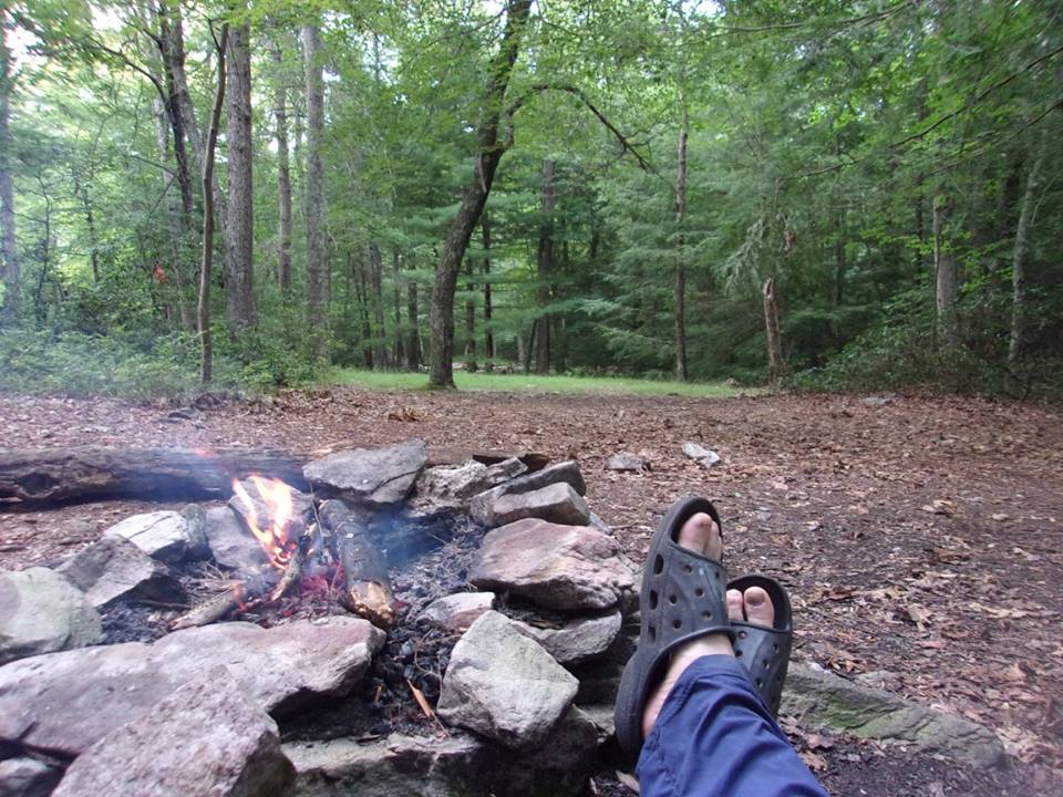
I arrived at the Birch Run shelter a little before 2 p.m., and set up camp under two pine trees a little ways behind it. I hadn't had any lunch yet, so I cooked it up at the shelter, and visited with a couple hikers. Afterwards, since I was early, I went back to my tent and had a nice little nap. In the evening, I decided to make my own personal campfire, and was happy just to relax in front of it watching the flames. There is just something very soothing about a campfire in the woods- even in July. This had been a very good day.
 |
| Relaxing by a Campfire at the End of the Day! |
Day 13- Sunday, July 17- Birch Run Shelter to Campsite south of James Fry Shelter (17.0 miles)
I slept well - more soundly than I had so far the entire hike, and it was nice to have a little extra time. I packed very efficiently and took off about 7:30 a.m. It was a very easy hike and smooth going for the most part. I was hiking fairly fast, and passed the official 2016 halfway point of the entire trail - yay!!! Two miles further on, I passed what I presumed was the 'unofficial' halfway point, although it seemed to be more of a permanent marker with flags. There were two section hikers stopped, so I asked them to take a pic.
 |
| A Domesticated Trail! |
 |
| The Official 2016 Halfway Point |
 |
| The Official Unofficial Trail Halfway Point |
I arrived at Pine Grove Furnace State Park around noon, where there was a country store, and a little restaurant. I also had been hearing many stories about the '
'half gallon challenge' at Pine Grove - the tradition where hikers who reach the mid-point of the trail eat a half gallon of ice cream to commemorate this accomplishment. I will admit that though I like ice cream, and hikers burn a ton of calories, I decided to forego the challenge. I did see a couple thru-hikers who were up to it, and snapped their pic. I ordered a hamburger with fries, drank several cold drinks, and sat down to visit with a tourist couple from Connecticut.
 |
| Lunch Stop at the General Store in Pine Grove Furnace SP |
 |
| Two Hikers Accepting the 'Half Gallon Challenge' |
After lunch, I took time to look in the
Appalachian Trail Museum, which was close by. It was interesting, containing information and memorabilia about the founders of the AT - Benton MacKaye and Myron Avery, and famous and not so famous thru-hikers including the first thru-hiker, Earl Shaffer - and the last remaining shelter he built on the trail, which was reconstructed inside the museum. After browsing around for a bit, I refilled my water bottles in the water fountain, and headed back to the trail.
 |
| The AT Museum at Pine Grove Furnace SP - Interesting |
The trail through the park passes busy picnic areas, a swimming lake, and bicycle and hiking paths. There are camping restrictions in the park, and for a mile on either side, so I thought of looking for a spot just beyond this mark. There is a long, but not terribly steep, climb up an old logging path for the few miles north of the park. I saw a few possible campsites, but the lack of a water source encouraged me to continue. After a short day yesterday, I was feeling pretty good today.
 |
| Path Through the Park |
 |
| Swimming Lake at Pine Grove Furnace SP |
The guidebook indicated a gradual descent and a spring just before the next shelter, so I decided I would look for a place to camp around that location. I didn't want to stay near the shelter, as I knew there were large groups of thru-hikers around, and I really desired solitude. It was odd to go through a stretch of about a mile with big, ripe blueberries on either side of the trail. I'd seen a few, but never in this quantity, and I wondered if it was because there wasn't as much wildlife to eat it.
 |
| A Variety of Colorful Flowers |
 |
| A Verdant Blueberry Bush |
I arrived at an unsigned blue blazed side trail, which I presumed to be to the spring, so I went down the hill to explore. I found a pitiful little spring that was mostly a mud hole, but just beyond it was a nice, clean-looking stream. I could tell it was a healthy stream from the decent sized trout I saw swimming around in it. I crossed the creek, and decided to make camp in a flat area between some trees. It was a somewhat new experience to make camp where no one had ever camped before, but it was a peaceful spot near a good water source.
 |
| A Mostly Isolated and Never Before Used Campsite |
After pitching my tent, I went down to the creek and made supper on a rock along the bank, where I enjoyed watching the water and the fish cavorting in it. It felt like an isolated spot, but I knew I was near civilization from the not too distant road noise, and occasional shouting, which I believe came from the shelter area. I was happy to be in this spot.
 |
| My Kitchen by the Creek |
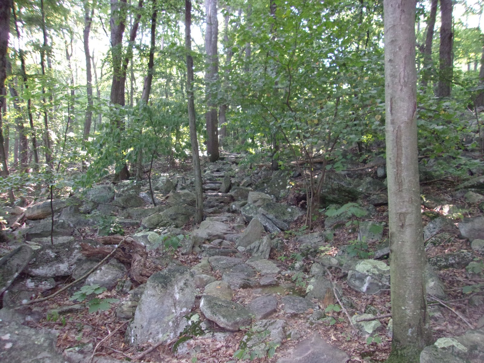
Day 14- Monday, July 18- Campsite to Backpackers Campsite outside Boiling Springs, PA (11.7 miles) An interesting day of hiking - no great views, but a couple 'rock mazes' on top of a ridge, and less than a mile apart. This is one of the great things about the AT - the character of trail is never the same, and sometimes changes dramatically within a short distance. It is hardly EVER boring. In the rock mazes, the trail planners intentionally put hikers through a complex set of turns over rocks and through tight squeezes. At one point I encountered a four or five foot ledge that I could see no way of getting over. I decided to go around it by climbing up the wall to the right. When I got close to the top there was a sheer drop to my left, and it was very exciting toeing the line before I got back on the trail.
 |
| Entering the Rock Maze |
 |
| Thank Goodness for the Arrow Pointing to Maine! |
 |
| Up, Over, Around, and Under!! |
 |
| I am Grateful I Lose Weight on the Trail - So Much Fun |
I took lunch by a stream and road at the bottom of the hill, and visited with a young female thru-hiker from Iowa, whose trail name was 'Game Warden'. She was given her name by other hikers for being a stickler for the rules whenever they played a game together. I asked her how she liked the rock maze, and she mentioned needing to take off her pack to get over that ledge. I hadn't thought of that!
 |
| Almost to the Historic Halfway Point |
After lunch it was mainly uphill to 'Center Point Knob', which is the historic halfway point of the trail. The trail has evolved and regularly been rerouted over the years, but this was the spot where hikers formerly celebrated. There was a little stone bench and a plaque marking the spot - a few campsites, but no water or view that I could see. Now I can most definitely say I have gone over the halfway point in my journey!
 |
| AT Plaque on 'Center Point Knob' |
It was a long, sloping descent to the valley below. I noticed what I think was man made hill of some sort, and thought it might be traces of previous coal mining activity. I knew that this area had been known for coal at one time. It was needed mainly to fire furnaces for the iron industry. I came out of the woods and into a cornfield, where I hiked past endless rows of corn almost all the way to Boiling Springs.
 |
| Past Endless Fields of Corn |
 |
| More Corn! |
 |
| A Long Open Stretch Heading in to Boiling Springs |
It was a little confusing finding the backpacker's campsite just outside of town, but it was situated in a corner between a cornfield and a set of railroad tracks. 'Game Warden' and two other hikers, 'Music Box' (neat name) and 'C-Man' were there. They had set-up camp, but were taking down their tents. They had decided they would hike on in to Carlisle (about 8 miles further)- as the local tavern was closed on Monday, and they were interested in having a beer.
I claimed one of the campsites they vacated. After pitching my tent and cleaning myself up, I headed into town to see about getting something to eat. On the way in to town I crossed a pedestrian bridge, and saw fly fisherman in a river below. I also passed an historic 19th century steel furnace, and then came to a very attractive park with a lake and benches along the shore. I stopped briefly at the ATC Regional office, signed the trail register outside, and asked a person inside for advice on where to eat in town. A fly fishing outfitter was still open, so I stopped in and bought some camp soap.
 |
| The 'Children's Lake' and Park in Boiling Springs |
After exiting the outfitters, I walked over to Cafe 501 which the person at the ATC had said was good, but found them to be closed for the evening. Across the road and down a little ways, I spotted an Italian restaurant named, 'Aniles'. They were open, so I ordered an excellent serving of veal parmesan, which came with a wonderful salad. After stuffing myself with non-trail food, I headed back to my campsite, pausing at a bench by the lake to call my friend, Bob. We had talked about meeting up in Duncannon, and I hoped to be there in two days.
As I sat enjoying sunset by the lake, I encountered a thru-hiker named, 'Balloo'. He was also camped at the backpacker's campsite, so I said I would see him later. After a while I headed to camp, and had the very worst night's sleep I have ever had on any hike. The reason being that trains were running 100 feet from the camp exactly on the hour- ALL NIGHT LONG. I don't like to be negative, but my impression of Boiling Springs, even though it is on the trail, is that they do not want to be known as a 'trail town', and it is not a very hiker friendly place.
 |
| The Backpacker Campsite Outside Boiling Springs |
For instance, there are no inexpensive hiker hostels or motels in town, and only $100.00 per night B&B's. The so-called backpacker's campsite could NOT possibly have been situated in a worse location, and there are very few options within the Cumberland Valley since camping is restricted throughout. Needless to say, this left a bad taste in my mouth. :-( Those of you hiking this section, I recommend bypassing Boiling Springs if possible, and shaking the dust off your feet. One good thing did happen during the night, however. We had a nice little cloudburst, which cooled things down.
Day 15-Tuesday, July 19- Backpackers Campsite, Boiling Springs to Cove Mt. Shelter (22.0 miles) I got up early (not much sleep anyway) and broke camp. I decided to make a stop in town for breakfast at Cafe 501. 'Balloo' caught up to me by the lake, and we walked the rest of the way together. I ordered the 'Eggs Benedict Florentine', which sounded good, coffee (of course), and juice. It was a pleasant morning, so I sat on the patio outside, and visited with 'Balloo'. He had recently separated from the Navy, and had gotten both his bachelors and master's degrees while serving in the navy.
 |
| View From Cafe 501 |
 |
| Thru Hiker, 'Balloo' |
After breakfast, I hit the trail north, stopping briefly for water at a tap behind the ATC office. As I mentioned, camping in the Cumberland Valley is restricted, so my choice of destination was limited to shelters or towns. I originally thought of heading for the Darlington shelter, but made the decision to try for the Cove Mountain shelter beyond it instead. This change in destination would make this a 22 mile day -my second longest ever! The terrain across the valley appeared to be mostly flat, so I wasn't too worried.
 |
(Above and Below)
Scenes of Hiking Through the Cumberland Valley |
 |
| Shady Trail Next to the Fields |
 |
| Some Kind of Honeysuckle Perhaps? |
 |
| Trail By An Old Family Cemetery |
The trail immediately north of Boiling Springs goes through many narrow wooded areas bordered by agricultural fields. I was grateful to be in the woods where it was cool. I crossed over I-81 and the Pennsylvania Turnpike. 'Balloo' caught up to me, and we hiked together. We reached Conodoguinet Creek (which looked more like river), and hiked beside it for a ways. We crossed the creek and stopped for lunch at the CVATC trail work camp, where we visited with a couple SOBO section hikers who filled us in as to what was ahead. I still had a long ways to go to get to Cove Mountain, so I just filled my water bottles, ate a protein bar, and headed on.
 |
| Crossing I-81 |
 |
| A Long Boardwalk |
 |
| Conodoguinet Creek |
It was four miles further to the Darlington shelter, but since it was early and I felt good, I decided to press on. The trail changed dramatically as it climbed a mountain, and I stopped once more for water at a nice spring on the climb up. Fresh, cold spring water is absolutely irresistible. On the way up the mountain I stopped to rest briefly at a nice view spot, and I greeted 'Balloo' as he passed by.
 |
| Trail Tunnel |
 |
| Some Kind of Animal out in A Field - I Think it was a Badger |
 |
| Pipeline View Spot |
There were other good climbs, with many rocky areas before I finally arrived at the cutoff trail to the Cove Mountain Shelter, and found 'Balloo' already settled in the shelter. It had been a long day, and I didn't feel like pitching my tent, so I made the decision to stay in the shelter too. I visited with 'Balloo', and we had good conversation on many topics - especially on the spiritual dimensions of hiking the trail.
 |
| The Cove Mountain Shelter as Seen From the 'Spring Trail' |
Day 16-Wednesday, July 20- Cove Mt. Shelter to Duncannon, PA- 'Nero Day' - motel (4.0 miles)
I woke up about 6:30, and went to the spring for water. It was a good source. I had my last food bar, made some coffee, and conversed with 'Balloo'. He departed before me, but just before leaving he mentioned that he would be stopping at Goodies restaurant in Duncannon for breakfast. I thought that was a great idea, and said would also stop there when I got into town. It was just a four mile hike to Duncannon, and I left the shelter about 15-20 minutes later.
It was a short, rocky hike down to Duncannon. I had heard about Pennsylvania being rocky, but most of what I have seen so far is not that bad. Today was somewhat level for the first couple miles, before the trail abruptly turns by a fabulous view spot, and descends steeply over several long sets of rock stairs.
 |
| GREAT View on the Way Down |
 |
| Rocks, Rocks, and More Rocks |
I came into Duncannon on High street, and crossed a little bridge. I spotted a Blue Herron standing in the stream below, and managed to get a picture of it before it flew off. Duncannon had the appearance of a typical small blue collar, rust belt town that was somewhat in decline. It seemed unpretentiously beautiful to me as crossed two small bridges into the downtown area.
 |
| Crossing the Bridge to Duncannon |
 |
| Capturing a Blue Herron on Camera |
 |
| Road into Town |
I came to Goodies Restaurant, which happened to be directly across the street from The Doyle Hotel. The Doyle is as an old Victorian style hotel, which looked like something out of the old west. I envisioned a saloon with dancing girls downstairs, and half expected to see Marshall Dillon, Festus, and Miss Kitty walk by. I had heard mixed reviews about the Doyle from other hikers, so even though it was convenient and cheap, I decided to stay at the Red Carpet Inn instead. The Red Carpet was just outside of town, and for only ten bucks they would pick me up and drop me off. I was also craving a private nice air conditioned room, and the Doyle did not have this amenity.
 |
| The Doyle Hotel |
When I arrived at Goodies I sat down with 'Balloo' and ordered the Breakfast Skillet - eggs, ham, green peppers, and home fries all mixed together! 'Thistle' came in, and I was happy to greet her. She had stayed at the Doyle and was preparing to resume her hike north, as was 'Balloo'. After breakfast I sat on a bench outside and visited with 'Balloo' and 'Thistle'. 'Thistle' had been on the trail since March 25, and 'Balloo' since April 25, but they had never met. My ride came, and I bid farewell to my hiking comrades.
 |
| The Red Carpet Inn |
I checked into the Red Carpet Inn - not elegant, but clean, and the proprietors were super nice. They even gave me several bottles of cold water 'on the house. I did laundry, took a bath, and called my friend, Bob. He was going to pick me up for dinner that evening after he got off of work. I checked my pack gear, as is my habit when I come off trail, and was horrified to discover that my trail journal and reading material were missing. I had a hollow feeling that I had left them back at the Cove Mountain Shelter, and knew that I would need to backtrack up the mountain to get them. ALL my daily notes were in the journal, and it is impossible to remember everything. I resigned myself to a long, hard hike tomorrow, with only a short gain northward. Bob, his wife, Katy, and little daughter, Rebecca picked me up at the motel, and we had a very nice dinner and visit at Lumberjack's Restaurant down the road.
Day 17- Thursday, July 21- Duncannon, PA to Scout Campsite south of Clarks Ferry shelter (4.1 miles +8 miles backtrack)
I did not sleep well for some reason. Maybe it was in dread of knowing that I would be hiking four miles back up the mountain this morning. I checked out of the motel a little after 7 a.m. and went back to Goodies for breakfast. The driver from the motel kindly gave me another bottle of water for the road. I had a big breakfast of pancakes, eggs, sausage, and toast. My usual breakfast is oatmeal, but I can always use the extra calories when hiking.
 |
| Rocks Going Both Directions |
 |
| Did I Mention it Was Rocky? |
I left Goodies around 8 a.m. and started back up the mountain. I encountered several hikers on the way up who had stayed at Cove Mountain Shelter the previous evening. I inquired if any of them had seen my bag of books, and two of them - a couple - confirmed that it was there it. At least I knew this wasn't a wasted trip. I arrived at the shelter at 9:43, retrieved my books, and was back at High Street in Duncannon by 11 a.m.
 |
| A Little Veterans Memorial in Duncannon |
 |
| Another View Coming in to D'Town |
The trail follows a residential street all the way through Duncannon before turning and crossing two river bridges - the Juniata, and the Susquehanna. After the long bridge across the Susquehanna River, the trail enters the woods and goes up and over a ridge. It was extremely rocky as it followed the ridge line for two or three miles, but the difficult terrain made it seem much longer.
 |
| The Juniata River Bridge... |
 |
| and then the Susquehanna River Bridge |
 |
| From Whence I had Come |
I finally came to a side trail which I assumed went to the shelter, but instead came to a nicely prepared campsite, with a picnic table and two or three tenting areas. There was little spring not too far beyond this, so I made the decision to camp here for the evening. A little later a thru-hiker came by looking for water. His trail name was, 'High Five', and we visited a little and shared stories of our journeys so far. We had a favorite section of trail in common - the Roan Highlands in Tennessee. This has been a long day, but only with a net gain of four miles from where I began in Duncannon. Oh well...I am just glad to have my trail journal back.
 |
| My Nice Private Campsite Courtesy of an Eagle Scout |
Day 18- Friday, July 22- Scout Campsite to Spring Campsite south of PA 325 (13.3 miles)
It was a relatively flat day of hiking mainly on top of the ridge, but not quite as rocky as yesterday. My intended destination was a campsite indicated on the ridge itself, but I decided later in the day to head for a spring on the northerly descent.
 |
| View of the River Valley from the Ridge line |
 |
| Bridge Over PA 225 - Where I Met 'Wild Bill' |
At the PA 225 Parking lot, I met a 'trail angel' from Duncannon who was handing out bottles of cold water. He told me he liked to come up especially on hot days to hand out water to hikers. I accepted a couple bottles of water, and sat down to talk. I gathered from his speech that he may have suffered a stroke at one time. I mentioned that I had started my hike in Luray, and he told me something about his life, including a story about an incident in Luray on his honeymoon. He said his aunt had called him, 'Wild Bill', in his youth, so he wasn't sure of the 'angel' designation. I could tell he really appreciated someone taking time to talk to him, and he gave me a packaged Smuckers peanut butter and honey sandwich, which I put in my pack to save for lunch later. I cherish these encounters with trail angels and their trail magic. This is one of the very best things about hiking the AT.
 |
| Side Trail to a View |
 |
| A View From Table Rock |
I hiked on to the Peter's Mountain Shelter, where I stopped for lunch. It was a very nice shelter with a loft. I thought briefly about refilling my water bottles there, but a sign indicated it was 300 steps down to the spring. Besides, there was no guarantee that the water would be flowing, so I decided to head on. I had tanked up just before leaving camp, and felt that I could make it to my destination.
 |
| Shelter Memorial |
 |
| Peter's Mountain Shelter |
 |
| I Don't Think So! |
I arrived at the cutoff trail to the spring just south of PA hwy 325. There were campsites on either side of the trail down to the spring, and I chose one that was close, but still a little ways up the trail. A short time after I set up camp another hiker arrived and pitched his tent nearby. He was a thru-hiker, trail name 'Pooch', who had taken time off the trail to do Naval Reserve duty, and was just getting back to the trail. I conversed with him at dinner, and found him to be an interesting guy who had a clear plan of what he wanted to do with his life. He had a Bachelors degree in business finance, but was planning to go back to school to work on a Master's Degree in Elementary Education. He had the goal of returning to Naples, Italy where he had been stationed on active duty, and teaching at the American school there. He loved Europe, and wanted to make a permanent home there.
Day 19- Saturday, July 23- Spring South of PA 325 to Campsite by Rausch Creek (12.2 miles)
I arose around 6:30, and packed up everything before making breakfast. I visited a little more with 'Pooch'. He was planning to make it all the way to Pine Grove today. There was a theatre in Pine Grove showing the new Star Trek movie, and he wanted to get there in time to see it. I took water at the spring, and broke camp a little after 8 a.m. I decided to take my time since I was not planning to go very far. It was relatively flat day of hiking, and I didn't encounter many people along the way. I crossed a pretty little creek in the gap below the spring, and hit a few rocky sections of trail on the other side.
 |
| Creek Crossing at the Gap near PA 325 |
 |
| Scenes From 'Rocksylvania' |
I paused for a break where the AT intersects the
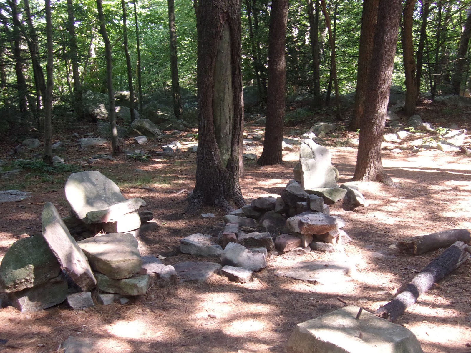
Horseshoe Trail- a 121 mile long trail to Valley Forge. I made a mental note to possibly return and explore this trail someday. I stopped for lunch at a clearing and trail registry near the site of the former Yellow Springs Village - a nineteenth century coal mining community. The clearing had a well-constructed fire ring, with a nice set of stone chairs around it. It was a good place to rest and cook up some ramen noodles for lunch.
 |
| Memorial Marker at the Horse-Shoe Trail Intersection |
 |
| Trail Registry at Yellow Springs Village Site |
 |
| Good Lunch Spot |
I continued on past several springs, stopping for water at one of them. I also passed additional evidence of former coal mining activity. The surface of the trail was black in spots, and there were places that had obviously been cleared at one time, with artificially produced hills and little vegetation. I came to Rausch Gap, and Rausch Creek. The creek here was diverted into an interesting bit of human engineering - a
Swedish Diversion Well - a concrete casement filled with limestone in order to decrease the water's acidity. The high PH of the creek was apparently the result of the former mining activity, which meant that fish were unable to survive. The hope was to create a cleaner aquatic environment so fish could be reintroduced.This area was also the site of another former community, specializing in mining and railroad equipment repair, but the community had died out by the turn of the twentieth century.
 |
| Rausch Gap |
 |
| Another Defunct Village |
 |
| The Trail Beyond Rausch Gap |
The trail parallels the creek going downstream, and I started looking for a campsite. I found one off the trail a little ways, and not far from the creek. Two female hikers came by, and I recognized one of them as 'Game Warden', whom I had encountered on day 14. They were thinking of stopping, and I told them there were plenty of campsites to choose from. They were also worried about the water quality, having seen the sign next to the diversion well. I thought it was probably safe at this location since we were downstream from the well, and the AWOL guidebook is usually reliable when in identifying good water sources. This felt like an isolated spot, but there were noisy people not too far away, as evidenced by the occasional 'primal scream' echoing through the forest. I thought it might possibly be a scout group, or perhaps a conglomeration of thru-hikers. I was grateful to not be too close, and they did calm down by 9:30 or 10:00.
 |
| My Final Campsite Near Rausch Creek |
Day 20- Sunday, July 24- Campsite by Rausch Creek to Swatara Gap, Lickdale (Jonestown), PA (5.5 miles)
I slept fairly well, and took my time getting up. This was my last day of hiking, and I didn't have far to go. I finally pulled myself out of the tent around 8 a.m. I packed up, and had a breakfast of oatmeal, and two packets of Starbucks Via instant coffee. I went to the creek for water, and noticed evidence of old building foundations and roads all around my campsite. I figured these must be the remains of the former Rausch Gap settlement.
 |
| Getting Started on My Final Hiking Day |
I left camp about 10 a.m., hoping to get to Lickdale by 1 p.m., and possibly an early check-in at the motel. Shortly before breaking camp, 'Game Warden' came by and wished me a good final day of hiking. It was a short four mile hike to Swatara Gap, and then another 2 or 3 miles into Lickdale. First I had to climb up one more mountain named, Second Mountain. It was unclear what, if anything, this mountain was second to.
 |
| Another Meadow Crossing |
 |
| A Log Bridge |
I traveled through an open field and another green tunnel before encountering a large group of thru-hikers congregating under an overpass of PA hwy 72. The thru hikers were hiking together, and passed me again before I finally arrived at Swatara Gap around 1:20 p.m. I crossed hwy 72, and down an embankment to an old iron bridge just past the intersection of the rail/trail to Lickdale (Jonestown). This is where I officially ended my year 7 adventure, and I asked a couple of bikers who were passing by to take my pic to commemorate the event. I placed a call to Ginny to let her know where I would be that evening.
 |
| Chain Bridge End of the Line for Year 7 |
 |
| Private Picnic Area on the Path to Lickdale |
It was a smooth path into town with the trail paralleling the river much of the way. I also passed alongside posted private camping/picnic areas. The trail finally dead ends at a KOA campground in Lickdale. Tuning right, it was just a short walk to Wendy's, where I stopped for lunch. It also happens to be next to the Day's Inn where I was staying for the evening. After lunch I checked in early to the motel, cleaned up, did laundry, very grateful for another GREAT hiking adventure.
 |
| Celebrating a GREAT Hike, and Looking Forward to Next Year! |
Summary of Year 7
Time on the trail can be physically, mentally, and spiritually cathartic, but each year is different, leaving it's own unique impressions. The biggest impression this year came from the many significant geographical milestones: the 1000 mile marker, the ATC center in Harper's Ferry (perhaps the psychological halfway point), and several other official and unofficial geographical 'halfway' points.
There were greater than usual physical challenges this year, including the difficult 'roller coaster' section south of Harper's Ferry, and the high temperatures. The weather was dry over the course of the entire three weeks, raining on only three occasions. Adequate hydration is at the forefront of every long distance hiker's mind, and water sources were sometimes limited and uncertain. In addition, even though I consider myself to be in good general physical condition, my body, and especially my feet, took a week or two to being conditioned to the trail. From week to week my condition gradually improved, and by the third week I felt as though I had finally 'hit my stride'.
Concerns about wildlife have generally become less of an issue for me, but this was an especially exciting trip in that I encountered four bears in the first five days of the hike; after having seen only one in the last six years! I also had many encounters with other humans: hikers (section, thru, and day), and people on or off the trail. I also had several unexpected encounters with 'trail angels' and 'trail magic', which always adds to the experience.
Finally, there is a strong spiritual dimension to hiking the trail for me, and I often directly and/or indirectly sense God's presence and guidance along the way. Throughout the trek I had an ever increasing awareness of God's presence. I return refreshed and transformed, and much better equipped to handle life in general. I am extremely grateful for the Appalachian Trail, and for all the people who love and maintain it. I want to thank everyone who is reading this blog. I hope you have found this year's travelogue/ narrative enjoyable, and I always encourage, welcome, and appreciate your comments. Please sign up to follow my blog. I would love to hear from you!


Thank you for posting your trail blog. I have only section hiked, and have done so in some of these locations, so reading this was so much fun to revisit them through your eyes and comments. Good luck on your future backpack trips.
ReplyDeleteThanks for reading, and thanks for your thoughts. -Happy Trails!!
Delete