I left home early on the morning of Saturday, June 5, to begin the two day journey to Glencliff, NH, where I would begin my hike. I was to pick up Don at the Hartford, CT, airport on the morning of June 6. This meant that I needed to get as far as possible this day. I had made prior arrangements with the owner/proprietor of the Hiker's Welcome Hostel in Glencliff, John 'Packrat' Roblee, to park my car for there for the duration of my hike. The hostel would also shuttle me back to the hostel from Gorham, NH, at the conclusion of my trip.
I wanted to avoid the traffic congestion and toll roads through the NYC area, so I took the longish route up I-81 past Scranton, PA. I stopped around 6 p.m. at a motel near the NY border in Milford, PA. My GPS told me I was about 3 1/2 hours from the airport in Hartford.
I ate a big breakfast in the morning and left around 7 a.m., following my GPS for the remainder of the trip. I often like to be surprised and explore routes off of the beaten path. I was happy that my GPS took me down back roads through the scenic Hudson River Corridor. It was a pleasant drive, and just a tad longer than the interstate might've been. After a few hickups, I finally arrived at the Bradley International Airport in Hartford a little before 11 a.m.
I picked up Don, and we commenced the drive north on I-91. I had not programmed my GPS for this leg, as it looked to be an easy drive to the Hwy 25 exit in NH, and then east to the hostel in Glencliff. What I didn't realize was the fact that there are several Hwy 25's (a, b, and c)! I stopped at a Burger King to pick up a whopper for lunch. Eating while driving was not the best idea, and I think I ended up wearing as much of the whopper as I ate. :-/ After two or three hours of driving, we arrived at our exit. It was another forty-five minutes to an hour's drive down the wrong Hwy 25, stopping for directions and gas. Don also needed a fuel canister for his stove. We finally arrived at the hostel and checked in for the night, choosing spots downstairs in the bunkhouse.
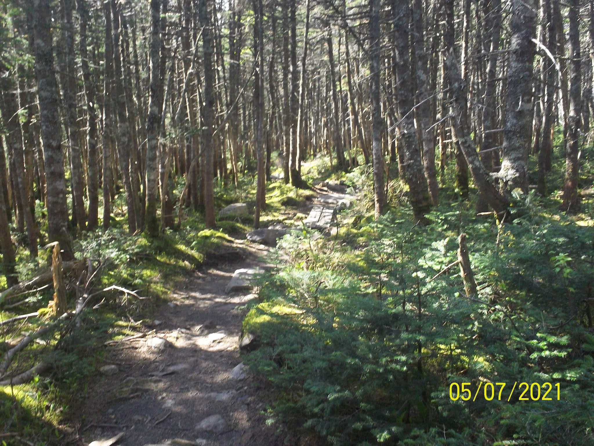
It was only about a quarter of a mile to the trailhead. I stopped for a quick pic approximately in the location where I had ended my previous hike. A hiker at the hostel had warned about an immediate unbridged stream crossing, and the possibility of crossing on a log downstream. We came to it not far from the road. It was 20 or 30 feet wide, but only looked to be about an inch deep. I decided it was not worth the effort of looking for a log, and walked right through it, while Don scouted for a dry crossing.
My AWOL trail guide showed Moosilauke to be a massive climb, much larger than anything I had seen so far on the entire AT, but then again, this appeared typical for the White Mountain range. We were passed by a young thru-hiker, and Don decided to try to keep up with her. Their Months on the trail has given thru-hikers very strong and fast trail legs. I chose to hang back, which didn't bother me, as I prefer to take my time anyway. The hike wasn't bad initially, but there were a couple confusing intersections and road crossings which were not well marked.
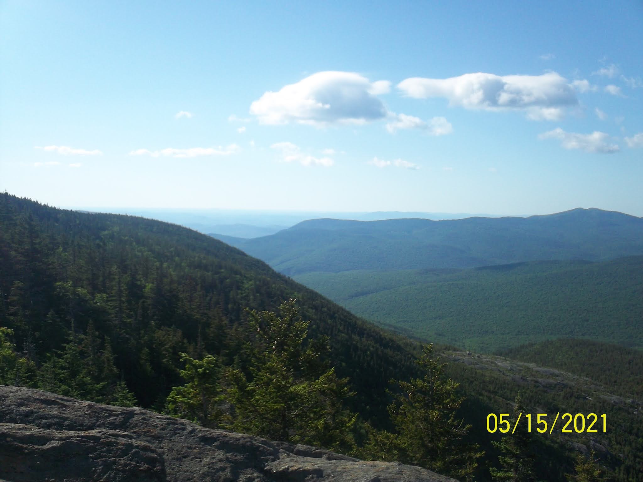
The climb to the top became relentless, with a few rocky sections here and there. I paused several times along the way to hydrate. There are two peaks at the summit, a south peak on a separate side trail, and the north peak, which the AT crosses. The trail remains rocky but opens up to spectacular 360 degree views near the top. I arrived around 11:30, and stopped to rest for lunch. There were several NOBO thru-hikers and several day hikers milling about.
Don and I continued together down the ridge and back below the tree line. It was rocky and steep in spots. We made it to the shelter and had our choice of campsites, behind the shelter. There was one VERY small tent platform, built for a 'Hobbit', as an entry in the shelter register put it. There were a couple suitable sites on the ground, which we chose for our tents. As it turns out, we had the shelter to ourselves that evening, which was nice .
After such a great first day of hiking, this day proved to be more problematic. Our itinerary called for a 14.9-mile hike to the Lonesome Lake Hut, where we had made reservations for this evening, but this proved to be very unrealistic as the day wore on. Everyone is different, but these trails are incredibly rugged and difficult to traverse. That said, most of the rest of my planned hiking itinerary proved doable.
I slept Comfortably, and rose very early to prepare for the day. The sun coming up earlier inspired me to rise with it. :-) Today was to be the longest planned day of the entire trip and I was hoping to hit the trail before 7. I packed up nearly everything, before heading down to the shelter for breakfast. Don was already there, enjoying a beautiful sunrise to the east, which was directly in front of the shelter.
 |
| Beautiful Sunrise at Beaver Brook Shelter |
We broke camp around 7:30. My trail guide elevation profile showed a steep descent along Beaver Brook. This was indeed the case, and the trail often descended on large, wet boulders, making the footing tricky. There were nice waterfalls near the bottom, however. Don decided to slide down a part of one, but I was a bit more cautious. It was tough, and I suspected that this might be typical of the trail heading north. We stopped along the way to chat with a few ascending hikers. Many people choose to slack pack Moosilauke going south, as it is consider an easier option. I've been exclusively heading north since Springer, and have no interest in doing otherwise at this point.
 |
| Don in Sliding Position Along Beaver Brook Falls |
 |
| Posing With the Falls |
Don and I reached the Parking Lot at NH 112 Kinsman Notch, and sat down for a short break. The next climb was Wolf Mountain. Much like Beaver Brook, it was steep and Rocky. I slowed down and took a few breaks, while Don motored ahead of me. I'd been thinking it might be possible to do lunch at the Eliza Brook Shelter, but was severely mistaken.
 |
| Another Falls Shot |
 |
| Sign at Kinsman Notch |
In addition to the difficult climbs, there aren't many water sources through this section. I stopped frequently to hydrate and take nourishment, but felt my energy waning with every step. It was both tough and humbling at the same time. I crossed a boggy area at one point, accidentally stepping on an invisible gap between the boards, and fell into quick sand up to my knee. It took some time to extract myself, but was more cautious after that.
 |
| Board Walks Over Boggy Areas |
I soon realized there was no way I was going to make it to the hut. The looming mass of South Kinsman Mountain was still in front of me, and the hut was three or four miles beyond that. I paused near the side trail to the Eliza Brook Shelter around 4 p.m., and texted Don that I was going to be a day behind schedule. I made camp near the shelter, just below South Kinsman. I pitched my tent in a nice campsite to the right of the shelter, adjacent to the water source in the bubbling Eliza Brook.
 |
| One of the VERY Few Power line Crossings |
I had gone about 9 miles, which still a solid day given the conditions, and was happy to be here. I was, however, a little apprehensive about how the hut reservations might be handled going forward. Oh well-I am just taking it one day at a time. It rained in the evening, but I stayed warm and dry.
Wednesday, June 9 - Day 3- Eliza Brook Campsite to Lonesome Lake Hut (6.0 miles)
I began the day very early, breaking camp before 7 in the hope of catching up with Don. I hadn't been in touch, and had no idea if he had made it to the hut or not. I knew the huge climb just ahead would be extremely difficult, but I thought it might be possible to gain back some lost time from yesterday.
 |
| Trail Beside Eliza Brook |
I know I am repeating myself, but no matter how difficult you might perceive sections of the AT in the south being, multiply that by 2, and it may approach what the Whites are like. I did consider the fact that my own perception might be faulty. After all, I'm not getting younger, but I cannot remember anything like this. The trail north parallels Eliza Brook for a mile or so before veering straight up the side of South Kinsman Mountain.
 |
Rocky Ascent
(Above and Below) |
The climb up South Kinsman had me seriously questioning my sanity. It was hand to knee for a mile and a half, often traversing boulders with no apparent way up, gaining 2000 feet or so of elevation. I started getting cell reception near the top, and called Don around 9 a.m.. He had also camped short of the hut, and was just arriving there when I called. He was consulting with the hut staff to discern ways of catching up with our original plan. The staff offered a shortcut option to the Greenleaf Hut, our original third day goal, which would cut four miles off the AT trek. He was planning on doing that.
 |
| Foggy South Kinsman Summit |
 |
| Looking Toward North Kinsman Mt |
I didn't think I could make it all the way to Greenleaf, and was happy to learn that Lonesome Lake was expecting me that very evening, and I was their only confirmed guest! Somehow, in the transition out of Covid, the online hut reservation system was messed up. While the online system indicated no vacancy, the opposite was actually true. Since Don and I had carried over our reservations from the previous year, we were somehow not affected by this.
 |
| Nice Views From North Kinsman |
I continued over South Kinsman, down and up to North Kinsman. I stopped to visit briefly with a friendly dog, whose owners were on the overlook. He looked alone, and I was afraid he might follow me, as another dog had on a previous hike. It was a steep, long, rear end slide down the north side of Kinsman. I began to encounter a few day hikers heading up the slope. I stopped at the Kinsman Pond shelter, refilled my water bottles, and cooked up some ramen for lunch. I took a few pics of the pond before heading on.
 |
| Changing Terrain |
 |
| Kinsman Pond |
Beyond Kinsman was yet more rough and steep terrain almost all the way to the hut. I encountered more day hikers, and arrived around three. I checked in, took a bunk in the upper bunkhouse, and was treated royally by the hut staff. I had a great dinner of split pea soup, salad, roast asparagus, homemade bread, and special cake for dessert. Following supper, the hut master, John, gave me a 'tech talk' on the operations of the hut, which was very interesting.
 |
| Arriving at Lonesome Lake Hut |
 |
| The Lower Bunkhouse at Lonesome Lake Hut |
Thursday, June 10 - Day 4 - Lonesome Lake Hut to Greenleaf Hut (6.0 miles)
I had been assessing my AT route in the evening. It was to be a 9.3 mile hike up Franconia ridge, plus an extra 1.2 mile hike down to the Greeleaf Hut. This would be the equivalent of 20 miles elsewhere, and I was feeling a bit beaten down by the trail so far. I decided to inquire about the 'short-cut' to the Greenleaf Hut that Don had done the previous day. The hut master, John said it was a simple trip around Lonesome Lake to the Old Bridle Path, which goes directly to Greenleaf Hut. I decided in the spur of the moment to do this bypass - the first time I had ever skipped and/or 'cheated' on a portion of the AT. I felt a little guilty, but will plan to return and 'slack pack' it someday.
 |
| Lonesome Lake From the Hut |
I arose early, and packed before taking breakfast in the dining hall at 7. I enjoyed the oatmeal, eggs, sausage, and coffee - so much food! Since I was going off the AT, I asked John to write out detailed trail instructions for me just in case I might be tempted to make a wrong turn. I took off just before 8. It looked to be a beautiful day, and I snapped a few pics around the hut and lake. I took the Lonesome Lake Trail around the lake, which was flat and scenic.
 |
| Franconia Ridge |
 |
| I-93 Underpass |
After heading west around the south end of the lake, the trail heads north and down to a campground. The trail through here was mostly smooth for a change. I went through a tunnel under I-93, and passed a large day hiker parking lot to the trailhead of the Old Bridle Path Trail, which headed upward towards Franconia Ridge.
 |
| Mt. Lincoln From the Old Bridle Path |
 |
| View Along the Ridge |
I started feeling rather weak and light-headed on the way up. A passing couple, who were in the health care profession, tried to offer assistance and diagnose my condition - some of which alarmed me. I considered possible options getting off of the trail, but decided to proceed to the hut, which was not far. After arriving and checking in at the hut, I called Ginny about my situation. She became even more alarmed than I was, and suggested paying for a helicopter to airlift me out! 😄
 |
| A Difficult and Rocky Traverse |
 |
| View Back Towards Lonesome Lake |
I tried to reassure her that this was not necessary. One of the less alarming possibilities was simple dehydration. This is something I am always aware of, and try to be careful with. Even though I felt like I was taking in adequate water and nourishment, the difficulty of this trail apparently was taking more out of me than I was putting in. At the hut I drank a liter of water, and resupplied with extra food bars I could easily access during the day. This did the trick, and I felt good for the remainder of the trip.
 |
| Arriving at Greenleaf Hut |
 |
| Eagle Lake and Mt. Lafayette from Greenleaf Hut |
I arrived at the hut around 1p.m., took a nap, and mostly enjoyed the fantastic scenery around the hut Mt. Lafayette was visible directly overhead, above the tree line. I could see hikers making their way down the Greenleaf Trail, entering the tree line, and emerging below the hut.
 |
Scenes Around the Hut
(Above and Below) |
I chatted with a former thru-hiking couple, and a few day hikers. Dinner at the hut was incredible, and once again, I was the only guest! I was treated to multiple courses of split pea soup, kale salad, and the best lasagna I have ever put in my mouth. I continued to thoroughly hydrate, drinking as much water as possible with the meal.
After supper, I was given a personal tour of the local ecosystems around the hut by Julia, the hut naturalist. I am always interested in learning things, and never assume that I know too much. :-) I asked some questions, and tried to absorb the information.
 |
| Entry Point to the Greenleaf Trail |
Friday, June 11 - Day 5 - Greenleaf Hut to Galehead Hut (7.8 miles)
I remained in bed a little later. The 'wake up' time in the huts is at 6:30 a.m., with breakfast at 7. I am almost always up before then, so 'later' is relative. I packed up, and ate a big breakfast. I was determined to take my time today. It was 1.1 miles to the top of Mt. Lafayette. Even it doesn't look far, everything I have read tells me to expect to take at least one hour to summit.
 |
| Looking Back From Eagle Lake |
I departed just before 8, stopping frequently on the ascent to hydrate, and taking pics back towards the hut. I timed myself, and it took an hour and twenty minutes to reach the summit. I sat down to eat a Luna bar, before turning left on the AT.
 |
| View to the South |
 |
| Looking Back from the Slope of Lafayette |
 |
| Where I am Going |
I hiked north along the exposed and rocky Franconia Ridge. My next objective was Mt. Garfield, which I could see looming ahead as I hiked down toward the tree line. It was rocky and steep, but not too bad.
 |
| Another Hut View |
 |
| Nearing the Summit |
I reentered the tree line through a coniferous forest down to the gap below. I took lunch at the foot of the mountain near Garfield Pond. It was another steep climb up Garfield, with many nice views back to Mt. Lafayette.
 |
Looking East From the Summit of Mt. Lafayette
(Greenleaf Hut Visible to the Left) |
 |
| Hiking the Cold and Windy Franconia Ridge |
 |
| Mt. Garfield Straight Ahead! |
My most serious mishap occurred while I was descending the northern end of Garfield Mt.. I passed a slow-moving group of hikers on the first part of the descent, and started feeling a bit cocky. Just as I passed the access trail to the Garfield Ridge Campsite, the path took an almost vertical downward turn, with a stream running down the face of it. It was literally like trying to hike down a waterfall. I thought to myself, 'this is insane'. In hindsight, I probably should've turned around and gone down it like a ladder. Unfortunately, I tried to face it, lost my footing and tumbled fifteen or twenty feet down the cliff.
 |
| Reentering the Coniferous Forest Tree Line |
 |
| View Back Towards Fog Shrouded Mt. Lafayette |
It was the worst fall I have ever experienced, and one of those slow motion, 'life flashing before your eyes' moments I've always heard of. I do remember thinking and repeating the phrase, 'please nothing break'. I came to a painfully dazed stop against a rock and took inventory of my condition. Thankfully, nothing was broken except one of my trekking poles. I did have a few scrapes and cuts, including a sharp laceration on my forehead.
After collecting myself, and bemoaning my sad lot for a time, I continued down (literally) the trail, somewhat more cautiously. I always try to learn something from every misstep, and I was VERY careful with my foot placement for the remainder of the trip. I still had three miles or so to go to the hut. I had heard that the last mile before Galehead was brutal, but I didn't find it excessively so.
 |
The Galehead Hut
(The Most Remote Hut in the Whites) |
I arrived at the hut and checked in. I was able to see the full extent of the injury to my forehead. It wasn't pretty, but I cleaned it up, applied some antibiotic ointment, and covered it with a large bandage from my first aid kit. From this point on, I was a little self-conscious, even for a hiker, and started wearing my stocking cap to cover it up. I was not the only guest at the hut this day. Two other hikers, Tillie and Rich, were with me.
 |
| My Own Private Bunkroom! |
 |
The Galehead Dining Room
(A Cold and Wrapped Up Tillie in the Foreground) |
I again enjoyed a private bunk room, along with another great dinner of salad, split pea soup, marinated chicken, carrots, and a surprise desert of delicious lemon squares. All the huts also sponsor 'tech' and 'naturalist' talks each evening. The 'tech talks', dealing with hut operations, generally take place before dinner at 5:30, while the 'naturalist talks' concerning the local environment, flora, and fauna, take place at 7:30. I took advantage of these talks whenever I could.
The 'tech talk', given by Zoe, was interesting in that she described some of the history and traditions of the huts. This sense of tradition, even if it doesn't always make sense, is important to hut operations. The food is hiked in by the crew (or 'croo' as they say) each Wednesday and Saturday on primitive pack boards designed in the 1930's. I have always been fascinated by ghost stories. and Zoe shared a few stories of reputedly haunted huts. After supper, the naturalist talk given by Emily was also interesting. She described the invasive species of Winter Tick, how this has impacted the moose population, and what is being done to combat this infestation. This was Emily's first presentation, and I could tell she was passionate about the subject, but also nervous. I asked a few questions, which seemed to put her at ease.
Saturday, June 12 - Day 6 - Galehead Hut to Ethan Pond Campsite (11.8 miles)
 |
| View in Front of Galehead Hut |
It was a cold night in the hut, and I needed to add layers of clothing to sleep in. I slept well, but I can only imagine what it might've been like had I been camping in my tent. Thus is the nature of this area at ANY time of the year. Today was to be my longest day of the entire trip, 11.7 miles, but I was more confident in the terrain ahead. There was a very difficult climb up South Twin Mt to begin the day. I had been told that climb this was considered, by some, to be the most difficult climb on the entire AT. I would pass the next hut at Zealand Falls at about 7 miles. This was followed by a long, virtually flat section to my intended campsite at Ethan Pond.
I enjoyed a great breakfast of oatmeal, eggs, sausage, and coffee cake. I conversed with Rich, who snapped my pic outside the hut, and took off around 8 a.m..
 |
| Morning Departure |
 |
| Sign Near The Hut |
It was a relatively short, but steep climb to the top of South Twin. I felt energized, but also took my time on the climb, stopping frequently to hydrate. I certainly did not want to have a repetition of my day 3 experience. I finally reached the summit, and sat down to eat a Luna bar. There were many hikers milling about, and one of them offered to take my pic.
 |
| On The Climb Looking South To Mt. Garfield |
 |
| Another Vista to the East |
 |
From the Summit of South Twin
Looking Towards the North Presidentials |
 |
| I'm There!! |
I encountered even many more hikers on the descent - more than I had encountered at any point so far. Most of these were day hikers, who were all heading in the opposite direction. The descent wasn't bad, and was followed by a long, smooth section, leading to a picturesque, open area above the tree line. This was a more difficult traverse, as it was a boulder strewn rock fall.
 |
| A Little Respite |
I crossed the bald, stopping once to converse with a couple of distance hikers. The trail took a left turn across the bald, and back down into the tree line, where I encountered more hikers. I stopped for lunch in a little clearing and continued on to Zeacliff, where I paused again. It was a very steep descent to the Zealand Falls Hut. The huts keep food on hand for passing hikers. This is free to registered hikers, and available for a fee to others. I decided to stop for a bowl of homemade vegetable soup, accompanied by a slice of homemade bread. I chatted with an AMC volunteer.
 |
| Crossing The Open Bald |
 |
| Part of the Traverse |
 |
| Rocky Open Sections |
The last 4.5 miles to the Ethan Pond Campsite were super easy. The trail follows an old railroad bed part of the way, and then along a river corridor all the way to the pond. It crosses the river a few times along the way.
 |
| Smooth Hike Along an Old Railroad Bed |
 |
| Looking Back Towards Zealand Falls Hut |
 |
| River Crossing |
I arrived at the campsite around 5 p.m., and checked in with the caretaker. I paid the fifteen dollar fee, and pitched my tent on platform 4, towards the back of the campsite. This was my first pitch on a wooden tent platform, which is the exact reason I purchased a free standing tent last year. Staking the vestibule and the vents required wedging the tent stakes between the boards on the platform, but this was easily done.
 |
| Stream Crossing |
 |
| First Tent Pitch on a Wooden Platform |
 |
| Ethan Pond |
Sunday, June 13 - Day 7 -Ethan Pond Campsite to Mizpah Spring Hut (9.3 Miles)
I got up early around 5:30 a.m., and started packing up. I had breakfast and coffee, and hit the trail before 8 a.m. I stopped at the Ethan Pond on the way out to top off my water supply.
 |
| Stopping For Water |
It was a flat hike initially, and then a good long descent to Crawford Notch. I paused several times to chat with passing hikers, and to frequently hydrate. I stopped at Crawford Notch to eat a Luna Bar in preparation for the long, brutal climb up Mt. Webster.
 |
| Crawford Notch Trail Crossing |
 |
| US Hwy 302 at Crawford Notch |
It was another climb requiring many choices and guesses on how to best negotiate the boulders and rock faces. It was very difficult, but also provided some rewarding views. I arrived at the Webster Cliffs, took a few pics, and continued to climb to the summit of Mt. Webster.
 |
| View of Hwy 302 from Webster Cliffs |
 |
| View South From Webster Cliffs |
 |
| View Looking North |
The pleasure was short-lived, as a brief descent to a small gap led to another rock scramble to the top of Mt. Jackson. Many people were lounging and milling at this spot. I chatted with a few young day hikers, and an extremely fast NOBO thru-hiker. I could see the hut in the distance down below, and knew I was not far from my destination.
 |
| More Climbs... |
 |
| ...with Great Views! |
 |
Summit of Mt. Jackson
|
 |
From Mt. Jackson
(Mizpah Hut Barely Visible in the Distance) |
The last 1.5 miles before the hut traversed some low, wet areas, carpeted with thick layers of moss. I stopped to top off with water, and arrived at the hut around 4:30 p.m.
 |
| Ridge Below Mt. Jackson |
 |
| Back to the Trees |
 |
| Arriving at the Mizpah Springs Hut |
I checked in, cleaned up, and caught a little bit of the 'tech talk', with a visual display of a pack board used to transport food to the huts. Supper was amazing as ALL hut food is IMO. Three hut crew (or 'croo' as they say) were working with more guests than I had yet seen in any previous stay.
 |
| 'Tech Talk' with a Pack Board |
After supper, I browsed the library a little , and attended the 'naturalist' presentation on the 'Fir Wave'.
This is a natural phenomenon, whereby fir trees at higher elevations begin to topple and die, exposing adjacent trees to elements, and causing them to do the same. This pattern continues similar to falling dominoes in wave fashion, allowing for growth of new trees in the understory. These events apparently occur every 70-80 years or so, and was currently happening in the vicinity of the hut. This explained the swaths of dead trees as I saw as I was approaching the hut. It was very interesting to hear the explanation of why this was happening.
 |
| Dead Black Balsam Fir Trees Around the Hut |
 |
| Guests Representing a 'Fir Wave' |
This had been a tough, but great day of hiking in the White Mountains. I am grateful to be feeling stronger and better every day as I continue to adapt to the rigors of hiking in this area.
Monday, June 14 - Day 8 - Mizpah Spring Hut to Lakes of the Clouds Hut (4.7 Miles)
This was a short, but very interesting day of hiking, mostly above the tree line to the largest hut in the hut system. As I mentioned, hut 'croos' follow many traditions, including providing wake up calls for guests promptly at 6:30 a.m.. I am always up before then, so I could observe this. In my observation, these wake up calls can take many different forms, according to the particular crews. This morning, I was treated to a beautiful Scottish folk song, sung wonderfully by the Assistant Hut Master, Emily. I complimented her on her singing, and mentioned as a choir director myself, how much I appreciated it.
 |
| Hut Side View |
I ate a big breakfast, and made further arrangement to push my hut reservations forward. I also decided to see about making a reservation at the Madison Spring hut for tomorrow. My original plan called for staying at a campsite below Madison Springs, but after looking at the terrain, the distance off the trail, and the weather, I decided the most prudent choice would be to stay in the hut. Fortunately, they had room for me, and I was able to confirm this reservation. My friend, Don, had accidentally left his trail journal at the hut the day before. He had left a message with the hut staff to give it to me to get to him, which I was more than happy to do.
 |
| Alpine Zone Sign Outside Mizpah Hut |
The weather was iffy for the afternoon, so I wanted to get an early start. It was a stiff climb up Mt. Pierce to begin the day, and then above the tree line across Mt. Franklin. It was VERY windy and cold in the higher elevations. I encountered and conversed with hikers coming from Lakes in the Clouds, and heading in the opposite direction.
 |
| Mt. Pierce Summit |
 |
| On to Mt. Franklin |
I hiked across a bleak, cloudy, and stark terrain around Mts. Eisenhower and Monroe. There were optional loop trails to the tops of both these peaks, but I chose not to do them. My conquest of the Appalachian Trail doesn't generally include the conquest of mountains not on the trail itself. Besides, the views this day were limited because of the clouds. I felt good, and hydrated and ate Luna Bars along the way.
 |
| Heading For The Next President |
 |
| A Little Color in a Generally Bleak Landscape |
 |
| Mt. Eisenhower to the Left |
I rounded Mt.Monroe, after which Mt. Washington, the highest point in the presidential range, was clearly visible. I also remembered reading stories of people who had gotten into serious trouble in this very area. Several had perished near to the hut, usually of hypothermia, and/or somehow losing sight of the trail in bad weather.
 |
Scenes From the Trail
(Above and Below) |
 |
| Rounding Mount Monroe |
I passed a small lake on the left below Mt. Monroe, and was happy to catch my first glimpse of the hut.
I arrived around noon, cleaned up, had a bowl of soup, and visited with a hiker couple I had seen at Mizpah. They were just out for a few days, visiting with their son, who was an AMC crew member.
 |
Into the Mist
(Yes, that is snow you are seeing!) |
 |
| First Glimpse of the Hut |
 |
| Fog Shrouded Mt. Washington |
The hut was socked in with rain most of the afternoon, so I passed the majority of time reading the book I had brought, 'Wilderness', the Gateway to the Soul, by Scott Stillman. This is the first year I have not hiked with Bill Bryson, which is a different feeling. :). The Hut Master, Libby, came by and introduced herself, and sat down to ask how I was doing. I thought she was just being friendly, but discovered that Ginny had called the AMC out of concern, following my day 3 call. The AMC, in turn, had alerted all the huts to be on the lookout for me. I generally feel self-sufficient, capable, and strong, and felt I was doing fine. Given the number of people run into problems the Whites, however, it was nice to be thought about. IMO, everyone should have some kind of support system no matter how capable they are, and/or think of themselves as being.
 |
| The Lakes of the Clouds Dining Room |
 |
The So-Called 'Dungeon'
(Emergency Shelter Below the Hut) |
We had a GREAT dinner of soup, salad, rice, peas, and chicken. Afterwards, one of the crew members gave a report on her AT thru-hiking experience. I never tire of hearing tales from the trail, and was fascinated to hear of her personal experience. Following this, I conversed with a brother/sister duo, Chris and John, who get together periodically to do extended hikes. Chris was a seasoned park ranger out west. She happily shared her experience, and I was more than happy to learn from her She expressed concerns about the weather forecast for the morning, and the potential dangers of summiting Mt. Washington if it didn't improve. Knowing the potential dangers myself, and respecting her experience, I was having second thoughts about trying to hike it, but took the position to wait and see. The weather in this area can change on a dime.
Tuesday, June 15 - Day 9 - Lakes in the Clouds Hut to Madison Spring Hut (7.2 Miles)
It was a cold and windy night in the hut. I needed to layer up to get sleep, grateful again that I was not camping outside. Today was definitely the toughest 7.2 miles of hiking I have ever done. I checked the weather carefully before departing, knowing the danger of crossing Mt. Washington in anything short of ideal conditions. Mt. Washington is known as the 'home of the world's worst weather', and the highest recorded non-hurricane or tornado land wind speed of 231 mph was recorded on its summit. Fortunately the weather this morning was fairly clear, with some beautiful views around the hut, including a cloud inversion in the valley below.
 |
View Around the Hut
(Above and Below) |
 |
| A Cloud Inversion |
 |
| Looking Towards Mt. Washington |
Breakfast was great, and included a little skit by the crew in solicitation of tips. I took off around 8 a.m.. The Hutmaster, Libby, asked if she might text Ginny that I was on my way to the Madison Spring Hut. Since I had no cell service, and hadn't been in touch with home, I happily assented.
 |
| Ready to Go - Posing With the Clouds |
 |
| Hut 'Croo' Solicitation Skit |
It was a steady, but rocky, climb to the summit of Mt. Washington. I once again, took frequent breaks to hydrate and rest. I passed a stark warning sign, alerting hikers of the danger ahead. This is something I already knew, but seeing it in print still gave me pause. On the way up, I could hear the whistle of the cog railway engine leaving the station below. I wondered if I would beat it to the top.
 |
| One of the Lakes Near Lakes of the Clouds Hut |
 |
| A Stark Warning |
 |
| A Rocky Ascent Up Mt. Washington |
 |
| View of the Valley Below |
I arrived at the summit around 9:30 a.m., passing the weather station, along with a variety of communication towers, dishes, and arrays. Mt. Washington is a popular tourist destination, with an access auto road to the top, so people have choices in how to get there. In addition, a snack bar and a post office are located right off the cog railway terminal. The historic 'Tip Top Inn' was closed for renovations.
 |
| At The Summit |
 |
| I'm King of the World!! :) |
After getting my pic taken at the summit, I headed down to the snack bar for a brief pit stop. The cog railway train was unloading passengers just as I arrived, providing an instant crowd of noisy tourists. I rested briefly, before heading on. The brother/sister duo, Chris and John, I had met at Lakes in the Clouds, were also on their way to the Madison Spring Hut, so I decided I would hike with them for a while.
 |
Sign by the Snack Bar
(Just so You know) |
One thing I forgot to mention is that the AT through the White Mountains follows, in many cases, trails that predate the AT by many years. When the AT was being planned early in the twentieth century, the path was first placed over existing trails. The Crawford Path to the summit of Mt. Washington dates to the late 18th century, and the oldest foot path in the country. This may partially explain why the trails are so difficult. The settlers who originated them just took the shortest distance between two points, and switchbacks to facilitate foot travel were simply not considered.
 |
| The AT North Follows the Crawford Path Up... |
 |
| ...And The Gulfside Trail Down |
We hiked down the rocky Gulfside trail, and into the Great Gulf Wilderness. We crossed the cog railway, and continued on the exposed ridge for a long distance. Since the sun was out, Chris and John decided to take the loop hike over Mt. Clay, while I continued down the AT bypass to the left. The trail was a little confusing at this juncture, as there were NO blazes to be seen anywhere. There were also a few intersecting trails below Mt. Clay, which added to the confusion.
 |
| Heading Down the Gulfside Trail |
 |
| Crossing the Cog Railway Tracks |
 |
The Valley Where the Cog Railway Originates
 | An Engine Heading Up The Mountain
|
|
 |
| Onward and Upward! |
 |
| Mt. Clay |
I kept going up the next rise, and around Mt. Jefferson. I met a few SOBO hikers along the way, who were coming from the Madison Spring Hut area. The entire section from Lakes in the Clouds to Madison Spring, is almost nothing but sharp rock hopping, and there was absolutely no way to safely go quickly. I took a break for lunch on the far side of Mt. Jefferson.
 |
| Approach to Mt. Jefferson |
 |
| Break on the Slope of Jefferson |
It began raining as Chris and John caught up to me, so we put on our rain gear. We hiked together to the col (gap) below Mt. Adams, crossing a small snow field at one point. The rain abated temporarily, but then started up again at the Sphinx Col. There was also some thunder and lightening close by, and no place to take cover, so I hung as close as possible to the scrub to the right of the trail. I fell behind my hiking companions as I negotiated the wet, slippery rocks. The rain continued all the way to the hut, which was another mile and a half. My hiking pants were already torn from climbs, slips, falls, etc. I slipped again, and completely tore my rain pants, along with the hiking pants beneath. The trail became slightly easier as I approached the hut, where I arrived around 4:30 p.m..
 |
| View of Mt. Adams - Rocky Path Forward |
 |
| Crossing a Snow Field |
 |
View From Edwards Col
(Below Mt. Adams) |
 |
| Great View From Sphinx Col |
 |
| Extra Large Cairn at Sphinx Col |
There were many people at the hut, all of whom were wet, and looking to dry out their things. The bunking areas in this hut were separated, but open to other bunk areas. The bunks were three levels high, so I took the highest bunk in the loft, which was right under a skylight. I hung all my wet things on the many hooks that were available.
 |
| Madison Spring Hut Lies Directly Beneath Mt. Madison |
Dinner was great, as usual. After dinner, in place of the regular 'naturalist' talk, we played a game of White Mountain Jeopardy, with different categories. We broke into two teams. Chris and John were on team with me, and we ended up winning! I also decided to take the Junior Naturalist Challenge. The hut 'croos' were promoting this to anyone. The educational challenge consisted of two levels: for 5-8 year olds, and/or 8-12 year olds, with corresponding study guide books. I decided to take the higher level challenge, which poses the question- 'am I really smarter than a fifth grader?' I stayed up late in the dining hall, reading the guidebook, and filling in the questions - many of which were somewhat challenging. I left my completed book at the front desk before turning in for the night. If I passed the exam, I might be awarded my Junior Naturalist diploma in the morning at breakfast.
Wednesday, June 16 - Day 10 Madison Spring Hut to Pinkham Notch Joe Dodge Lodge (7.8 miles)
The wind was howling all night, and I delayed getting out of my comfy sleeping bag. I finally got up at 6 and started packing up. I set some of my still wet items - socks, shirt, pants, outside the hut to see if the wind might dry them out a little more. I had to place the items under rocks to keep them from blowing away.
 |
| Front of Madison Springs Hut |
Breakfast was a 7 - yum! I was proud to graduate as an AMC Junior Naturalist, with a brief ceremony in which I was awarded with an official patch and diploma. The diploma included the Junior Naturalist pledge to respect all living things, learn about the natural world, and work towards protecting our planet - worthy goals!
 |
| Receiving My Diploma and Patch |
 |
| Patch Proudly Displayed On My Trail Map at Home |
 |
| My Official Junior Naturalist Diploma and Pledge |
After breakfast, I collected my clothes from outside, which were still damp, and took off around 8 a.m.It was a short, steep, harrowing climb to the top of Mt. Madison. It was extremely windy and cold, but at least the sun was out. There were great views at the summit, but hard to stay steady in the wind.
 |
| Steep Rocky Climb Up the Last Presidential |
 |
| Valley View |
 |
View Back Towards Mt. Adams
(The Hut is Visible Below) |
The hike didn't get any easier at the summit, and I could see the open, rocky ridge line I would be traversing. I think this was probably the most difficult rock hopping I have done this entire trip. The only way to safely negotiate it was to carefully sight the cairns, and try to find the best paths between them.
 |
| Way Forward |
 |
| View Down the Ridge |
 |
| Above the Clouds |
I crawled carefully from cairn to cairn, trying to avoid being blown off the rocks in the process, stopping regularly for breaks along the way. I was sheltered briefly from the wind as the trail looped around the east side of the ridge. It was tough, but I could see the way gradually leading down to the valley below. The exposed ridge was difficult hiking, but all downhill. I don't like to talk much about physical pain, but my knees were feeling the accumulated stress of the steep downhill hiking.
I finally entered the tree line, and stopped for lunch. I had cell service, so I called Ginny, Josie (Bradley), and Don Rice. Don and I briefly compared notes. He had just ended his hike at Pinkham Notch, and was on the bus to Boston for the trip home. We regretted that we weren't able to do much of the hike together, but both had successful trips. He was happy to know I had his journal, and would see that it was returned to him at the conclusion of my trek.
 |
| Towards Greener Pastures |
 |
| Not Quite Finished With the Climbs |
It was somewhat of a relief to finally be back in the trees after almost three whole days of exposed hiking on sub arctic ridges. The trail was slightly easier, but still a long, slow slog down the mountain. I stopped to chat with a SOBO section hiker, trail name - 'Special Ed', for his teaching career. He had met Don and his friend, Susie, at the Joe Dodge Lodge.
I passed the cutoff trail to the Osgood tent site. It seemed an interminable hike down the mountain, crossing several scenic brooks and a suspension bridge. I didn't see many other hikers though this section. My hiking pants were ripped to shreds, and I am hoping to buy a new pair at Pinkham Notch. In the meantime, I wore my long underwear underneath my tattered pants, partially out of a sense of modesty, and partially to stay warm. I could feel the temperature changing as I descended off the ridge, and into the valley.
 |
| Scenic Brook Crossings |
 |
| A Nice Suspension Bridge |
I crossed the Mt. Washington Auto Road, and followed the Old Jackson Road Trail. This trail is relatively flat and smooth all the way down to Pinkham Notch. I arrived around 4 p.m., and checked into the Joe Dodge Lodge. This lodge, like the high mountain huts, is operated by the Appalachian Mountain club, and like the huts, breakfast and dinners are provided to guests of the lodge. Joe Dodge was the president of the AMC in the early part of 20th century. He is legendary character in these mountains, having overseen the development of the park and much of the hut system. He also personally performed and organized MANY search and rescue operations from his base at Pinkham Notch.
 |
| Trailside Sign |
The Visitors Center and Trading Post is adjacent to the lodge. The Trading Post carries a quantity of hiking gear and supplies, providing a resupply opportunity for anyone needing it. I took a shower and cleaned up a bit before heading over to see about getting a new pair of hiking pants. The Trading Post selection is limited, and not cheap, but I did manage to buy a very good pair of pants. The material is such that it should last me many seasons.
 |
| The Joe Dodge Lodge |
I took dinner at 6:30 in the visitors center. Unfortunately, there were no laundry facilities, so I had to wash some of my stuff in the sink, and dried it with a box fan in my room.
 |
The Visitors Center and Trading Post
|
Thursday, June 17 - Day 11 -Zero Day at Pinkham Notch
This was mostly a do nothing day, and I basically goofed off all day - reading, browsing the little library, napping, eating, and buying a few supplies at the Trading Post. There was little else to do in Pinkham Notch. I'm sure I could've taken a shuttle somewhere, but I didn't feel much like doing anything. It was a refreshing break, just letting my body recover, and getting psyched for my last three days of hiking. :-)
Friday, June 18- Day 12 - Pinkham Notch to Carter Notch Hut (5.9 miles)
I got up, packed, ate breakfast, and left around 7:30 a.m. for a short, but steep hike to the last hut in the White Mts. heading north, Carter Notch. Carter Notch is also the oldest hut in the hut system. I had been hearing stories about it almost since the beginning, and was excited to be going there. Of course, there was another BIG climb to come up Wildcat Mountain.
I crossed the road and started along the Lost Pond Trail. This trail follows the river/creek to the Lost Pond. It started out easy, but became difficult to discern, because of roots and rocks along the way. The AT intersects the Wildcat Ridge Trail to the left and heads up the mountain.
 |
| At The Trail Head |
 |
| Traveling Along the Creek |
 |
| The Lost Pond |
As mentioned, it was a big climb, with a few tough scrambles. There were some good viewpoints to the notch below, andI stopped to rest briefly. I continued to where I had good cell service, and called the Hiker's Welcome Hostel to confirm the shuttle information for my planned arrival in Gorham two days hence.
 |
Views Back From Wildcat Ridge
(Above and Below) |
 |
Mt. Washington to the Left Foreground
Mt. Madison to the Right in Back |
I came to the Wildcat Ski area, with the inactive Gondola transport, and an observation platform just beyond it. I was hopeful this was the end of climbing for the day, but there was more to come before I finally reached the apex of Wildcat Mountain. I stopped for lunch at a nice view spot.
 |
| Gondola Lift at Wildcat Mt. Ski Area |
 |
| Observation Platform |
 |
View From Observation Platform
Looking Back Toward the Northern Presidentials |
From here, the trail heads steeply down the mountain. I stopped for water at a spring along the way. I find these little water sources irresistible at times. I arrived at the bottom of the notch, taking the short spur trail to the Carter Notch Hut.
 |
| Southeast View from the Summit of Wildcat Mt. |
 |
| Another View |
I passed two very scenic little ponds before arriving at the hut. The hut was different from the others, in that the original building was completely made of stone. This building now contained the crew area, kitchen, and dining hall. There were separate bunk houses for guests. I checked in, ate a bowl of soup and visited with the staff.
 |
| View of Wildcat Mt. From Below |
 |
| Scenic Pond at Carter Notch |
Later at supper, I met four other guests at the hut - a married couple, and two other women. After supper, the Assistant Hut Master, Abigail, gave an interesting talk on lichens, with a little tour around the facility. I was pleased to discover that Abigail was also a musician, having studied cello in college. She was planning to work on a graduate degree in mathematics, but was very knowledgable about orchestral and chamber music. It is always refreshing to meet people with such diverse and varied interests.
 |
| Going Around the Pond Towards the Hut |
 |
| Arriving at Carter Notch Hut |
Saturday, June 19- Day 13 - Carter Notch Hut to Imp Shelter Campsite (7.2 Miles)
I arose before 6, and started packing. I ate my final hut breakfast - pancakes, oatmeal, eggs, bacon, and coffee of course. The married couple, Bob and Laura, snapped my pic in front of the bunkhouse. Bob was a professional photographer, and I felt honored for him to take my pic with my little Kodak digital camera. I was looking towards a tough climb (What a surprise!) up Carter Dome to begin the day. The steep ascent was visible from where I stood.
 |
| Photographer Bob and Laura |
 |
Pointing to Carter Dome
Wildcat Mountain in the Background |
I headed off before 8 a.m., and it took over an hour to reach the summit of Carter Dome. There was a flat area on top, and I could see the hut down below. The next peak with good views along the ridge line was Mt. Hight The trail followed the ridge line for a long ways, occasionally moving above the tree line.
 |
View From the Side of Carter Dome
(Hut Visible Below) |
 |
| View Along the Ridge |
 |
| From Whence I Came |
There were a few ups and downs, including a particularly treacherous section after North Carter Mountain. The rocks were wet, and I gingerly descended, carefully planning each step. Somehow I reached the bottom without falling. The rest of the way to the Imp Campsite Trail intersection was no problem.
 |
| A Few More Nice Views |
I arrived at the campsite, and checked in with the caretaker. I paid the $15.00 fee, choosing a tent platform furthest back from the shelter. It was extremely windy, and I had a difficult time pitching my tent. In order to keep it in place, I needed to stake the footprint to the platform slats. Finally, after some effort, I was able to get it steady, and laid down for a bit before making supper and getting water.
A mother, hiking with her young daughter, were camped in the next spot over from mine.
 |
| My Windy Tent Site |
Sunday, June 20 - Day 14 - Imp Shelter to U.S. Hwy 2 Gorham, NH (8.0 miles) (Finish)
After a windy night in the tent, I wanted to get an early start on my final day of hiking in the Whites.
I started packing up at 5:30, and went down to the covered cooking area near the shelter to make breakfast. At breakfast, I visited with a father with his 30-40 something daughter, who get together for hikes. In this case, it was in celebration of the father's birthday, which I though was a very nice gift! I broke camp around 7 a.m.
 |
| Filtering Water While I Break Camp |
It was flat initially, but I knew that wouldn't last. There was a long looping climb over open rock, with great views in all directions. I was worried about some severe drops in elevation, which appeared in my trail guide elevation profile. There were some drops, but not too bad - perhaps I am just getting used to it.
 |
Scenes From the Last Day
(Above and Below) |
I took a brief break at the intersection with the Rattle River Trail. The AT follows this trail downhill to the river, at which point it flattens out. I needed to get in touch with the shuttle driver, 'Accadius'. to confirm a pick-up time and location in Gorham, but there was no cell service. I kept my phone on, hoping I would enter a service area at some point.
 |
| Rattle River Crossing |
There were several scenic river crossings, and I took lunch at the Rattle River Shelter. This was the first shelter I had seen since Eliza Brook, which didn't have an AMC caretaker present. I kept on trucking, paralleling the river, and recrossing it twice along the way. The last three miles were flat and smooth, which I considered a reward for all the hard miles I had accomplished the last two weeks.
 |
| A Pleasant Change of Pace |
My cell phone suddenly roared to life as I neared Hwy 2. The driver, 'Accadius', needed to do a run to Hanover before coming to get me. Hanover lays in the opposite direction from the hostel, so I knew it would be a long wait before he could pick me up. My primitive flip phone doesn't do texting well, so I called Accadius to make arrangements. My initial thought was that I would wait at a hostel near the trailhead, but he suggested I hitch a ride into Gorham and meet him at a park there. Unfortunately (or fortunately) I have been conditioned since childhood on the inherent dangers of hitchhiking. This is something I have an averse reaction to, even though I know it is a common practice with many long distance hikers. Perhaps if I was with someone else, but the bottom line is I decided to walk the three highway miles to Gorham.
The sun was bright, and I stopped once at a little roadside picnic area for water. I finally arrived in Gorham, stopping at a gas station across from the park for drinks. A little league baseball game was in progress next to the park, and I sat and watched the game as I relaxed and cooled off. There was also a train museum at the back of the park. Trains have long been a source of interest and fascination for me, so I enjoyed looking at them. I got something to eat at a Subway across the street, and more drinks while I waited. The game ended, and all the fans went home. Accadius finally arrived around 6:15, with his friendly dog, Chloe, and we rode down scenic roads back to the hostel. I'll spend the night there, and head back home to North Carolina tomorrow morning.
Summary:
I don't know that I can say much more about this hike than has already been said. Suffice it to say this was, by far, the toughest stretch of trail I have ever done, but I am finally seeing the finish line of this great AT adventure. I know there are more challenges ahead. Next year, I will likely pass through Mahoosic Notch, considered to be the single most difficult mile of the entire AT. I am constantly learning and working to improve in ALL areas of my life, so I hope to be prepared for anything that might come my way.
Though I am a serious and committed introvert, I appreciate the many people God has placed, literally and metaphorically, in my path: and for the tapestry of knowledge, resources, thoughts, and feelings they bring into my life. If you are reading this, I want to thank you for joining me for a portion of this journey, and invite you to become a follower if you have not already done so. Please let me know if you have any thoughts, comments, and/or questions - I will gladly respond.
Until Next Time - Peace and Blessings to You and Yours!
'Triple M...mmm'


I’m glad to see you e started posting about or trip- yay!
ReplyDeleteYes, Suzy - It will be a work in progress, but thanks for reading. I'll be adding more, and editing as I go, so keep checking back. :-) Tim
DeleteOk, I'm all caught up and can't wait to see some more photos and text. Some of your writing makes me laugh! Glad your fall was not more serious.
DeleteHi Tim,
ReplyDeleteI loved reading your post! What an awesome trip, it was great reliving our time in the White's as I read your post. It for sure was the toughest, most rewarding backpacking I have ever done. Glad we got to share some trail miles!!!
Don
Thanks, Don! Thanks for your thoughts. I am glad you could join me for a bit, and thanks for sharing some of your pics. Tim
Delete