AT - year 10 section - MA, VT, NH - Williamstown, MA to Glencliff, NH (198.7 miles)
I enjoy the freedom of having a car whenever I travel. Since I am working my way northward, my AT starting and finishing points are getting further away from home. Therefore, transportation to and from the trailheads is becoming more of an issue. Last year (AT-Year 9) I was able to get one way car rentals without transfer costs to and from my starting and ending points. I investigated options for this year, but unfortunately could not find any one-way car rentals that were not prohibitively expensive. I decided I would drive to my starting location in Williamstown, MA, park my car there, and arrange for a shuttle from the Hikers Welcome Hostel in Glencliff, NH, where I hoped to end up at the conclusion of my hike. I contacted the hostel proprietor, John 'Pack Rat' Robblee, several months prior to make these arrangements, and was given a quote on the shuttle cost. It was a six hour round trip for the shuttle driver, and was not going to be cheap, but I decided to go with it anyway.
It was an inauspicious beginning to this adventure. In the chaos of preparing to depart home - packing, cleaning, emptying trash, etc., I inadvertently left an important bag of hygiene items in one of the rooms. It wasn't until I did a shakedown of my pack at a motel in Williamsport, MD, on the evening of the third, that I realized the bag was missing. My wife was out of town with my parents, but thank God for my sister, Jennifer, who took the time to go to my house, locate the bag, and send it to me by overnight express to where I was beginning my hike in Williamstown, MA. Of course this meant an extra day in Williamstown, and a delay in starting my hike. I decided to take advantage, and see some sights in the area, which I had not seen at the conclusion of last year.
Friday, July 5 - Day 0 - Zero Day in Williamstown and North Adams, MA
With the extra day in Williamstown, I set my mind to do two things: visit the summit of Mt. Greylock, and go to the Mass MoCA (the Massachusetts Museum of Contemporary Art) in nearby, North Adams. I left the motel around 10 a.m., and drove up the long access road to the top of Mt. Greylock. Mt. Greylock is the highest point in Massachusetts, and the AT crosses right over the top of it. I hiked it on my final day last year, but at that time it was completely fogged in, and there were no views to be had.
Today was a beautiful clear morning. I first visited the War Memorial Tower on the summit, which has an observation room at the top of a winding staircase. At the bottom level is tastefully done 'memorial room'.
 |
| War Memorial Tower on the Summit of Mt. Greylock |
 |
| Memorial Room |
There were spectacular views in all directions from the observation deck in the tower. From the top, I could see the rustic Bascom Lodge, as well as the warming shelter for the Thunderbolt ski trail that once existed here.
 |
Views From the War Memorial Tower
(above and below) |
Another great vista was available from an open observation area just below the tower. After visiting the tower and enjoying the views, I followed the AT down a short hill to the Thunderbolt shelter - a 'warming shelter' for the former Thunderbolt ski trail.
 |
| Vista From Below the Tower |
 |
| The Thunderbolt Shelter |
 |
| Interior of the Warming Shelter |
I wandered over to Bascom Lodge on the opposite side of the summit, where I purchased a cup of coffee and sat down at a picnic table outside to enjoy the day.
 |
| The Rustic Bascom Lodge |
 |
| Bascom Lodge From Ground Level |
I enjoyed my time on Mt. Greylock. I was distracted, however, by the news that our old dog, Duke (18 yrs), who was being cared for at home, had unexpectedly gotten sick. I placed a few phone calls, but he was in my mind. I drove back down the long road to the motel. It was still early in the day, so I decided to just take my time in visiting the
Mass MoCa in the afternoon.
 |
The Massachusetts Museum of Contemporary Art
(MASS MoCA) |
I drove the few miles east to North Adams. Traffic was heavy around the museum, and I felt fortunate to find a parking spot. The museum is housed in a former factory, and contains an extensive collection of exhibits from a variety of artists. The neat thing about contemporary art in my mind is that it is so completely different from artist to artist. Each artist has a unique style, using a very distinctive medium. I took my time browsing the collections, wandering though as many of the exhibit halls as possible. I was particularly fascinated by a room containing playable musical art from an artist/musician who designed his own instruments! I thoroughly enjoyed my visit to the
Mass MoCa. I am not a visual artist, but I can appreciate the depth and creative genius in all the arts. I grabbed a sandwich in the museum cafeteria before heading back to the motel.
I am hoping to get back to the trail as soon as my package arrives tomorrow. My sister had sent it by trackable USPS overnight express, and it was scheduled to arrive by 3 p.m.. Rocky, the motel proprietor, was OK with me remaining in my room past checkout time as long as it was not booked. He told me to check at breakfast time, and he would shuttle me to the trailhead as soon as my package arrived. I also found out that I could leave my car parked in the motel lot for three dollars a day for the duration of my hike. I decided to do this since I knew it would be a safe location.
Saturday, July 6 - Day 1 - Williamstown, MA Hwy 2 to Seth Warner Shelter (6.9 miles)
I awoke with thoughts of the day on my mind, and hung around the motel room as long as possible. My thoughts were also with our old dog, Duke. My wife had taken him to the vet, and though I resisted it, we had to make the sad decision to have him put to sleep. It was apparent that he was not going to get better. This is definitely not a good way to begin a hike, and I was a bit 'weepy' the first week out.
 |
| The Williamstown Motel Proprietor, Rocky |
The room had to be cleaned and prepared for another guest, so I moved to the motel lobby, and tracked my package on my i-pad until it arrived around 2:45. Rocky drove me the two miles down to the trailhead, and snapped my pic in approximately the same location where I had ended last year's hike. I want to put in a good word for Rocky and the
Williamstown Motel. The owners are super nice and VERY accommodating to hikers. They will do a pick-up and/or return to the trailhead, and there are great places to eat and resupply nearby. Plus, the Berkshires are a beautiful area to visit.
 |
| Getting Started at the Hwy 2 Trailhead |
I was happy to hit the trail north and quickly crossed the Green River. It was a fairly steady climb most of the way, with one steeper climb. The trail follows a creek bed initially, and I passed the first campsite. I made the decision to aim for the Seth Warner Shelter about 7 miles up the trail in Vermont. This meant hiking a little later into the evening, but I wanted to try and catch up on some distance since I was starting later than planned.
 |
| The Green River |
 |
| How Far I need to Go |
 |
| Following a Stream |
I crossed the Vermont border (It is always nice to check off another state!) and entered the
Long Trail. This 278 mile foot path has the distinction of being the nation's oldest designated national scenic trail, with construction taking place between 1910 and 1931. The Long Trail runs concurrently with the AT for 100 miles in Vermont before diverging near the border with New Hampshire. The rain started falling, so I put on my pack cover on, and proceeded carefully down the dark path. I decided to forego putting on my rain jacket for the time being, since it wasn't raining hard.
 |
| My Covered Pack |
 |
| Entering Vermont and the Long Trail |
I was passed by several young and fast NOBO thru-hikers. The path was extremely muddy in sections, and I needed to carefully pick my way over these spots. I arrived at the Seth Warner shelter around 7 p.m., and found MANY people camped in and around it. I scouted around for a possible campsite, and found one behind the shelter, but very close to other campsites.
 |
| The Trail was a Mud Pit in MANY Spots |
 |
| My Chosen Campsite Near the Seth Warner Shelter |
I pitched my tent, and visited with some of the nearby campers. I met a group of three fraternity brothers, all of whom were alumni of Washington and Lee University, and periodically got together for AT section hikes. I chatted with a NOBO AT thru-hiker, 'Sweatsickles', from Florida, who had begun his hike in February. There was also a teacher who was hiking the Long Trail on her summer vacation. She had the goal of finishing it in 30 days.
I desire seclusion at the start of every hike, and was frustrated by the crowded conditions of the campsite. I realize, though, that I am hiking over two popular trails - the Appalachian and Long Trails, and would likely continue to experience a some crowding. It was getting late and dark, so I made the rather risky decision not to hang my bear bag, and kept it in the vestibule of my tent under my pack. This is NOT something I EVER recommend.
Sunday, July 7, Day 2 - Seth Warner Shelter to Melville Nauheim Shelter (13.1 miles)
I arose early, packed my stuff, cooked breakfast, got water, and said goodbye to the frat boy trio. They intended to end their hike in Bennington. My plan was to head for a shelter just north of there, so I thought it unlikely that I would see them again, unless they were hiking extremely fast, which they weren't. The weather today was great for hiking - clear and cool.
 |
| Boggy Trail Boardwalk |
 |
| The First Climb of the Day - Billy Lagalo Mt. |
I hit the trail shortly before 8 a.m.. I had a few good climbs along the way, and got my first nice view spot at a power line crossing after the first hill. I passed several beaver constructed ponds, along with many streams, but no springs, which are always my favorite water sources. There was a spring indicated in my guidebook, but either it was dry or I just missed it.
 |
| Power line Crossing |
 |
| First View Spot |
 |
| Roaring Branch Pond Courtesy of the Busy Beavers |
I paused for lunch just before the Congdon Shelter. The trail then follows a steep descent to VT Hwy 9, with Bennington 5 miles to the west. It was rocky, and a bit wet and treacherous. I got a little fatigued on the steep climb that followed, and rested on the way up to consider options short of the shelter. I also knew that the shelter area would probably be crowded, and hoped to find a spot offering a little more solitude.
 |
| A Mountain Brook |
I finally arrived at the blue blazed trail to the shelter, with a stream running across the trail and down the hill to the left. I scouted along the left side of the stream, and found a possible site. It was flat, but barely wide enough for my tent and closely surrounded by trees. It was possibly the worst site I have ever tried to camp in, but it WAS private, and very near to the water source. I decided it would do, and set up camp.
 |
| A Small Squeeze |
The mosquitos and black flies were swarming, and the cedar oil repellent I had brought along, based on a hiker recommendation from last year, did very little to keep them off me. In addition, the area around my chosen campsite was very tight, with little space to spread out, so I violated a few backpacking taboos: cooking supper close to my tent and, once again, not hanging a bear bag. I knew I could be playing Russian roulette with my food, but it was getting dark and I didn't have the inclination or energy to try to do more.
 |
| My Not So Great Private Campsite |
Monday, July 8 - Day 3 - Melville Nauheim Shelter to Goddard Shelter (8.5 miles)
As mentioned, I am hoping to do longer days to catch up with my original schedule, and maybe even get a little ahead of it. It is always my preference, though, to go with how I feel rather than push to a schedule. I also like to get into camp early, and I had been hiking later into the evening the first two days. I awoke around 6 a.m., got water from the stream, and used gravity to filter it while I packed up.
 |
| Getting Water From the Stream By My Campsite |
 |
| Gravity Filter Method |
I broke camp around 8 a.m. for what was mostly an uphill day. I hiked through the Glastonbury Wilderness. My original plan was to get to the shelter just north of Glastonbury Mt., but since water sources were limited, I made the decision to head for the Goddard Shelter on the southern approach instead.
 |
| Powerline View After the First Climb |
I climbed Porcupine Ridge and Little Pond Mountain, crossing paths with several SOBO thru-hikers along the way. I took a break around 11 a.m. , and stopped to cook a lunch of Ramen noodles around 1p.m. on the long climb up Glastonbury Mountain. Today is my anniversary, so I placed a call to my wife, Ginny. July is generally the only month I can get out for an extended hike, and I am grateful that she doesn't mind me doing this.
 |
| Entering the Glastonbury Wilderness |
 |
| A Rocky Stream Crossing on Glastonbury Mt. |
I arrived at the Goddard Shelter early, and had my choice of multiple campsites. I chose the most remote site I could find from the shelter and set up camp. The water source here is a great piped spring. I am very grateful for the clean and cold water.
 |
| My Campsite Near the Goddard Shelter |
Tuesday, July 9 - Day 4 - Goddard Shelter to Stratton-Arlington Road Campsite (12.5 miles)
I arose early, packed efficiently, and tanked up with with water from the excellent spring before hitting the trail around 7 a.m.. There were many hikers camped in the area, but I was among the first to depart. On the way out I greeted an LT thru-hiker who, like me, had a Nemo tent and a Granite Gear Backpack. Neither were exactly the same model, but I complimented him on his choices, and mentioned that 'great minds must think alike'. :-)
It was a short hike to the top of Glastonbury Mt.. More hikers were camped on the summit, along with an old fire tower. I took a little time to check out the view from the top, which was wonderful.
 |
| Checking Out the Fire Tower on Glastonbury Mt. |
 |
| Great View from the Fire tower on Glastonbury Mt. |
It was a relatively smooth hike beyond Glastonbury Mt. I met an LT thru-hiker, 'Zion', near the Kid Gore Shelter, and passed another magnificent beaver-constructed dam and pond.
 |
| Beavers Are Such Wonderful Engineers! |
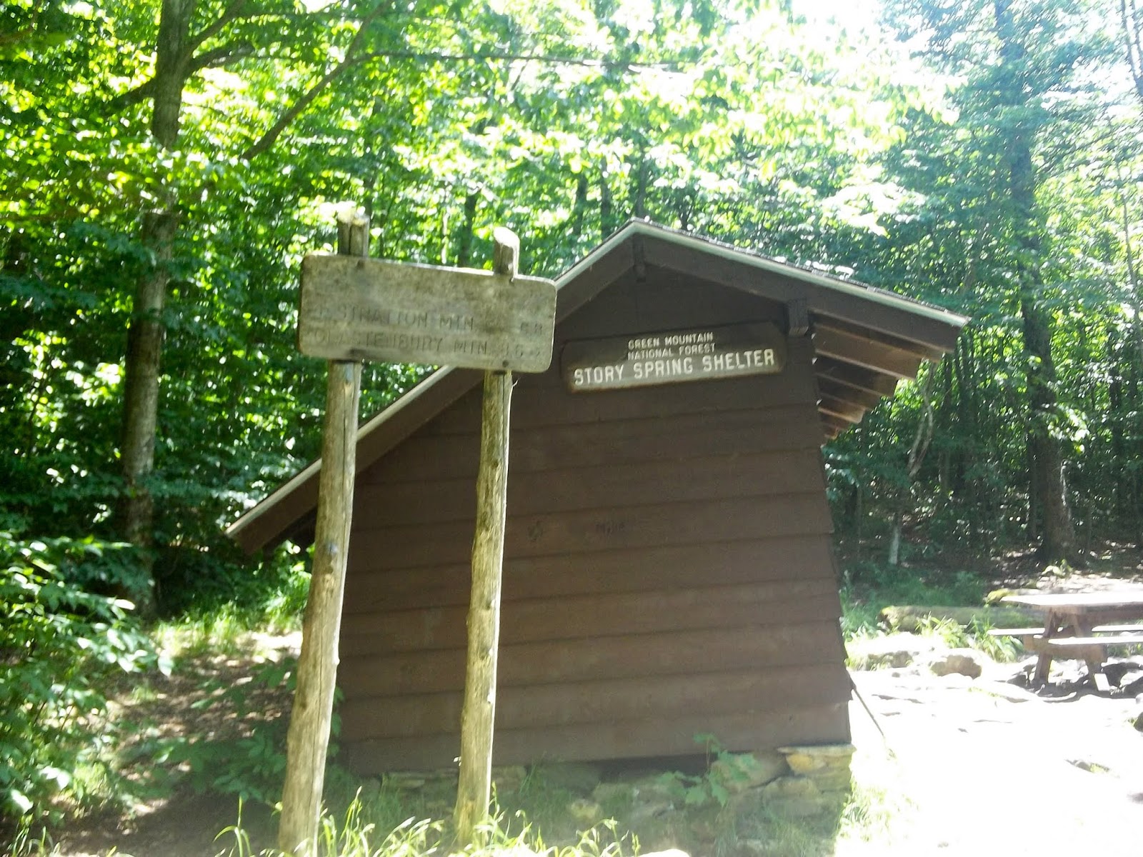
I stopped for lunch at the Story Spring shelter, with another great spring water source nearby. I gravity filtered water in the shelter as I ate, and visited with a few hikers around the picnic table. There was 'Zion', a school teacher in inner city Boston, who was thru-hiking the LT on her summer vacation. and an LT section hiking uncle/nephew duo.
 |
| Lunch at the Story Spring Shelter |
I took time to consider the path ahead. I wanted to put in a few slightly longer days, but needed to consider the terrain and camping options. Stratton Mountain is the big peak looming ahead, and I thought I might look for a spot on the southern side of it.
Heading on after lunch, the trail descends to boggy sections in the lower elevations until crossing Black Brook and reaching a road. The trail then turns east along the road, crossing the Deerfield River. I inquired of some passing day hikers if they had noticed any campsites. They directed me to the other side of the river where the trail reenters the forest.
 |
| Low Ground |
 |
| Foot Bridge Over Black Brook |
I passed an obvious campsite to the right, which was occupied by at least two other tents, so I scouted around to the left, and found a site just up the hill from the river. I made camp, tanked up with water, and laid down in my tent to consider possible off-trail options the next few days. I am anticipating the need of alcohol fuel for my stove, and at least a light resupply of food. The encounters with civilization appeared to be limited for some distance. I knew I would need to be judicious with my food and fuel. Cold coffee and cereal in the mornings will be just fine.
 |
| My Wooded Campsite |
Wednesday, July 10 - Day 5 - Stratton-Arlington Road Campsite to Spruce Peak Shelter (14.7 miles) This was a really good day of hiking with interesting scenery and good people encounters. I made the decision to go a bit longer, and aim for a NERO (Near Zero) day in the Manchester area tomorrow. Manchester, which is 5 miles west of the trail, has many food and lodging options, including a good hiker hostel.
I know that many hikers don't mind hitch hiking, and though it is probably safe, my parents had ingrained in me an acute awareness of the dangers it. It is always my first choice to walk in, or arrange for a shuttle. The Lodge at Bromley is only 1 mile east of the trail, and although it is a more expensive place to stay, they would pick me up and return me to the trail head. There is also a small market and town not too far away, so I decided I would call there for a room.
Stratton Mountain is one of the biggest peaks in southern Vermont, and it was a huge climb to the top. Legend has it that the summit is where Benton MacKaye was inspired with the idea for the Appalachian Trail. It took most of the morning to reach the peak. There is another fire tower on the summit, with wonderful views in all directions. This is definitely a great way to begin a day.
 |
| Marker at the Summit of Stratton Mountain |
 |
| Fire Tower Atop Stratton Mt. |
 |
| From Inside the Fire Tower |
 |
| Another View Coming Down |
 |
| Watch Your Step! |
I stopped at a nice piped spring just below Stratton Mt. for a drink of cold water. Thoroughly refreshed, I continued to hike the long downhill and on fairly level ground all the way to Stratton Pond. The Green Mountain Club stations caretakers at Stratton Pond, and other campsites in Vermont which may suffer from overuse. There is a small fee to camp in these locations.
 |
| Nice Piped Spring Just Below Stratton Mt. |
 |
| Stratton Pond |
I stopped at a flat rock past Stratton Pond for a hot lunch of ramen mixed with tuna. I called ahead for a reservation at the Lodge at Bromley for tomorrow evening. The motel clerk, Robert, told me to give him a call when I was a mile from the trail head, and someone would come pick me up.
 |
| My Lunching Rock |
I was 'playing it by ear' as to today's destination. I crossed muddy, low-lying, ground along the way. The next shelter, the Douglas Shelter, was half a mile off trail, and I really had no desire to make that much of a side trip. I arrived at the shelter trail intersection, and scouted around for a suitable stealth site. I went up an old path and found a campsite and fire pit. I would've camped here but for discarded food wrappers littering the area. This is exactly what attracts bears and other undesired wildlife.
 |
| Picking My Way Through the Mud |
I continued down the the trail on a gravel road for a long distance. The trail turns back into the woods at Prospect Rock. This is a great viewing area, with an obvious campsite. I again considered stopping, but the swarming black flies, and proximity to the road made me decide to continue on to the Spruce Peak Shelter.
 |
| The Trail Follows this Gravel Road |
 |
| View From Prospect Rock |
I arrived at the shelter area around 5:30 p.m. The campsites in the area were mostly occupied, including by a large group of noisy kids, accompanied by a few 'adults', who also looked like kids. I made the decision to stay in the shelter, which was was nice - fully enclosed with a wood stove and a sliding door to keep out bugs.
 |
| Interior of the Spruce Peak Shelter - Comfy! |
I cleaned up, cooked supper, and met three other (adult) hikers in the area. I often feel spiritually focussed during the long hours on the trail. Over time the awareness of God's presence becomes more acute. This was the first place so far on this hike that offered what I consider to be a 'God moment'. It is somewhat ironic that it came in people encounters, something I generally try to avoid.
I was sharing the shelter with an LT section hiker named, Ben. Ben was a recent college grad from Beloit, Wisconsin. I discovered that his mother had graduated from Valparaiso University, my alma mater. She was a student there during the same time period as me. Secondly, his grand parents were both from Moline, Ill, where I lived from kindergarten to the 6th grade. The second hiker was an interesting guy named, Alex, who was on a hike with his mother. Alex was a field science education teacher, who felt strongly that kids need to learn about nature and science through hands-on experience. He was very interested and knowledgeable in the fields of geology and geomorphology- an interest I share. He kept a scientific sketch book of flora he found along the trail, which included drawings with detailed descriptions to the side. I thought that it resembled something Audubon or Muir might've done.
 |
| Alex and Ben |
Another camper close by was called, 'Stickman', because he was very tall and thin. He had all the appearance of a homeless person (as if ALL hikers don't appear homeless), which may have discouraged some folks from conversing with him. He began hiking in Manchester with the intent of getting to Massachusetts. It had taken him six hours just to hike two miles to this shelter. He discovered that his body was not up to the task, and had been hanging around the shelter for three days, hoping to recover enough to get back to Manchester. He had a tent and food, but was aware of what people might think. In my conversations with him, he shared that he was a recovering alcoholic from Mobile, AL, and that his life had been changed by God through the ministry of the Salvation Army. My wife's family is from Mobile, and I had recently taken a youth choir on a tour there. The Salvation Army was also an important ministry in my mom's life. She had spent her formative years at a Salvation Army camp, and later worked there as a registered nurse. I am thankful for the opportunity of meeting these three very interesting, and thoroughly unique people.
Thursday, July 11 - Day 6 - Spruce Peak Shelter to VT Hwy 11 & 30 (motel/resupply) (2.8 miles) I took my time getting up since it was only a short distance to the highway. I was looking forward to a NERO day in the Lodge at Bromley and and some time off the trail. Ben left early, but I remained in my cozy sleeping bag for awhile. I finally got up and made breakfast at the picnic table outside the shelter, while visiting more with 'Stickman'. We conversed about Mobile; his upbringing as an 'army brat', and the time he lived in Germany and France. I mentioned that I was born in France when my dad was in the army there.
 |
| 'Stickman' |
I got started around 9 a.m., hiking VERY slowly. Since I was not in a rush, I took a short side trail excursion to Spruce Peak, where there were good views of the valley below. I placed a call to Robert at the Lodge when I got within a half mile of the VT Hwy 11 trailhead. I arrived at the trailhead parking lot shortly after 11 a.m. There was heavy road construction going on in the area, with the lot was being used as a staging area for dump trucks and other equipment. Traffic was backed up on the road, and one lane was completely closed. As I crossed the highway, a construction worker who was stopping traffic, asked me if I had seen the bears? Apparently she had just seen two bears on the side of the hill, but of course I didn't see any.
 |
| Rock Scramble Up Spruce Peak |
 |
| View From Spruce Peak |
I sat down in the parking lot and called the lodge once again. I was told I would need to wait a little while until they could send someone to pick me up. I hung around watching the machinery and trucks for about 45 minutes before my ride arrived. I was picked up by, Ashley, a recent HS grad who worked part time at the motel. She was planning to attend college in the fall, majoring in something related to physical therapy.
 |
| Construction at the VT Hwy 11 & 30 Crossing |
I checked into the lodge, which was very nice, and I didn't mind paying more for the accommodations. A family amusement area was situated next to the lodge on the side of what appeared to be a ski slope. After checking into my room, I took inventory of supplies, took a bath (wonderful), and did laundry.
 |
| My Room in the Lodge at Bromley |
 |
View From the Balcony
(The Family Amusement Park) |
Feeling refreshed, I headed down the highway to the nearby Bromley Market. They didn't carry much in the way of hiker supplies, but I did purchase a bottle of Heet fuel for my stove. I was looking for ramen or other easy trail food, and was directed me to the J. J. Hapgood General store a mile or two down the road in Peru. There was a deli in the market, so I ordered a pulled pork sandwich and a tub of fruit, and sat at a picnic table outside to eat.
I wished I had remembered my camera, which I had left back in the room. There were many typically New England(ish) sights to see as I hiked down the road towards Peru town. Peru (est. 1761), itself, was a quaint and picturesque little hamlet. When I arrived at the J.J. Hapgood store, I found several tubs of microwavable pho noodles and steel cut oatmeal. I thought I might separate these into baggies for lunch/dinners and/or breakfasts. This idea actually worked very well. It was lightweight and offered a little variety to my overall menu for the next few days.
I stopped once again at the Bromley Market as I walked back to the lodge, and picked up an egg salad sandwich, along with a few drinks for dinner back in the room. It is so refreshing to the body and spirit to be able to take an occasional NERO day off the trail. I took time in the evening to ponder my trail guide to figure out what I needed to do to catch up to my original plan.
 |
| A GREAT Stop Off the Trail |
Friday, July 12 - Day 7 - VT Hwy 11 & 30 to Campsite south of Big Branch Shelter (16.0 miles) Spending the night in a comfy motel room felt very good. I arose early and packed up about 6 a.m.. I went downstairs around 7 for a good breakfast. The sun was shining just a bit, but there were clouds on the mountainsides which made for a beautiful scene. I took a few pics outside the motel before heading back to the room to collect my pack.
 |
Fog Covered Mountains in the Morning
(above and below) |
I checked out of the lodge, and Robert drove me down to the trailhead parking lot around 8. Since I was feeling so refreshed, I was hoping to do a longer day today. I greeted a couple of NOBO LT thru-hikers hanging around trailhead parking lot before heading up the path. The first climb of the day was Bromley Mt. It was foggy, and started to rain as I hiked, so I put on my rain gear, and followed a ski slope part of the way to the top.
 |
| A Slippery Bridge Crossing |
 |
| White Rocks |
 |
| Following a Rainy/Foggy Ski Slope |
The summit of Bromley Mt. was fogged in. There were slopes heading in different directions, with a chair lift and a warming cabin. Apparently, there had also once been an observation tower here, but it had been torn down for safety reasons. Money was being raised to erect a new one. I took a few pics, and headed down the trail for more climbs ahead.
 |
| Chair Lift Pavilion on Bromley Mountain |
 |
| Warming Cabin |
 |
| Heading in the Right Direction |
The next peak was Styles, with some good views from the top. I paused briefly for an early lunch before arriving at Peru Peak at the northern end of the same ridge. After Peru Peak, the trail was mostly downhill and flat. I took a short break at the Peru Peak shelter and visited with a section hiker from Connecticut named, 'Old School'. He had completed a thru-hike of the AT in 1982. I was particularly interested in his impressions of the the trail and the terrain going north.
 |
| Nice Flowers on a Tight Trail below Bromley |
 |
| View From Styles Peak |
I passed Griffith Lake, and came to one more unexpectedly big climb to the top of Baker's Peak. The elevation profile in my trail guide made it appear mild, but it is a tough rock scramble to the top. It even includes a bad weather bypass trail, but since the weather had improved, I decided on the more difficult option. The reward was in the nice views of the valley below.
 |
| Griffith Lake |
 |
| Unexpected Rock Scramble Up Baker's Peak |
 |
| View From Bakers Peak |
I stopped for water at a spring near the Lost Pond shelter, and found a nice campsite just off the trail south of the Big Branch shelter, but adjacent to the creek. I thought it might be a secluded site, but a NOBO thru-hiker, 'Jay', later showed up and pitched his tent nearby.
 |
| My Campsite Adjacent to Big Branch |
Saturday, July 13 - Day 8 - Campsite south of Big Branch Shelter to Minerva Hinchey Shelter (13.7 miles) I am determined to catch up to my pre-planned itinerary, with the campsite locations coinciding with the number of days on the trail. Each day was bringing me closer to this goal. I thought it might even be possible to work ahead in order to shave a day off the end. Since I started a day late, my anxiety level was slightly elevated about finishing on time.
 |
| The Big Branch Below My Campsite |
I slept well and got up early. I packed up, ate a breakfast of steel cut oats and got water at the creek before breaking camp. I took off around 7:15. I crossed the bridge over the Big Branch and soon passed the Big Branch Shelter, which was close to where I had camped.
 |
| The Bridge over Big Branch |
 |
| Passing by the Big Branch Shelter |
It was fairly level hiking for the next several miles. I crossed the Danby-Landgrove road past a parking lot. The trail follows a rolling creek for a few miles, finally exiting near the Little Rock Pond Shelter and tenting area. I happened to see a watch laying to the side of the trail. I picked it up, but couldn't say what kind it was. I thought it was probably a cheap one.
 |
| Trail Head at Danby-Landgrove Road |
 |
| Following A Mossy Creek Bed |
Camping around Little Rock Pond requires a nominal fee, and the Green Mountain Club has a caretaker stationed there to monitor use. It was a scenic little lake, and I wished I had time to take a dip. I spotted one hiker who was actually doing just that.
 |
| Little Rock Pond |
 |
| A Hiker Cooling Stop |
The stretch of trail beyond Little Rock Pond climbs gradually, and I passed a couple of interesting rock sculpture locations. The first location seemed isolated, but the second one was near the blue blazed trail to White Rocks Cliff. There were a group of day hikers milling around. One of them appeared to be an actual rock sculpture artist!
 |
| Interesting old Wall and Machine Parts |
 |
| Rock Artists Work |
I decided to stop for lunch at the Greenwall Shelter. The AWOL guide book indicated an unreliable spring near it. This was apparently incorrect information, as I could locate NO SPRING. The only water source I could see was a dried up creek bed with scattered muddy puddles. I had no desired to take water here, but I had enough water for lunch, and hopefully get me where I am going.
 |
| The Greenwall Shelter Lunch Stop |
 |
| A Tumbling Brook |
The trail continues to descend beyond Greenwall Shelter before crossing VT Hwy 140, and ascending once again over Bear Mountain. This is the third state I have hiked on the AT with a 'Bear Mountain'! It was a long slog to the top, with NO reward of a good view - just another PUD (Pointless Up and Down). After crossing Bear Mountain, I took water at a small spring right next to the trail. This was relatively close to my final destination at the Minerva Hinchey Shelter. I filled up my 2 liter 'dirty water' bottle to carry into camp.
 |
| Campsite Near the Minerva Hinchey Shelter |
The shelter area was crowded when I arrived. I scouted around and found a secluded site that looked like it had been used at some point in the distant past. I was hopeful to be away from people, but two guys later set up camp nearby. Oh well...I guess it's a free woods!
Sunday, July 14 - Day 9 - Minerva Hinchey Shelter to Governor Clement Shelter (9.8 miles)
I am grateful that today is my first day back on the original schedule, which means I had caught up to some of the time and distance lost at the beginning of the trek. My plan called for a relatively 'easy' day of around 10 miles. It was a good day of hiking. Early in the day I reached a splendid viewing overlook, with the Rutland, VT airport visible in the distance. The weather was clear, and it felt good to just sit down on the rocks to enjoy the view.
 |
| View from the Ridge |
 |
| Taking a Break - Rutland, VT Airport in the Distance |
I was soon joined by two SOBO section hikers, 'Thing One' and Leah (no trail name). I didn't ask, but I perceived them to be a father/daughter duo. They were from Framingham, MA, near Boston, and we had a good conversation about all things hiking. I took their pics, and invited them to become followers of my blog. This was the first of many blog invitations made on this hike. I can't say why I had never thought of it before.
 |
| LT Section Hikers - 'Thing One' and Leah |
The hike continued with a steep descent to the Clarendon Gorge. This is a scenic area, with a waterfall and a suspension bridge over the Mill River. I could see people playing in the river below. After this, there was a steep and rocky scramble out of the gorge. I paused briefly at another view spot near the top. and visited with some day hikers. One, who was named Marcos, informed me that he performed with an Irish band at the Long Trail Inn just off the trail. This is a popular hiker stop, and I am thinking it might be a good lunch stop in a couple days.
 |
| Mill River From the Suspension Bridge |
 |
View From the Other Side of Clarendon Gorge
(Rutland, VT, Airport Still Visible) |
I stopped for an early lunch at the Clarendon Shelter, and visited with Isaac and Ivy, two LT through hikers. They departed before I finished my lunch. As I was packing up to leave, a big old, dirty blue off road pickup truck, with the name, 'BIG BLUE' scrawled on the side, rumbled into the shelter area. It was very loud, and I could hear it coming up forest road for some some distance, but it still surprised me. Three scraggly looking good ol' boys emerged from the truck and offered me a greeting. They didn't appear too interested in me, but in my mind I heard banjos, so I left in a hurry.
 |
| Lunch Stop at the Clarendon Shelter |
It was an interesting landscape beyond Clarendon Shelter - a few more climbs, and bridgeless brook crossings, where I needed to pick my way over slippery rocks. I also passed through agricultural lands, and two gravel roads before reaching the Governor Clement shelter area around 4 p.m..
 |
Interesting Flora
(Above and Below) |
 |
| I don't Know What this Is, but I thought it was Pretty |
 |
| Rocky Stream Crossing |
I found a somewhat secluded campsite a short distance in front of the shelter. I set up camp, and ate a dinner of pho noodle soup and hot chocolate. I checked my guide for possible resupply points in a few days. Killington Peak was ahead, with a lodge/restaurant .2 miles off the trail. I am thinking this might be another good lunch stop tomorrow. I am always on the lookout for convenient off-trail food options.
 |
| Getting There!!! |
 |
| Campsite in Front of the Governor Clement Shelter |
Monday, July 15 - Day 10- Governor Clement Shelter to Churchill Scott Shelter (8.7 miles)
I felt no rush to get up since this is another short day. There were two hikers camped nearby who left early. I finally broke camp and got moving around 8:20 a.m., thinking about getting to the Killington Peak Lodge for lunch. It was a big uphill climb for most of the morning. I crossed paths with a few SOBO hikers, and was passed by, 'Gash', one of a few NOBO LT thru-hikers I am encountering.
 |
| My Camp Alcohol Stove and Windscreen |
 |
| The Governor Clement Shelter |
 |
| Smooth Path to Start the Day |
 |
| A Prickly Wildlife Warning Sign |
I stopped for some nice cold water at a spring on the way up the mountain. From Shrewsbury Peak I caught sight of what I assumed to be the Killington Peak Lodge across the valley. My trail guide indicated it was still two miles up the trail.
 |
| Sneak Peak of Killington Lodge |
 |
| A Big Toad |
I arrived at the blue blazed cross trail to Killington Peak. The fully enclosed Cooper Lodge Shelter was visible to my left, with wooden tent pads along the main trail. Killington Peak is only .2 miles to the east, but it is a brutal rock climb straight up the side of the mountain. I sincerely hoped this was worth the effort.
 |
| A Brutal Rock Climb... |
 |
| ...And a Big Reward! |
I was happy to arrive at some spectacular views atop Killington Peak. The marked trail to the lodge passed by the gondola lift, which cost $25.00 for the ride up. There were no roads that I could see, so this may be the primary vehicle of ascent. I came to Killington Lodge, with many people seated at tables and chairs outside enjoying the vista. I went into the restaurant and ordered 'The Lodge Burger', with a side of fruit salad (I'm always craving this), a peach, with lemonade and a Long Trail Ale. I sat at one of the tables outside enjoying the vista and beautiful day.
 |
| The Killington Peak Gondola |
 |
| The 'Lodge Burger' - Yum!! |
 |
| Lunch Time Vista |
After thoroughly stuffing myself, I headed back down the treacherous side trail to the AT. It was mostly downhill and/or flat for some distance. I was passed by an LT thru-hiker named, 'Soul Asylum', who I began to leap-frog as he or I stopped along the way. He was considering camping at the same shelter destination as me, so we visited a bit. He had already completed the AT in three years, doing extra long section hikes. He was a hiking a little faster than me, so he went on ahead.
I arrived at the Churchill Scott shelter area, and scouted the water source first. My guide book indicated the source was unreliable, but I found two little active springs at the bottom of a hill to left of the shelter. I couldn't locate any great campsites, so I decided to stay in the shelter for the evening. 'Soul Asylum' had found a small campsite on the shelter approach trail.
 |
| The Churchill Scott Shelter - My Home for the Evening! |
I visited with 'Soul Asylum' at dinner, and we were later joined by a young LT thru-hiker from Mystic, Connecticut, named Fabrizio. I enjoyed a wide-ranging conversation with 'Soul Asylum', who was a professional chef at a golf resort in Tarpon Springs, Florida. He said it was a stressful and demanding job, but he had flexible time to do extended hikes. One of the many things we discussed was our experience with trail magic. I mentioned my very best trail magic experience was with 2016 thru-hiker, 'Hawk Woman', who was giving back to the trail on her very birthday. He was happy to hear that, because he had spent a night with 'Hawk Woman' at the Hexacuba shelter in 2016. He said she had been discouraged at that point, and was considering dropping off the trail. He was very happy to hear that she had made it, and I was happy to share the news!
Tuesday, July 16 - Day 11 - Churchill Scott Shelter to Quimby Mt. Campsite (8.8 miles)
My original goal today was to get to the Stony Brook Shelter. Word on the trail was that a 'nuisance bear' was currently hanging around that particular shelter, going so far as to invade tents. I made the decision to either stop short or camp beyond it. It was a good day of hiking with a little more mileage, as I made two side trips for lunch and supplies. I arose around 6 a.m., got water, made breakfast, and visited with Fabrizio before he took off. I started hiking about 8:15. I was a short hike downhill to VT Hwy 4.
 |
| Nice Day to Begin |
I didn't feel the need to rush. I wanted to stop for lunch at the Long Trail Inn. It is about half a mile off the trail at Sherburne Pass, and only three miles from the shelter. I had been hearing about it from other hikers. In addition to lodging, it has an Irish Pub that my guidebook indicated opening at 11:30. My guidebook also indicated an outfitters further down the trail at Killington, and I hoped to stop there as well for a major resupply.
 |
Significant Trail Signage
(Above and Below) |
Shortly after crossing VT Hwy 4, the Long Trail and Appalachian trail diverge. I will just be encountering AT hikers from here on out. The trail gradually climbs before descending to Sherburne Pass. I generally assume I am the slowest hiker on the trail, but I actually passed an older couple heading up the hill.
 |
| Lunch Stop at the Long Trail Inn |
I reached the Sherburne Pass Trail intersection about 10:30, and hiked the half a mile down to the Inn. The Inn is very nice and welcoming to hikers. I hung my pack on one of the hooks conveniently placed outside the main entrance. The pub was not open yet, but the clerk kindly gave me a glass of iced water, and I sat down to wait. I took time to visit with a mother/daughter section hiking team from PA. They were checking the bus schedule into town.
The pub opened right at 11:30, and I sat down at the bar to order lunch. It is a VERY authentic looking place, with an authentic menu. The friendly bartender/owner was also of Irish ancestry. I ordered the Guiness Stew and a draught pint of Long Trail Ale. The bar tender explained that he used nitrogen rather than co2 to pressurize his on-tap choices. It tasted smoother and more authentic than the average American on-tap choices. I had a nice visit with 'Soul Asylum' at lunch. He was staying at the Inn, and needed a temporary shoe repair. Before I left, I gave him some of my tenacious tape, and invited him to follow my blog.
 |
| Bridge Crossing |
 |
| Small Cataract |
I headed back up the hill to the AT intersection and down the trail to Gifford Woods State Park. The trail goes through the camping area and I passed many nice sites (not primitive). It began raining, so I put on my gear and continued on past Kent Pond. The mosquitos were swarming in this damp, low lying area. I took a short side trail up to the BCO (Base Camp Outfitters) and purchased enough food items for 6 more days to hopefully get me to the end of my hike.
 |
| Kent Pond |
 |
| How Far I've Come! |
The next area of interest was 'Thundering Falls'. I missed a turn in the trail and briefly went up the wrong path, but backtracked and found the correct way. There is a long boardwalk beyond Thundering Falls before the trail crosses River Road.
 |
Thundering Falls
(Appropriate Name) |
 |
| Boardwalk Before River Road |
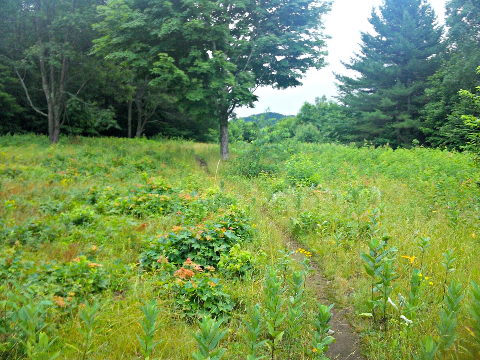
It was a long slow climb up Quimby Mountain, and I was feeling every step. I asked a passing SOBO hiker if there were any obvious campsites at the top. She said she didn't see any, but I might find a 'stealth' campsite. I thought this was a good idea. Just as I reached the pinnacle of Quimby Mountain, I spotted a campsite to the left of the trail, and made camp. This has been a successful day!
 |
| Stealth Campsite on Quimby Mountain |
Wednesday, July 17 - Day 12 - Quimby Mt. Campsite to Winturri Shelter (13.0 miles)
It rained in the night, but subsided after 6:30 a.m., It was nice having a somewhat secluded campsite atop Quimby Mountain, but with the rain I had trouble rousing myself to get out of my cozy sleeping bag. Everything was wet, including the tent. I am hoping to get somewhere this evening where I can dry things out. One of the nice things about most most modern hiking gear is that it is made to dry very quickly. Carrying wet gear is NEVER fun, and sleeping in wet gear is even worse! My goal today is to get to the Winturri Shelter.
 |
| Misty Morning Powerline Crossing |
This was a relatively dull day of hiking - no good views, overcast, and rain part of the day. I stopped for lunch alongside the trail, and was passed by a girl I had met the very first day of my hike. She was a young AT thru-hiker, who had taken three zero days in Manchester Center to visit with her parents. There were a few good climbs after lunch, with a ladder assist at one particularly rocky descent. I encountered the thru-hiker again at the Chateauguay road crossing. Her trail name was, 'Ukelele', for her ability to play that instrument, which she sometimes did at hostel stops.
 |
| Dark Path Ahead |
 |
| Ladder Assist Down a Steep Rock face |
I stopped again for water just beyond Chateauguay Road, and then began a big climb up an unnamed mountain. A lookout/fire tower was on the summit, but I chose not to stop this time. It was very smooth hiking beyond this, with one bump before the shelter.
 |
| Stopping For Water |
 |
| Very Easy and Smooth Trail |
The shelter is about .25 miles west of the trail. There was a large group of people hanging in and around the shelter when I arrived, but they assured me that they not planning to stay in the shelter itself. I gleaned from their conversation that they worked together. It was not the usual hiker banter. They turned out to be a regional ATC (Appalachian Trail Conservancy) work group out for their annual staff section hike. They gathered from all over New England to hike the trail, meet, and discuss how to keep the trail as usable and pristine as possible. Since they were occupying most of the sites around the shelter, I made the decision to stay in the shelter, and was later joined by two SOBO thru-hikers.
 |
| The Winturri Shelter |
Thursday, July 18 - Day 13 - Winturri Shelter to Thistle Hill Shelter (12.3 miles)
This was an especially enjoyable day of hiking- one of the best so far of this trek. There were some good climbs, open pastures, good views, and some good off-trail food/drink options. I got up very early and started hiking right at 7 a.m. The surface or the trail heading north was mostly dirt and not very rocky at all.
 |
| Open Field Traverse |
 |
| I am Not an Expert on Flora, But I always Enjoy it. |
 |
| Nice Path |
I noticed a small sign on a tree just before Pomfret Road. It was an invitation for hikers to come to the home of two former thru-hikers - 'Firefly and Loon'. They had purchased an old farm house just down the road from the trail crossing. They made their back porch available during the day for hikers to relax and get refreshment. I decided it was a good place to stop for an early lunch. I purchased a few sodas, a couple hard of boiled eggs, and visited with a thru-hiking couple from Hamburg, Germany.
 |
| Approaching a Road Crossing |
 |
| Open Pasture Before Pomfret Road |
 |
| The Home of 'Firefly' and 'Loon' |
 |
| The Back Porch Hiker Hangout |
 |
| Nice Selection on the Honor System |
Hitting the trail north again, there were 2 good views on the next climb. I crossed some high, open pasture land, which I had not seen so far on this trip. It was a pleasant stretch of trail. I was looking forward to another possible off-trail stop at Cloudland Road. My trail guide indicated the Cloudland Market to be just .2 miles off trail.
 |
| A VERY smooth Path on an Old Logging Road |
 |
| More Ancient Stone Walls |
 |
| One of the Nice Views |
I arrived at Cloudland Road, and headed uphill to the left to the Cloudland market. It was a very small store containing mostly locally produced items. I purchased a pint of ice cream (something I never do at home) with two sodas, and sat down on the front porch. I poured some of the soda on the ice cream to make a little float, and chatted with a SOBO thru-hiker from Queensland, Australia. I am amazed at how many people from around the world come to hike the AT.
 |
| The Cloudland Market and Restaurant |
 |
| Front Porch View from the Cloudland Market |
It was a short hike to the Thistle Hill Shelter. No one was around when I arrived, so I chose a site back behind the shelter. I tanked up with water, pitched my tent, strung a line, and hung my wet things up to dry. I ate supper in the shelter, and visited with two young section hikers from Virginia were staying there. They had both just graduated from high school in Fairfax, and decided to do a lash of the AT before heading off to college. This was their first day out, and they were fairly exhausted from hiking 16 miles from Hanover. Neither had much long-distance backpacking experience, but they seemed to have done their homework. They were trying to go 'minimalist', but may have skimped a little too much. I couldn't help but admire them for their effort and gumption.
 |
| My Tent Pitch and Drying My Wet Gear |
Several of ATC crew on their annual staff hike showed up later, and pitched their tents nearby. I chatted with the leader of the crew, who had been working with the ATC for 19 years. This has been a good day, and I slept well.
Friday, July 19 - Day 14 - Thistle Hill Shelter to Velvet Rocks Shelter (16.1 miles)
Today was a long, but great day of hiking, mostly downhill over rolling terrain with a smooth surface. I traversed a few nice open balds with good views. I passed an observation bench under an apple tree on one if the balds. I sat down to admire the view to the east while munching on a green apple. I hadn't seen very many natural snacks along the trail so far, so the sour apple was alright.
 |
| Entering an Open Area |
 |
| View From the Top |
 |
| A Little Color Along the Trail |
 |
| Nice Place to Relax Over a Green Apple! |
I arrived at West Hartford road, and followed it across the White River bridge into the little town of West Hartford, VT. The river below the bridge looked inviting. I thought it would've been a nice place to take a dip if I had the time and inclination. The other end of the bridge comes to a 'T' intersection. I stopped to ponder the direction, when a lady called to me from her house across the street. She was offering trail magic for passing hikers on her back porch. I gratefully sat down and visited with her while enjoying a couple cold sodas and a donut. I told her of my plans to camp near Hanover this evening, and she informed me of campsites near the ball field at the far end of town.
 |
| A Little Beach on the White River |
 |
| Trail Angel in West Hartford |
 |
| Road Through Town |
The trail out of West Hartford passes under I-89, and ascends Happy Hill. It was a good and happy climb to the top. Along the way I encountered two very nice section hikers - a married couple from Connecticut, who were both teachers at the same school. Felicia was a P.E. teacher, and Michael taught Industrial Arts. I enjoyed our brief conversation, and they assented to letting me take their pic to share in my blog.
 |
| I-89 Underpass |
 |
Section Hiking Couple
Felicia and Michael |
After Happy Hill, it is a long (mostly downhill) descent to Norwich, Vermont. I took a couple breaks along the way and arrived at Elm Street at around 2 p.m. The trail follows the road though a residential area to the right. Some of the residents placed trail magic water or other items for hikers along the road. It was a hot day, so I stopped for some water.
 |
| Trail Angel Water for Hikers |
It is a three or four mile road walk through Norwich, and then over the Connecticut River into Hanover, New Hampshire - yay!!! It is hard to believe I am actually in the next to last state in my overall conquest of the AT. Hanover is the home of Dartmouth College, and has the look of a typical college town. I needed to get cash, so I stopped at a bank in town for an advance on my credit card. I then sat down for some cold drinks at a Starbucks next door, and placed a call to Ginny.
 |
| Road Through Norwich, Vermont |
 |
| Crossing the Connecticut River |
 |
| Hanover, NH - Dartmouth College Entrance |
It was a hot day, and the air conditioning in the bank and Starbucks felt wonderful. After a little break, I continued hiking through the town, passing the Dartmouth Football stadium on my left, and soccer fields to the right. On the far end of town, the trail takes a left turn and passes behind the baseball/softball stadiums. I scanned for the tent sites the trail angel had mentioned, but none were obvious. The Velvet Rocks Shelter was less than 2 miles further on, so I decided to keep going.
 |
| Passing the Football Stadium |
 |
| Heading out of Hanover |
 |
| Trail Behind the Ball Fields |
The terrain noticeably changed in New Hampshire. It was a hard climb up the hill, but I soon arrived at the shelter, which was rather small and primitive looking. There was no one around, and it looked as though I would have it all to myself this evening. I figured most hikers would probably take a day in Hanover since this shelter was so close.
 |
| Not Too Far!! |
 |
| Taking Over the Velvet Rocks Shelter |
Saturday, July 20 - Day 15 - Velvet Rocks Shelter to Moose Mountain Shelter (9.5 miles)
It was a rather miserable night in the shelter, with mosquitos feasting on virtually every exposed millimeter of skin. Needless to say, I did not sleep well. I was also running out of water in the morning and, to my chagrin, there was no source close by. Fortunately, I did manage to leave early for a short, but brutal, day of hiking. The weather was unusually hot, with the temperature expected to reach the upper nineties. I decided just to take my time, with plenty of hydration stops and breaks along the way.
 |
| A Wetland Traverse |
My first goal was to get water. A short blue blazed trail north of the the shelter led to a muddy ground spring, where I tanked up for the day. The trail follows a varied terrain, with rocky climbs mixed with low-lying ponds and swampy areas. I crossed paths with a SOBO section hiker named, '76, with whom I chatted for a bit. He had thru-hiked the trail in 1976, thus earning his name. I thought it incredible that he carried a walking stick he had found on the trail in 1976, and had been using ever since!
 |
| Board Walk Assist Through Low Ground |
 |
| Taking a Break at Mink Brook |
There weren't as many hikers on the trail today. The heat index today was in the danger zone, which I presumed to be the reason for fewer hikers. It was good to be under forest canopy for the most part, but I knew I still had to stay as hydrated as possible. I took frequent breaks, with a slightly longer break at Mink Brook. I sat down to put my feet in the water, which felt wonderful. I could see the big climb up Moose Mountain ahead, and forced myself to eat some peanut butter biscuits for a little extra energy.
 |
| Arriving at Moose Mountain South Peak |
On the climb up Moose Mountain, I met two French speaking girls from Quebec. They had just begun a long section hike to northern New Hampshire, and were headed to the same shelter destination as me. I could tell right away that they were packing a little heavy, and were not moving quickly. I take pride going slow, however, especially on hills, so I let them go ahead of me.
 |
| Moose Mountain View Spot |
I came to several good view spots on the south peak of Moose Mountain, and arrived at the shelter location around 2:30 p.m.. I was happy to get into camp a little early, and found several decent campsites below the shelter. The girls from Quebec arrived shortly after me. I chose a site nearest to the water source, which allowed them to claim a bigger site just above me. After setting up camp, I decided to take a nap in my tent, hoping to cool down from the heat. It felt nice, but there was little or no breeze to assist in the effort. I walked up to the shelter later on to cook supper, and visited with two SOBO section hikers who were out for a week. It is nice to have a little extra time at the end of the day.
Sunday, July 21 - Day 16 - Moose Mountain Shelter to Fire Wardens Cabin (12.4 miles)
I got up around 6 a.m., and packed up everything before heading up to the shelter to cook breakfast. I visited again with the section hiking couple, 'Clueless' and Brian. They were gradually working on completing the entire trail, but of because of their work, had limited time off to do it. As we were visiting, '76' came by with his '76 walking stick. I took pics of them before heading out for the day.
 |
| 'Clueless' and Brian |
 |
| '76' with his Walking Stick from '76 |
It was almost thirteen miles of tough hiking, but thankfully not quite as warm as yesterday. There were two really big climbs: first up Holts ledge, and then a very long climb to the top of Smarts Mountain, my destination for the evening.
 |
| View From Holt's Ledge |
The Trapper John Shelter was just beyond the first big climb. I paused to get water at a spring on the downward side, and then for lunch at flat rock, which was just vacated by the Canadian duo.
 |
| Goose Pond |
I was still not feeling great, and wondered if I was a little dehydrated. I dreaded the climb to up Smarts Mountain, which seemed endless. I plowed ahead as best I could, stopping frequently to rest. To complicate matters, there were several false summits on the way up. These did provide a few nice views, however, and (finally) some nice ripe wild blueberries to snack on!
 |
| Rocky False Summit |
 |
| View from the Side of Smarts Mountain |
The ascent was sometimes steep and rocky, but I persevered and managed to reach the summit around 5. There is a campsite/privy to the left just before a Fire Tower, and then the former Fire Warden's cabin just beyond it. The fully enclosed cabin is now a designated hiker shelter, and I was happy to find some room in the Inn for me! :-) Several SOBO thru-hikers were sitting around outside the cabin, but I think they were planning to stay in the nearby campsites. Several more hikers were in the cabin with me, including the two girls from Quebec, and two NOBO thru-hikers
 |
| Stair Assisted Rock Climb |
I went down the hill to get water at a muddy spring. Back at the cabin I visited with one of the NOBO thru-hikers named, 'Bounce'. He had begun his hike from where he lived in Florida, and was recovering from what he believed to be severe dehydration. He wanted to spend a little more time at the shelter just to make sure he was completely healthy.
 |
| Fire Warden's Cabin Shelter |
Later on, I sat on the bench outside and cooked a supper of Beef Masa. It was a little too spicy for my taste. It seems difficult to find a 'middle ground' when it comes to freeze dried trail food. It's either too bland or too spicy. I visited a little more with the 2 girls from Quebec, who were hiking as a step-mother (Natalie), and step-daughter (Joannie) duo. Natalie, the step-mother, painted and hung drywall for a living, while the step-daughter, Joannie, served in the Canadian Army reserve as an administrator.
 |
Section Hikers from Quebec
(Joannie and Natalie) |
Joannie noticed me furiously swatting mosquitos and black flies, and offered me a repellent. I sprayed some on and found immediate relief. I did a search for it when I got home after my hike. It is a 30% deet repellent, and is the official bug repellent of the Canadian army. It's called the 'Great Outdoors Insect Repellent'. 'Sorry to not have a link to it. It's apparently not sold in the U.S., and I could only find one Canadian firm that carried it online, but I went ahead and ordered it. I have personally tried every non-toxic insect remedy known to man (or woman) to no avail, and I am now prepared to go to the toxic dark side. We built a little fire in the fire pit and visited a bit more before going to bed.
Monday, July 22 - Day 17 - Fire Wardens Cabin to Ore Hill Campsite (12.4 miles)
After a tough (and hot) hike yesterday, I am looking for something a bit nicer today. Today was about the same distance, but the weather was slightly cooler, and the terrain didn't seem quite so brutal. I got up early, had coffee and a poptart for breakfast, and decided to check out the fire tower. There were some nice views on the way up. I visited a little more with Natalie and Joannie, and bid them farewell as they headed out for the day.
 |
| Checking out the Fire Tower |
 |
| View on the Way Up |
 |
| Another Shot |
I left around about 7 a.m. It was a downhill trek during most of the morning. I stopped briefly for water at South Jacob's Brook, and visited with another section hiker. After that, it was a relatively gradual climb up Mt. Cube, with some good views on the ascent at Eastman Ledges. There were a number of rocky sections and false summits along the way, so I took a few breaks.
 |
| I was Told that These are Moose Droppings! |
 |
| View From Eastman Ledges |
 |
| Rocky Ascent on Mt. Cube |
 |
| Another Misty Viewing Spot |
I had purchased a bag of freeze dried fruit at the Base Camp Outfittes - a 'tropical tango' of dried banana, pineapple, and mango. I wasn't sure exactly what to do with it, but decided on a whim to put some of it in my go to water bottle. This was a GREAT decision, as the resulting fruit concoction provided a wonderful boost of energy. I don't care much for trail mix, and had been using Gu Gels for electrolyte replenishment. This rehydrated fruit drink was the best yet, and will definitely do it again.
 |
A Very Old Name Inscription on Mt. Cube
(My Grandmother's Maiden Name was Blanchard) |
It was a long downhill stretch after Mt. Cube, and I made good time. It began raining, which continued for the next several miles. I encountered some nice trail magic at NH Hwy 25A. A couple from West Virginia were serving hikers from a cooler of items in the back of their car. I drank a can of soda, and grabbed a cup of pudding for later on.
I arrived at the Ore Hill tenting area around 4:30 p.m., and found a campsite on the blue blazed water trail. A shelter had once been located here, but it had been recently torn down and removed. It had to have been a recent change, as signs on the trail still indicated distances to the shelter. Fortunately, the campsites and privy remained, so now it is a prepared 'tenting area'. The rain came down harder just after I set up camp, so I crawled into my tent, hoping it would subside enough to cook supper. It continued to rain, so I finally decided to just suck it up and cook/eat in the rain. This is never fun, of course, but all a part of the total backpacking experience. I am definitely looking forward to a short hike to Glencliff tomorrow - my last day!!!
 |
| Wet Tent in the Ore Hill Tenting Area |
Tuesday, July 23 - Day 18 - Ore Hill Campsite to NH 25 Glencliff (Hikers Welcome Hostel) (7.5 miles) It rained hard ALL night long, and I was grateful just to curl up inside my nice warm sleeping bag. It is only about 7 miles to the
Hiker's Welcome Hostel in Glencliff, so I wasn't in a big hurry. Besides, I like to arrange days off of the trail, and/or the last hiking days, to be shorter. I can then enjoy more time relaxing, recovering, doing laundry, etc. I stayed in the tent late into the morning, but this being a single walled tent, there was a lot of condensation inside. It seemed to also be leaking around the corner seams - something I will need to address with seam sealer when I get home.
I finally willed myself up to make breakfast in the rain, and pack all my wet gear. I do believe God was looking out for me in my preparation for this adventure. My pre-AT hike on the Foothills Trail in June also included lots of rain and wet gear. I broke camp around 9 a.m. and headed up to the main trail.
Just as arrived at the AT intersection, I encountered another hiker- a LASHER from Cincinnati named, 'Chocoholic'. She was doing a lash from Harper's Ferry to Mt. Katahdin, and was heading to the same hostel destination. We were hiking at almost
exactly the same pace, so we hiked together the remaining seven miles, conversing the entire way. It tuns out we shared a few things in common. We were both runners, who also enjoy physical training and activity. She had done over 50 marathons and ultras, and traveled extensively. Being on the trail is not a race, but it was nice having a conversational 'pacing partner' the last day out. It made the time and distance fly by.
 |
| One More Beaver Pond |
We arrived at the NH Hwy 25 intersection, and 'Chocoholic' snapped my pic at the trailhead where I hope to begin nest year. We headed down the road to the Hiker's Welcome Hostel. It is a large and popular hostel, which takes pride in never turning away hikers. The complex consists of two buildings: a main cabin and a newer bunkhouse that can accommodate twenty-six persons. There is a fire pit, laundry facilities ($3.00 fee per wash/dry), and a shower ($3.00 fee) in back.
 |
| Outdoor Laundry and Shower Area |
 |
| Hiker's Welcome Bunkhouse |
It was fairly early in the day, so I had time to do some things. I chose a bunk on the lower level of the bunkhouse and took a shower. 'Chocoholic' and I combined to do laundry. I went through my pack, and hung some of my really wet gear on a clothes line to dry. I drank a bunch of sodas and ate a microwave pizza in the main cabin.
 |
| My Final Day Hiking Partner, 'Chocoholic' |
Hikers staying at the hostel can sign-up for a shuttle to a deli in town. Pre-orders are taken, and the sandwiches made are ready ahead of time. I ordered the 'Gentle Giant', which was mostly turkey. I also picked up an apple and green tea to drink. Upon returning to the hostel, I sat and visited with a few other hikers at a picnic table out front. One of the caretakers later built a fire in the outdoor fire pit, and I made a few smores.
Wednesday, July 24 - Day 19 - Hiker's Welcome Hostel Shuttle to Williamstown, MA
I had called the owner, 'Packrat', several months prior to check on a shuttle back to Williamstown, where I had left my car. The quote provided was based on the total travel time. I must say it was not cheap, but it did allow me the freedom of following my own travel schedule. I always prefer avoiding the hassle of figuring transportation times, connections, etc. Some hikers at the hostel were planning to do a slackpack from Kinsman, and were being shuttled there early in the morning. My ride would be ready sometime after 9:30.
I hung around the main cabin, ate breakfast, and visited with 'Bounce' - an interesting guy. He had served in the military, with the Civil Service, and also for the federal government in DC. The latter experience left him feeling somewhat 'burned out' by the politics. He was still doing occasional contract work by computer, and was just enjoying the freedom of hiking and being his own boss. I enjoyed my conversation with him. We exchanged blog information before I bid farewell.
 |
| Thru-Hiker, 'Bounce' |
The caretaker, who was my shuttle driver, returned shortly after 9:30. I am hoping to get back by mid day, so I could drive at least part of the way back home before nightfall. It was about a 3 hour trip back to Williamstown, which left plenty of time to converse. My chauffeur was a former thru-hiker, who was hired as a seasonal caretaker at the hostel for when it was open, which was from the end of May until September. I inquired what might be the best time to schedule my hike next year to avoid the biggest crowd of thru-hikers. He told me that mid-June was not busy, but it picked up considerably from the end of July into the beginning of August.
It was a pleasant drive back to the Williamstown motel. When I arrived at the motel, I paid Rocky for the extended parking, and grabbed a bite to eat at the Asian Bistro before heading down the road. I try to avoid freeways if I am not too big of a hurry, so I took back roads through the Berkshires into New York and New Jersey. I decided to get on the Interstate in Pennsylvania to look for a motel, and stopped for the evening at a Super Eight motel in Hershey.
The next morning I left early heading down I-81 through the Shenandoah Valley past my old stomping grounds in Roanoke, VA, and finally back to my current home in Rock Hill, SC.
 |
End of AT Year 10
Just A Few More Whiskers, and a Few Less Pounds! |
Summary:
This was a GREAT HIKE - super tough and demanding physically, but rewarding in so many ways. I find myself going through a range of emotions over the course of the trip, even questioning my sanity for putting myself through it at times. Inevitably, though, I feel a great sense of satisfaction and joy in the accomplishment, and almost always feel transformed into a better human being at the end of the trip.
A BIG distinguishing characteristic of this year's hike were the many people encounters. I generally start out craving solitude, resisting encounters with other humans. This year, though, I surrendered early, and decided to channel my inner extrovert. The fact that the Appalachian Trail and Long Trail run together for 100 miles in Vermont dramatically increased the number of hikers on the trail. This turned out to be a positive thing, as I often felt a divine presence in these encounters, many of which were unexpectedly providential.
I look forward to Next year's hike, though I am somewhat apprehensive of the difficulty. I will be hiking through what is widely considered to be the toughest section of the entire AT - the White Mountains of New Hampshire. I know I will need to bear down on my training during the year in order to be adequately prepared for the difficulty of it. My body clock is not running backwards. I am considering the possibility of hiking with a partner through this section. No matter what happens, though, I also try to maintain the attitude of not rushing, hiking my own hike, being open to whatever comes, and to just enjoy the total experience.
Thank you for reading this year's installment of AT adventures. I would love to hear from you, and welcome comments, questions, thoughts, and suggestions.


Hi TripleM, Highlander here again - did you manage to hike any of the trail this year or did Covid prohibit you?
ReplyDeleteAll the best.
Hi Highlander,
ReplyDeleteI had planned to hike the White Mountain section in June, and had hut reservations, but they closed all huts for the remainder of the year, and campgrounds through July. I had the option of a refund or carrying the reservations until next year, which is what I chose to do. I plan to do it next June. I did get out for a 5 day, 57 mile, hike on the Bartram trail, which travels 110 miles from NE Georgia to Cheoah Bald on the AT. I do have a trail report and pics, but just haven't gotten around to putting it up yet. Hope all is well with you.
Triple M...mmm
That's a shame. The mountains here were "closed" for several weeks as well. Ironically, the weather during that time was lovely. I understand the Whites are a really tough section of the trail so at least you now have longer to do some training! All the best.
ReplyDelete