AT Year 9 Section - NY, CT, MA Bear Mountain-Harriman SP, NY to North Adams, MA
(208.3 miles)
Thursday, July 5 - Day Zero
I've heard it said that the most difficult part of running a race is getting to the starting line. This is the first year in which I was completely responsible for getting myself to and from the trailheads. I spent the preceding year thinking about this. I investigated public transportation options, but the logistics, expense, travel times, etc. were daunting. I wanted to be on the trail as quickly as possible. Last year, I had gotten a one way car rental from the Newark airport for my return trip. I was under the impression that one way car rentals were only possible from major airports. On a whim, I decided to investigate this further, and found one way rental options through Hertz from my home in Rock Hill, SC, to within 20 miles of where I would start at Bear Mountain, NY. I also found one-way options for the return trip where I hoped to end up in North Adams, MA. Both these options were less expensive, and/or less complicated than ANY of the public transportation choices I had investigated. The only drawback was that the these were 24 hour car rentals, meaning I could not waste any time getting there and back.
I picked up my car the morning of July 5th, and drove all the way to Mahwah, NJ, where I had reserved a motel room for the evening. My plan was to turn the car in on morning of the 6th and get transportation to the trailhead. I was a little nervous, because I hadn't been able to confirm transportation from the car rental location in Upper Saddle River, NJ, to the trailhead at the hiker parking lot at Bear Mountain-Harriman SP, NY. I wasn't too worried, though, as I planned to drop the car off early, and figured I could hire a local taxi.
I arrived at the Super 8 motel in Mahwah around 8:30 p.m., settled in, double checked my pack and wrote down phone numbers of local taxi services from the phone book. I hoped to be back on the trail by 10:30 tomorrow morning.
Friday, July 6 - Day 1 - Bear Mountain-Harriman SP Arden Valley Rd. Parking to Campsite beyond West Mt. Shelter (13.0 miles)
I arose early, anxious and eager to get started. I ate breakfast in the motel, and prepared for an early departure. I knew the Hertz location was not far away, and arrived before they opened. As I prepared to drop the car off, I suddenly realized that my AT trail guide was not in my pocket. I remembered looking at it while I was lying in bed at the motel, and knew I must've left it. I can do without some things, but the trail guide is NOT one of them, so I headed back to the motel to retrieve it. The clerk let me in the room. I found the guide, and headed back to the Hertz location to arrive just as they were opening. I placed a call to a local taxi service, who gave me the number of another service they felt might be a little closer to my location.
The taxi arrived after a short wait, and I was driven to the trailhead by a friendly, talkative local who had been driving taxis in the area for 12 years. He wasn't sure how to get where I needed to go, but put Arden Valley Road into his GPS. I knew it intersected Hwy 17 near Tuxedo, NY, and that the trail crossed at that point. It was only about a 20 minute drive. I was a little surprised that the driver had never heard of the Appalachian Trail, and had no idea that people hiked long distances on it. He had many questions, which I happily answered as we traveled. We found the location, and I recognized the exact spot where I had ended last year's hike.
 |
| A VERY Wet Start |
As we approached the intersection, a big storm blew through, the skies opened up and the rain came down hard. I put on my rain gear along with my pack cover. I asked the driver if he would snap my pic. I always try to get a shot at the beginning and end of every hike in the locations where I start and stop respectively. He took the pic through the passenger side window. I gave him a good tip, and headed down the soggy trail.
 |
| A Rainy Path |
 |
| Passing the Island Pond |
I encountered very few hikers early in the day, and was just happy to take my time on the climbs, especially over often slippery rocks. The rain gradually subsided, and I passed Island Pond. There was a clear view of the pond to the east. In short order I found myself approaching the infamous 'lemon squeezer' - a narrow cleft in a rock through which the trail passes. I needed to turn my body sideways to wriggle through it. I'm not sure how people larger than myself, and/or with a bigger pack could possibly do it.
 |
| Approaching the 'Lemon Squeezer' |
 |
| Blazes at the Entrance |
 |
| Fresh Squeezed Lemonade? |
After being thoroughly compressed by the 'lemon squeezer', I encountered a sheer vertical rock ledge. I couldn't immediately discern a way over it, at least with my pack on, so I decided to throw the pack to the top of the ledge, while I looked for an unencumbered way up. Just as I was doing this, a tall hiker with a verdant red beard came along behind me. I explained the problem to him as I scrambled up the right side of the rock face. He managed to follow the same route with somewhat less difficulty, and without removing his pack! I perceived him to be a thru-hiker with many miles under his belt. Just beyond the ledge, we both noticed a sign facing the opposite direction indicating an 'Easy Way'. Neither one of us had seen such a sign on the on the other side, and assumed the trail planners intended the 'easy way' only for SOBOs, or as a practical joke on us NOBOs. :-)
 |
| Out of the Squeezer and Into the Pitcher |
 |
| The 'Easy Way' - Unfortunately NOT for Me |
My trail guide had the silhouette of a bear imprinted over the next section, which included the Fingerboard Shelter. There was a notice in the guide of a 'problem bear' at that shelter in 2017. I was not intending to camp around the shelter, but I did stop at an open area just beyond it to cook some Ramen noodles for lunch. Thankfully, there were no bears in sight.
 |
| Open Area Beyond the Fingerboard Shelter |
 |
| My Designated 'Lunching Rock' |
I recrossed Arden Valley Road which transects the park, and crossed a small stream. Along the way I snacked on nice, ripe wild blueberries, which I can never resist. A thru-hiker came up behind me on the next climb. He looked and sounded to be from somewhere in northern Europe. I didn't ask him where he was from, but did point out the blueberries. He had never tried them before, but got the idea to collect a bunch to enhance his dinner menu. Before long I came to a rather primitive looking little shelter - the William Brien Memorial Shelter - lodged in a notch between hills.
 |
| My First Stream Crossing of the Day |
 |
| The William Brien Memorial Shelter - Fit for a Caveman |
There was a trail maintenance work area in a gap beyond the next climb, and I stopped for water at a nearby stream. This was the first of several encounters I had with trail work crews, and/or evidence of trail maintenance. I just want to take a moment to recognize and thank the wonderful people who lovingly and freely volunteer their time in support of the AT. It makes a huge difference to those of us who hike it, and I hope there comes a day when I might be able to do the same.
 |
| Trail Work Area - Thankful for the Volunteers! |
I climbed Black Mountain, with good views at the top. I encountered a couple of day hikers who kindly snapped my pic. On the other side of Black Mountain the trail crosses four lanes of the Palisades Parkway- a very busy highway, but not wide, or with problems in seeing oncoming traffic. My intended destination for the evening was the West Mountain Shelter, but it was off the trail a bit, so I decided to bypass it. I found a peaceful campsite with a fire ring just beyond the summit of West Mountain, and decided to make camp.
 |
| View From Black Mountain Summit |
 |
| First Day Action Shot! |
I pitched my tent, built a little campfire, and had a dinner of loaded potatoes and tuna. It was a good first day!
 |
| My First Campsite! |
Saturday, July 7 - Day 2 - Campsite beyond West Mt. Shelter to Graymoor Spiritual Life Center (13.3 miles)
This was an eventful day of hiking, with
many people encounters, along with scenic viewpoints along the way. I took my time getting up, since I had the initial goal of doing only ten miles. I ate a breakfast of cold Mountain House granola, with my special 'rocket fuel' of Swiss Miss cacao mixed with coffee to drink - yum!
 |
| A Beautiful Morning on the Ridge of West Mountain |
It was a beautiful, clear morning. My trail guide indicated limited water sources ahead, so I tried to conserve water at the start. I hiked for a time on the ridge of West Mountain, where I could see Bear Mountain (The park's namesake) ahead before descending to the gap. After descending West Mountain, the trail follows an old access road before climbing Bear Mountain.
 |
| Heading the Right Direction! |
 |
The Next Climb - Bear Mountain
(Observation Tower Visible on the Summit) |
 |
| Following a Road Bed Before the Climb |
It was a steep climb to the top, but the trail designers and maintainers had put in rock stairs to assist. On the way to the summit I passed a hiker-constructed trail sign indicating the 1400 mile marker (from Springer). I also began to encounter day hikers, and traversed an open area with some nice views to the southwest. At this point I passed a rather fancy memorial bench in honor of a former chief park ranger. I sat down briefly to rest and enjoy the view.
 |
| Stairway to Heaven |
 |
| Another Milestone!! |
 |
| Memorial Bench to A Fallen Ranger |
An observation tower sits on the summit of Bear Mountain, and I crossed a few parking lots, with many tourists, hikers, bicyclists, etc. I also was delighted to find two vending machines which accepted credit cards. I immediately guzzled two Fuze Green Teas, and a flavored water beverage. I sat down on a bench to rest, and noticed an asian looking female tourist with a camera. She seemed to be taking a particular interest in me, moving around for photo ops. I did my best to act natural and nonchalant, but it is difficult when someone is staring, and pointing a camera in your direction. I really don't think she intended to be rude. I momentarily imagined I was a celebrity being stalked by a paparazzi! :-) I went up the tower to check out the view, and saw the NYC skyline in the distance, which was truly amazing.
 |
| MANY People on the Trail |
 |
| Observation Tower on Bear Mountain |
 |
| The NYC Skyline in the Distance |
The long descent from Bear Mountain heading north was different just in the sheer number of people on the trail. A day hiker in front of me tripped and fell coming down the rocky trail. He had blood on his forehead, and looked a little shaken. I stopped to lend assistance, but thankfully he was alright. At the foot of Bear Mountain, just before the Hudson River, is the Hessian Lake Recreation Area. The park was teeming with a huge variety of people picnicking, cooking out, dancing, singing, playing guitars, and speaking a multitude of languages.
 |
| Hessian Lake Recreation Area |
 |
| Saturday In the Park ( 'I think it was the 4th of July' :-) |
It dawned on me that today was Saturday, and an old song,
Saturday in the Park , by my favorite band, Chicago, spontaneously began playing in my mind. I almost sang it out loud, because this did seem like the 4th of July, even if only a few days past it! The sights and smells as I walked through the park made me nostalgic, and a little hungry. Since it was close to lunch time, I decided to stop at a concession stand for a bite to eat. I try to never pass up an opportunity for non-trail food.
 |
| Concession Stand In the Park - Yay!! |
 |
| Pausing to Enjoy Non-Trail Cuisine |
After lunch I inquired the direction of the trail from a couple of park employees. They informed me that that the trail north passes through a tunnel, and I had a choice of either going through or around a 'Trailside Museum'. I chose to go through the museum. I went down some steps and through the tunnel, which also has the distinction of being the lowest point on the entire AT! There was a line of people waiting at the entrance to the indoor museum, with a swimming pool below and to my right. I decided to bypass the indoor museum in favor of the outdoor museum and zoo just beyond it. There was no admission fee to the museum, which contains a sampling of the the wide variety of flora and fauna found along the length of the Appalachian Trail. Just past the entrance is a statue of the naturalist poet, Walt Whitman, to whom the museum is dedicated. I pondered a significant and meaningful portion of his 'Song of the Open Road' inscribed on a rock nearby.
'The Song of the Open Road'
(v. 1)
Afoot and light-hearted I take to the open road,
Healthy, free, the world before me,
The long brown path before me leading wherever I choose.
Henceforth I ask not good-fortune, I myself am good-fortune,
Henceforth I whimper no more, postpone no more, need nothing,
Done with indoor complaints, libraries, querulous criticisms,
Strong and content I travel the open road.
-Walt Whitman
 |
| Swimming Pool Below the Trailside Museum |
 |
| The AT Goes Right Through the Museum |
 |
| Dedicatory Plaque to Walt Whitman |
After passing through the museum, which was well-worth the time, I crossed the Hudson River on the Bear Mountain Bridge. There were boaters and kayakers in the water below, with wonderful views of the surrounding countryside. On the other side of the bridge is a steep mountain, and I had a brief flashback to the brutal climb I encountered in AT year 8 at Lehigh Gap, PA. Thankfully, after crossing the river, the trail heads down the road to the left before ascending the mountain at slightly less severe incline.
 |
| Crossing the Hudson River |
 |
| Scenic View of the River - Boaters and Kayaks Below |
Even though it wasn't as bad as feared. the climb beyond the river was still strenuous. There were MANY day hikers ascending the hill with me, but they were mostly headed to a spot known as 'St. Anthony's Nose', at the peak of the mountain to the right. I continued on, intending to camp at the Hemlock Springs Campsite, about a mile beyond the ridge. I arrived at an obvious campsite that I thought must be the one, but could find no spring nor any apparent water source nearby. Reluctantly, I decided to proceed to the Graymoor Spiritual Life Center three or four miles further up the trail. I stopped briefly for water and refreshment at the Appalachian Convenience Store at the Highway 9 trail crossing before continuing to Graymoor.
 |
| Approaching Highway 9 and the Appalachian Convenience Store |
Graymoor is a Franciscan monastery. The monks have a tradition of hospitality to hikers, and they make their ball field available for tent camping. There are picnic tables, a shelter pavilion, a shower, and potable water supply adjacent to the field. I met a young thru-hiker, 'Time Shift', who was heading to the same destination. He had just arrived from the Czech Republic. I pitched my tent in the field, took a bracing cold shower, and had dinner. I met several other thru-hikers camped there, including 'Chad the Dad' and 'Godfather'. 'Godfather' was the red bearded hiker I had encountered at the 'lemon squeezer' the day before. A group of people were constructing a platform for a mass that was to be held at the ball field in the morning. I asked them what time the mass would be, hoping I might be able to attend. It was scheduled for late morning, so I knew I couldn't stay.
 |
At the Graymoor Ball Field
(A Neat Combination of AT and Christian Symbolism) |
 |
| My Campsite Next to the Horse Shoe Pits |
I had a good conversation with 'Time Shift' at dinner. He had literally gotten off the plane from the Czech Republic the day before - thus earning his trail name. I was interested to discover that both his parents were musicians, but he had chosen a different path. Our wide-ranging discussion went from family relationships, classical music, to European history, with a smattering of other topics in between. It was an interesting and refreshing conversation.
 |
| Thru-Hiker 'Time Shift' |
'Time Shift' was also hammock camper. I had been wondering about hiking hammocks for some time, and was interested to see his set-up. In my experience, hammock campers love their equipment, and he was no different. He showed me his camping set-up, and and though I can see the appeal, I still think I personally prefer a tent.
Sunday, July 8 - Day 3 - Graymoor Spiritual Life Center to Clarence Fahnstock SP Tenting Area (13.8 miles)
The hiking distance yesterday ended up being longer than originally planned, and the distance today ended up being a little shorter. This is OK as far as I am concerned, because my preference is to 'play it by ear' when possible. Besides, over the course of my journey, the daily distances seem to have all averaged out nicely. Compared with yesterday, today was to be dull in terms of sights and events.
 |
| One of Not Many Views Today |
I awoke early, and visited a little with 'Time Shift' at breakfast. He left before me, and I never saw him after that, but then again, almost everyone on the trail moves faster than me. I finally took off around 8 a.m., and bid farewell to the hikers still in camp. The terrain was not bad, with slight rolling hills and open forest. I was taking breaks every two hours, and the others who left after me soon passed me.
 |
| Crossing a Board Walk |
 |
| Frequent Ancient Stone Wall Boundary Markers |
I refilled my water bottles at a spigot on the side of a pump house at the Dennytown road crossing, grateful for the clean, cold water. I was feeling a bit slow and lethargic, so I forced down some trail mix and a meal bar for lunch.
 |
| Small Stream Crossing |
I arrived at the NY Hwy 301 crossing, with Canopus Lake across the road. I stopped to consult my trail guide. It wasn't immediately obvious whether the trail went to the right or to the left, so I hung around a few minutes, hoping another helpful hiker might show up. I finally made the correct decision to head down the road to the left. The trail almost immediately enters the Clarence Fahnstock State Park. I ascended a hill to a what seemed like an interminable ridge line around the western perimeter of the lake. I had earlier encountered a thru-hiker, 'Hard Hat', who told me he was planning to camp at a designated AT thru-hiker tenting area near the beach within the park. My planned destination was still another three miles north, but I thought a slight detour to the state park for some refreshment might be in order.
 |
| Canopus Lake and the Clarence Fahnstock State Park |
As I neared the north end of the lake I ran into a day hiker from Cherokee, NC, who directed me down a blue blazed side trail to the beach. From there I found the park concession and camp store, where I was able to purchase some cold iced tea and lemonade, along with a grilled cheese sandwich. I sat down outside the store and visited with a few thru-hikers, while contemplating the trail north. I wasn't feeling very energetic, so I made the decision to camp at the designated thru-hiker tenting area in the park.
 |
| The Designated Hiker Tenting Area in the Fahnstock State Park |
It was just a short hike from the concession area to the hiker campground in a large open field. There were other hikers already camped there, but there was more than enough room for me to pitch my tent. I chose a spot away from the others, but not too far from where I might be able to sit and cook.
 |
| My Open Campsite |
I cleaned myself up and laid in my tent for a while to read my book. Thru-hiker, 'Chad the Dad', whom I had met briefly at Graymoor, was camped nearby. I was able to visit with him as I walked to the concession/rest room area to get water for supper. The park officially closes at 5 p.m., after which it is basically open for AT hikers to swim at the beach, and/or use the shower/restrooms. I wished I had thought to bring along some kind of quick dry swimming gear. I have never been crazy about swimming, or being in the water in general, but it would've felt good to take a dip in the lake after a warm day of hiking.
Monday, July 9 - Day 4 - Clarence Fahnstock SP Tenting Area to Morgan Stewart Shelter (14 miles) I got up early after a night filled with 'crazy' dreams. I returned to the restroom area to fill up with water, after which I ate breakfast back at the tenting area, and visited with a SOBO thru-hiker, 'Mizman'. He had been a NOBO, but changed his plans to do a flip flop after needing to drop off the trail because of injury. He said being a SOBO felt a little weird. I assumed the 'bubble' for SOBO hikers was not as big, plus he was now running into hikers he had known when he was a NOBO, but heading the opposite direction.
 |
| Beautiful Morning Hike on the Ridge Line |
I hit the trail north around 7:30 a.m., with the goal of doing 14 miles. It was fairly smooth hiking most of the day, some of it on a ridge. There was a gradual ascent to the top of Shenandoah Mountain, where an industrious person or persons had taken the time to paint an American flag on the rocks. A 'trail angel' had left water near Hortontown road, so I topped off my supply just to be on the safe side.
 |
| From Shenandoah Mountain |
 |
| Flag Painted On the Summit |
 |
| Bridge Over Brook Before Hortontown Road |
I arrived at the Ralph's Peak Hiker cabin, an interesting fully enclosed shelter that is well equipped and maintained. The shelter has a covered portico with a picnic table, lounge chairs, a well pump for the water, and a desk with a hiker box. I signed the shelter register, and sat at the picnic table while noticing some creative touches in and around the cabin. For instance, there is a fake owl on the corner of one of the bunks- presumably to scare away roosting pigeons. Perhaps the most interesting feature were the two booted feet protruding from holes in the ceiling - obviously an upstairs hiker who misstepped! :-) Two thru-hikers stopped by - 'Godfather' and 'Butter' - and I visited with them a little before heading on.
 |
| The Fully Enclosed RPH Shelter |
 |
| Furnishings Inside the Ralph's Peak Hiker Cabin |
 |
| The Owl Observing an Unfortunate Hiker? |
There were a couple good climbs beyond the RPH shelter. I was intending to stop and cook up some chicken noodle soup for lunch at the next good resting spot. I arrived at a stream crossing where I decided to pause for lunch at a shady place below the bridge. The trail guide warned against drinking the water from this particular stream due to agricultural runoff upstream, but I had plenty of water on hand to boil for lunch. I was just getting my cooking gear out when 'Chad the Dad' happened by. He informed me of a deli .3 mile off trail at the Highway 52 crossing. He was planning to stop there for lunch. This sounded good to me, and since it was only a mile or two ahead, I decided to forego the chicken noodles and head there myself.
 |
| From the Next Mountain |
There was another good climb before I arrived at the Highway 52 intersection. I was getting a little hungry, but found some nice, ripe blueberries along the way to tie me over. I crossed paths with a SOBO section hiker from Massachusetts. I told him my overall plans, and where I hoped to eventually end up in Massachusetts. He said I would "love Massachusetts", "but Connecticut not so much". I wondered at the time if he was a little prejudiced.
 |
| On the Descent to Hwy 52 |
When I arrived at Highway 52, it was only short hike to the left and down to the the deli. I put my things next to a picnic table in back when I arrived, and purchased several cold drinks, a big turkey sub, and a tub of fresh fruit. I've been having a distinct craving for fresh fruit. I visited with 'Chad the Dad', and another thru-hiker, 'Jack Rabbit'. 'Chad the Dad' was a retired army officer from Oklahoma, who had decided to thru-hike the trail. He was having some pain in his lower leg, which was slowing him down. He had gone off trail earlier to see a doctor, and suspected a possible stress fracture. 'Jack Rabbit' was intending to get off trail here for a day or two.
 |
| Arriving at the Deli |
I hung around the deli until about 2 p.m. before heading back up the road to the trail crossing. I have been extremely grateful for the many off-trail food options I've had so far this trip. 'Chad the Dad' was in the process of working on several beers, but was intending to get to the same shelter destination as me, so I said I would see him later.
 |
| Passing a HUGE Old Maple Tree |
There was one more big climb up Mt. Egbert before my destination by the Morgan Stewart shelter. On the way I passed a very big, old tree, that seemed comparable in size to the Keffer Oak in Virginia. When I looked closer, however, I could see it was a maple and not an oak, but still very impressive.
 |
| View From the Top of Mt. Egbert |
When I arrived at the shelter, I located a nice little campsite up a rise to the right of the shelter, but not too far and/or close to it. This shelter has one rather unusual feature - a large and deep fire pit. 'Hard Hat' was camped in the shelter, but no other campers were yet around. I pitched my tent, and visited with 'Hard Hat' by the shelter as I enjoyed the other half of my turkey sub from lunch.
 |
| My Tent Pitch Near the Morgan Stewart Shelter |
 |
| Huge and Deep Fire Pit in Front of the Shelter |
The temperature was warm, so I changed into my camp clothes without my outer shirt, and laid in my tent to read. Around 6:30 or so, 'Chad the Dad' arrived at camp, offered me a greeting, and pitched his tent nearby. I was glad to see that he had made it.
Tuesday, July 10 - Day 5 - Morgan Stewart Shelter to Wiley Shelter (16.6 miles)
I got up before 6 a.m., and visited with 'Chad the Dad' at breakfast. This was to be my longest day so far, and I wanted to get an early start. I broke camp around 7:30, but before doing so, I asked 'Chad the Dad' if he would snap my picture, which he kindly did in front of the shelter.
 |
| Preparing to Head Out in front of the Morgan Stewart Shelter |
There were not many big climbs today, with mostly rolling terrain. I made good time in the beginning of the day, and came to the south end of Nuclear Lake, a rather large and scenic lake with NO people anywhere to be found. I wondered how this lake earned it's name, and if the name might've scared people away. The trail goes around the western perimeter of the lake, and I stopped for a short break around 10:30 a.m. near the northern shoreline. A young thru-hiking couple, 'Espresso' and 'Clover', whom I had seen earlier, had camped here, and were just breaking camp as I arrived. I sat down to chat with them a little before they departed.
 |
| Open Trail Near Nuclear Lake |
 |
| Passing Nuclear Lake |
 |
| The North End of Nuclear Lake |
I continued north, and took a break for lunch at a campsite to the left of the trail, about a mile before the Highway 22 crossing. A passing SOBO couple informed me of a food truck located down the road at the highway intersection, so I thought I might stop there too. I descended the ridge and came to a boardwalk passing through wetland areas of the Pawling Nature Preserve. It was a long, open hike before reaching the Appalachian Trail Railroad stop, with Highway 22 just beyond. The food truck was a short distance to the left of the trail crossing, so I walked down and ordered a chili dog, a raspberry lemonade, cold water, and finished with a great milk shake.
 |
| Crossing a Bridge into a Swampy Area in the Pawling Nature Preserve |
 |
| Boardwalk Through the Preserve |
 |
| Nearing Highway 22 |
I left the food truck, and crossed Highway 22, climbing over fence styles, passing through open farmland, and an interesting wooden water tower to the left of the of the trail. My trail guide indicated it as a water source, but I chose not to investigate this. I traversed a field containing bales of hay, several tractors, and even a back hoe. I thought of my two year old grandson, Bradley, who loves any kind of construction/farm equipment.
 |
| Fence Style and Wooden Water Tower |
 |
| New Mown Hay |
 |
| This Backhoe Seems a Bit Out of Place |
After passing through farmland, the trail reenters the woods and climbs to the top of Hammersly Ridge. I followed the ridge line for some distance, with intersecting color coded loop trails to the east and west. These loop trails reattach to the AT at different points. This section is still a part of the Pawling Nature Preserve. I noticed a curious sign on a tree that read, 'This area under 24 hour surveillance'...hmmm. As far as I could tell, I was still in a wilderness area...a 'Sasquatch cam' perhaps!?
 |
| Big Brother is Always Watching! |
The trail eventually descends from the ridge, and I arrived at the Wiley shelter. There was a large group of noisy young people camped around the shelter, although the shelter itself was not occupied. I thought briefly of staying in the shelter, but decided instead to look for a campsite nearby. I found a good wooden tent platform, but since my tent is not free-standing, this wasn't a good option for me. I looked a little more, and found a slightly more remote campsite on the other side of the trail. This site was closely surrounded by trees, but just wide enough for me to pitch my tent.
I made camp and walked to the water source down the trail. The water source for the shelter is an old style pump, which appears to have been built over an enclosed spring. I could hear the water gurgling below the pump. A sign next to the pump indicated that the water was contaminated with coliform bacteria, and needed to be treated and/or filtered. I filtered some water, and was happy to find it both cold and refreshing.
 |
| The Pump and Enclosed Spring |
'Chad the Dad' arrived later and pitched his tent on the tent platform. He was worried about his leg, which was really hurting and slowing him down. He inquired of my plans, and if I might be interested in splitting for a motel room in Kent so he could take a 'zero day' to rest and recover. My plan for the moment was to hike for a couple more days and take a 'nero' (near zero) day in Cornwall Bridge, which is about twenty miles further north. I wasn't against the idea of stopping sooner, and said I would check my trail guide and maybe we could talk about it at supper.
The loud group near the shelter seemed to have taken over the picnic table by the shelter, so I cooked supper at a fire ring next to 'Chad the Dad's' campsite. 'Chad the Dad' had gone ahead and contacted another thru-hiker acquaintance, 'Mad Max', who agreed to meet him in Kent and split for a room there. It was only a short distance to Kent, and he was intending to get an early start in the morning. I know how problematic a stress fracture can be, if that is what it was. It can become a chronic condition, and/or result in more serious injury if not treated properly. He was also concerned, but thought he would likely be able to continue his journey after a day of rest and recuperation.
Wednesday, July 11 - Day 6 - Wiley Shelter to Schaghticoke Mt. Campsite (9.5 miles)
I woke up early, concerned for Chad the Dad's leg. I saw him leave around 6:30 a.m. heading for Kent, and a 'zero day'. I bid him farewell, and said I might see him down the trail, since I was also going slow. I ate a breakfast of Oatmeal, and refilled with some of the excellent pump spring water. I broke camp at 7:45 for a relatively short hike, but with two intervening climbs at Ten Mile Hill and Schaghticoke Mountain. I decided to take as many breaks as I wanted today.
 |
| Adding Another State to My List! |
After an initial descent from the mountain, I crossed the border between New York and Connecticut...yay...another state down! The trail continues over Ten Mile Hill to the Ten Mile River, where it follows the river bank for a mile or so. It was a pleasant section, and I could see whitewater on the river. I took a short break at the Ten Mile River shelter, which also has a pump water source, and refilled with some of the nice spring well water.
 |
| View from Ten Mile Hill |
 |
| Breaking at the Ten Mile River Shelter |
After leaving the shelter the trail continues to parallel the Ten Mile River, and I continued to enjoy the whitewater rapids along the way. I arrived at a good looking foot bridge, The Ned Anderson Memorial bridge, where the trail crosses the river.
 |
| Easy Hiking Along the Ten Mile River Bank |
 |
| Ten Mile River Sights and Sounds |
 |
| Crossing the Ned Anderson Memorial Bridge |
During the next climb I stopped at a stream crossing, enjoying the hypnotic effects of the gurgling water. A fast moving thru-hiker, 'Onset', stopped to refill with water, and we visited a little. We were both Air Force veterans, and conversed about our experience in the military. He was younger than me, and I wasn't surprised to learn that I was the FIRST Air Force band member he had ever met. Military bands have become somewhat of a rarity in recent years; speaking as a musician though, I am forever grateful for the opportunity I had to serve in one.
 |
| Ascending Schaghticoke Mountain |
The trail passes briefly back into New York state, before returning to Connecticut two miles further on. I encountered a group of kids resting at a nice viewpoint on the Schaghticoke Mountain ridge. They were on a three day camping/hiking expedition. If I can ever get an 'action shot' near scenery, I try to take advantage, and one of them snapped my picture at this beautiful spot.
 |
| Scenic Viewpoint to the West from Schaghticoke Mountain |
 |
| A Particularly Verdant Blueberry Bush |
I headed along the ridge for a couple miles before arriving at the blue-blazed trail to the designated campsite around 2:30 p.m.. I hadn't eaten lunch yet, so I refilled with water at the trail intersection, and got a bite to eat. I decided to try my hot cocoa cold out my bottle. I needed to shake the bottle vigorously to get it dissolved, but it was quite good.
 |
| Path Along the Ridge |
 |
| Another Viewpoint to the East |
Camping in Connecticut is restricted to shelters and/or designated sites. This designated camping area was nice. The sites are all numbered, and since no one was around, I decided to claim the first one. This particular site was very spacious, and also nearest to the water source. Additional amenities in the area included a bear box and a privy.
 |
| Schaghitcoke Mountain Campsite no. 1 |
Thursday, July 12 - Day 7 -Schaghticoke Mt. Campsite to Stony Brook Campsite (10.8 miles)
I've noticed the longer I am on the trail, the more efficient I become in getting ready in the morning; packing, loading, cooking, etc., and today was my earliest start of the trip so far. After retrieving my bag from the bear box, I had a breakfast of Mountain House granola and coffee. I broke camp about 7:30 for another relatively short day.
 |
| Nice Day to Begin |
This day brought a few good climbs, which were enhanced with great views. I was enjoying just taking my time, with frequent breaks along the way. Occasionally I would remove my pack, and lie down on a flat rock or other comfortable surface for a little 'cat nap'. I crossed Thayer Brook, and took a break at the Mt. Algo shelter. I stopped later for lunch near Skiff Mt. Road.
 |
| A Rock Traverse |
 |
| Trail Crossing Sign at CT Hwy 341 |
 |
| Thayer Brook |
My 'trail legs' must be coming back, because I am feeling better today than I have so far the entire hike. I climbed Caleb's Peak, and then over St. Johns Ledges, with views of the Housatonic River valley to the east. I met an older day hiking couple on the ledges, who pointed out MANY ripe and sweet blueberry bushes in the area. They inquired about bears, and whether I had seen any. I knew bears were active in the area from conversations with other hikers, but I hadn't seen a one, nor did I see any for the remainder of the trip.
 |
| View From St. John's Ledges |
It was a steep, rocky descent to the Housatonic River. On the way down I passed rock climbers, who were scaling a sheer rock cliff to my left. At the bottom of the hill, the trail follows River Road, paralleling the river for some distance. It was a relatively easy, flat hike, almost all the way to my destination at the Stony Brook campsite. I stopped once on the way for water at a creek. The river looked nice, but the trail guide warned against drinking from it because of 'heavy metal' contamination in the riverbed.
 |
| Rocky Descent to the Housatonic River Valley |
 |
| Housatonic River Views (Above and Below) |
I arrived at the campsite, which is up a hill about a quarter mile away from the river. The 'Stony Brook', which flows past the campsite downhill to the river, is very nice. I tanked up again with enough water for supper and breakfast tomorrow. Remnants of stone walls are visible throughout the area, with the wall foundation of a larger structure also in evidence. I deduced that there must've been a mill or some kind of settlement here at some point. The campsites are all numbered again, and since no other campers had yet arrived, I had my choice of sites. I decided to make camp at site number three.
 |
Campsite No. 3 at the the Stony Brook Tenting Area
(Notice the Hat on the Trekking Pole - my 'standard'!) |
A thru-hiker arrived later, camping at a site directly across from mine. We hollered a few greetings to each other at supper time. I had phoned ahead earlier to make a reservation at a motel in Cornwall Bridge, where I planned to take my first day off trail tomorrow. The clerk informed me that the check in time was any time during the day. I am definitely looking forward to getting into town early for a 'nero' (near zero) day to rest and resupply. The distance is only four miles, and I hoped to get there before lunch.
Friday, July 13 - Day 8 - Stony Brook Campsite to Cornwall Bridge, CT- (3.5 miles) (Motel Resupply)
For some reason, I've always assumed that my trusty Nemo sleeping pad would never leak. Unfortunately that assumption was proven incorrect, as it had sprung a leak, and most of the air was leaking out overnight. It had probably happened a few days earlier when I made the grave error of laying down on the pad on the ground outside my tent. :-( Anyway, I decided I would try to find the leak and repair it once I arrived at the motel today.
 |
| Morning at the Riverbank |
I arose around 6 a.m. as I generally do, and started packing up. My Fitbit had run out of charge, and I was glad to be getting to a place where I could recharge it. I wasn't sure of the exact time I broke camp, but wasn't really concerned. It is a good thing to occasionally be 'timeless' at times. ;-) I stopped for water again on the way down to the trail intersection, and chatted with a thru-hiking couple there.
 |
| Fly Fishermen on the River |
The trail north continues along the river bank for some ways, so it was a relatively flat, scenic hike to begin the day. I spotted a couple of fly fisherman across the river. I am thinking the river couldn't be too polluted if people felt safe fishing in it. Signs were posted along the way indicating a catch and release policy in the state of Connecticut. I passed several open fields to my left, and spotted a brave deer was grazing in one, with the ruins of a picturesque silo on the far side of another.
 |
Wildlife Encounter
(Deer Visible in a Field) |
 |
| Old Silo Scenery |
There is a nice piped spring right before the trail begins to ascend Silver Hill. It is the nicest water source I have seen this so far this hike, and thought it must be very clean. I paused briefly to enjoy some of this fine spring water. Silver Hill is a long, steep climb, and I passed the Silver Hill Campsite near the summit. I had accidentally packed away my trail guide in my backpack, and didn't feel like digging for it, so I picked up a Connecticut AT map available at a kiosk near the turn-off to the campsite.
 |
| Arriving at CT Highway 4 |
The clerk at the motel had suggested I give him call him at the road crossing, and that he might be able to pick me up at the trailhead. Since the town of Cornwall Bridge is only about a mile to the east, and the weather was nice, I just decided to 'hoof it' into town when I arrived at the crossing. I stopped briefly on the way into town for a cold green tea at a Citgo gas station, and then crossed a bridge over the Housatonic. The Hitching Post motel, where I intended to stay, is only a short distance beyond the main part of the village, and I arrived there around 10:30 a.m.
 |
| Crossing the Housatonic River into Cornwall Bridge |
 |
| The Hitching Post Motel |
 |
| A Comfortable Little Motel Room |
I needed to do some laundry and a little resupply. I paid $5.00 to the motel manager to for the laundry. The manager was super nice, and the motel very accommodating to hikers. When I handed my laundry off to him, he commented on how 'tough' he thought hikers were. I took this as a compliment, even though the trail seems to beat much of the 'toughness' out of me at times. I returned to the room, took a shower, and walked to the Country Store down the road from the motel. There is a deli inside the store, along with grocery options, so I ordered a ruben sandwich and tater tots for lunch. I enjoyed lunch on the front porch of the store. After purchasing a few food items for the trail, I walked across the street to an outfitters to see about getting fuel for my stove. It was mostly a fishing outfitters, and didn't carry much hiking stuff. A hardware store is right next door to the outfitters, and I was grateful to find that they carried HEET, the auto fuel system anti-freeze that is my fuel of choice for my alcohol stove.
 |
| The Country Store in Cornwall Bridge, CT |
I returned to the motel, and worked to find the leak in my pad. I inflated it and laid it on the bed, using soapy water to discover the location of the leak. It took a little time, and I had to listen carefully, but amazingly I found the small, practically invisible leak. I covered the spot with Tenacious Tape, a contact gear repair tape I had purchased at REI. This tape is better than duct tape IMO for many types of repairs. I used it once to repair a pair of hiking pants that blew out the seat on the trail a few years ago. This could have been an embarrassing situation, but the tape did the job. I no longer hike in those pants, but I still wear them around the house, and the repair has remained solid through multiple machine washings and dryer cycles! The bottom line is that my sleeping pad is fixed, at least for the time being.
 |
Finding and Fixing the Leak in My Sleeping Pad
(...and feeling like a genius!!) |
The manager brought my clean laundry to the room, and I laid down on the bed to watch Croatia beat England in World Cup soccer on the TV. I can't believe how absorbed I became in the match. I have never been an aficionado of the 'beautiful game'; but having a mix of Serbo-Croatian ancestry myself, plus pulling for the underdog, I watched the entire match and enjoyed it tremendously! :-) Later, I returned to the country store for dinner. The deli was closed, but pre-made sandwiches were available. Cell service in town is not great, but was better at the store, so I sat outside, enjoying a chicken salad sandwich, while placing phone calls to my wife and daughter. I am grateful for this very refreshing 'nero' day.
Saturday, July 14 - Day 9 - Cornwall Bridge, CT to Belters Campsite (11.2 miles)
I succumbed to the temptation, as I sometimes do, of staying up late watching movies in the motel room, and didn't sleep much. My bedtime on the trail typically can be as early as 7:30 or 8:00 p.m. My biological clock still demanded I arise at the usual 6 a.m. time. I decided to walk down to the Country Store for breakfast, but it wasn't open until 8, so I returned to the motel, packed up, and checked out shortly after 8 a.m.. I stopped at the Country Store for a breakfast sandwich on the way out of town. I sat down to eat at a picnic table outside, before heading up Highway 4 to the trailhead. Small town New England is very scenic. It was a nice morning, so I took a few pics on the way out of town.
 |
| Scenic View on the Way out of Town |
The trail north had several good climbs, but no views. I stopped for water at the Pine Swamp Brook Shelter. It is NOT a good source, rather shallow and silty, and a considerable distance downhill from the shelter itself. I returned to the shelter, where I met a thru-hiker from Nottingham, UK. We had a good conversation about England, and I related about the three months we had lived in Northampton. We also discussed the interest many Europeans have in hiking the AT. I have encountered many thru-hikers from all over Europe during my annual treks, and this number appears to be growing.
I order a new 'AWOL' NOBO trail guide, and just tear out the pages I need for the particular section I am planning to hike. This year however, I apparently missed the pages containing information for the cities of North Adams and Williamstown, MA, where I hoped to end my hike. The English hiker was carrying the full AWOL guide, and he kindly let me write down the phone numbers of a few motels. There were three motel options in Williamstown and one in North Adams. Williamstown was the less expensive of the two, so I thought I might call them first.
 |
The 'Lemon Squeezer Lite'
(Above and Below) |
The trail north passes through another cleft rock, which my trail guide compared to the infamous, 'lemon squeezer'. It isn't quite as narrow or difficult as the original, so I will just call it, 'squeezer lite'! As I hiked onward, I kept hearing a continuous sound of engines roaring in the distance. At first I thought it could be a busy highway, but it was too loud. Then I thought it might be a motorcycle rally, but the sound was too constant. It suddenly dawned on me that this had to be some sort of motor racing course. My hypothesis was proven correct when I caught a glimpse of it from the top of a ridge. I couldn't really tell what kinds of cars they were racing, but the sound continued for a long time.
 |
| View of A Distant Motor Racing Track |
I arrived at the side trail to the designated campsite, with a nice spring just off the main trail. I filled up with water before heading up to look for a campsite. I passed site no. 1 to the left. It was not a great site, very small with barely enough room to pitch a tent, and cut tree stumps strewn about. I scouted further up the path, but people were camped there. I felt like solitude today, so I returned to site no. 1, and made camp.
 |
| A Miserable Campsite |
I always want to be positive in my journaling, but I must say I have struggled with a few things. First, there is the physical adjustment to returning to the trail. I generally try to stay in shape during year with weekly runs and workouts, but this year I have not felt as physically prepared as in years past. That said, I am encouraged by the fact that my physical condition seems to be improving as the days wear on.
The most bothersome aspect of this hike so far have been the murderous encounters with insects. Nothing I do or wear keeps them from attacking me, and this particular campsite is THE MOST mosquito infested place I can remember. These aren't normal mosquitos either. These are large mutants, which attack in swarms even if I've doused myself in five different kinds of repellent. I was barely able to exit my tent to cook supper, before jumping right back in- zipping up as quickly as possible to wait out the siege until morning.
 |
| A Clue Perhaps!? ;-) |
Sunday, July 15 - Day 10 - Belters Spring Campsite to Riga Shelter (13.4 miles)
It rained in the evening, and I awoke around 5:30 a.m., packing all my wet things as quickly as possible. I hoped to get going before the mosquitos discovered I was out of the tent. Alas, they had been patiently waiting for me on the screen all night, and were now ready for breakfast. I complained about the mosquitos to some departing hikers. One of them answered with a short, three word reply, "try cedar oil". I have never heard of it, but at this point I am willing to try anything, so cedar oil will be on my equipment list next year.
 |
| Agricultural Lands For the AT |
 |
| Fields to the Left |
The rain subsided just before I departed camp. It was a short hike to the US Highway 7 crossing. The trail traverses agricultural lands set aside to maintain the character and integrity of the trail. I crossed the Housatonic River into Falls Village, CT. A portion of the trail along the river corridor is maintained and managed as part of a municipal park. There are historical markers along the way, along with mileage posts indicating distances to the trail terminuses in Georgia and Maine.
 |
| Beautiful Flowers Along the Road |
 |
| Trail Marker on the Housatonic River Bridge |
 |
| Crossing the River |
 |
| Distance so Far |
At the end of this section, I came upon a man who was in the process of setting up a 'trail magic' table. He introduced himself as 'Trail Mixer', and was a member of a local trail running club, the CT Trail Blazers. The club sponsors runs and races on the AT and other trails, and occasionally does 'trail magic' for long distance hikers. I thought this to be a neat and generous activity for their club, and I gratefully accepted a soda, yogurt, and some delicious sliced apples sprinkled with cinnamon. He told me that there would be a bigger spread later on, when more club members arrived. I was a little early, but we had a good little chat about hiking and trail running. I signed their register, and he snapped my pic before I left. He said it might be posted on the club's FB page. I did a brief search when I got home, but couldn't find it. Please let me know if anyone finds a link.
 |
| Just Down the Road from the Trail Magic |
 |
| Walking Through Falls Village and the Power Plant |
 |
| The Amesville Iron Bridge Over the Housatonic River |
I headed north through a scenic part of town, past the hydro power plant, and recrossed the Housatonic River on the Amesville Bridge. Just north of the bridge are scenic views of the great falls, from which Falls Village derives its name. There is a long, steady climb up Prospect Mountain, with the last quarter mile before the summit being very steep. On the ascent, I paused briefly at a spring, and chatted with a female thru-hiker from Georgia. The summit of Mt. Prospect has a spectacular view across a broad valley. I encountered several thru-hikers resting there: 'Mad Max', 'Echo', and 'Godfather'. Echo mentioned that she believed the famous actors, Meryl Streep and Johnny Depp, have homes somewhere on the other side of the valley. We could see what appeared to be large mansions from our vantage point, and tried to speculate which ones might be theirs. I recalled that 'Mad Max' was name of the thru-hiker 'Chad the Dad' had mentioned he was meeting in Kent. He was one and the same. I was glad to learn from him that he had met 'Chad the Dad' in Kent, and that 'Chad the Dad' was better, and already back on the trail, probably somewhere ahead of us.
 |
| Great Falls in Falls Village, CT |
 |
| View From Mt. Prospect |
The descent on the northern side of Mt. Prospect is somewhat gentler. The trail suddenly erupts into a field with a magnificent view to the east (Rand's View). I stopped for lunch at a place called 'Billy's View', with good views to the southwest. After lunch I passed a couple unofficial and one official marker indicating the 1500 mile mark from Spring Mt...yay!
 |
| Fantastic Surprise Vista and Field at Rand's View |
 |
| Billy's View (Lunch Stop) |
 |
| First Unofficial 1500 Mile Marker |
 |
| Assisted Climb |
 |
| Second Unofficial 1500 Mile Marker |
 |
| Third 'Official' 1500 Mile Marker |
I arrived at the highway skirting the town of Salisbury. After passing through Salisbury, there are a few climbs before I finally reached the Riga Shelter area. I filled up with water from a nearby spring, and claimed a spot in the the 'group campsite' for the evening. I was hoping there would be no large groups coming through, but since this was Sunday, I thought it less likely. I went up to the shelter to check out the view which was spectacular, directly facing the valley below.
 |
| Open Path Near Salisbury |
 |
| View In Front of the Riga Shelter |
 |
| My Spacious Campsite Near the Riga Shelter |
Monday, July 16 - Day 11 - Riga Shelter to Race Brook Campsite (7.8 miles)
I have gradually become more and more flexible with my daily plans, often changing on the fly if circumstances dictate. Readers of my blog may have noticed this gradual evolution in approach. I made the decision to make this a VERY short day, even though my original plans called for it to be fairly short anyway. My original destination at the Glen Brook Shelter had three big climbs: Bear Mountain, Race Mountain, and Mt. Everett. My energy was depleted after the first two climbs, so I decided to skip the last one and head for a designated campsite off the main trail.
 |
| Trail Sign at Riga Junction |
Bear Mountain, the first climb of the day, is also the highest point in the state of Connecticut. Although not extremely steep, it is still a formidable climb with the reward of a fantastic view from the summit. This was a terrific place to arrive early in the day. There is an 'observation tower' on the summit, which appears to be little more than an organized pile of rocks, with a plaque marking the spot.
 |
| Cloud Shrouded Views on the Ascent to Bear Mountain |
 |
| So-Called Observation Tower Atop Bear Mountain |
 |
Bear Mt. Summit View
(Highest Point in Connecticut) |
The descent from Bear Mountain is very steep and rocky - definitely the most difficult so far, and I needed to be extra careful in placing my feet. I was glad to not be a SOBO having to climb this section. At the bottom of the hill is a wooded area known as 'Sages Ravine'. There are warning signs against camping here, as apparently it has been overused and abused in the past. I can see the attraction for potential hikers/campers, as it is a very scenic area of pine groves, a tumbling brook, waterfalls, with several large and deep 'swimming holes'.
 |
| Sages Ravine Brook |
It was very peaceful and beautiful, and I was not in any rush, so I decided to pause at one of the swimming holes to soak my feet. I wished again that I had thought to bring along some sort of quick-dry shorts to take a real dip in the water. Many hikers choose to hike in shorts, especially in the summer, but I always prefer long pants for a number of reasons. For instance, it only takes one tiny lyme disease carrying deer tick to ruin not only a hike, but a person's long-term health. Then there are the areas of dense brush and vegetation, which hide insects, snakes, and other hazards. In my mind, a little extra comfort is just not worth the risk.
 |
| Many Little Waterfalls and Pools on the Tumbling Brook |
 |
| Cooling My Feet in One of the Larger, Deep 'Swimming Holes' |
While I was sitting and chilling out at the swimming hole. another hiker came by. I extended a greeting, and invited him to join me, which he gladly did. He was a SOBO section hiker from Richmond, Virginia, who had the worthy goal of doing five-day section hikes of trails in every state. He was a recent graduate of James Madison University, with a degree in sustainable energy development and management. I thought this was a neat and forward looking profession. He had a job waiting for him in another field, but was just happy be entering the work force, and hoped to get a job in his chosen profession eventually. He departed after a time, while I remained with my feet in the water, enjoying the coolness and sounds of the gurgling creek. I probably could've stayed all day, but eventually decided I needed to get moving. The trail north continues through the ravine alongside the brook, before crossing a bridge into Massachusetts - hooray!! I had a sense of accomplishment in reaching the last state in my journey this year.
 |
| I love Mountain Streams, and This was One of the Best!! |
 |
| Entering Massachusetts |
I refilled with water at a stream on the ascent to Race Mountain. It was a big, long climb to the top of the ridge, with the trail following the ridge for some distance. It was a beautiful but strenuous hike, with many great viewpoints along the way.
 |
| View From Race Mountain Summit |
 |
| A Difficult, but Rewarding Ridge line Traverse |
 |
| Another Ridge View |
I arrived at the Race Brook Falls trail intersection around 2:30 p.m., with the blue blaze trail to the right. The campsite is about four tenths of a mile off the trail. The site has tent platforms scattered about, along with a privy and two bear boxes. I first needed to go to the brook for water, which is downhill from the camping areas. I located a level campsite to the left of the privy, and adjacent to a wooden tent platform.
 |
| North End of Race Mountain Ridge |
 |
| My Nice Campsite Adjacent to the Tent Platform |
I pitched my tent, and cooked supper on the tent platform, which was very convenient. No one else was camped in the area, but it was still early in the day. I suspect that hikers may not frequent this campsite as much as others, since it is a good distance off trail, plus the next shelter/campsites north and south are not far. I jumped in my tent around 7:30 or 8 in a state of blissful solitude.
Tuesday, July 17 - Day 12 - Race Brook Campsite to Tom Leonard Shelter (16.2 miles)
I arose early in the morning for a slightly longer day of hiking. When I went to get my things out of the bear box, I noticed another bag in the box. I then saw another tent pitched further up the hill. I figured they must've arrived late, because I hadn't heard a peep.
 |
| Rocky Climb Up Mt. Everett |
The day began with a big climb out of the gap to the top of Mt. Everett. It is rocky and steep in spots, and the weather was somewhat foggy. There is a marker at the summit, with the concrete footings of a fire tower that had once stood on the spot.
 |
| Summit Marker |
 |
| Foggy Mt. Fire Tower Footings |
I descended Mt. Everett. and crossed Mt. Everett road. On the far side of the road is a sizable parking/picnic area, where I was happy to find a cooler of trail magic Gatorade sitting on one of the picnic tables. I gratefully guzzled a bottle of Gatorade, and continued hiking past the Glen Brook shelter trail intersection, and over the top of Mt. Bushnell.
 |
Views From Mt. Bushnell
(Above and Below) |
 |
| Jug End View |
After Mt. Bushnell are many miles without much elevation change, which is fine with me. Just before Highway 41, I crossed paths with a trail work crew, who were replacing wooden planks on a boardwalk through a swampy area. I needed to walk to the side of the boardwalk to get around them. One of the women on the crew mentioned water and sweet cherries at the parking lot kiosk just ahead, and to help myself. I quickened my pace at this mouth watering prospect.
 |
| Trail Turn |
 |
| Nice Flat Pasture Land |
When I arrived at the highway, I ate a few handfuls of cherries, and refilled my water bottles before heading on. I passed an interesting monument at another road crossing before Sheffield. The monument commemorated the Shays Rebellion. This rebellion, led by Massachusetts farmer, Daniel Shays, began as a peaceful protest against the agricultural policies (or lack of policy) of the fledgling American government. The trail passes through open pasture lands in the Sheffield area, where it once again parallels the Housatonic River.
I followed a road and crossed the Housatonic River for the last time, stopping for lunch as the trail begins to ascend a hill beyond Boardman Street. A rainstorm blew through just as I was finishing lunch, and it rained hard for the next eight miles. I put on my rain gear, but got fairly waterlogged anyway. The rain was accompanied by a bit of thunder, and I hoped to avoid hiking over open ridges, especially if there was ANY possibility of lightning.
 |
| Trail Along the Housatonic River |
 |
| Crossing Again |
 |
| Kellogg Road Bridge Over the Housatonic |
The rain subsided just as I arrived, exhausted and soaked, at the Tom Leonard Shelter. There were only two other hikers there, with open bunks in the shelter, so I decided to stay in the shelter for the evening. I went to the water source, which was a long slippery trek downhill to a spring. I am always glad to find cold spring water, and don't mind hiking a little further to get it. I returned to the shelter, and chatted with the two thru-hikers camped there - a middled aged woman, and the young guy. We were later joined by a hiker from Georgia, 'Stone Heart'. He was president of the Georgia ATC, and was being commissioned and paid to hike different sections of the trail, and report back. It is a tough job I suppose, but someone's got to do it! He also runs a hiker hostel near Springer Mountain, and we had an interesting conversation about his experiences with unprepared and/or underprepared hikers.
Wednesday, July 18 - Day 13 - Tom Leonard Shelter to Shaker Campsite (11.2 miles)
 |
The Tom Leonard Shelter
(Morning Departure) |
One of the hikers in the shelter mentioned an 'aggressive' mama bear with cubs reported at a campsite further north. The local AT club recommended that this campsite be avoided. Well, wouldn't you know it, it was the Shaker Campsite, my intended destination for the evening, and the next camping/shelter area beyond it is another nine miles! I had absolutely no desire to hike that far, so I made the decision to take a chance, and stick with my plans despite the possibility of bears.
The day was nice and relatively cool as I began hiking. I passed a few lakes and ponds with good climbs in between. One of the passages is through an area called the 'ledges'. but I couldn't quite figure out how it earned its name. There are two shelters along the way: the Mt. Wilcox Shelter South and Mt. Wilcox Shelter North. These shelters are within 3 or 4 miles of each other, and I stopped for lunch near the northern one.
 |
| First Little Pond |
 |
| Scenic Trailside Views |
On the long descent before Jerusalem Road, I crossed paths with a SOBO hiking couple, who informed me that the 'aggressive' mama bear and cubs were no longer around the Shaker Campsite. The bears were now reportedly roaming near the North Mt. Wilcox Shelter. This news eased my mind somewhat as to where I intended to go. The couple also told me to be on the lookout for a well-stocked hiker stand at a road crossing further north. I was a little confused as to which road they were referring to, but it looked to be three or four miles beyond my destination. I didn't tell them of my plan to camp at the bear infested site.
 |
| Benedict Pond |
 |
| Another View of Benedict Pond |
I came to the gravel paved Jerusalem Road, and saw a sign warning hikers against camping at the Shaker Campsite just ahead. I was a little alarmed by this printed alert, and took the warning seriously. I weighed this printed warning with the second-hand reports that the bears were no longer in the vicinity. I hiked past the campsite to the water source, which is a small stream a quarter mile north. I returned to the camping area, and saw bear warnings posted there as well. I decided to check the trail register, noting that there had been no log entries in over a week. The final entry from one of the ATC members cleaning up at the site indicated that discarded food wrappers had been found littering the area. This is obviously what attracted the bears, and a sober reminder to ALWAYS PACK OUT TRASH. I made the decision to make camp anyway, and pray the bears had moved on. At the very least I thought I should have a secluded evening.
Thursday, July 19 - Day 14 - Shaker Campsite to Upper Goose Pond Cabin (9.9 miles)
It was a rather cold, but peaceful night, without any sign of bears. The general temperature is clearly changing as I head north, and I was amazed that I could see my breath when I got up. I also saw that two other hikers had made camp in the area. They must've arrived late, and though I can't be certain, they may have been reassured to stay when they saw my campsite. My goal for today was the second shelter north, and I intended to get an early start.
 |
| Climbing Cobble Hill |
It was a bit of a climb up Cobble Hill to start the day, but not rocky at all. This section of trail is owned and managed by a local land trust, the Trustees of Cobble of Tyringham, MA. It is a pleasant, well-maintained section.
 |
The AT Stand on Jerusalem Road
(Visible to the Right) |
I arrived at the paved Jerusalem Road, which is where the couple yesterday had told me to look for the AT stand. Just to the left of the road crossing was a small, lockable shed, containing a refrigerator, and an assortment of food and hiking items available for purchase on the honor system. I downed a couple cans of lemonade, and also purchased a few additional items for lunches and breakfasts. I visited with a thru-hiker, 'Rooster', who was also by the stand. He mentioned plans to stop for a break at the next shelter, Upper Goose Pond Cabin. His description of the cabin made it sound more like a hostel than a shelter. There is a caretaker on hand, and a free breakfast of pancakes and coffee is offered to all hikers staying there. Recreational opportunities include swimming and/or paddling around the pond in a canoe. This is definitely a step up from the normal shelter, so I decided I would head there this evening.
 |
| Boardwalk Beyond Jerusalem Road |
It was a pleasant hike to the cabin. I stopped once for water and lunch next to a spring along the way. The water source wasn't much, and heavily infested with mosquitos, but I had a good chat with a young SOBO thru-hiker passing by.
 |
| Old Stone Chimney Near Upper Goose Pond |
I arrived at the south end of Upper Goose Pond, and the trail skirts the eastern shore for a time. There is a marker at the site of a former lodge which had stood on the shore, and remnants of a stone chimney which I assumed to be part of the former lodge. The cabin itself is a half mile off the trail, which is a little long, but given the anticipated amenities, I didn't mind the extra distance.
 |
| Upper Goose Pond Cabin |
I arrived at the cabin and was warmly greeted by the caretaker, Catherine. The local ATC club who maintain the cabin, recruit volunteers to sign-up for one or two week shifts as caretakers. Catherine was staying here with some of her family, including two of her children. Since I was the first overnight guest to arrive, I had my choice of bunks in the upstairs loft. Catherine explained the procedures, and that breakfast would be served at 6:30 the next morning. She told me be sure to check out the waterfront (beach) area.
 |
| Homey Interior of the Cabin |
 |
| The Dock (Beach) Below Upper Goose Pond Cabin |
I was very early with plenty of time to look around. I cleaned myself up, and hung my damp clothes on the front porch to dry. I headed down the hill to check out the 'beach'. There is a dock with a canoe in front of it. The pond is idyllic- perfectly clear, and teeming with fish. It felt wonderful just to sit on the end of the dock, dangling my feet in the water watching the fish swim by.
 |
| Upper Goose Pond as Seen from the Dock |
 |
| Many Fish in the Clear Water |
Later in the day I cooked supper at a picnic table behind the cabin, and met thru-hikers spending the evening here: 'Mad Max', 'Chad the Dad's' friend who I met a few days earlier, and 'Pilgrim' and 'Acolyte', a father/son hiking duo whom I would be paralleling almost to the end of my hike.
 |
| A Brave Chipmunk in Front of the Cabin |
Towards dusk, as I was sitting on the porch, visiting with my thru-hiking companions, a woman excitedly approached us. She was concerned about her husband, who had gone for a swim in the pond. She had seen him slapping the water in the distance, and was worried that he may be in trouble. 'Mad Max' and I ran down to the beach to see if we could assist. When we arrived at the dock, we could see the man swimming slowly about two hundred yards off the pier. We waited around the dock as he slowly approached, just to make sure he was OK. We were relieved to discover he had only been slapping the water in an effort to rid himself of an annoying horse fly.
An older thru-hiker arrived late in the evening. He wanted to be near the back door of the bunkhouse, where I had placed my stuff on the bottom bunk. He was having difficulty climbing to the upper bunk, so I offered to trade bunks, which he accepted.
Friday, July 20 - Day 15 - Upper Goose Pond Cabin to Kay Wood Shelter (17.6 miles)
I got up early in anticipation of pancakes for breakfast, plus I knew I needed to do a longer day, and this was going to be the longest day of the trip so far. The older hiker in the bunk below me had gotten up even earlier, and was making noise going in and out the bunkhouse door. He wasn't staying for breakfast, so I visited with him a little on the front porch while he packed his things. He was a seventy-seven year old retired farmer from Indiana who was on his fourth complete thru-hike. He had completed his first thru-hike when he was sixty-six, but thought this might be his last one. He was carrying an identical pack to the one I began with in 2010, but had upgraded from. It was a fully loaded Deuter 65+10. I asked him how he carried so much weight, to which he replied, "I would 'rather have it and not need it, than need it and not have it". Common sense advice perhaps, but unusual for experienced backpackers who generally want to go as light as possible. He was slight of build, and I thought he must be nothing but lean muscle. He was hiking long days, leaving before dawn and hiking late in the evening, which sounds like farm schedule to me.
 |
| Cabin Caretaker, Catherine and 'Tadpole' |
I had a GREAT breakfast of pancakes and coffee prepared by the caretaker, Catherine and her husband. The breakfast is 'free', but donations are accepted. I hit the trail north around 7:30, one of the first hikers to depart. From the elevation profile in my guide, it appeared as though this would be a relatively flat, uninteresting day, but it ended up being awesome. I passed the seventy- seven year old hiker on the next downhill about an hour after departing. 'Mad Max' and 'Butter' caught up with me just before the trail crosses a bridge over I-90 - the Massachusetts Turnpike. 'Mad Max' was getting off the trail to meet some people at the next road crossing - Highway 20. We hiked together to the road, and that was the last I saw of him.
 |
| Crossing I-90 Massachusetts Turnpike |
 |
| The AT Bridge Crossing |
'Butter' and I encountered 'trail magic' just past the highway as we began to ascend Becket and Wailing Mountains. It was a cooler full of Gatorade, fresh blueberries, and other items, with a friendly balloon smiling down on us. I gratefully downed a Gatorade, and a few Blueberries. 'Butter' was a fast thru-hiker, and surged ahead of me.
 |
| A Welcome Trail Magic Marker |
 |
| Good 'Trail Magic'...mmm |
I paused for water and lunch at the October Mountain Shelter. 'Acolyte', 'Pilgrim', 'Red Hawk', and one other local hiker were there. My lunch choices were limited, and as I considered my options, 'Red Hawk' offered me an Entenmann's Apple Pie, which was very good. I think these will be on my grocery list for next year! We had been hearing tales of the 'cookie lady', who reportedly hands out free cookies to hikers at Washington Mountain Road. She runs a little farm/orchard near the road/trail intersection, so my mind was set to stop there.
 |
| The 'Cookie Lady' Just Ahead |
 |
| Sign At the Washington Mountain Road Crossing |
It was about three more miles to the Washington Mountain Road, and it felt good to take a break at the home of the famous 'Cookie Lady'. Unfortunately she didn't have any cookies to offer when I arrived, but I did purchase a couple hard boiled eggs, three lemonades, and a Klondike bar. I tanked up with water at a spigot outside the house, and enjoyed the nice breeze while sitting at a shaded picnic table. 'Acolyte and Pilgrim' arrived a short time later.
I left the 'cookie lady', and proceeded north hiking with 'Acolyte' and 'Pilgrim' for a time. It was a fairly flat hike to Blotz Road, where we stopped to rest at a small parking area on the north side of the road. Just as we stopped a man pulled into the lot, and got out of his car to offer some cold 'trail magic' oranges. I am always craving fresh fruit and vegetables, so this was a welcomed treat. He was a gregarious 'trail angel', and former thru-hiker named, 'Mad Hatter'. He was ex-military as were the three of us, and we had a good conversation. He shared an inspiring video from another thru-hiker of 'ten reasons to hike'. I asked him if he would send me a link to the video, so I could share it, but apparently he didn't get my correct contact information. He also shared a personal story of his own near encounter with death in a climbing accident, and how he came back strong from that experience. He said he was working on a soon to be published book entitled, 'Spirit'. His real name is John McKenna, and I would appreciate having a link if anyone knows of the book.
 |
| Blueberry Bushes on Warner Hill |
'Mad Hatter' informed us that Warner Hill, the next little climb, was an unappreciated 'gem' on the trail, with many good views. He thought he might be able to distribute more of his cold oranges on top of the hill, so he joined us for the short hike to the summit. There are great views from the top of Warner Hill, and more large ripe blueberry bushes than I had ever seen. 'Mad Hatter' pointed out Mt. Greylock, the highest point in Massachusetts, visible in the distance. I could've tarried longer, but 'Acolyte and Pilgrim' wanted to keep moving, so we accepted more cold oranges, and hit the trail.
 |
View North form Warner Hill
(Mt. Greylock is visible on the horizon) |
 |
| Another View |
I am generally a solo hiker, but am grateful for my hiking companions. They were hiking faster than me, but it felt good to push the pace a bit. We arrived at the blue-blazed trail intersection to the Kay Wood shelter. 'Acolyte' and 'Pilgrim' stopped to consult their maps, and deliberated whether to stay at the shelter, or to proceed to a hiker hostel in Dalton, which is not far. I felt physically done for the day, and headed down the trail to the shelter. 'Acolyte' and 'Pilgrim' were still in consultation, and said I may or may not see them later.
 |
| My Campsite Near the Kay Wood Shelter. |
I set up camp at a site to the right of the shelter, but within sight of the shelter. I ate dinner by the shelter and visited with other hikers there: 'Cheddar', 'Whistler', 'Lune Seeker', and 'Pack Rat'. I took time at supper to work out my upcoming schedule.
Saturday, July 21 - Day 16 - Kay Wood Shelter to Mark Noepel Shelter (16.9 miles)
Today was a GREAT hiking day, with good weather, good mileage, good trail encounters, and good views. I got up at 5:45, had a cold breakfast with pop tarts, and hit the trail around 7:30. There was a big climb to start the day, and then it was all downhill to Dalton, MA.
 |
| Entering Dalton, MA |
The trail goes right through Dalton along roads and sidewalks. I stopped at a convenience store for a couple of cold drinks and 'meal bars'; and an extra bottle of iced tea to carry in the bottle holster attached to my pack. It is a nice hike through town, passing many interesting sights, with trail markers on the sidewalk.
 |
| Spillway In Town |
 |
| New Sidewalks |
I passed a park on the left with a ball field. There was a girls fast-pitch softball game going on as I walked by. It was then that I encountered a true rarity, something I have never seen in all the years I've been hiking the trail - a blaze actually being painted!! Two women from the local ATC were re-painting blazes on telephone poles in town, and also strategically placing new ones. Of course, I had to stop and get a picture of this momentous event. The white blazes along the length of AT are almost always well placed and very bright. I knew this didn't happen by magic, but had never actually seen one being painted. I chatted a little with the women placing the blazes, and mentioned how much us hikers appreciate their great work. It felt a little like being struck by lightening, but in a good way.
 |
| Trail Marker Embedded in the Sidewalk |
 |
| A White Blaze Actually Being Painted!! |
After a mile or so, the trail leaves Dalton, and begins to ascend. It's not a bad climb, but fairly long to the top of the ridge. On the way up, I stopped briefly to chat with a SOBO thru-hiker, 'Otis'. My journey today would take me through another town, Cheshire, and my goal was to get some lunch there. I reached the crest of the ridge, and followed it for several miles, passing the Crystal Mountain Campsite, Gore Pond, and Gore Brook.
 |
| A Little Trailside Art on the Way Out of Dalton |
 |
Passing Gore Pond
(above and below) |
At the northern end of the ridge is a rocky outcropping known as 'the Cobbles', with great views of the Hoosic river valley below. I stopped on the way down to call ahead for motel reservations in Williamstown, and to see if I could adjust my car rental forward a day or two since I would be arriving earlier than originally planned. My plan was to pick up the car at the Hertz location in North Adams, which is a couple miles east of the trail. Williamstown is to the west at the same intersection, but has less expensive lodging options. I thought I could probably hike or use public transportation to get to the rental agency. I called the Williamstown Motel, and made reservations for two evenings. The motel offers free transport to or from the trailhead for hikers who stay there, and the friendly clerk said he would pick me up where the trail crosses Highway 2. He said to give him a call when I got close.
 |
| View From the Cobbles |
 |
| The Hoosic River Valley and Town of Cheshire |
On the descent from the Cobbles, I crossed paths with 'Stone Heart', the Georgia ATC leader, whom I had met at the Tom Leonard shelter on day 12. He was slackpacking through this particular section. I arrived in Cheshire, and the trail follows a road on the edge of town. I stopped at a little ice cream/food parlor, Diane's Place, for two drinks and a turkey sandwich. 'Pilgrim' and 'Acolyte' came along, and we visited at a picnic table outside. They were meeting family, and going off trail for a while. I appreciate their brief companionship during these final days of my hike. I took their pic and we exchanged blog and contact information.
 |
| The Road Into Cheshire |
 |
| Hiking Companions - 'Acolyte' and 'Pilgrim' |
The climb out of Cheshire looked big on paper, but it was not as bad as anticipated. I passed through wooded areas between roads, and across open fields before beginning the climb. It was flat on top of the ridge, and I had a relatively uneventful hike to the shelter.
 |
| Wooded Path on the North side of Cheshire |
 |
| Along Corn Fields with the Next Climb Ahead. |
There were a couple of people already in the shelter when I arrived, and I could not find any stellar campsites nearby. I decided once again to make camp in the 'group' campsite just above the shelter. It was a newly constructed site, and very spacious, containing its very own picnic table. The water source was downhill from the shelter, and may have been the best source I had seen this entire trip. My margin for meals was running very close, and dinner options were limited. I decided to experiment, and prepared a Chinese ramen noodle mix that came with a separate soup mix. It was really quite good.
 |
| My Final Campsite with My Own Private Picnic Table |
I went to bed early as usual, and the rain came down hard n the evening. It rained most of the night and into the morning. I am grateful that this has mostly been a good hike weather wise, with only three days of rain and generally cool temperatures. As previously mentioned, I have noticed that the climate is changing as I head north, so I am thinking I will need to adjust my clothing/gear options accordingly. The nights, in particular, are getting much cooler.
Sunday, July 22 - Day 17 - Mark Noepel Shelter to Williamstown, MA (9.6 miles)
It was still raining heavily when I woke up, so I remained snuggled in my tent, hoping it would subside so I could begin packing up for my last day. I felt no inclination to hurry, as it wasn't a long hike to Williamstown. The rain was still coming down hard when I finally decided to get moving. I walked over to the shelter and spoke with two people there who informed me that the forecast for the day was mostly rain.
My Fitbit had run out of charge again, so I couldn't be certain of the time. I thought I could bring most of my gear to the shelter to pack underneath the awning. I could then leave my tent set up to pack last. I ate a cold breakfast, which is OK since I was out of alcohol fuel. Besides, my matches were soggy and useless.
I put on my rain gear - coats, pants, gaiters, and pack cover, and headed for the climb up Mt. Greylock. Mt. Greylock is the highest point in Massachusetts, and I have been hearing about it for many miles. The rain subsided as I went along, but the mountain was completely shrouded in fog and mist, which made for an eery hike. I crossed the road to the summit several times, with signs marking the distance. I also passed a little pond and cabin to my left as I made the ascent. I assume the cabin is rentable, and thought it might be a neat place to hang out someday.
 |
| Road Crossing Sign |
 |
Misty Pond on Mt. Greylock
(The cabin is invisible just on the other side) |
 |
| Another Sign |
The visibility was basically zero when I arrived at the summit of Mt. Greylock. There is a lodge located there that I thought of trying to find, but decided not to. There are also interesting historical and topographical displays, with a war memorial observation tower. Since the mountain was completely shrouded in fog, there was nothing to observe, and I saw no reason to remain. I did take a short snack and refreshment break at a table outside the 'Thunderbolt' shelter. There had once been a downhill ski run here known as the 'Thunderbolt Trail'. The run is long gone, but the shelter, which had been a warming cabin for cold skiers, remains.
 |
| Topographical Profile Display |
 |
| War Memorial Observation Tower |
 |
| Unfortunately No Views Today! |
The AT follows a ridge line from Mt. Greylock to other summits, including Mt. Williams and Mt. Prospect. The weather had cleared somewhat by the time I arrived at Mt. Williams, and there was a better view of the valley. It continued to clear, so I stopped to remove my rain gear, which was becoming uncomfortably warm. By the time I reached Mt. Prospect I was treated to a wonderful clear view of the Hoosic River valley, and the towns of North Adams and Williamstown below.
 |
| View to the West From Mt. Williams |
 |
| The Hoosic River Valley from Mt. Prospect |
The descent from Mt Prospect is long, with MANY switchbacks, but not as steep as suggested by the elevation profile in my trail guide. When I arrived at Phelps Avenue I placed a call to the motel to let them know I was close. The clerk wasn't exactly sure where I was, and I couldn't explain it very well either. He said to call again when I reached the traffic light intersection at Highway 2, that he was not far, and would come pick me up. I called for pick-up when I arrived, but before he came, I asked two passing thru-hikers to snap my pic at the spot where I will begin next year's hike.
 |
| AT Year 9 End of the Road is in Sight! |
The motel clerk picked me up at the intersection, we drove the 2 miles to the Williamstown Motel. It is VERY nice, nothing fancy, but the people were so hospitable and welcoming. I paid a little extra to get my laundry done, and settled in to my room. I walked to a convenience store just down the street to purchase some shaving equipment, along with some drinks and snacks for the room. I was taken aback when man behind the counter took offense to the fact that I chose not to buy beer. He kept pushing me, asking if their selection was not good? It felt very awkward to say the least. I returned to my room and took two blades to remove my facial hair. I had kept the beard as a souvenir from last year's hike, but decided I would shear it off this time.
 |
The Williamstown Motel
(Mt. Prospect in the Background) |
 |
| My Comfy Room in the Williamstown Motel |
After retrieving my clean laundry and changing clothes, I started thinking about where to get a bite to eat. The motel proprietor recommended the Olympic Restaurant, and said they would give me a discount if I showed them my room key. Unfortunately the Olympic was closed, but the nearby Chop Stix Asian Bistro was open. The restaurant specializes in Chinese, Japanese, and Vietnamese cuisine. I ordered a dish called the Four Seasons, which was a great sampler platter. I enjoyed the beautiful evening and sunset, as I contentedly walked back to the motel.
 |
| Storm Clouds at Sundet |
 |
| A Pleasant Evening |
It is difficult to compare, but I think of all the places I have ended my sections, this area is the most beautiful. Not only is it a beautiful landscape, but there are many things to see and do in the Berkshires, especially for those of a musical and/or artistic inclination. Williamstown has Williams College, and North Adams has the Massmoca, the Massachusetts Museum of Contemporary Art. I am thinking I may wish to come early to the trail next year just to explore this area a little more.
 |
Conclusion of AT Year-9 in Williamstown, MA
(Mt. Prospect in the Background) |
Monday, July 23 - Day 18 - Finish - 'Zero Day' in Williamstown
After being on the trail for seventeen days, I couldn't decided what to do with an actual 'zero day' in the Berkshire Mountains of Massachusetts. My body felt like vegetating in bed, but my mind knew there were interesting things to see and do, and downtown Williamstown is just a mile or so down the road. It was rainy outside, so I had a convenient excuse to delay getting up. I finally roused myself to go for breakfast in the motel lobby, and walk into town.
I left the motel around 10:30 a.m. in a drizzling rain. Williams College, an exclusive and expensive liberal arts college, straddled both sides of the road. Most of the campus was across the street on the right, but the Williams College Museum of Art was on left. I planned to stop at the museum, but first I wanted to look around town. I found the main business thoroughfare just past the museum, and scanned for interesting shops to look at or places to eat. It may have been an orientation day for incoming students, because I encountered several guided groups of young people, along with individuals trailing anxious looking adults.
College towns generally have interesting eating establishments, and I decided to take lunch at a little sandwich shop. After lunch, I walked around a bit more before heading to the Williams College Museum of Art. I was greeted by a friendly student at the entrance, and picked up a guide to the collection. The museum contains an eclectic display of art from around the world, and had an additional ongoing exhibit of photographs, memorabilia and costumes from the Dennishawn School of Dance. This is
the groundbreaking early twentieth century work of the husband and wife dance duo of Ted Shawn and Ruth St. Dennis. The exhibit was appropriately entitled, Dance We Must.
I can never rush through museums, so of course I took time to leisurely wander through the exhibit halls, reading every word while pondering the visual impact. After a few hours, I walked back to the motel, and placed calls to a local bus service to see about getting to the Hertz rental location in North Adams in the morning. It didn't sound difficult or expensive, and there is a bus stop conveniently located behind the motel. I returned to the convenience store to buy some junk food to graze on in the motel room. The same clerk who had hassled me yesterday about not buying beer was there, with loud music obnoxiously blaring from behind the counter. He was considerate enough to turn down the music when I entered, and did not comment on my purchases.
Later, I walked to the Olympic restaurant for dinner, and got a nice discount by showing my room room key. It had been a good day, and I had a pleasant evening doing nothing.
Tuesday, July 24 - Day 19 - North Adams to Home
I got up early after a fairly good night's sleep. My car pick up in North Adams was scheduled for 1 p.m., but I wanted to give myself plenty of time to make local bus connections. I packed up all my gear and had my pack ready to go before going over for breakfast in the motel lobby. I checked out around 10 a.m., and was heading out the door, when the same clerk who had picked me from the trailhead, offered to give me a ride into North Adams.
 |
| Saying Goodbye to My Room at the Williamstown Motel |
I accepted his gracious offer. I figured I would have plenty of extra time in North Adams to get to where I needed to be, plus I was really hoping to find a local coffee shop. I commented on the beauty of the country, and how nice everyone was as we drove down Hwy 2. He was from India, and had been working at the motel for three years, but was planning to relocate to Manhattan soon to work with family there. We drove past the
Massmoca, and I only wished I had a little more time to explore. He dropped me off by the bus station downtown, but said it wasn't a bad walk to the Hertz Rental, which was about two miles out of town. I thanked him, bid farewell, got my pack out of his trunk, and and gave him a little cash for his trouble.
 |
| Downtown North Adams, Massachusetts |
Since I was early into town, I wandered around the downtown area exploring a bit. I was surprised that I couldn't find a coffee shop, but didn't really mind. It was a nice day, and I enjoyed looking into some of the shops. The was an upright piano at the entrance to one store. It apparently was there for passersby to play, and I was happy to observe a few people who actually sat down to play it! Some of them were even carrying music. I arrived at a little 'war memorial' park, and sat down on a bench to enjoy the sunshine.
 |
| The War Memorial Park in North Adams |
I noticed a Dunkin Donuts and McDonalds across the street from the park. I decided to go over to the McDonalds for a sausage and egg biscuit and a cup of coffee. I sat down at a table outside, and enjoyed the surroundings and watching the cars and pedestrians go by.
 |
| My Lunch Place Outside of McDonalds |
I walked back through town, and found the road that the motel clerk said led to the Hertz establishment. I had the address, and followed the road across the Hoosic River. There were good views back into town. I was still early, but arrived at the Hertz location around 12:15. The rental business was located in an auto repair shop. I had a twenty-four hour rental beginning at 1 p.m. I was hoping they might let me have the car a few minutes early, but I had to wait. It was interesting in that the chairs in the waiting area were old style barber chairs that had been re-purposed. Sitting in one these old chairs was a little nostalgic. Before returning the car in Rock Hill, I was planning to stop near Roanoke to pick up a set of church hand bells which were being refurbished.
 |
| Bridge Over the Hoosic River in North Adams |
 |
| View Back into Town from the Bridge |
I drove all the way down to south of Lexington, VA, and got a motel room for the evening. I got up early the next morning (July 25) to meet someone at the handbell shop by 9 a.m., and returned the car to the Hertz in Rock Hill by 1 p.m.. I was very grateful to have completed yet another wonderful AT hiking adventure.
Summary
Long distance hiking can be both rewarding and fun, but it is also hard work no matter what physical condition a person is in. Each section hike has its own unique set of challenges. Some of the challenges include: weather, terrain, insects, gear, people encounters, etc. Along with these challenges come unique life lessons. I think the most descriptive word for this year's hike is, 'perseverance'.
I felt that my physical condition heading to the trail was not quite what it should've been. It's not that this hadn't been on my mind. I did a two day preparatory hike on the Art Loeb trail in North Carolina the month prior. This is something I plan to do every year, and I know it helped me prepare, or at least illuminated deficiencies. I also had been doing regular, weekly workouts the preceding year, but many of these had been shorter, strength building routines, rather than building endurance. Long-distance hiking is a sport that requires both strength AND endurance.
One of the blessings solo hiking is being able to hike at whatever speed I choose. I made a conscious decision to just relax, take my time, and enjoy the journey as much as possible. It was somewhat easier to do this year, since I had gotten on the trail so quickly at the beginning of the hike. There was only one day of travel time getting to the trail head, so I had a spare day or two to play around with, and could amble through the woods, stopping to rest whenever the notion struck me. I've noticed that most hikers, especially NOBO thru-hikers who have a time crunch to get to Maine, hike much faster than me. Most of these hikers also have been on the trail for months, and have strong 'trail legs' and stamina. It is somewhat of a cliche, but it is true that every hiker should 'hike their own hike'. Personally, I like the feeling of having no pressure to be anywhere, and just savoring the experience.
Another positive of this trip were the number of off-trail dining and food opportunities available. This was especially evident the first week out, when I was looking to build and maintain strength. I also encountered some nice examples of 'trail magic' along the way. Long-distance hiking turns the human body into a calorie burning machine, and it is very difficult to keep from going into calorie deficit no matter what is consumed. I do believe that these extra off-trail food/calorie options made a difference in how I felt in the latter stages of the hike.
On the negative side, I seem to be a magnet for bugs, and the insects were very bad this year. The Mosquitos, especially those in Connecticut, were unusually aggressive. I prefer not putting harsh chemicals and insecticides on my body. Over the years, I have tried different kinds of repellents. I took several different non-toxic types along, but none of them seemed effective. The mosquitos were so bad at times that I didn't even want to get out of my tent to cook or use the bathroom. Another hiker mentioned cedar oil, and I will plan to try that next year. PLEASE, if you have ANY thoughts and/or recommendations, I would be very happy to hear them.
The number of hikers on the trail has definitely increased over the years. There was a time when this bothered me, and I would go out of my way to avoid human contact. Perhaps I am becoming more of an extrovert, because I found myself actually embracing interactions with other hikers. Although I always prefer peace and solitude, I can usually find it during the daytime. At night, however, it is almost impossible, especially when needing to camp in designated campsites and/or shelter areas.
Finally, I've noticed that the nature and character of long-distance hikers is changing. Just a few years ago, most thru-hikers and LASHERS such as myself, were openly proud of being 'unplugged' and disconnected from the world. Most hikers preferred relying on as little technology as possible, and letting daily events 'unfold'. This ethos seems to have vanished to some extent. Many, if not most, hikers now carry 'smart phones' - texting, listening to music, engaging in social media, and incorporating trail apps that tell them everything from water locations, to when they might have wandered two feet off of the trail, to where bears have been spotted in the past two hours. The unknown variables have disappeared in many instances, along with a few backcountry skills that once were requisite. In my opinion (and this is a judgement), some of the sense of adventure has disappeared. It seems that many people might be just as happy with an Appalachian Trail program for their home treadmills.
As for myself, I will continue to be an oddity- carrying only a flip phone (turned off most of the time), a digital camera, a good (paper) book to read, and a paper trail guide. I don't feel handicapped in the least, and find that I can often access information in my paper guide faster than someone with a phone app. The content of my pack will continue to evolve, especially in terms of lighter gear and food options, but don't expect the latest techno-gizmo alerting folks at home to my precise location, and/or what movies are showing in the next trail town.
When all is said and done, this was a great hike. I crossed several outstanding peaks, including the highest points in Connecticut and Massachusetts, and the lowest point on the entire trail in New York. I passed some significant mile markers at 1400 and 1500 miles, accomplishing my distance goals more quickly than originally planned. I will admit occasionally feeling discouraged, especially the first week out, but I persevered, and felt stronger every day. The word, 'perseverance', often came to my mind while lying in my tent at night or in the morning. There are many scriptures dealing with the subject of perseverance, and this is something I can directly apply to my daily living. I am always grateful for the life lessons on every trip.
Thanks, as always, for reading this chapter of my trail blog. I would love for you to become a blog 'follower', and always welcome responses, thoughts, and questions. With less than 600 miles to go to Mt. Katahdin, I have the end in sight. I know that the greatest physical challenges are yet to come, but my eyes are focused on the prize, and I anxiously look forward to next year.
Happy Hiking!
'Triple M...mmm'


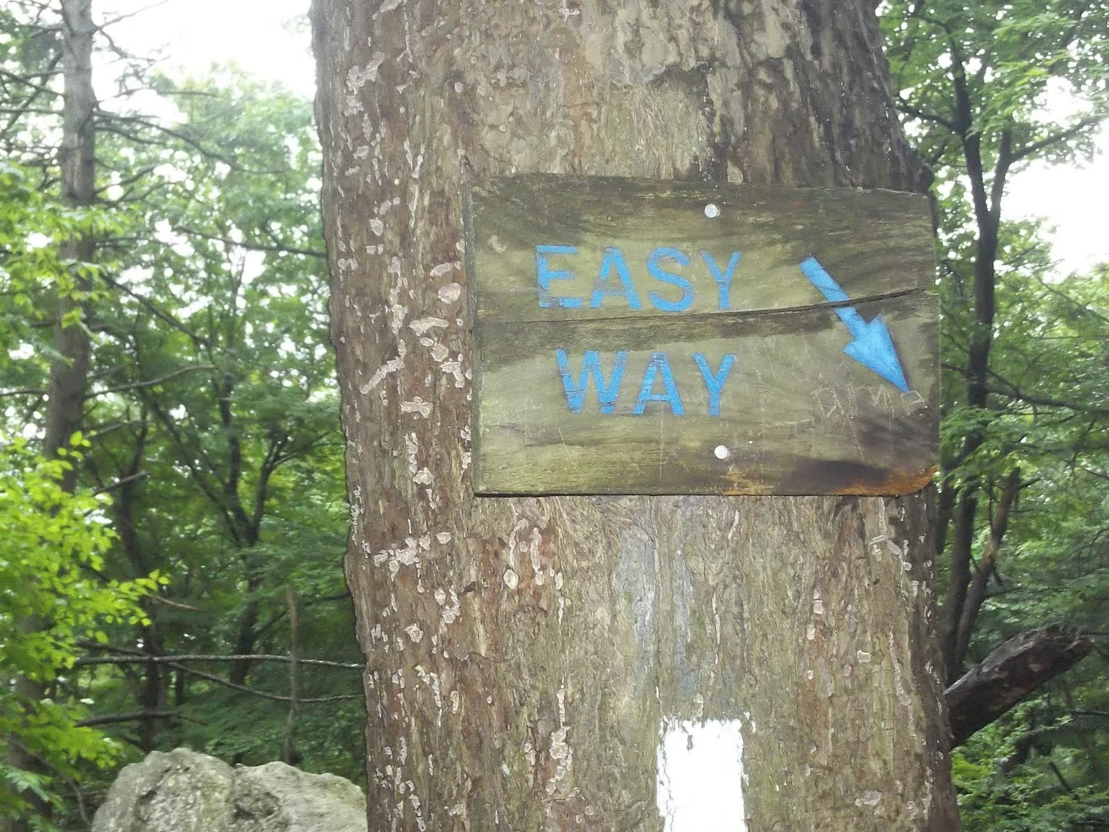


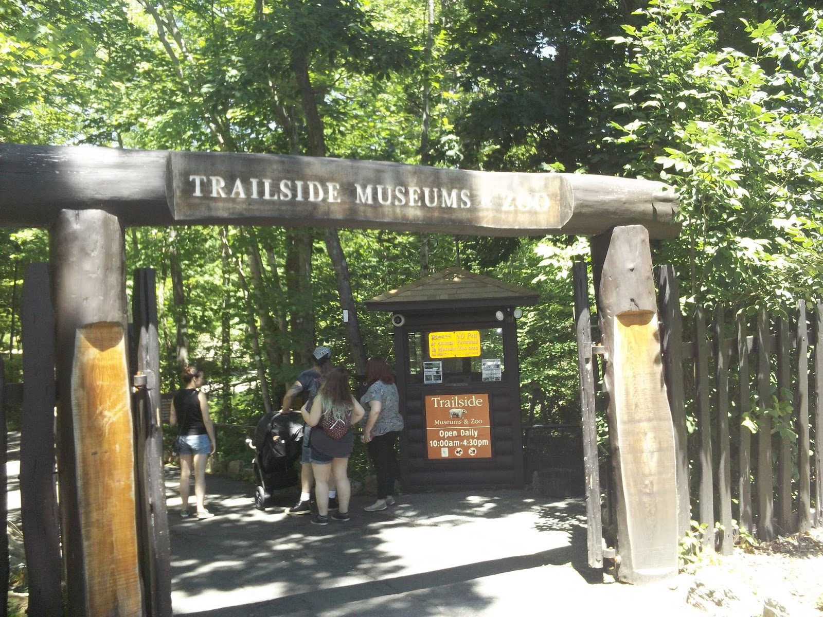

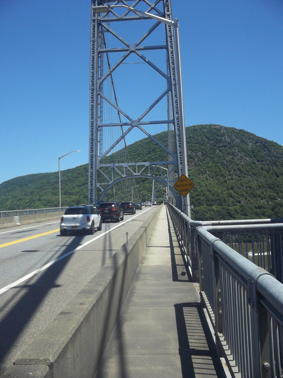


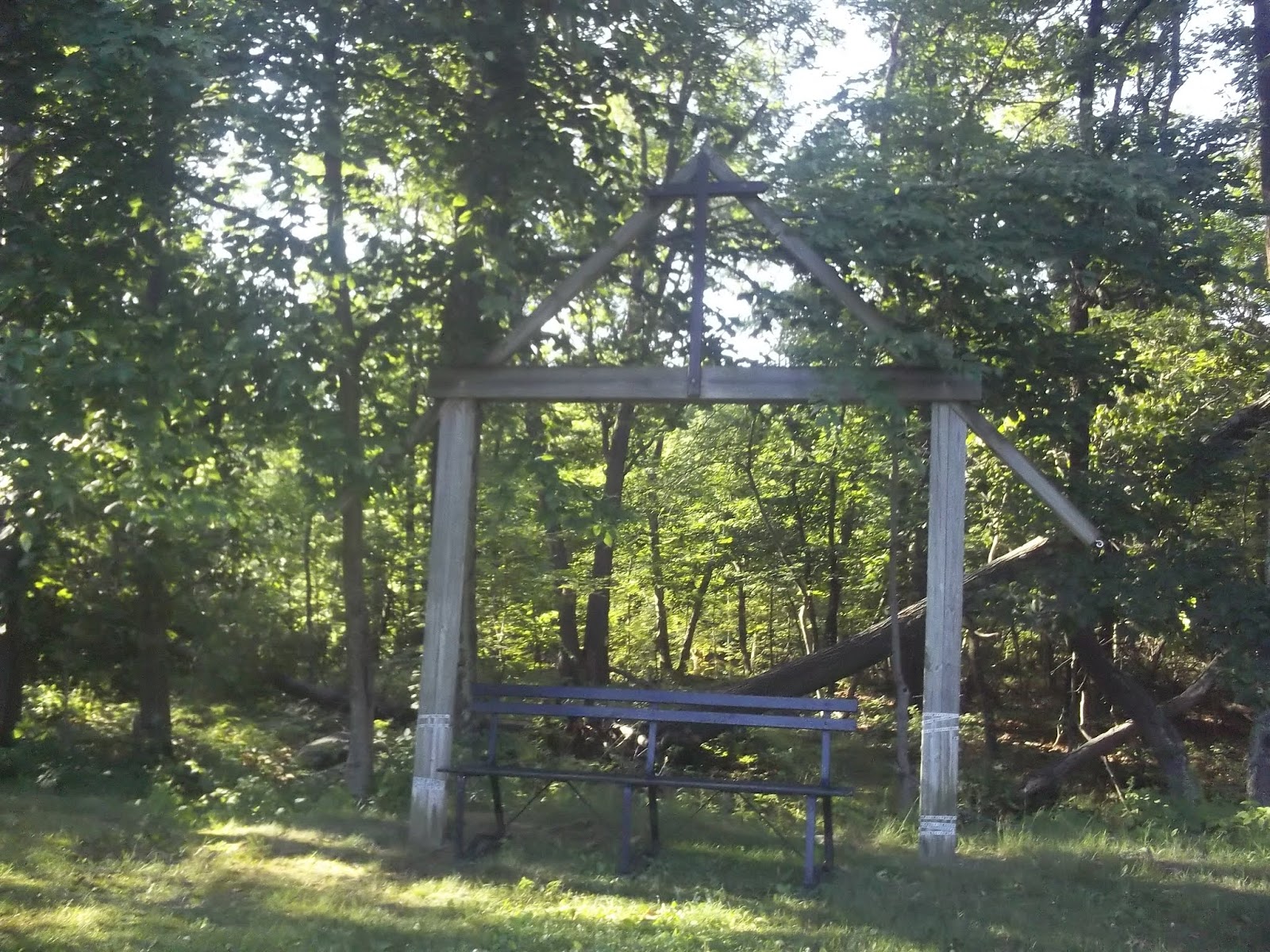


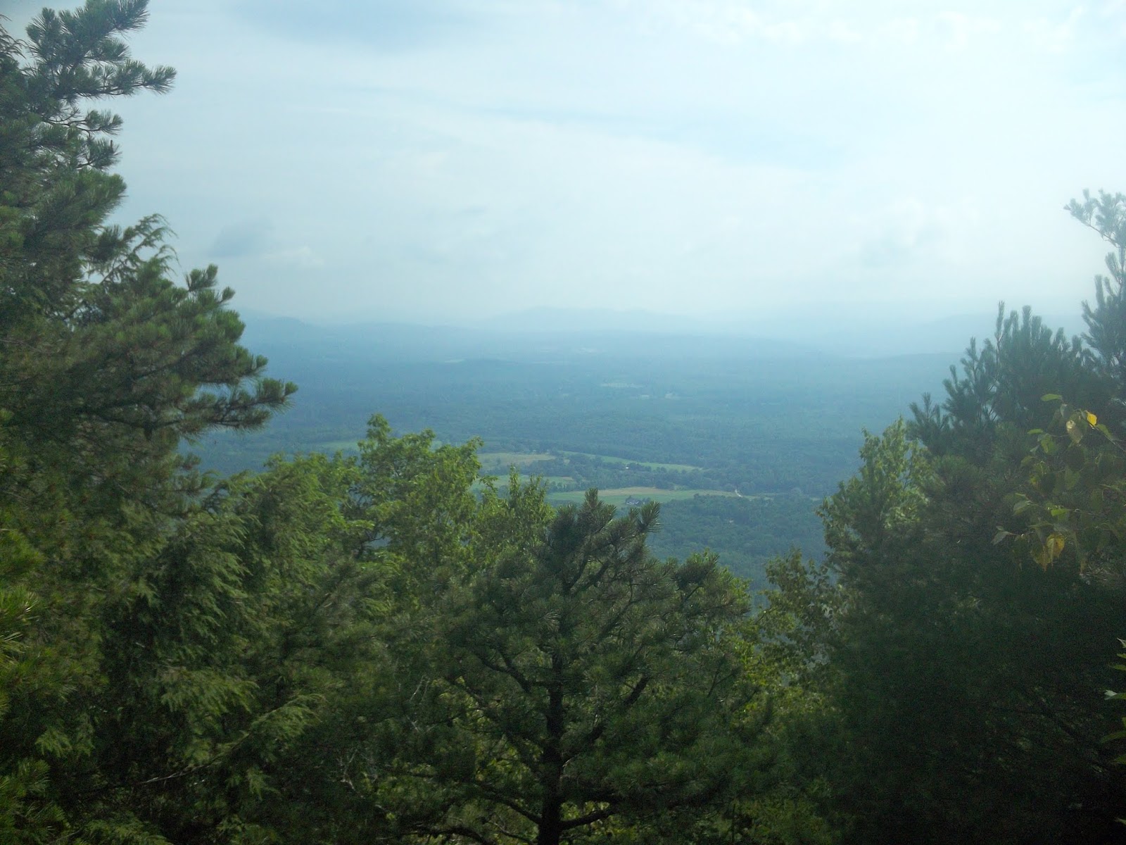


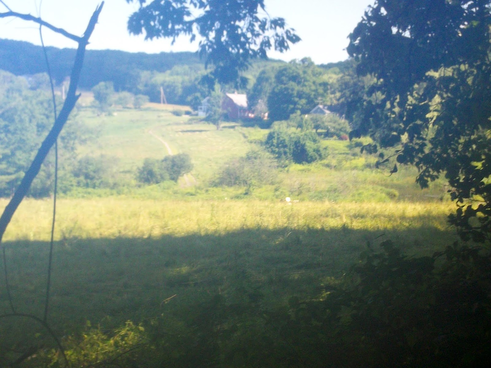


Hi Triple M,
ReplyDeleteI would love to hike the AT myself and hope to make the ambition a reality one day. I live in Scotland so would have to be a section hiker (commuter) like you. I have read a few reports of a growing party culture on the trail but you don't mention it at all. Is this something you are aware of?
I've enjoyed your blog so keep going and thanks.
Highlander
This comment has been removed by the author.
DeleteHello Highlander, and greetings from the U.S. Thanks for taking the time to read my blog and comments. From my personal experience, I think the notion of a 'party culture' on the trail is a bit overblown. It's not that it doesn't exist, and I have actually run into it a little, mainly with groups of thru-hikers. Many thru-hikers may start separately, but then tend to clump together as they move northward, forming traveling communities. These communities often take on a culture of their own. I think there is a difference between the truly serious hikers who ultimately complete, and those who like to party. I believe the partiers generally fade and drop off the trail. That being said, I think if you careful about when and where you begin your hike, you shouldn't have any problems. Also, in my experience, section hikers are NOT part of this. Thanks, again, for reading and your support thoughts. I hope you will do it someday, and please let me know if I can help or answer any questions. It is definitely a life-altering experience. 'Triple M...mmm'
DeleteMany thanks for your reply, Triple M,
DeleteI can understand that happening with groups of thru-hikers and as the popularity of the trail grows it is more likely. I suppose it is more likely to happen with the bubbles that move along the trail. I agree that those types of hiker are more prone to dropping out. The way you are section hiking appeals to me too - starting every year where you finished the year before. I suppose there will be years when you hit a bubble and the trail is busy and other years when the section you are on is really quiet.
I only wish I'd known of the AT when I left the Army in 2001. That would have been an amazing thing to do then and would have been a good thing to do whilst adapting to civilian life. But you can't regret decisions you didn't make. It's never too late and now all I have to do is convince my wife to let me go to the States for 3 weeks every year for the next decade or so!
If I make it I'll let you know and I'll probably have lots of questions about things like equipment and transport!
All the best,
Highlander
Thanks for your comment, Highlander. I was fortunate to learn about the AT and hiking when I was in HS back in the '70's. It wasn't nearly as popular back then, but I've always had it in my mind to do the entire thing. I never had the time or resources to do it earlier in my life. I feel blessed to be able to do it now, but it feels like I am fighting 'father time' a little, as each year gets physically more difficult. I'm encouraged by the fact that there are many hikers my age or older out there. The experience has changed in many ways, and I have seen changes just in the time I've been doing it. The changes are mainly with the number and nature of people. Fortunately, the scenery and terrain never change. There are MANY thru-hikers who are doing as you wished you had done, and are either out of the service and/or school. Let me know if you decide to get started. I will be happy to be a resource. 'Triple M...mmm'
DeleteSorry, just seeing your last comment now! Thanks for the offer of help - much appreciated. Looking forward to reading the next instalment. Highlander.
ReplyDeleteHi Highlander - You are welcome! I just returned from AT year number 10, and will be updating my blog. Keep in touch. 'Triple M...mmm'
Delete