 |
| Ready to Depart at Swatara Gap, Lickdale, PA |
Year 8 - Swatara Gap, PA 73, Lickdale, PA to Bear Mountain-Harriman SP Arden Valley Rd. Parking (202.1 Miles)
Wednesday, July 5 - Day Negative One
Ginny and I left Rock Hill on the morning of July 5 to head up to where I would begin my hike. Our intent was to visit my brother in-law, Tom, in Maryland, before heading up to the trailhead on Friday morning. We stopped for lunch at the General Store in Floyd, VA. The store sponsors a 'blue grass' jam session every Friday evening. Floyd has become a 'blue grass' music mecca of sorts, attracting people from around the country. My impressions of Floyd growing up in Roanoke were mainly of its gas station(s) and traffic light(s) as I drove through town. I had no idea it had become such a 'happening' place. In addition to the General Store there were an assortment of arts and craft shops, along with a good coffee shop which I am always up for.
Ginny had arranged for a us to stay in an air B 'n B in Frederick, MD, on Wednesday and Thursday evenings. It was a beautiful 2 BR condo, not very expensive, with much more room than the average motel. We arrived in mid-afternoon. Tom picked us up in the evening to take us into town for dinner at a nice brew pub in downtown Frederick. After dinner we strolled around looking at the very historic and interesting downtown area. We decided we would take some time in the morning to explore a bit more when things were open.
Thursday, July 6 - Day Zero
We met Tom back in downtown Frederick on Thursday morning. It was a slightly rainy day, and the first thing we decided to do was visit the historic Frederick Evangelical Lutheran Church. The congregation was established in 1738 and, like many churches in the area, had served as a hospital during the Civil War. The sanctuary was very attractive, with a nice 53 rank Moller pipe organ, and six octaves of Malmark hand bells and choir chimes on tables to the side.
 |
| The Chancel of Frederick ELC |
 |
| The Moller Pipe Organ- Tracker (mechanical) Action Instrument |
Tom and I visited the interesting Museum of Civil War Medicine, while Ginny investigated a local book store. After eating lunch at a Cuban restaurant, we walked around the streets popping into various shops. We stopped in at an outfitters, and I decided to buy a lightweight inflatable pillow for the trail. We also looked around the large 1920's era movie theater, very nostalgic, which had been restored for use as a community theater, including a fully restored Wurlitzer theater pipe organ.
All in all it was a very good day. I encourage anyone who is traveling through this section of Maryland to give Frederick a look.
Friday, July 7 - Day 1 - Swatara Gap, PA 72, Lickdale, PA to Applebee Campsite - 11.9 miles
We got up early. It was about a two hour drive to the trail head in Lickdale, PA. I had prepared, packed, and rechecked the night before so we could get an early departure. As we were leaving the condo, I suddenly realized I had left my two Smart Water bottles in the refrigerator, but it was too late, Ginny had already locked the door. I briefly panicked, but quickly realized that Smart Water could be purchased at almost any convenience store! I don't think I would have been quite so unperturbed had it been my old Nalgene bottles.
We went for breakfast at the Barbara Frietchie restaurant, a local landmark named for a citizen of Frederick and heroine of the Civil War, who is memorialized in a poem by John Greenleaf Whittier. The poem entitled...(drum roll)...,
Barbara Frietchie, was posted on the wall of the restaurant, so I took a little time to read, reflect, and ponder. Whittier's Quaker sensibilities have always appealed to me. The restaurant itself was originally a confectionary, but the candy making business had long since faded away. The only reminder was a big candy cane attached to the sign outside the restaurant.
 |
| The Barbara Frietchie Restaurant in Frederick, MD |
We drove north to Lickdale. We arrived at an intersection with a Wendy's on one corner, and a Day's Inn across the street. I immediately recognized where I had stayed at the conclusion of my previous year's hike. We stopped briefly at a convenience store for gas and two more bottles of Smart Water. We had a little trouble finding the trailhead on PA 72, and doubled back once, but I spotted the old chain bridge where I had finished last year. Ginny snapped my pic in approximately the same location, we said our farewells, and I headed up the trail shortly after 10 a.m..
 |
| Flowers on the Trail Before the I-81 Bridge |
Very shortly I crossed under the I-81 bridge, and began an ascent to a ridge. I encountered few people along the way initially, but did cross paths with a SOBO section hiker who was very similar to me. He was currently in his seventh year of hiking the trail, and had completed the halfway point. It was a fairly smooth hike on top of the ridge. I stopped for lunch at a log just past the William Penn Shelter.
 |
| Interesting Lichen |
 |
| A Brief Lunch Stop |
I ran into my first example of 'trail magic - just a cooler with some Coke Zeros in it, but I gratefully downed one. This was the first of MANY magical examples to come over the next two weeks. I traversed some nice view points at the Fisher and Kimmel Lookouts before crossing PA 501.
 |
| First 'Trail Magic' |
 |
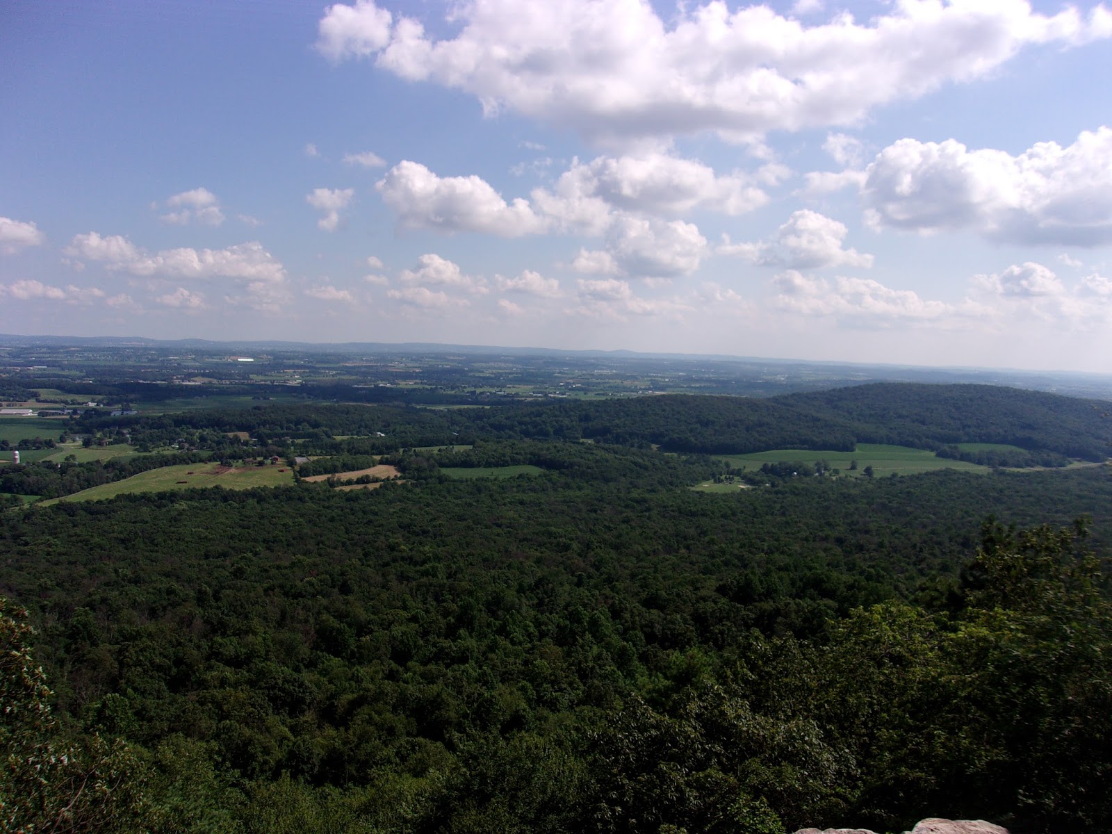
| Fisher Lookout View |
 |
| Kimmel Lookout View |
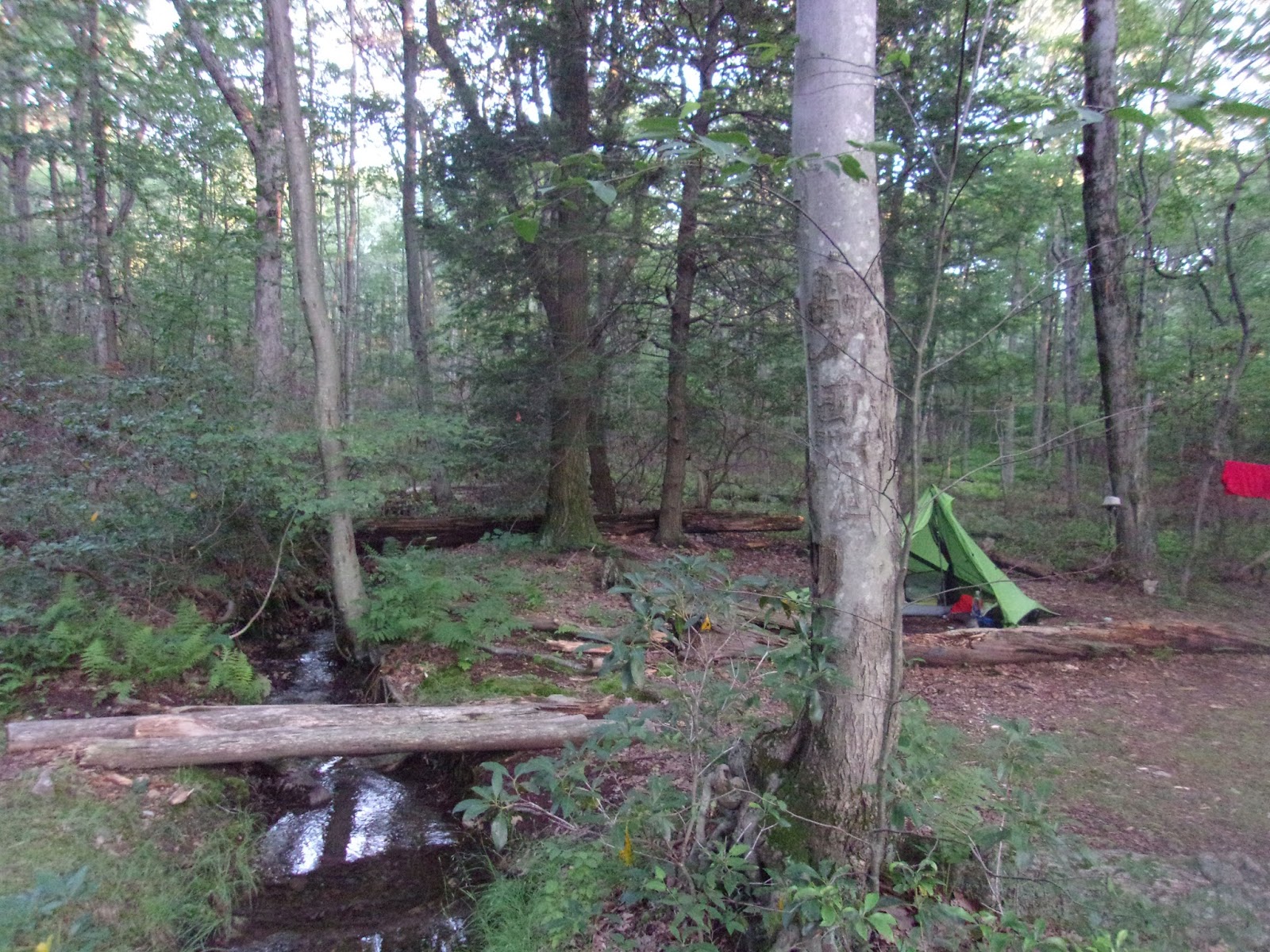
I was concerned that the Applebee campsite, my destination for the evening, might be crowded. I arrived at the campsite intersection around 4 p.m. There was no one around, so I selected a site towards the back. After pitching my tent, I went down to the spring to load up with water. Upon returning to the campsite, I dawdled a little too much as a big storm was brewing. It blew in just as I was about to light my stove for supper, and I quickly dove into my tent to wait out the storm.
 |
| Arriving at My Destination |
 |
| My First Camp at the Applebee Campsite |
The storm passed quickly, and I fixed a dinner of AlpineAire three cheese chicken pasta - not bad. After supper I made several efforts to hang my bear bag using the PCT method. I was grateful that no one was around to see, because I am sure it would've made a good comedy sketch. I finally gave up, and hung the bag using my old familiar, 'Moe Method', which includes hanging my laundry below the bag. If a bear wants my food he will need to go through my stinky clothes to get to it! It's been a good first day and I am happy to be back on the trail.
 |
| Outdoor Kitchen |
 |
The 'Moe Method' of Bear Bagging
(Please note: extra-smelly clothes are helpful) |
Saturday, July 8 - Day 2 - Applebee Campsite to Sand Spring Campsite- 13.9 miles
This was a GREAT day of hiking. I awoke about 6 a.m. and started breaking camp. My tent and clothes were still a little wet from the preceding evening's rain, so I saved them for last as I packed my things. I had instant oatmeal for breakfast along with my 'rocket fuel' of instant coffee and cocoa. I felt ready for the day.
I broke camp around 8:30 a.m. It was a fairly smooth hike with some rocky spots. These rocky spots can be extensive and severe. Many people who hike the trail associate Pennsylvania with rocks, but there are some long, relatively smooth sections as well. I encountered another SOBO long distance section hiker, who had completed more than half the trail doing scattered flip-flop sections. Many hikers do this, which makes it easier to arrange shuttles, etc.. Maybe it is my sense of order, but I personally like to work in contiguous NOBO sections - plus I have a map on the wall at home on which I highlight my completed sections, like a thermometer graph used for fundraisers. I can always admire how far I've come, and how far I've yet to go. The SOBO section hiker told me to be on the lookout for some great 'trail magic' at highway 183. This was still about three or four miles ahead, so I thought it might be a good lunch stop.
 |
| Nothing Like Rocks to Start Your Day! |
 |
| Overlook South of Hertline Campsite |
I took a short break at Hertline Creek and chatted with a young thru-hiker, 'Zen', from Long Island, NY. I asked him how he liked the trail so far, and he said it was much better than Long Island! As I proceeded north, part of the trail went through swampy, low lying ground that was mostly underwater. The trail looked like a creek, but there were bypasses around these sections. I encountered a cigar smoking day hiker with a dog. The hiker offered me a beer. It was a tempting to accept his offer, but I decided to wait for the 'trail magic' just ahead.
 |
| A Watery Trail (above and below) |
Just before I arrived at the Fort Dietrich Snyder monument there was a sign hanging over the trail announcing 'trail magic' a half mile further on. I paused briefly at the monument to read the inscription and take a pic, and in short order came upon a feast unlike anything I had seen in eight years of AT hikes. 'Hawk Woman' (thru-hike class of 2016), assisted by a hoard of family and friends, was giving back to the trail. Her husband was grilling hotdogs and hamburgers, and there were an array of side dishes, drinks, and deserts to choose from. Many hikers were sitting around in a gazebo and in chairs. I filled up a plate and sat down to visit with 'Hawk Woman's' sister. She told me that this very day was 'Hawk Woman's' birthday, which made this gift to hikers even more exceptional. I was treated royally by the support crew - feted with drink refills and a Pennsylvania specialty, shoo fly pie for desert. I took a few pics of 'Hawk Woman' and her crew.
 |
| The Fort Dietrich Snyder Monument |
 |
| 'Trail Magic' and Some of the Support Crew |
 |
| 'Hawk Woman' - Thru-Hike class of 2016, and Bringer of 'Trail Magic' |
After thoroughly stuffing myself and signing the trail log, I waddled on down the trail. The path was fairly level, but rocky in spots. Then, without warning, something totally unexpected happened; my foot caught on a stump and I did a face plant into the ground. It happened so suddenly that I didn't even have time to put my hands out to catch my fall. Fortunately, it was only earth and not rocks below my face. I jumped up, dusted myself off, and scanned for an audience. Hearing no applause, I proceeded with slightly more vigilance.
 |
| Passing the Eagles Nest Trail Intersection South of Eagles Nest Shelter |
My destination for the evening was the Eagle's Nest Shelter area. I decided to catch water at the Sand Spring, less than a mile south of the shelter. There were some nice campsites around the spring, so I made the spontaneous decision to make this my home for the evening. As it turned out, this was the second evening in a row I had an entire site to myself. From my (introverted) perspective this was a great way to begin a long distance hike.
 |
| My GREAT Campsite At Sand Spring |
 |
| My new Nemo Tensor 2OR Sleeping Pad |
 |
| The Sand Spring Itself |
Sunday, July 9 - Day 3 - Sand Spring Campsite to Pocahontas Spring Campsite - 11.8 miles
I arose around 6 a.m., packing slightly more efficiently than yesterday. I broke camp shortly after 8 a.m. Today was to be a shorter day, but I always prefer starting early and ending early whenever possible. Even though the distance was not long, the elevation profile looked a bit more rugged towards the second half.
 |
| At the Blue Blazed Intersection to Sand Spring |
 |
| A Nice Day to Start |
I didn't see a soul before taking a lunch break at the Auburn overlook. I broke out my stove and cooked up some chicken ramen noodles mixed with Lipton chicken noodle cup-a-soup with white meat. I figured the chicken cup-a-soup might add a little protein to the abundance of carbs in the ramen. I sat in the shade enjoying the great view.
 |
| Sign for My Lunch Stop Location |
 |
| Breaking Out the Stove |
 |
| Enjoying the View! |
It was a precipitous descent to Port Clinton, very steep but not too rocky. At the bottom of the hill I crossed the paved Schuykill Trail, which looked like a 'rails to trails' project. I stopped to take a couple pics and encountered a thru-hiker, 'French Press'. We hiked together across railroad tracks and into town. From his trail name, I deduced that he was a coffee lover. I also discovered that he was a college student from Connecticut, hoping to complete the trail during his summer break. He was having problems with his boots, and was planning to stop at the Cabelas in Hamburg for new insoles, so we parted ways.
 |
| The Schuykill Trail |
 |
| Information Sign on the Schuykill Trail |
 |
| Final Descent before the RR Tracks |
The trail in Port Clinton just skirts the town then follows the river before passing under a highway bridge and ascending out of the valley. I was looking to get to an unnamed campsite near a spring in a gap a mile or two beyond the next mountain. It was a big climb out of Port Clinton, and I began slowing way down. I did come across some nice ripe blackberries which is always a welcomed treat.
 |
| Trail Along the River (invisible to the right) |
 |
| Pointing the Way to Maine, and Out of Port Clinton |
I finally reached a sign marking the Pocahontas Spring, which I presumed to be the unnamed spring next to a campsite indicated in my guidebook. I found a nice campsite just beyond the spring with a little stream running right down the middle of it. I had the thought that if it rained I could be underwater, but a passing hiker informed me that rain was not expected until Thursday, so I was safe. I pitched my tent, cooked dinner, made a phone call to Ginny, and planned tomorrow and beyond. I was looking at the itinerary with an eye towards avoiding ultra long days, but as they inevitably do, circumstances would dictate otherwise.
 |
| A Spring Runs Through It |
 |
| A Natural Bear Barrier (I hope) |
Monday, July 10 - Day 4 - Pocahontas Spring Campsite to creekside campsite north of Eckville Shelter - 12.5 miles
I woke up early, and broke camp
before 8 a.m. - just a relatively short hike with a couple of very good view
spots along the way. After a mile or so I passed the Minnehaha Spring, the
name in keeping with the Indian Princess theme I suppose. I descended
past Reservoir Road and arrived at the Windsor Furnace parking area. I encountered a group
of young people coming down the road, and asked one of them if he could snap my
picture. This is the only pic I got of myself on the trail until the very last
day. There were a few signs in the area commemorating the Appalachian Trail,
which I thought was neat.
 |
| Windsor Furnace Sign |
 |
| 75th Year Trail Anniversary Sign |
 |
| Nice Open Path at Windsor Furnace |
 |
| 4th Day Action Shot! |
After a very rocky ascent, I
arrived at the first view spot, 'Pulpit Rock', around 10 a.m. In addition to
the great view to the right of the trail, there was an astronomical park to the
left, with a large green space enclosing several observatories. It was a
pleasant area, so I decided to take a little break in the shade and enjoy the
cool breeze.
 |
| Rocky Passage |
 |
| Pulpit Rock View |
 |
| The Astronomical Park at Pulpit Rock |
After a little rest and
refreshment, I headed on to the next great viewing area known as the
Pinnacle. I came upon a huge pile of rocks that was obviously not a natural formation. I stopped for a photo, and then missed the trail as it makes a u-turn around the rock pile and heads in the opposite direction. At the same spot was a blue-blazed trail to the right leading to the Pinnacle overlook, so I went over to have a look.
 |
| Great View from the Pinnacle |
 |
| Another Great View |
I took a few pics and headed back to the trail intersection, with no idea where the northerly trail was. Fortunately, as is often the case, I encountered two local day hikers who pointed me in the right direction. I was grateful for their assistance, as I don't think I could've found it quickly on my own. They also told me the legend of the big rock pile. Supposedly, passing hikers add a rock to the pile to make one less rock on the trail for other hikers. I am grateful, but I didn't take time to calculate how long before the trail would be rock free!
 |
| The Rock Pile - Clearing The Trail for Hikers |
After Pinnacle the trail flattened out, following a road bed for some distance. This made for easy, fast hiking. Along the way I saw a bright red bird with black wings flittering close to the trail. I snapped a bunch of pics trying to capture a good shot. I found out later that this was a male Scarlet Tanager - not something I generally see at home.
 |
| Easy Road Bed Hiking |
 |
| My Best Shot of a Male Scarlet Tanager |
I came to the intersection of the Gold spring trail, and filled up with water. I ate lunch back at the intersection and visited with a NOBO thru-hiker, 'Kansas', who had begun his hike on April 18. He had been bouncing on and off the trail for various reasons, but was putting in 18 mile days on a regular basis. I was looking at only 3 miles or so to my intended campsite north of the Eckville Shelter. I thought briefly of trying to go further, since it was still early, but decided to make this a short day instead.
 |
| Passing by Panther Creek |
 |
| View On the Descent to Hawk Mountain Road |
I crossed Hawk Mountain Road, with a sign indicating the shelter to the right, and in less than a mile came to a stream and a nice campsite on the other side. It was just a little after 2:30, but this was a good place, and I didn't feel like climbing another hill today. 'Kansas' came by. He had stopped to check out the Eckville Shelter. A short time later, 'Zen' also passed through and said 'hello'. I made camp, and was happy to take a little cat nap in my tent before supper.
 |
| Trail Sign at Hawk Mountain Road |
 |
My Solitary Creekside Campsite
(before the thru-hikers arrived) |
I knew it was too good to hope for a fourth straight solitary site, as a few late arriving thru-hikers later set up camp right outside my tent - oh well. Tomorrow would be my longest day so far, and I needed the rest.
Tuesday, July 11 - Day 5 - Campsite north of Eckville Shelter to campsite near Bake Oven Knob Shelter - 17.0 miles
This was going to be a long day. Since I don't generally like to hike past 5 p.m, I arose very early and broke camp before 7 a.m.! This may have been my earliest start in recorded history. My intention was to go as far as possible beyond Bake Oven Knob, the second shelter north. I ended up camping just beyond it, but within walking distance of the shelter. It was a mostly smooth hiking at the beginning of the day, with a nice view and a trail register at Dans Pulpit following the first big climb.
 |
| Dans Pulpit View |
I paused three or four times along the way - once at a spring by the Allentown Shelter for water, and later to cook a lunch of ramen noodles with a pack of tuna mixed in. There were two exceptionally treacherous bits of trail to keep my attention; the so-called, 'Knife Edge' and 'Bear Rocks'. The most memorable stretch was the 'Knife Edge', which as the name implies, is a sharp rocky ridge, with many potential pitfalls. It was
very difficult to negotiate.
 |
| Getting Water Near the Allentown Shelter |
 |
| Signs of Earlier Civilization |
 |
| Here We Go! |
 |
| The 'Knife Edge' - A Sharp Scramble! |
 |
| Knife Edge View |
 |
| Bear Rocks View |
I arrived at the Bake Oven Knob Shelter a little after 5 p.m. I went down to the spring below the shelter to load up with water, and made camp at a site to the left of the trail just past the shelter. It was not the greatest site, but was OK. I was looking towards another relatively long day tomorrow (anything over 15 is long for me), and maybe taking a 'zero day' in Wind Gap.
 |
| Flowers Near Bake Oven Knob |
 |
| Camp Near Bake Oven Knob Shelter |
Wednesday, July 12 - Day 6 - Campsite near Bake Oven Knob Shelter to unnamed campsite north of Little Gap Road - 15.4 miles
This may have been the MOST interesting day of hiking in my eight years of section hiking, and that's saying something. I got up before 6 a.m., and broke camp just before 7:30, for another early start. I was anticipating a long day, and contemplating a possible 'zero' day in Wind Gap to refresh and resupply. This would mean arranging a motel room for tomorrow and Friday. I hadn't called ahead , but there were two motels in Wind Gap, so I didn't foresee a problem.
 |
| Power line Clearings Always Make for Nice Views |
 |
| Trail Turning Through A Pipeline Clearing |
The water sources along the way were limited, and I planned to stop and fill up at a spring just beyond the next shelter. Beyond that it was downhill to Lehigh Gap. There was a warning in my trail guide about passing through a superfund site in the area of a former zinc mine. The zinc mine had operated from 1898-1980. The tailings from the mine operation had left the mountains beyond the gap deforested and the springs contaminated with high metal content.
 |
| The South Trail - One of Many That Reconnect with the AT |
 |
| Another View Toward the Lehigh Valley |
 |
| One of My Favorite Trail Treats - Ripe Wild Blueberries |
I arrived at the spring and visited with a few thru and day hikers as I filled up my bottles. One of them told me that he had heard the climb out of Lehigh Gap was very tough. The elevation profile in my guide was obscured by text, but it didn't look especially bad on paper, so I wasn't too worried. As I approached the road at the gap I came upon box of 'trail magic' under a sign. It contained some candy and fresh fruit, so I gratefully took a crisp apple for the road. The trail follows the road across the Lehigh River, then turns right along a highway to cross at a traffic light. Upon seeing the mountain with bare rock outcroppings all the way to the top, I had the sinking feeling this was to be my next climb.
 |
| Crossing the Lehigh River and Dreading the Climb Ahead |
 |
| The Lehigh River |
I believe that the climb out of Lehigh Gap was probably the most harrowing of all the climbs since Springer Mt. To say it was nerve wracking might be an understatement. My pack was heavy with extra water, and I felt at any moment I could go plunging backwards down the mountain. I paused a couple times on the way up to catch my breath and hydrate. When I finally reached the top, I rested in the shade under a pine tree on a nice soft bed of pine needles. An older female thru-hiker came by, and told me she felt she may have 'lost one of her nine lives' on the way up. I felt much the same way.
 |
| A Precipitous Drop |
 |
| Rocky Climb |
 |
| Great Views |
The reward for such a strenuous climb were some great views, and a long smooth ridge along the superfund site. This section was in in the process of being reforested. It was a pleasant stretch of trail, with many white birch trees, wildflowers, and ripening raspberries and blackberries. I passed a cutoff to Metallica Springs, but my Awol Guidebook had warned against water from it, except in an emergency.
 |
| A Pleasant Ridgeline Hike |
 |
| Interesting Wildflowers |
 |
| Good Things to Snack On |
 |
| Views of Industrial Areas |
I was feeling somewhat fatigued, and the next water source was over five miles away. I thank God for many the 'trail angels', those who do unselfishly good deeds for hikers, and for the jugs of water that were left at Little Gap Road. I topped off with water, and decided to look for a campsite on top of the next ridge. I was going very slowly up the hills which, thankfully, were not too severe. I found a nice site to the right of the trail about two miles south of Delps spring, and set up camp.
 |
Power line Clearing Views
(Above and Below) |
It was less than a day's hike to Wind Gap, where I was hoping for a motel stay tomorrow and Friday. Wind Gap was only a mile off the trail, but it was not a designated 'trail town'. I have found that not every town on the AT is necessarily 'hiker friendly'. There is an application process for towns that wish to be granted official 'trail town' status. These are the towns that specifically welcome and cater to hikers. I called both motels in Wind Gap, and was disappointed that both were 'full'.
 |
| My Campsite on the Ridge |
I had several more days of food, but wanted and needed time off the trail to refresh, refuel, and do a small amount of resupply. I looked in my trail guide for alternatives, and saw the home of John 'Mechanical Man' and Linda 'Crayon Lady' Stempa, one mile west at Smith Gap Road about 4 or 5 miles away. For only $10.00, hikers could camp or stay in their garage, with a hot shower and towel and a ride into Kunkletown included. I called 'Mechanical Man', and had a nice conversation. He was a section hiker (like me) who had hiked everything north of Hot Springs, NC. He said he would pick me up at Smith Gap Road, and to give him a call when I arrived at the Stempa spring' trail, which was only about a half a mile from the road. I thought it was neat that he had discovered the spring, hence the honor of having it named after him. My plan was to get to the spring around 11:30 a.m. so I didn't need to rush.
Thursday, July 13 Day 7 - Unnamed campsite north of Little Gap Road to Stempa House (Smith Gap Road) - 'nero' day - 4.5 miles
I was a little disappointed in missing out on a 'zero day' in Wind Gap, but happy for just a short jaunt to Smith Gap road and a 'nero' (near zero) day. I didn't know the exact location of where I had camped, but had a rough idea of the distance. I knew it wasn't far, but I had used most of my water for dinner and breakfast, and had very little remaining. The trail was relatively easy to start. I even passed two NOBO thru-hikers slower than me, which I thought impossible.
The first landmark I came to was a road/powerline clearing, followed by the Delp's spring. 'Mechanical Man' had said that the spring was dry, so I didn't bother trying to get water. In less than two miles beyond this I arrived at the blue blazed spring trail. It was only 10:30, and being parched, I decided to make the journey down to the spring, which was a little long - .6 miles off the trail downhill. My stomach was slightly upset, and I was also feeling lightheaded. My first thought was that I was becoming dehydrated. I finally reached the spring (a really nice piped spring), and guzzled water like I hadn't seen it before. I quickly realized this was a mistake as I began to feel worse. Then, thinking that perhaps I had had TOO MUCH water - a condition that can sometimes be deadly, I struggled back up the hill feeling worse and worse with every step. When I finally reached the trail intersection, I immediately mixed some apple cider drink mix in one of my bottles and drank it down. I felt better almost instantly, which told me that my blood sugar was probably low.
I want to take a moment to discuss hydration. This is something NOT to be taken lightly, especially when hiking long distances. Hiking is an
extreme athletic activity, and should be treated with the same level of seriousness as running a marathon or an ultra-run. This is the first trip I have taken without a hydration reservoir in my pack, which made me a little nervous. Water is very heavy, and I did this to lower weight and create a little more room. I am relying on more frequent pauses for water. I also carry drink mixes with added electrolytes, but nothing specifically designed for the trail. From this point on, in addition to my two Smart Water bottles, I will carry a 16 oz. water bottle in my pocket that I can use on the go. I think I will also look for electrolyte tablets to put in that bottle, and just stop to refill when needed.
I called 'Mechanical Man', and he agreed to pick me up at the road at 12:30 p.m. I arrived at 12:15 and sat down to await my ride. He came right at 12:20, accompanied by his red doberman, 'Guinness', who was very friendly. We drove the mile back down the hill to his house, which was originally a dome house that had been added to, and built into the side of a hill. His garage was set-up as a hiker hangout. Since the garage was below ground level, the temperature was satisfyingly cool. That, together with a portable dehumidifier, made it very comfortable. There were sodas available for $1.00 each. I drank three of them, and took a hot shower, and I met another, older red doberman, 'Nemo'. It was great to feel 'human' again.
 |
| The Stempa Home on a Hill |
 |
| The Stempa house garage and hiker hangout (my sleeping bag to the right) |
It was still relatively early in the day, and I hadn't had lunch yet. John rode me into Kunkletown, where I picked up an egg salad sandwich, and an Arizona Green Tea. I also did a little resupply for the trail, picking up a carton of 'Swiss Miss' drink mix. I ate my lunch back at the house, and made plans to return later on for supper at the Kunkletown Pub. I plugged in my fitbit and phone to recharge, and laid down on my sleeping bag for a nap. I was half expecting other hikers to show up, but none did.
 |
| The Kunkletown General Store |
Around 6 p.m., John took me back into K-town and dropped me off at the Kunkletown Pub. I sat at the bar and ordered a dinner of shrimp and scallops with a side salad and a baked potato. Free beer was included with dinner, so I had two draught Yuenglings to go with it, and conversed with a local who was sitting across from me. For dessert I ordered a brownie and coffee, which were wonderful. After more than a week of trail food, non-trail food literally tastes 'heavenly'. I left the pub, and walked across the street to the General Store to get a roast beef sandwich to eat for lunch on the trail tomorrow.
 |
| The Kunkletown Pub - Good food/beer!! |
I went back up to the house and, since I was the only hiker there, had a good conversation with 'Mechanical Man' on many topics. His son (also named John) was a former BMX champion who was now a musician (guitar/drummer), and had played in the prestigious School of Rock house band. It also turns out that 'Mechanical Man' personally knows and/or has known many famous hikers and celebrities, including: Scott Jurek, Earl Schaeffer, Ed Garvey, David 'Awol' Miller, and former heavyweight boxing champ, Larry Holmes. It was a very good stay, and I encourage hikers passing through the area to consider taking a day or half at day there. You certainly can't beat it for only ten bucks.
 |
| John 'Mechanical Man' Stempa and Guinness |
Friday, July 14- Day 8 - Stempa House (Smith Gap Road) to unnamed campsite south of Wolf Rocks- 13.8 miles
I slept well in the Stempa garage, woke up around 6 a.m. packed my gear, got water from the spigot, and collected my roast beef sandwich from the refrigerator upstairs. 'Mechanical Man' took me back to the trailhead at 9 a.m. Today was only a thirteen mile day, and I didn't think I needed to rush. I decided I would take another 'nero day' in two days in Delaware Water Gap. I was in need of a major resupply. Delaware Water Gap IS an official 'trail town', so I knew I could purchase exactly what I needed for another six or seven days on the trail to get to my final destination.
 |
| High Grass and a Rainy Trail |
It was a rainy day, the first really damp one since the beginning of the hike. It rained steadily much of the morning into the afternoon, mostly just a drizzle, but came down hard later in the day. I paused for lunch at campsite just off the trail, enjoying my huge roast beef sandwich with mayo, lettuce, and tomato on a hoagie bun. It was much better than my usual trail lunch fare.
 |
| Very Wet Climbs |
Be aware that wet rocks can be hazardous. I have often slipped on them, and did it again as I was descending to Wind Gap, snapping one of my trekking poles in two. Thankfully, I still had another good pole, and I needed to be extra careful with it.
Trekking poles provide many benefits, and they have saved my bacon on more than one occasion. I also carry a tent that uses a trekking pole for support.
 |
| My Snapped Trekking Pole - :-( |
It was a good, rainy climb out of Wind Gap. My objective was to camp somewhere between Wind Gap and Delaware Water Gap, and to get a motel room in Delaware Water Gap to resupply, do laundry, get a decent meal, etc. I crossed paths with a SOBO section hiker who was working on a thru-hike of the trail going north. He was using two cars, driving one to a northern parking area, and then day hiking south to his other one. His trail name was, 'I Think I Can'. He had begun hiking last November, but had been delayed because of injuries, and no longer believed he would finish the trail this year. I shared my story of 'Pringles', the thru-hiker I had encountered in AT year 6. 'Pringles' had used the same method on his thru-hike. Just like my experience with 'Pringles', I thought it likely that we would continue to encounter one another as I headed north.
 |
| The Rain Finally Stopped Late in the Day |
 |
| My Day 8 Campsite |
I was not certain of the distance to a decent campsite, but Pennsylvania has plenty of them along the trail without many restrictions. There were some rather rocky sections along the way, but I finally came to a nice site where the trail turns to the east. My guidebook indicated a campsite before Wolf Rocks, and I thought this might be it. I set up camp and called the Deer Head Inn in Delaware Water Gap to reserve a room for tomorrow. I had intended to call someplace a little less expensive, but accidentally dialed the wrong one. It was rather pricey for one night, but I considered it a trade off for have not done two evenings in Wind Gap. I knew it would be a nice place, because I could hear a piano being tuned in the background as I spoke on the phone.
Saturday, July 15 - Day 9 - unnamed campsite south of Wolf Rocks to Delaware Water Gap, PA (motel resupply) - 9.8 miles
I took my time getting up, as it is only ten miles to Delaware Water Gap. I also wanted to allow a little time for my things to dry out. The weather was clear as I broke camp around 9:30. Wolf Rocks was a short distance ahead. A bypass trail was provided around it, but I always enjoy the challenge unless there is a risk of a thunderstorm. The rocks were wet and slick from the previous day's rain, so I proceeded gingerly through this section. After a mile or so the trail smoothed considerably.
 |
| View From My Tent as I Woke Up |
 |
| Wolf Rocks Bypass |
 |
| The Road Less Traveled? |
 |
| Wolf Rocks View |
 |
| Another Rock Traverse |
After 'Wolf Rocks' there were not many big climbs. I stopped for lunch at the Kirkridge Shelter, and took water from a tap up the hill behind the shelter. I chatted with a few hikers at the shelter, including a female section hiker who was planning to attend Duke University in the fall. She intended to work on her Master's degree in theology, medicine, and the arts! This was such an interesting interdisciplinary field of study that I longed for an opportunity to converse more, but alas this was not the day.
 |
| Pretty Trail Beyond Wolf Rocks |
I headed on past a few good views and along a long stretch of road bed beyond Fox Gap and before Mt. Minzi. I saw a couple of young male thru-hikers along the road creating a '900 more miles' sign out of pebbles. I entered the Delaware Water Gap National Recreation Area, and arrived at the top of Mt. Minzi. There were no views at the summit, but there were a couple very good view spots on the steep downhill side. I recalled seeing old landscape paintings of this very spot - scenes of 'old Americana'. I also traveled through some nice groves of Rhododendron which reminded me of Virginia. I encountered MANY day hikers along the way.
 |
| Entering the Delaware Water Gap NRA |
 |
| Rhododendron Groves |
 |
| Scenic View of the Delaware River |
At the bottom of the hill I passed a little pond, walked through a parking lot, and arrived at the
Deer Head Inn, which was adjacent to the trail. It appeared to be a renovated Victorian style hotel - very historic looking. I discovered later that it was famous for it's live jazz music, and had hosted many well-known jazz musicians of the mid-twentieth century. I checked in to room 305, and took a shower. There were no laundry facilities at the hotel, so I washed my clothes in the sink hoping they would dry out before tomorrow. I took an inventory of food and items for resupply. I was planning no more stops, and would need enough for six more days on the trail.
 |
| A Pond below Mt. Minzi |
 |
| The Deer Head Inn and Jazz Club |
 |
| My Comfy Room in the Deer Head Inn |
After cleaning up, I walked to the outfitters down the street and bought a couple items. I chatted briefly with the man behind the counter. He had been repairing many trekking poles that day. He also informed me that there would be about twenty more miles of rocks heading into New Jersey, but thought the trail smoothed out after that. I continued on to a convenience store where I purchased some food bars and pop tarts, then had a nice dinner at the Sycamore Grille. After dinner I walked over to the Castle Inn directly across the street from the Deer Head. It contained an authentic 1920's style soda fountain. It was like walking into a set of the 'Little Rascals' complete with the soundtrack! I ordered a chocolate malt and chatted with the lady behind the counter.
 |
| Delaware Water Gap- An Official Trail Town! |
 |
| The Castle Inn (a great soda fountain) |
Delaware Water Gap is a designated 'trail town' -VERY hiker friendly. I have found that most towns and cities along the AT are welcoming to hikers. As mentioned previously, though, not everyplace welcomes or caters to hikers with the same level of enthusiasm. I can't be too judgmental. Most long distance hikers do become a little 'ripe' after a few days.
 |
| Crossing A Pretty Little Creek in DWG |
Sunday, July 16 - Day 10 - Delaware Water Gap, PA to campsite near Rattlesnake Spring - 13.8 miles
I had been given a $7.50 voucher for breakfast when I checked into the Deer Head Inn. I was a little concerned the breakfast might be expensive, but it was reasonable priced, and VERY good. I ordered coffee and 'Eggs Atlantic' - eggs poached over lox with a side of fruit - yum!! After breakfast I returned to my room, packed up my stuff and prepared to head out. I departed the Inn at around 9:30 a.m.. I checked my guidebook, and almost immediately decided to head for a destination farther up the trail than the one I had originally planned.
 |
| 'Triple M...mmm' Crossing the Delaware |
It was a beautiful morning as I crossed the I-80 bridge over the Delaware River. Halfway across the bridge was a trail sign indicated my passage from Pennsylvania into New Jersey - another state down...yay!! I passed the
Kittatinny Valley State Park Visitor's Center along with a multitude of day hikers and river rafters.
 |
| Another State Bites the Dust! |
It was mostly uphill through the park to begin, but not a steep grade. Camping is restricted to shelters or 'designated sites' in New Jersey. I still was looking for places a little less crowded, but knew these might be more difficult to find. The ascent bordered a stream from part of the way, and I also passed some interesting rock sculptures.
 |
| Trailhead in the Park |
 |
| Along a Little Stream |
 |
| Rock Sculpture Garden |
I arrived at 'Sunfish Pond', a scenic little lake formed by glaciers in the last ice age. The information posted stated that the pond was more acidic than many other lakes. It earned it's name, because Pumpkinseed Sunfish were one of the few varieties of fish which could survive in its waters. The trail goes around the western perimeter of the pond. I crossed a small stream and stopped for lunch.
 |
| Sunfish Pond Information |
 |
| A Registered Natural Landmark |
 |
| Sunfish Pond Itself |
 |
| More Rock Sculptures Along the Shoreline |
Beyond Sunfish Pond I hiked over a long, frequently open ridge, with some nice views along the way. I crossed paths with the thru-hiker, 'I Think I Can', for the third straight day, and encountered a very gregarious day hiker, Valarie, accompanied by her dog. She was a local public school teacher who loved to hike and run trails. She got out whenever she could, and expressed an interest in doing an extended hike one day.
 |
An Abundance of Nice Views
(above and below) |
 |
| More Artistic Endeavors |
The trail crossed many open balds, a couple of streams, and a long open ridge with great views everywhere. I arrived at a fire tower and went to investigate. I hadn't seen one that I could remember since Tennessee.
 |
| View From the Ridgeline |
 |
| A Fire Tower |
 |
| Going Up for a Look |
Rattlesnake Spring was below the fire tower at the bottom of the hill. My campsite destination was just a short distance ahead, so I filled up with water. The first campsite I came to was occupied, but I located a somewhat more solitary spot beyond it and just off the trail. Many other campers arrived and camped in the immediate vicinity, but the site I had chosen still felt isolated.
 |
| My Semi-Isolated Campsite Near Rattlesnake Spring |
Monday, July 17 - Day 11 - Campsite near Rattlesnake Spring to unnamed campsite north of the Gren Anderson Shelter - 18.8 miles
Today was to be my longest day of the entire hike. I decided I would do some longer days to see if I could shave a day off the end of the trek. My goal was to find a campsite around the Gren Anderson Shelter, but I ended up going a couple of miles beyond it. I got started around 7 a.m.. I saw many hikers camped nearby, but I was the first one out. It was a nice day to begin. I crossed the Millbrook-Blairstown Road, which was very close to the campsite, then through a low lying swampy area. I quickened my pace through this section to escape the MANY mosquitos who eagerly pounced on me.
 |
| Scene From the Swamp |
 |
| Mosquitoland USA |
I crossed a pretty meadow with high tension power lines, and then hiked on a ridge for a long ways. There were not many water sources along the way. I crossed paths with 'I Think I Can' once more before reaching the blue blazed trail to the Brinks Shelter. A couple of guys at the trail intersection told me there wasn't much water at the shelter, but since I was running low I decided to go investifate for myself. Fortunately they were wrong, as I found a very nice spring near the shelter with plenty of water. I completely replenished and sat down to eat a food bar for lunch.
 |
| Meadow at Power Line Crossing |
 |
| Nice! |
After leaving the shelter area I kept on trucking up another long ridge line, with great views all along the way. I was temporarily driven out of my 'big mile day' hiking stupor when I almost stepped on a small copperhead snake. It coiled to strike, but I quickly jumped over it and ran twenty yards...whew...nothing like a shot of adrenaline to quicken the pace!
 |
Ridge Line Scenes
(above and below) |
There were some nice views on the descent to Culver's Gap. At the gap I crossed US 206 and came to a short side trail to an adjacent parking lot. Two kids were sitting at the trail intersection, and they invited me to come to the parking lot for 'trail magic'. A older couple from Texas were providing the magic out of the back of their pickup truck. They had an assortment of drinks, snack bars, and fruit. They invited me to sit and visit for a while, which I gratefully did. They had been visiting family in New Jersey, and were on their way back home with their grandkids. Since they were passing close to the trail, they made the spontaneous decision to be 'trail angels' for the day. I am always amazed and gratified by the warm-hearted generosity of people along the trail, and this has been especially evident this trip.
 |
| Heading Towards Culver's Gap |
 |
| Another View |
 |
| Texas Trail Angels |
I continued up a mountain beyond the gap to the Culver Fire Tower. This time I decided not to go up for the view. The view from below was just fine. I kept on going past the shelter area, and then made a decision to look for a suitable site somewhere off the trail. I saw a couple possibilities, but much of the area to the right of the trail was posted private property.
 |
| Culver Fire Tower |
 |
| View from The Fire Tower Area |
I trudged on for a couple miles before seeing an unmarked trail to the right leading up a little embankment. I decided to investigate and found an obvious hidden campsite just on the other side of the embankment, and out of sight of the trail. A storm was rolling in so I needed to make camp quickly. I covered up my gear but decided to leave my clothes hanging on nearby tree. The synthetic material dries quickly, and the rain can be a natural 'freshening agent'.
 |
| My Super Secret Campsite...shhh |
Tuesday, July 18 - Day 12 - Unnamed campsite north of the Gren Anderson Shelter to campsite outside High Point Shelter - 11.8 miles
The weather today was mixed throughout. It started out sunny, rained hard mid-morning, then sunny again in the afternoon, with rain coming down again in the evening. This was not to be a long hiking day. My goal was to camp somewhere in the High Point shelter area. The first peak I came to was Sunrise Mountain, with a nice pavilion at the summit.
 |
| Nice Flower |
 |
| Pavilion on the Summit of Sunrise Mountain |
 |
| View From Sunrise Mountain |
I was passed by some fast moving thru-hikers, who were all congregating at the next shelter as I walked by. I extended a greeting, but only one of them seemed to take notice. One of the many reasons I love the trail is that differences of gender, age, race, nationality, economic status, etc. seem to disappear It is generally a very egalitarian place to be. I have noticed an interesting phenomenon, though. Maybe it is just my imagination, but as time goes by my body seems to be becoming less and less visible to those who have not yet achieved the same level of transparency...hmm.
 |
| Many Ancient Stone Walls- Signs of Earlier Civilization |
A storm rolled in, so I put my pack cover on, but didn't want to take time to mess with my personal rain gear (jacket). I was hopeful that the storm would blow over quickly. Unfortunately the rain came down fairly hard for some time. It subsided as I paused for lunch on a rocky peak, so I broke out my stove and cooked up some ramen and chicken noodles. Just as I was finishing up, the rain came down much harder so I moved along quickly.
 |
| A Rainy, Slick Passage |
I entered the High Point State Park, and encountered an older male day hiker who inquired about the distance to the park headquarters. It appeared from my trail guide that the headquarters were about a mile ahead where the trail crosses NJ Hwy 23. The man looked somewhat winded and out of shape, and I was a little concerned that he might have problems getting there. I came to the headquarters building and refilled my water bottles at the spigot outside. The plastic bag I had my camera in was broken. The camera was wet and no longer functioning. :-( I thought I would open it up and change the batteries later to see if it would recover.
 |
| View From My Lunch Perch |
I arrived at a wooden observation tower, so I went up to have a look. There were terrific views in all directions. I changed the batteries but the camera was still not working properly. I snapped one final picture of the High Point monument - the highest point in New Jersey - and it quit working again. This was the last photo I personally took before the last day of my hike.
 |
| High Point Monument |
As I was sitting on the top of the observation tower, two hikers came up to have a look. One of them was the girl I had met on day 9 at the Kirkridge shelter, who planned to attend Duke in the fall. I had hoped for the opportunity for a longer conversation on her field of study - theology, medicine, and the arts. I was grateful for a little time to visit, and we had a GREAT conversation. I discovered that she was interested in perhaps working in hospitals - something akin to a chaplaincy or involving music therapy. She also saw the trail as being like a 'pilgrimage', an analogy I have often used to varying degrees. She was from Nashville, and we discovered we had a common connection to a former teacher of mine. I am always amazed at these types of coincidences. God is good!
It was a short distance from there to the High Point Shelter. I took water near the shelter and looked for a campsite not too close. I found a suitable site, setting up camp just before a massive storm rolled in.
Wednesday, July 19 - Day 13 - C
ampsite outside High Point Shelter to Pochuck Mt. Shelter - 12.4 miles
I am a little bummed that my camera is still not working. My photographic record is a significant factor in how I recall details of my journey. I will just try to be more detailed in written journaling, and find photos of the missing areas from other sources. I arose around 6 a.m., breaking camp shortly before 8. My goal was the Pochuck Mt. Shelter. The elevation profile between here and there looked mostly downhill and smooth.
I crossed many roads and old stone walls, which probably delineated pasture/property land at one time. I thought they had perhaps been constructed by the early English settlers, who would've naturally built walls similar to those in England. I tried to imagine the time and manpower required to build them. I also crossed many streams and ponds along the route, with areas of open farmland that I have not seen much of so far. I regretted that I had forgotten to put on sunscreen as I passed through the open areas.
 |
| Some Low Areas |
 |
| Open Pasture South of Unionville, NY |
I came to a subdivision in Unionville, NY, with the trail barely thirty feet behind someone's backyard. The trail crossed more pastureland and some nice smooth stretches before hitting a stretch of roads -Carnegie Road and State Line Road. I took a break below a bridge at the Wallkill River trail parking lot. There I had a nice long conversation with a 'birder' who was monitoring hawk migration. She seemed to know about all species of birds, but was also interested in butterflies. She knew how to recognize bird calls, etc. and suggested 'Merlin', an app for bird identification. Before I left, she told me to be on the lookout for a hot dog stand and ice cream parlor right off the highway at Belvale, NY. This was a couple days north, but I made a mental note of it.
 |
| Wallkill River Below the Bridge |
I shortly came to the entrance to the Wallkill National Wildlife Refuge. It was a large area of natural wetlands. I really regretted not having my camera available as I spotted some large birds and a groundhog on the path. The AT around the refuge traverses three sides of a rectangle on the southern, eastern, and northern perimeters, allowing for many fine views across the area.
 |
| Trail around the Wallkill National Wildlife Refuge |
I stopped for lunch on a bench on the northern end of the refuge - cooking up some Lipton cup-a-soup. The trail on the northern perimeter reenters the woods, and goes for some distance on a boardwalk over swampy ground. I finally arrived at Liberty Corners Road, intending to make a water stop before reaching the Pochuck Mt. Shelter area.
 |
| Long Path Over Swampy Ground |
I started up a hill beyond the road and came to a sign indicating water to the left. The water source was a spigot behind an abandoned house. I completely filled up with water, including my 2 liter 'dirty water' bottle, and greeted a few hikers there who were lounging about. My trail guidebook indicated the Pochuck Mt Shelter was just ahead. The climb was steep and much longer than I anticipated. Just when I began to wonder if I had missed it, I arrived at the blue-blazed shelter path. I located a site past the shelter on the other side of the privy. It was still early, so I set up camp and relaxed in my tent for a while. Later on, after I had eaten supper and retired for the evening, many other campers appeared and pitched their tents all around me.
 |
| The Only Water Source for Pochuck Mt. Shelter |
 |
| The Pochuck Mt. Shelter |
Thursday, July 20 - Day 14 - Pochuck Mtn. Shelter to campsite just south of NJ/NY state line - 15.5
I got up early at 5 a.m. and was hiking before 7. People were camped everywhere around and in the shelter. I REALLY hate crowded campsites, but camping restrictions in some states force people into 'hiker pens'. :-( The terrain forward was mainly gentle with a couple exceptions. I had a good climb up Pochuck Mountain. There were fantastic views from two locations at the top.
 |
View From Pochuck Mountain
(The Highpoint Monument is just visible WAY off in the distance.) |
After that there was a long descent to a road and a lengthy passage on a swamp boardwalk. There were many Redwing Blackbirds fluttering amongst the emergent cattails and swamp grass to the right and left of the boardwalk. I crossed a suspension bridge over Pochuck Creek.
 |
| Pochuck Boardwalk |
 |
| Suspension Bridge Over Pochuck Creek |
I saw a sign on a fence post announcing ice cream and water to the left at Heaven Hill Farm as I arrived at NJ Hwy 94. It was just a short distance off the trail, so I decided to treat myself before the next climb - the so-called 'Stairway to Heaven' up Waywayanda Mountain. I bought a couple of drinks and a cup of Espresso Pillow ice cream, containing chunks of dark chocolate and coffee beans...yummm!! I sat at a picnic table and visited with a few thru-hikers.
 |
| Boardwalk View of Waywayanda Mountain |
 |
| Heaven Hill Farm and Garden Center on NJ 94 |
I could see how the 'Stairway to Heaven' earned it's name. It was a challenging and difficult climb up the side of Waywayanda Mt., but three quarters of the way up there is a spring, so I stopped for water. I encountered many day hikers as I crossed over the top of the mountain. One of them told me to avoid the pile of rocks on the top, as it contained a wasp nest. There was also a trail register box at the intersection to the pinwheel vista. I signed the trail register and kept going.
 |
| Climbing the 'Stairway to Heaven' |
 |
| Rock Pile View |
 |
| Trail Register on Waywayanda Mountain |
 |
| Pinwheel Vista |
There was a large cooler of trail magic soda at Barrett Road, and I helped myself to a couple. There were a few ups and downs, but nothing major. I came to a short spur trail leading to Waywayanda State Park, where I used the facilities and got water again. I stopped for a late lunch at 2:30 p.m., and around 3:30 began looking for a suitable campsite.
The terrain was getting very rocky. I encountered a few thru-hikers, including two hiking couples. One slow moving pair were hiking with a very large and very small dog. I was leap-frogging other couple, 'Willie' and 'Turtle', who were hiking faster than me, but also taking frequent breaks. I climbed a peak and arrived at a blue blazed trail just south of the NY/NJ state line. The trail was marked, 'Abraham Hewitt State Forest, and I found a suitably isolated spot in a hollow below the ridge. It was soft ground with the remains of a fire pit nearby.
 |
| This looks like the side trail I took to find my campsite |
Friday, July 21 - Day 15 - Campsite just south of NJ/NY state line to campsite near Mombasha High Point - 11.9 miles
It was a rocky stretch to begin the day. I shortly crossed the New York/New Jersey state line, which was painted on the rocks. After that I crossed the highest point on the AT in New York at Prospect Rock. An American Flag was flying on top of the mountain with great views.
 |
| Crossing the State Line |
 |
| Flag on Prospect Rock - Highest Spot on the Trail in NY |
 |
| View Along the Ridge to Prospect Rock |
I passed a few thru-hiker campsites, along with 'Willie' and 'Turtle' who had been leap-frogging me since yesterday. They were hoping to stop for lunch at the hot dog stand at Bellvale, NY, just off Hwy 17A. This is the place the 'bird lady had told me about several days before. I thought it was a good goal as well. There was a rough segment of trail beyond Furnace Brook. I needed to literally climb a rebar ladder embedded in the rock at one point. I took water at Cascade Brook. The water was unappealingly brown colored, which I assumed was from the tannin in the leaves.
 |
| Rebar Assisted Rock Climb |
I came to Bellvale, NY, and followed the road to the hot dog stand. I was disappointed that it was closed, with no sign of it opening up again soon. I checked my guide, and remembered the ice cream parlor just across the road. I proceeded over to the Bellvale Farms Creamery. It was about 11:30, and the parlor wasn't open yet, but the proprietor made an exception. Unfortunately they didn't serve any food, but there was a water spigot outside, so I decided to trade my brown water for clear. I went inside to order a vanilla cream soda and a root beer float. I enjoyed the fantastic vista while sipping my float at a picnic table outside. 'Turtle' and 'Willie' were there, so we visited a little, exchanging blog and email information.
 |
| Ice Cream... |
 |
| ...with a GREAT View For Lunch!! |
Beyond Bellvale there were both smooth and rocky sections of trail. The rocky sections crossed some great view spots at Eastern Pinnacles and Cat Rocks. These sections had bypass trails around them, but I always prefer to experience the trail in its totality, plus I enjoy the challenge. I went down to the Wildcat Shelter spring for water. It was not a great spring. The water source was slow and pitiful, and the mosquitos just about carried me away, but the water was cold and satisfying.
 |
| View from Eastern Pinnacles |
 |
| View From Cat Rocks |
 |
| Wildcat Shelter Spring |
In encountered 'Turtle and Willie' at Lakes Road. The trail direction was confusing, and we had a little trouble locating it. We managed to find it, and soon arrived at Fitzgerald Falls. It was a beautiful spot. The falls were soothing, so I visited with 'Turtle' while taking a little break. He was close to my age, and had been an avid runner before injuring his meniscus. He had run fifty marathons in fifty states - a remarkable accomplishment! His partner, 'Willie', was a runner too. He said he runs to the kitchen! :-)
 |
| Fitzgerald Falls - Stairway to the Right |
There were some nice campsites around Fitzgerald Falls, but I decided to head on. I went up the stairs to the right of the falls. The trail follows a stream for a ways and then flattens out at the top. Around 3 p.m. I began looking for a campsite, but it was too rocky. I crossed over Mombasha Highpoint and came to a site just to the right of the trail where it turns and begins to descend. It was a good spot with a fire ring, and a nice breeze to cool off and dry out my stuff. I pitched my tent and placed a call to my nephew, Michael, who lived nearby and would be picking me up tomorrow. I arranged to meet him at Arden Valley Road at 1 p.m. which I estimated to be about 7 miles ahead. I was excited and sad when I realized that tomorrow is the last day of another GREAT hiking adventure.
 |
| Mombasha High Point |
Saturday, July 22 - Day 16 - Campsite near Mombasha High Point to Bear Mountain-Harriman SP parking on Arden Valley Road - 6.5 miles
I arose early to have enough time to get to my destination before 1 p.m. The elevation profile showed some serious ups and downs along the way, but knowing this was my final day of hiking gave me an extra burst of energy. I had almost completely exhausted my food and drink supply.
After the initial descent from the ridge, I hiked over some boardwalk. I crossed West Mombasha and East Mombasha roads before coming to Little Dam Lake and the Orange Turnpike. There was a sign on guardrail at Orange Pike pointing to a spring down the road. I considered NOT stopping, but was low on water and still had a ways to go. It was a bit of a walk down the road to a really nice piped spring. Cars were even stopping by to fill up with this very clean and fresh spring water, so I didn't bother filtering.
 |
| Boardwalk Through the Bog near West Mombasha Road |
 |
| Little Dam Lake North of East Mombasha Road |
I conversed with a local man at the spring who was feeling down. He was recently out of a job and a relationship. I tried to cheer him up and encourage him. He seemed to have many marketable skills and was thinking of moving elsewhere. I suggested hiking the trail was a good way to clear the mind and get focussed if he needed it. Even though I primarily get on the trail for solitude, I am grateful for these interactions.
 |
| Rocky Descent From Arden Mountain |
It was a very steep climb up Arden Mountain, and then a VERY treacherous descent to NY Hwy 17. I was unsure how to get to Arden Valley Road. It was actually a T-intersection. The trail follows the road perpendicular to Hwy 17. There was a sign pointing to the entrance to the state park. I crossed a bridge over the I-87 Thru-way and came to the state park parking lot where I ended my hike. I arrived about an hour early, so I called Michael to attempt to give directions. It was going to be a little while, so I laid under a tree and took a little nap.
 |
| Trail Crosses I-87 Bridge To Harriman State Park |
After napping a little, I chatted with a section hiker, 'Motrin', who needed a ride a few miles up the road to his car. I want to help fellow hikers whenever possible, and told him that my nephew was on the way, and didn't think it would be a problem. Michael arrived shortly after 1. My camera was working again (Yay!!), so Motrin snapped my picture on the trailhead in the Harriman State Park parking lot where I finished up.
 |
| End of AT Adventure Year 8! |
The Journey Home
Since I am getting so far north on the trail, I now need to allow two days of travel time on either side of the trip. I believe that this can be factored in to the adventure, though I might just offer a brief summary. I has very happy to spend a day and a half visiting with my nephew, Michael, and his family in Maplewood, NJ. I appreciate that he could pick me up at the end of my hike.
I had arranged for a one-way car rental from the Newark, NJ airport, and Michael took me there on Monday morning. I planned to take two days, and decided stop in Fredericksburg, VA, a significant Civil War site I had never visited. I drove straight down I-95 into Virginia on many toll roads. I checked into a motel on the road between Fredericksburg and Chancellorsville, another battlefield I wanted to visit.
I got up early on Tuesday morning, checked out of the motel, and drove into Fredericksburg. The park and museum were not yet open, so I had a good breakfast at the Battlefield Restaurant right across the street. After breakfast I looked around the museum and then took a walking tour around the site. Parts of the battlefield were fully preserved, including a portion of the sunken road at the foot of Marye's Heights. I was generally familiar with the strategy and tactics of the battle, but it was interesting seeing it in person.
 |
| Battlefield Marker |
I visited the national military cemetery on top of the heights, and sat down on a bench to reflect.
 |
| Canon at the Entrance to the National Cemetery on Marye's Heights |
After visiting the Fredericksburg Battlefield, I drove several miles down the road to the site of the battle of Chancellorsville. The Visitor's Center also had a small museum, along with a informative movie. This battlefield also had a trail traversing some significant parts of the battle. The Visitor's Center is very close to the site where Stonewall Jackson was shot while reconnoitering the Federal positions. I hiked the trail a couple miles to the site of the former Chancellor mansion. It was very interesting.
 |
| Overview Map of the Battlefield |
 |
| First Jackson Monument |
 |
| Second Jackson Monument |
After leaving Chancellorsville, I decided to drive through some of my old stomping grounds - west to highway 29, then south through Charlottesville to Lynchburg intersecting 460 to my 'home town', Roanoke, and on then on to my home in Rock Hill.
Overview: Every hike leaves a distinct impression, and seems to have its own 'personality' if you will. Many factors feed into this impression: the terrain, physical/mental challenges, weather, people, wildlife and, for me especially, the unexplainable coincidences, and/or 'God moments' that seem to occur at some point on every trek. All these experiences leave a mark. I always feel changed and/or transformed by the overall experience. It increases my desire to be a better person in every area of my life, both personally and professionally.
This hike was distinctive in terms of the physical challenges; the terrain, and especially the extreme climb out of Lehigh Gap was most memorable. I am increasingly aware that this is only a foretaste of things to come. The hike was also unique in terms of the quality and quantity of 'trail magic' I encountered. This was a real blessing, because it often appeared exactly when most needed. There were memorable encounters with people along the way. This is not something I actively seek, but almost always figures prominently in the overall experience. These people encounters can be affirming to me personally, while at other times I am grateful for opportunities to positively impact someone on their journey.
In terms of the hike itself, I felt positive about covering over two hundred miles in just fifteen days. I didn't feel like I needed to push myself, and mostly let the hike unfold. This is something that has evolved over time; feeling comfortable being on the trail, and realizing that everything will work out. The original itinerary did not pan out exactly the way I planned it, but that's OK, and maybe even preferable.
Thanks for reading this year's installment. As always, I welcome your thoughts and comments. I can hardly wait for the journey to continue, and I feel like I can almost see the end of the trail now. I know that the path ahead holds many challenges, but I will use this for additional motivation.
Blessings to you and yours!!
-'Triple M...mmm'


No comments:
Post a Comment