Various Day Hikes in the Western Carolinas - March to December, 2020
I have come to realize that the best way to get and keep in physical shape for hiking the trail is to hike. Although I do weekly aerobic and strength cross training, there is no substitute for hitting the trail equipped similarly for what one might actually carry on an extended trip. This page is a compendium of preparatory day hikes.
I purchased a book entitled,
Hiking the Carolina Mountains, by Danny Bernstein. This book details 57 day hikes in the mountains of Western North Carolina, and upstate South Carolina. The hikes are of varying distances and difficulties, through a variety of terrains and scenery. With a flexible daily schedule, I decided to set aside one day each week for hiking excursions. This would also give me the opportunity to add one or two days for possible overnight adventures.
Thursday, March 5, 2020 - Craggy Gardens Out and Back - 7.2 miles
I had intended for my first day hike to be the Camp Alice Loop in the Mt. Mitchell State Park. I set off with this destination in mind. I entered the Blue Ridge Parkway north of Black Mountain and followed my GPS toward Mt. Mitchell. It was a relatively cold and dreary day, and I began to see snow on the hillsides as I ascended to higher elevations.
I was disappointed to find the parkway closed to traffic just past the turn-off to the Craggy Gardens picnic area, so I turned around to try to find another route. Parkway entry points are limited, so in the interests of time, I stopped to look for an alternative hike. I checked the book, and found Craggy Gardens to be one of indicated hikes.
It was listed as a 'shuttle' hike, but having only myself and one car, I decided I would make it an out and back hike instead, achieving the same distance or more. I was dressed in layers, with my new Outdoor Research shell and Marmot Rain jacket over that. This is exactly the same gear I intend to use on the AT in June in the White Mountains, so I figured this would be a good test of that cold weather gear set-up.
 |
| Trailhead at Craggy Gardens Picnic Area |
 |
| Snow Covered Path |
I parked at the far end of the picnic area and headed up the trail. There were no other people in the area, and I seemingly had the trail to myself. The initial ascent is though an area of scattered picnic tables. The trail passes an oddly placed gazebo, where I stopped for a few pics. I arrived at a shelter pavilion, and side trail to the bald summit of Craggy Pinnacle, where there were good views to be had.
 |
| Oddly Placed Gazebo on the Ascent to Craggy Pinnacle |
 |
View From Craggy Pinnacle
(Above and Below) |
After descending from Craggy Pinnacle the trail continues to the visitors center, which was closed. The
Mountains to Sea Trail veers to the left at the first trail intersection, so I continued downhill on this long distance trail. I hiked past the Craggy Gardens visitor center, and over a windy ridge with a stone peak visible to my left.
 |
| Stone Peak On Ridge by the MTS Trail |
 |
| Crossing the Ridge Snow Covered Path |
 |
| Nice View From The Ridgeline |
The trail continued through a sheltered area on the other side of the ridge, which I followed for three or four miles, arriving at a narrow paved service road adjacent to a strong little utility building. The MTS trail follows this road uphill where it intersects the Blue Ridge Parkway. This was the closed section of the parkway, but I crossed the Greybeard Mt. Overlook, and took a few pics, before turning back in the direction from which I had come.
 |
| Paved Service Road Towards the Parkway |
 |
| MTS Trail at the Greybeard Mt. Overlook |
 |
| Parkway Overlook Sign |
 |
| Greybeard Mountain (A Future Destination?) |
I stopped for lunch near the utility building on the service road before continuing. It was a relatively smooth hike back to the Craggy Gardens parking area where I arrived around 3:30 p.m. I had only encountered one other hiker all day. This was a nice, invigorating little hike.
Thursday, March 12, 2020 - Hardtimes Loop - 6.0 miles
For my second day hiking excursion, I looked for something not quite as long and a little closer to home. The Pisgah National Forest is a bit nearer, and was broken into two divisions (east and west) in my guide book. The Hardtimes trail loop seemed to fill the bill. It is in the Bent Creek Experimental Forest area between Waynesville and Asheville - about a 45 minute drive from my home.
I left around 10 a.m., and after one or two mis-turns, I found the trailhead off of Bent Creek Road. The parking lot was packed with cars, and I soon discovered that the trails in this area are popular with mountain bikers. I found a parking place near the main road, put on my day pack, and headed out.
 |
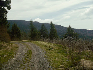
| The Trail is Mostly Gravel Roads |
The trail follows gravel service roads throughout most of the hike. I tried to follow the directions contained in my guide book, but they were somewhat confusing. I made a wrong turn at the first intersection, and ended up by the Lake Powatan dam. I managed to find my way back, and easily followed the indicated landmarks from then on.
 |
| The Hardtimes Trail |
I crossed a concrete bridge over a canal, and up the Hardtimes Trail. The trail gradually ascends on a gravel roadbed, passing a piped spring along the way. I paused for a pic of the spring, and also a concrete enclosure below the spring, which I surmised to be a former 'spring house'. The trail reaches the Blue Ridge Parkway, at that point intersecting the Mountains to Sea Trail.
 |
| Piped Spring |
 |
| A Former Spring House? |
I paralleled the parkway for a very short distance, before diverging from the MTS trail, and once again following a forest service road downhill. I stopped briefly for lunch at a log along the road. After resuming my hike, I passed through a fenced gate into the North Carolina Arboretum. The loop passes through the a large portion of the Arboretum.
 |
| Arriving At the Blue Ridge Parkway |
 |
| Gate Into the North Carolina Arboretum |
It being early in the year, there was not much in bloom. There were some nice side paths, benches, stream crossings, and bridges throughout the area. I passed by the National Native Azalea Repository: extensive exhibit containing many varieties of Azaleas. Most of the trail through here is on gravel road, but there are short, scenic alternative foot paths along Bent Creek.
 |
| Bridge Over Bent Creek In the NC Arboretum |
 |
| The National Azalea Repository |
 |
| A Pleasant Sit Spot |
 |
| An Alternative Trail Through the Arboretum |
I continued on another forest service road, and out another gate before finally ascending a hill back to my car in the Hard Times Trail parking lot. This was a relatively easy, but rewarding, little hike. Just be aware that this is a very popular trail, so do plan accordingly as trailhead parking may be limited.
 |
| Signs of Spring |
Saturday, March 21, 2020 - Cold Mountain - 9.8 miles
I was still searching for a more challenging hike in terms of distance, elevation change, and technical difficulty of the trail. I had thru-hiked the Art Loeb trail through the Pisgah National Forest in 2018, and remembered passing a spur trail to the summit of Cold Mountain. Cold Mountain, of course, was made famous by a novel (and subsequent movie) of the same name by Charles Frazier. I thought this would be an appropriate challenge,
 |
| Trailhead in the Daniel Boone Boy Scout Camp |
The trailhead in the Daniel Boone Boy Scout Camp is not far from my home in Waynesville, and also very near to where my daughter and grandson live. I left the house around 9:30 a.m. to drive to the trailhead. It was a sunny, cool day - very nice for hiking. The first part of the hike was mostly uphill. The trail intersects a forest service road, and there was no clear direction on which way to go. I made a guess to go left, which turned out to be correct.
 |
| Heading Up the Ridge |
The trail meanders alongside the ridge line for several miles, occasionally crossing hollows of moss covered rocks and streams. There are few blazes to be seen, but I eventually arrived at a gap in a clearing with scattered campsites. From my previous hike, I recognized this as the place where the Cold Mountain trail diverged from the Art Loeb Trail. I recalled a sign formerly being here, but the sign was now gone. I briefly visited with an older female hiker resting on a log before heading on.
 |
| View From the Ridge Line |
 |
| Stream Crossing |
I continued up the path to the left for a ways before stopping at a nice log by the side of the trail to eat lunch. A fast moving hiker from Gastonia paused to visit. We conversed about my plans to us day hikes in preparation for my continuing conquest of the Appalachian Trail. He was followed by three buddies who passed me on the way to the summit.
 |
| A Leaf Covered Trail |
 |
| A Nice Piped Spring Along the Trail |
 |
| View From Near the Summit |
The trail got a bit more challenging, steeper, and rockier as I approached the summit of Cold Mountain. There were great views to be had at the top. I chatted a bit more with the four male hikers. They were from different parts of North Carolina. I took a few pics before heading back, and also one of myself for posterity.
 |
More Views From the Top
(Above and Below) |
 |
| On the Summit |
I took a few pics on the way back to the trailhead. This was a GREAT hike, and good test in preparation for the AT.
 |
| View Of Cold Mountain From the Art Loeb Trail |
 |
| Arriving Back at the Trailhead |
Thursday, March 26, 2020 - Avery Creek Loop - 9.5 Miles
NC Hwy 276 runs from where I live in Waynesville through the Pisgah National Forest to Brevard, NC, transecting the Blue Ridge Parkway along the way. It's a very scenic route, with MANY hiking/camping opportunities along the way. It is also an easy drive from where I live. I decided to explore one of the longer loop hikes contained in my guidebook.
Since I am not completely familiar with all the side roads, I wanted to get an earlier start. The trailhead is off Forest Service Road, 477. This is a gravel paved road that actually has two entry points to 276. The first entry point was gated and blocked. I was a little worried that some others might be closed, as Corona Virus restrictions were beginning to take effect. I continued on to the second entry point towards the horse stables.
 |
| Forest Service Road 477 |
The road along Avery Creek was pitted and rough, and slightly longer than anticipated. there were. I passed many car campers in sites along the creek before finally reaching the horse stable parking lot close to the trailhead. The road was closed just beyond the stable, so I parked in the stable parking lot, and walked through the gate up the road about a quarter mile to the trailhead.
 |
| Avery Creek Trailhead off FS 477 |
I was grateful for the sunny and slightly warmer hiking weather as I arrived at the trailhead. The trail initially heads downhill through rhododendron tunnels to parallel Avery Creek for a mile or two. I crisscrossed the creek several times over primitive bridges before arriving at the intersection with the Buckhorn Gap Trail.
 |
| Rhododendron Tunnels on the Trail |
 |
| Avery Creek |
 |
| Crossing a Primitive Bridge |
I followed the Buckhorn Gap Trail along the creek. So far I had not seeing another soul. There is a spur trail to Twin Falls. Being a fan of waterfalls, and being able to take my time, I decided to head down for a look. I encountered another hiker on the way to the falls, but I had the whole thing to myself when I arrived. There are two high falls separated by a hundred feet or so and converging at the bottom - very impressive!
 |
| Buckhorn Gap Trail |
 |
| Twin Falls Spur |
 |
| Twin Falls (left) |
 |
| Twin Falls (right) |
After taking a few pics, and retraced my steps to the Buckhorn Gap Trail, which takes a turn to the right away from the creek to ascend the ridge. I climbed for sometime before arriving at Forest Service road 5058. I observed several mountain bikers on the road ahead of me. The trail follows the road, then back into the woods, then recrossing the road at the intersection with the Black Mountain Trail. I greeted the mountain bikers who were pausing here for lunch.
 |
| The Buckhorn Gap Shelter |
 |
| Mountain Bikers Heading up the Ridge in Front of the Shelter |
I continued on the Black Mountain Trail up ridge, and decided to stop at the Buckhorn Gap Shelter along the trail for lunch. Resting in the shelter gave me a feeling of nostalgia for the AT, where I often take lunch in shelters on my extended hikes.
 |
| My Nutritious Lunch |
After lunch, I continued up Soapstone Ridge, passing a slightly obscure view of Looking Glass Rock to the left. I encountered two day hikers at the intersection with the Barnett Branch Trail. They were practicing social distancing due to the virus and were surprised to see me. They also lived in Waynesville, and usually hiked with a regular group that was now inactive.
 |
| Continuing Uphill on Soapstone Ridge |
 |
| Looking Glass Rock from Soapstone Ridge |
I climbed over a peak, passing two mountain bikers on the summit. I continued downhill to Club Gap, where the Avery Creek trail once again intersected the Black Mountain Trail. The trail was well worn by mountain bikers. I came down to the creek, this time passing on the left side until arriving at the trailhead on FS Rd. 477. This was a good day hike, and with the shelter area, would also make a relatively easy overnight trip.
 |
| Another Crossing of Avery Creek |
 |
| Avery Creek |
Thursday, April 2, 2020 - Stradley Mountain Loop - 8.3 miles
This is another case where I ad initially intended to hike a different trail, but ended up on this one. I had originally intended to drive to the familiar area of Montreat, NC, to do hike to Greybeard Mt. I knew the possibility existed that the trails would be closed due to the virus, but decided to chance it anyway. Well, no surprise, the trails were closed. I looked for other possibilities close by, but the only other one in Black Mountain was also closed. I decided once more to check the Pisgah National Forest, and found another trail starting (Stradley Mountain) starting off Bent Creek Road opposite the Hardtimes loop I had done several weeks earlier.
 |
| Bent Creek Trailhead |
 |
| Paved Trail to Begin |
The road to the trailhead parking lot was closed, so I parked on the Bent Creed Road. I could tell these trails were popular with mountain bikers, as there were other cars parked, and some bikers apparent. I walked past the gate, and down the parking lot access road to the trailhead. The initial trail is paved downhill and across a creek up to where the former Deer Lake Lodge once stood. This was a private lodge, which had been turned over to the forest service before falling into disrepair, and being torn down. I noticed an interesting little door on the side of a tree to the side of the trail - maybe the hope of a chipmunk or a Keebler elf. I knocked, but no one answered! :-)
 |
| Bridge Over Wolf Branch Creek |
 |
| A Very Small Ladder and Doorway |
I briefly took a turn on the wrong trail. Passing bikers directed me back, and I continued on the Wolf Branch trail, crossing several creeks along the way. I took a right turn at the Ledford Trail which eventually ascends to follow Forest Service roads, 479 and 491. The climb up Stradley Mountain was easy with frequent switchbacks. Trails through this area are part of the Bent Creek Experimental forest
 |
| Following a Forest Service Road |
 |
| Experimental Forest |
 |
| Some Kind of Experiment on Stradley Mountain |
I crossed over the top of Stradley Mountain, and stopped for lunch at the gap known as "4 corners", for the intersection of four trails. A couple mountain bikers and one solo hiker came by as I was eating. I took the far left trail, 'Ingles Field Gap', which descends steeply, obviously worn and well-used by mountain bikers.
 |
| View From Stradley Mountain |
 |
| Lunch at "4 Corners" Gap |
I reached Ledford Gap, and continued downhill on Forest Service Road 479E. There were informative and interesting signs along the way describing particular areas of experimentation with particular tree growth, and research on control of invasive species. I enjoyed stopping along the way to read many of these signs.
 |
| Ledford Gap |
I reached the base of the hill and paralleled a creek until reaching the parking area at Ledford Branch and Bent Creek Roads. I crossed the parking lot to the Deer Lake Lodge Trail passing through a nice shaded evergreen forest and back to my starting point
 |
| Deer Lake Lodge Trail |
 |
| A Cool Evergreen Forest |
Thursday, April 9, 2020 - Looking Glass Rock - 6.2 miles
After every hike, I scan my book for other possibilities in my area. Highway 276, which traverses the Pisgah National Forest between Waynesville and Brevard, is relatively close to home, and offers multiple attractive day hiking possibilities. I am looking for more a challenging climb, and decided on Looking Glass Rock. I had viewed this massive granite rock outcropping from a distance on a previous hike, and thought it to be a worthy objective.
 |
| Looking Glass Rock Trailhead |
Looking Glsss Rock is popular with both hikers and rock climbers alike. The trailhead is accessible off Forest Service Road 475, which intersects Highway 276. Because of the Coronavirus pandemic, I am becoming a little concerned about possible side road closures, but access to this area was still open. It was a beautiful, cool day to hike, and I reached the trailhead parking lot around 10:30 a.m. I was pleased to find no other cars. The trail ascends wooden steps to begin following a creek to the right.
 |
| A Step Climb to Begin |
 |
| Creek to the Right |
The trail gently ascends to the left of the creek before turning away and heading uphill. The climb up is not bad, with many switchbacks. There are a few nice views at various points.
 |
| A Well Used Path |
 |
| Climbing Through Tunnels of Mountain Laurel |
My guidebook indicated that there was a hospital Helipad on a wide rock area. This apparently is to transport injured rock climbers from the mountain. I viewed and passed it on my left before continuing my climb.
 |
| Helipad Near the Summit of Looking Glass Rock |
 |
| The 'H' for Hospital and/or Helipad |
 |
| Trailside View |
The trail continues to ascend, but flattens out as it reaches the crest of the ridge. The is wide space with sitting spots near the summit. A sign here warns of the dangerous dangerous cliff just a bit further down the trail. The book stated that people here had slipped to an unhappy end, so I was extra cautious to stay far away from the edge. The rock face was sloping downwards. If it had been raining or wet, this would have been very treacherous indeed. There were terrific views from the cliff.
 |
| Warning Sign |
 |
Views from Looking Glass Rock
(above and below) |
 |
Interesting Wildflowers On Descent
(above and below) |
I headed back to the summit clearing to sit down for lunch and write in my journal. I hadn't seen a soul all morning, but I encountered many hikers on the trip back to my car. I was glad I had arrived early enough to avoid the crowds, glad for the opportunity to hike to this iconic spot before the trail was closed due to the pandemic.
Thursday, April 16, 2020 - Coontree/Buckwheat Knob. 9.2 miles
Because of the Covid-19 pandemic, the national forest service in North Carolina had closed some of the popular trails in the Pisgah National Forest. I downloaded a list of affected trails and checked it against my guidebook. I found the Coontree Trail and Buckwheat Knob, neither of which were on the list, and decided to go. This trail is located along Highway 276 in between Looking Glass Rock and Avery Creek, both of which I had already completed.
 |
| Heading along Highway 276 to the Trailhead |
The trailhead is located across the road from the Coontree Campground entrance which was blocked. I parked in a pullover about a quarter of a mile from the entrance. It was a nice, cool day to hike. The route is what is called a 'lollipop', meaning a out and back with a circle at one end or the other. In this case, the Coontree Loop Trail is near the trailhead, with long stem trails leading to Buckwheat Knob beyond it.
 |
| Coontree Loop Trailhead |
 |
| Bridge Crossing |
The trail follows the left side of the creek before crossing on wooden bridge. I passed a rock overhang along the trial above the creek before recrossing the creek, and climbing Coontree Mountain. There were many switch backs along the way, some flat and some steep, with small stream crossings.
 |
| Overhanging Rock |
 |
| Pretty Spring Wildflower |
As I approach the ridge line, I caught my first glimpse of Looking Glass rock to the left. I reached a Rocky area further on, with excellent views of the Davidson River and Avery Creek valleys. After this, the trail descends to Bennett Gap, passing through a mowed field Wildlife Management area. I crossed Forest Service Road 477.
 |
| Rocky Ascent |
 |
| Looking Glass Rock From Coontree Mountain |
 |
| Wildlife Management Area |
 |
| Colorful Flowers |
The trail climbs over several 'false summits' on the way to Buckwheat Knob. I was looking for landmarks to indicate my location, but completely missed the actual summit. I still wasn't sure until I reached the Avery Creek Trail intersection, and recognized it from my hike of several weeks prior. I backtracked to a nice rock chair, where I decided to take lunch.
 |
| Lunch Chair |
I continued back the way I had come, taking the left end of the Coontree Loop trail to the trailhead.
I crossed Coontree Creek on a log bridge, and saw interesting wildflowers blooming all along the route. This was very nice and rewarding hike.
 |
| Log Bridge Creek Crossing |
Thursday, April 23, 2020 - Devil's Courthouse out and Back- 7.0 miles
So far, I had explored a few of the hikes along Highway 227 towards Brevard in the Pisgah National Forest. There is another highway, Highway 215, heading in the opposite direction, which also has MANY great opportunities for day hiking. I wanted a longer, more challenging hiking experience, and decided on the Sam Knob Loop. Rather than a loop, this hike was a shorter out and back because of an impassable stream.
 |
| A Rainy Wet Trail |
The weather was not ideal for hiking. It was cold and rainy. I briefly considered not going, but I needed and wanted to have experience hiking in different weather conditions, much as like I might experience in the White Mountains in June. The access to the trailhead off of the Blue Ridge Parkway was closed, but I found that could access the part of the loop as the Mountains to Sea Trail crosses 215. I collected my gear, and headed out. I drove up the winding road in a driving rain past Lake Logan. The rain subsided as I ascended up through the clouds towards the entrance to the BRP.
 |
| Creek Crossing |
There were very few cars on the road. I reached the pull-off just up from the trailhead, and just below the entrance to the parkway. I headed up the steps on the MTS trail, and climbed steadily for the first mile or two. The trail was soggy and wet, with additional scattered patches of snow. I carefully made my way up.
Not another 'crazy' soul on the trail today, although it is well worn. I crossed a creek, and passed through a nice area of spruce forest. There was an interesting log structure, with a fire ring in front of it.
I arrived at the intersection with the Little Sam
Trail, and took a left. The trail follows a ridge line, but was all clouded in, so no views. I did pass old large iron cables on the path, which I found were used in previous logging operations. This entire area had once been logged for the local paper industry. I arrived at a turn in the trail which led downhill to a creek crossing. The creek was flowing intensely, and I couldn't see any easy way across.
 |
| Little Sam Trail Intersection |
 |
| End of the Line for This Hike |
I decided to call it a day, and backtracked the way I had come. I would return in a couple weeks to do the entire loop. On the way back to my car, I stopped for lunch at the interesting log structure. This was a shorter hike than intended, but still good to be out.
 |
| An Interesting Bit of Trailside Brightness |
Thursday, April 30, 2020 - Nantahala National Forest - Junaluska/Hikory Knob Trails - 6.0 miles
For the second week in a row the weather was not good. Having gone to several of the open trails in the western Pisgah NF, I decided to look for something a little farther afield in the Nantahala Forest. This area is less popular, and the none of the trails had been closed to hiking. I decided I would try the Appletree Loop.
 |
| Trailhead Near the County Line |
To get to the trailhead, I drove through an area I am somewhat familiar with, down highway 19 in the Nantahala River valley. I passed the Nantahala Outdoor Center, where the AT crosses, and where I had stayed on one of my earlier AT adventures. I turned left on Wayah Road, ad traveled traveled through a scenic area of whitewater rapids. The trailhead is off Junaluska Road close to the border of Macon and Cherokee Counties.
 |
| London Bald Trailhead by Junaluska Road |
The weather, again, was not ideal - wet and cold, but I was determined to make the most of it. I had become accustomed to the well-used and marked trails in the Pisgah NF, which these trails were mostly not. My route began on the London Bald Trail, then took an immediate right turn on the Junaluska Trail, which was indicated to follow the road to the Appletreee Group Campground.
 |
| Bushwhacking Rhododendron Thickets |
It was a mess, walking along an obscure trail, with many blowdowns, along with tricky creek crossings. In one section, the only noticeable trail marking were occasional pick ribbons. After a few miles of bushwhacking, I intersected a roadbed, and came upon a clearly marked orange double blaze trail up the hill to the left. The Junaluska Trail is blue blazed, so I continued on down to the road. This was incorrect, so I backtracked to a small blue ribbon indicating the trail. I followed it until it became very difficult to go further. I decided to head up the orange blazed trail, as there were two trails on my map that appeared to cut across the loop.
 |
| Challenging Trail Conditions |
I took the orange blazed trail to be the Diamond Gap Trail. The trail was initially clear, heading up a draw, crossing a creek, and then up a mountain towards the gap. It was a fairly steep climb, with a few switchbacks, but not too difficult to negotiate. I reached the gap, with peaks to the left and right. The blazes stapped and no indication of trail direction.
 |
| Two Mile Road Walk |
 |
| A Welcomed Sight! |
I continued on a short distance, but once again, the trail became impassable. I retraced my steps, and took lunch on a peak to the right of the trail. If the weather had been nicer, I may have decided to explore more, but I made the decision to head back down to the Junaluska Trail intersection. From there, rather than bushwhack back to my car, I hiked to the road and walked two miles back to where I had parked. I will likely return to this area to attempt this hike in nicer conditions.
Thursday, May 7, 2020 - Pisgah National Forest - Sam Knob Loop - 10.6 miles
After two weeks of bad weather and shortened hikes, today was a very nice day. I decided to revisit the area of the Pisgah National Forest I had visited two weeks prior. That hike had been hampered by rain, fog, and finally an impassable stream. I drove up Hwy 276 to the trailhead with the Mountains to Sea Trail. My goal was to do a big loop in the Shining Rock Wilderness. It was a clear morning as I hiked up to the ridge near Devil's Courthouse, so named for it's appearance from a distance of a face turned skyward.
 |
| The MTS trailhead off Highway 215 |
There were small patches of snow on the ground as I climbed. I saw no other hikers at the beginning of the day, with the exception of couple who appeared to be long-distance MTS trail hikers. I continued south on the Little Sam Trail along the ridge line. There were a few nice views along the way. I easily crossed the stream that had been impassable before. The tree cover began to thin, and I had some very good views of the ridge ahead and Sam Knob to the left.
 |
| Little Sam Trail Intersection |
 |
| Crossing A Formerly Impassable Stream |
 |
| View of Sam Knob |
I arrived at the Sam Knob parking lot along a closed section of the Blue Ridge Parkway. I stopped to eat lunch and consult my map. I knew I needed to take the trail to Sam Knob, but there were confusing trail markings. I briefly went down the wrong trail, before backtracking and locating the correct one to the right of the closed rest rooms. The trail goes down a series of wooden steps to a gap before intersecting the trail to Flat Laurel Creek. There was an excellent view of Sam Knob ahead. I would be taking the trail to the summit.
 |
| Sam Knob Parking Lot |
 |
| Wooden Steps to the Base of Sam Knob |
I took the trail to the right heading to the summit of Sam Knob. The climb is graded well, with switchbacks, and even steps built over a particular steep and rocky area. As I wound my way to the top, I could look below and to my left to see Flat Laurel Creek and the trail leading to it. I also had views of the Devil's Courthouse in the distance. There are actually two peaks on Sam's knob, with the norther peak being the higher of them. I passed a huge white granite quartz outcropping. This is the predominant rock in the area that gives "Shining Rock" it's name.
 |
| View of the Gap Below, with Devil's Courthouse (center distance) |
 |
| An Example of 'Shining Rock' in the Shining Rock Wilderness |
I hiked to the peak of Sam Knob. The views were magnificent, and I took a few pics in different directions. There were no other people at the summit. I returned to the intersection with the Flat Laurel Creek Trail, and proceeded downhill to the gap. I crossed the creek on rocks, and noticed many campsites in the vicinity.
 |
Views From Sam Knob
(Above and Below) |
 |
| Crossing Flat Laurel Creek |
After crossing the creek, the Flat Laurel Creek Trail follows an old railroad be for some distance. I paralleled the creek in the gap between Little Sam and Sam Knob. There were many visible campsites along the creek, along with whitewater areas. The former railroad was used to transport logs for the local paper industry. The trail goes around north end of Little Sam, traversing the east ridge back to Highway 215. I crossed a concrete bridge, with a nice waterfall to the left.
 |
| Sam Knob From the Gap |
 |
| Flat Laurel Creek Trail |
 |
| Waterfall Next to Concrete Railroad Bridge |
 |
| Small Falls Near the Road |
I encountered more day hikers as I approached the highway, and also saw evidence of campers along the creek. When I reached the highway, I walked to the left a third of a mile or so back up to where I had parked. I must say, this is one of the nicest day hikes I have done so far.
 |
| Walking Back to My Car on Highway 215 |
Thursday, May 14, 2020 - Mt. Mitchell State Park - Camp Alice Loop - 4.5 miles
The North Carolina State Parks, which were temporarily closed because of the virus, have now been reopened. I checked online to make certain that the trails in Mt. Mitchell SP were also open, and that the Blue Ridge Parkway through the area was accessible. I decided to make the trek to Mt. Mitchell, the highest point east of the Mississippi, to hike the Camp Alice Trail Loop. This was not a long hike, but had some strenuous sections with good views.
 |
| CommissaryTrail |
I arrived at the Park Visitor's Center just inside the gate and parked my car. The hike begins on the CommissaryTrailhead, which is located just behind the building. A sign indicated portions of the trail still being closed, but I assumed this was because the signs had not yet been removed. The trail follows an old forest road for the first mile or so. It was downhill initially, with good views of the mountain and gap ahead.
The Commissary Trail intersects the Camp Alice Trail, and I could see the road in the distance coming in from the east. Also, visible to the left was the State Park restaurant. I reached the gap and followed the signs into the woods to the left along a creek.
 |
| Mt. Mitchell Ahead |
 |
| Approaching the Camp Alice Trail |
 |
| Camp Alice Trail Intersection Sign |
I headed through the woods, with a gradual climb until I reached the Old Mitchell Trail. The trail to the left traverses the ridge line past the restaurant, and eventually to the visitor's center, where I had parked my car. This is the trail I would be taking on my return to close the loop. To the right, the Old Mitchell Trail proceeds to the summit of Mt. Mitchell.
 |
| Heading Uphill Through Pine Forest |
Thursday, May 21, 2020 - Montreat Wilderness - Greybeard Mt. Loop - 9.7 mileMontreat, NC, is a place I am very familiar with, and have been there countless times. It is the home the Presbyterian College, and the Presbyterian Church USA Conference center. I worked for many years in a PCUSA church, and often took church-wide and small retreats there. I've also attended the Summer Worship and Music Conference on many occasions.
 |
| Trailhead Parking |
 |
| Many Stream Crossings |
Montreat, the name of which comes from an elision of two words, mountain and retreat, is situated in a bowl shaped cove between two ridge lines. It has many hiking trails, some more strenuous than others. Greybeard Mountain is one of the high peaks on the northern side of Montreat. I had hiked it with a church group on one other occasion.
 |
| First Bridge Crossing |
 |
| Trail Sign |
I drove to the trailhead on Assembly Drive, across from the Nature preserve. The trail to the peak initially follows and criss-crosses a stream. The enclosed Walker Ridge Shelter is located near the summit. The trail intersects the West Ridge trail which follows the western side of the of the Montreat Bowl. The weather was overcast, so there were no views to be had unfortunately. I did pass a nice waterfall on the return.
 |
| Lunch at the Shelter |
 |
| West Ridge Trail Intersection |
 |
| Beautiful 'Orchid-Like' Flower |
 |
| Waterfall On the Way Back |
Thursday, May 28, 2020 - Dupont State Forest - Five Waterfall Loop. - 11.2 Miles
The Dupont State Forest had previously been a private forest/retreat area for the Dupont Corporation. It is now a public forest, containing many hiking trails, and a preponderance of very fine waterfalls. This is probably what makes it the most visited forest in the state of North Carolina. I was a little familiar with it, having visited for a group run once before. It is near Brevard, and very easy to get to from my home in Waynesville heading down Hwy 276.
 |
| Trail Detour |
 |
| Easy Path For the Most Part |
 |
| Nice Flowering Trees |
I left early and arrived at the parking area on Staton Road, which I recognized from my prior visit. the five falls on the loop are Hooker Falls, Triple Falls, Grassy Creek Falls, High Falls, and Wintergreen Falls.
 |
| Triple Falls |
 |
| High Falls |
 |
| Covered Bridge |
 |
| Grassy Creek Falls |
 |
| Wintergreen Falls |
 |
| Peaceful Lake Imaging |
I also crossed a covered bridge, and ate lunch by Lake Imaging, a small man-made lake. There are a warren of trails in the Dupont, so it is easy to get off track, but the good thing is, they all connect at some point. It was an enjoyable hike over mostly easy terrain.
Thursday, June 25, 2020 - MTS Trail - Lane Pinnacle - 10.0 miles
The
Mountains to Sea Trail is a long distance trail traversing the width of North Carolin, from the Smokies to the coast. Some of the trail is over roads, and some through forests. The trail around Asheville parallels the Blue Ridge Parkway. I made my way to the trailhead southeast of Asheville on Ox Creek Road near milepost 375.6 on the BRP. It was a clear day for an out and back hike.
 |
| Smooth Trail at Trailhead |
 |
| Occasional Views |
The trail travels basically up for five miles to Lane Pinnacle. I past the site of the former Rattlesnake Lodge, built in 1903 as the summer retreat for Asheville physician and naturalist, Dr. Chase Ambler and his family. The lodge was destroyed by fire in 1920, but evidence of its former glory still exists.
 |
| Rattlesnake Lodge Retaining Wall |
 |
| Another Remnant |
There are not many views on the way up, but the view from the pinnacle is spectacular, with the Beetree Reservoir visible in the distance. Part of the trail follows a former road to the Rattlesnake Lodge, so the hiking is not difficult through this section.
 |
| View from Lane Pinnacle |
 |
| Parkway Visible |
Friday, July 3, 2020 - Green River Game Lands Loop - 9.4 milesI decided to take a slightly longer trip to the Green River Gorge today. I had driven through the area many times on I-26, but had never stopped. It seemed like a rather long drop down to the river from the interstate, and I thought it would be a good place to explore. The trail begins in the game lands near Saluda to the east off of exit 59. I drove down the twisty road to the parking area on Green River Cove Road.
It is necessary to hike several trails to complete the loop. The initial path is a gravel road before taking the Turkey Gut Trail and descending to the river. I saw no hikers at first, but encountered more as I approached the river. I was unable to take any pics, as my camera batteries were running out. It is a long, steady, and occasionally steep descent to the Green River Cove Trail. At this point I could see the river, and also people tubing in it. My guide book indicated some intense kayak runs further upstream.
The Green River Cove Trail parallels the river for some distance. I passed the intersection of the Pulliam Creek Trail to arrive at a sandy beach area, where I stopped to rest for lunch. I backtracked to the Pulliam Creek Trail heading away from the river back to Green Cove River Road, where I headed to the right for a mile or so to complete the loop. This was pleasant hike, with some nice river/falls spots along the way.
Thursday, July 9, 2020 - Montreat Wilderness - Pot Cove Loop - 6.5 miles
I love Montreat, and always love explore the trails there. I parked in the parking lot by Anderson Auditorium, just off of Lookout Road, and walked down Greybeard Trail Road. The Walker C. Jones Wildlife Sanctuary is directly across from the Trailhead, so I decided to make the short loop around it before heading up the Graybeard Trail, which is marked by blue diamond blazes.
 |
| Walking Past Lake Susan |
 |
| Walker C. Jones Wildlife Sanctuary |
 |
| Loop Around the Lake in the Wildlife Sanctuary |
I took another short loop through the Bell Forest on Harry H. Bryan and Julia Woodward trails to small waterfall, which was nice.
On my hike to Greybeard Mt. this past May, I followed the Greybeard Trail until it intersects the Old Trestle Rd. and Old Mitchell Toll Road trails at Pot Cove. Legend has this that a pot formerly hung in a tree here to remember the spot where a railroad worker had died. The pot is no longer there, but the railroad bed is now a well-used trail. At Pot Cove, I followed the Old Mt. Mitchell Toll Road around the Preimeter of the Montreat Grounds to Appalachian Way, and back down on paved roads back to my car.
 |
| Sign at the Pot Cove Gap |
 |
| View Off the Old Mitchell Roll Road Trail |
Thursday, August 13, 2020 - Great Smoky Mountains NP - Boogerman Trail - 7.5 miles
For some strange reason, I have been avoiding hiking in the Smokies, even though the park is very convenient. I decided this day to do a hike in the closest section of the park from where I live, the Cataloochie area of the southeast section of the park. A thriving community of settlers once existed here, and the Boogerman Trail is a named for one of them, John 'Boogerman' Palmer. Palmer was a rather eccentric individual who, as legend has it, earned his nickname for his odd behavior in school. He lived alone, and vigorously resisted the encroachment of lumber companies on his land. Thus, the area of the trail through his former property, contains some spectacular examples of old growth forest.
 |
| Crossing Caldwell Fork at the Trailhead |
The way into the park from my house was a very easy drive down Hwy 276 through Jonathon Valley, and up Cove Creek Road. Much of the road is dirt gravel. I arrived at the Caldwell Fork trailhead parking lot just past the campground, and headed up the Caldwell Fork Trail, which is also a horse trail.
 |
| The Trail is Wide at the Beginning |
 |
| Paralleling the Creek |
I soon came to the intersection of the Boogerman Trail, which travels up Den Ridge, and into the area of the former Palmer Homsesite. I passed through the old growth forest, along with evidence of former habitation, and an interesting hollow poplar trail alongside the trail.
 |
| Well-Marked Trail Signs |
 |
| Evidence of Human Habitation |
 |
| A 'Stand-Up' Poplar |
The Boogerman Trail reconnects with the Caldwell Fork Trail to complete the lollipop loop hike. There were MANY unbridged creek crossings on the return trip. There was nothing to do but ford these creeks, once in almost hip deep water. I got somewhat wet, but was able to dry off. Despite this challenging inconvenience, my first day hiking foray into the Great Smoky Mountains National Park was a success. The trails were well marked, and I didn't see another soul the entire day.
 |
| Shedding My Boots at the First Stream Crossing |
 |
| Typical |
Thursday, August 20, 2020 - Great Smoky Mountains NP - Mt. Sterling - 13.5 miles
My first venture into the GSMNP was so good that I decided to stick with it this week. The hike to Mt. Sterling can happen in several different ways, but it is so simple to get to the Cataloochie valley from my house, that I went to it from that direction. I traveled down a rugged dirt road (old NC 284) that used to be a main thoroughfare through the area. Now, it seems to be very rugged and remote, which is just the sort of adventure I love to find. This would be my longest day hike so far, and I was excited to do it.
 |
| Sign at the Trailhead |
 |
| Gate by Hwy. 284 |
I parked by the gate at the Little Cataloochee Trailhead. The initial hike is on another old road for a mile to the intersection with the Long Bunk Trail, which heads to Mt. Sterling. Close to the intersection is the Hannah Cemetery, an important family in the Cataloochee Valley. The descendants of the families who inhabited the area before its incorporation into the park, return for reunions, and to maintain the cemeteries.
 |
| Bridge Crossing on the Little Cataloochee Trail |
 |
| Longbunk Trail Intersection |
 |
| Passing the Hannah Cemetery |
The trail becomes narrower and more rugged as it follows a creek uphill. At 4 miles, I turned left on the Mt. Sterling Trail. This was a wider, but rock trail up the mountainside. It was also a horse trail, and I saw evidence of recent horse traffic.
 |
| Entering the Woods |
 |
| Creek Crossings |
 |
| Generally Good Signage in the Smokies |
The trail continues up steeply. As I approached the summit, I encountered a team of rangers surveying some of the trees in the area. At the summit, I encountered a woman from Kentucky and her grandson, who were traveling on horseback. We conversed a little before I sat down by a fire ring to eat lunch. There is an old fire tower on the summit of Mt. Sterling, but since it was now raining and the mountain fogged in, I decided not to explore it.
Thursday, August 27, 2020 - Great Smoky Mountains NP - Hemphill Bald - 9.5 miles
I am so much enjoying hiking in the GSMNP - mostly for the feelings of solitude that I crave so much. This hike was in a slightly different area, right along the southern boundary of the park. It was an out and back to the top of Hemphill Bald, beginning at Polls Gap 6.2 miles off the Blue Ridge Parkway.
 |
| At the Trailhead |
 |
| Woodland Color |
 |
| Split Rail Fence along the Park Boundary |
The trail goes gently uphill on the edge of the park, climbing more steeply up Little Bald Knob, with some good views at the top. It descends to a grassy area below Little Bald before beginning the climb up Hemphill Bald at about 4 miles. The private Cataloochee Ranch is just to the right. This ranch was founded in 1933 by Tom and Judy Alexander. It now serves as a conservation easement to the encroachment of development.
 |
| On the Climb |
 |
| From Little Bald Knob |
 |
| Ascent to Hemphill Bald by Cataloochee Ranch |
I came to a fenced in picnic area near the summit of Hemphill Bald. There is a stone picnic table, with a memorial plaque to the Alexanders. A few cows were lying down within the fenced area as I sat down for lunch, enjoying the marvelous 180 degree vista, and views of many well-known peaks to the east.
 |
| At the Summit of Hemphill Bald |
 |
| My Lunching Spot |
 |
| Grazing Cattle On Hemphill Bald |
Tuesday, Sept. 1, 2020 - Great Smoky Mountains NP - Deep Creek Loop - 13.4 miles
I drove a little farther today to enter the Smokies near Bryson City. I forgot my camera, so unfortunately no pics for this hike, but I hope that this brief description will adequately describe it. Deep Creek is a popular area of the GSMNP near Bryson City. The creek, which flows out of the park, is a very popular place for tubing. There is also a camping area near this entrance to the park.
I parked in a lot at the far end of the campground, and proceeded down the trail for a long loop hike.
The initial trail travels along the creek over a wide forest service road. There are several side trails to waterfalls at the beginning. I stayed on the Deep Creek Trail past campsites, and considered this as future introductory overnight backpacking possibility with my grandson. The hike was gently uphill over a well-marked trail paralleling the creek for some distance. There are some options for a shorter hike.
The trail heads away from the creek at about 5 miles. I stopped for lunch at campsite 57, where the Martins Gap trail intersects. At this point, I took the Martins Gap Trail which climbs to Martins Gap at about 7.5 miles. There is a four-way trail intersection here with the Benton MacKaye, MTS, and Sunkota Trails. I remained on the Martins Gap Trail heading downhill to the Indian Creek Trail. I took a slight detour to view Indian Creek Falls along the way, and came back to the Deep Creek Trail to close the loop. At this point, I began to encounter people carrying tubes up the trail to run the creek.
This was a longish hike, but a good one in many ways. I did suffer with chafing from my day pack, which is not an expensive one. I will probably need to upgrade at some point, but I have really learned to love the hiking opportunities in the Great Smoky Mountains National Park!
Tuesday, Sept. 8, 2020 - Pisgah Ntl Forest, West District - Cat Gap Loop - 8.3 miles
This hike was back in familiar territory in the Pisgah Forest. It starts at at the parking area for the Pisgah Center for Wildlife Education and Fish Hatchery on FS road 475 off of Hwy 276. The hike begins on the Cat Gap Loop Trail with orange blazes, crossing Cedar Creek and beginning to climb. At 2.2 miles it reaches Cat Gap, and intersects an 'old friend', The Art Loeb Trail. I became a little confused here, and briefly went the wrong direction, but soon realized my mistake and turned around.
 |
| Bridge Over Cedar Creek |
 |
| Trail Signage |
The Art Loeb Trail and the Cat Gap Loop Trail parallel each other for a short distance, and I continued on the Art Loeb Trail, passing a few campsites, before getting my first glimpse of the massive Cedar Rock to my right. I remembered passing this spot heading the opposite direction on my AT year nine prep. hike. I then began to descend, sometimes steeply, past and around Cedar Rock.
 |
| Campsites |
 |
View of Cedar Rock
(Above and Below) |
The trail veers to the left and passes the A-Framed, Butter Gap Shelter, where I stopped for lunch. After lunch, and not far from the shelter, I proceeded down the Butter Gap Trail. The trail parallels Grogan Creek, and reconnects with the Cat Gap Loop Trail where I made a left turn.
 |
| Butter Gap Shelter on the Art Loeb Trail |
I made a slight diversion at 7.4 miles to view the scenic, Cedar Rock Creek Falls, and traversed a small open field on the site of a former homestead. The road widens, and I came to the Fish Hatchery research area and FS road 475 to conclude the hike.
 |
| Small Open Field |
 |
| Cedar Rock Creek Falls |
Monday, Sept. 14, 2020 - Appalachian Trail - Max Patch to Lemon Gap - 11 miles
Whenever I hike a trail I have hiked before, it seems like greeting an old friend. The Appalachian Trail will always have special place in my heart. Today, I decided to hike a section of it beginning at one of the most beautiful and iconic spots on the entire trail, Max Patch Bald. It is not an extremely long drive from my house, but the much of the road up is rough and worn. I found the parking lot, and headed down the access trail to connect with the AT.
 |
| Access Trail from the Parking Lot |
 |
| A Little Brightness |
 |
| An 'Old Friend' |
Being on the AT was a bit of a nostalgic trip for me. It had been early summer when I had hiked it before, and there were MANY ripe blackberries on the trail. I didn't encounter any other hikers in the first part of the day. Max Patch is maintained as an open bald, with 360 degree views at the top. There was a bit of fog in the coves below as I crossed over.
 |
Heading Up Max Patch
|
 |
| Fog In the Coves |
The other end enters the woods. I soon crossed paths with a very vocal hiker, who was loudly singing as he came down the trail. I went through a rhododendron tunnel near a creek below Max Patch, and came to the intersection with Buckeye Ridge Trail for horses.
 |
| A Rhododendron Tunnel |
 |
Intersection with the Buckeye Ridge Horse Trail
|
The AT makes a left turn and continues to descend through woods. I passed the Roaring Fork Shelter, which I remember camping next to on my previous AT section hike.
 |
| Roaring Fork Shelter |
I continued through and around many coves and switch backs until I arrived at and obvious campsite, supposedly the site of a former shelter. A short distance beyond this is the dirt road and parking area of Lemon Gap. I returned the way I had come, stopping for lunch at the campsite on the way back.
 |
| Glimpse of My Car From Max Patch |
Thursday, Oct. 8, 2020 - Mountains to Sea Trail - Mount Pisgah - 5.7 miles
I decided to finally hike one of the most recognized peaks in western North Carolina, Mt. Pisgah. This was an out and back hike, with a slight extension the opposite direction on the Mountains to Sea Trail. It was a shorter hike than most of my recent ones, but the climb to the summit compensated. The trailhead is just past the Pisgah Inn in the Mt. Pisgah Parking Lot. I started on the Mt. Pisgah trail.
 |
| Mt. Pisgah From The Parking Lot Below |
The trail is wide and flat initially before beginning the climb. It becomes rocky and steep in places towards the top, and I began to see other day hikers. There s a wooden observation platform on the summit, and along with a large broadcast tower, which was being worked on. I understand there was an unsuccessful effort to have this tower removed at one point. Still, there were wonderful views to be had as I sat dow to rest.
 |
Views From The Observation Deck
(Above and Below)
|
 |
| Broadcast Tower |
I returned the way I had come, and continued on the Mountains to Sea Trail back at the parking lot intersection. This trail took me Over Buck Springs Gap to the site of the former, Buck Springs Lodge, a summer retreat of George Vanderbilt. Only remnants of the foundation remain, but the original spring house remains intact.
 |
| Lunch View |
 |
| The Buck Springs Lodge Springhouse |
I had lunch at a marvelous viewpoint near the area, before continuing on to the summit of Little Bald Mountain. There were a few more good views before I retraced my steps back to my. This was a nice little hike, with good weather.
 |
| From Little Bald Mountain |
Friday, Oct. 30, 2020 - Mountains to Sea Trail - Folk Art Center - 9.3 miles
The Mountains to Sea Trail travels from the Smoky Mountains all the way to the Carolina Coast. Much of the section in Western North Carolina parallels the Blue Ridge Parkway. I usually hike alone, but I've often missed having conversation, so invited a partner from my church, Matt, to hike a section of the MTS trail from the Folk Art Center off the BRP just outside of Asheville. Matt had another engagement in the early afternoon, so we needed to begin hiking early.
 |
| From Haw Creek Overlook No. 1 |
I departed from Waynesville around 7 a.m. to arrive at the Folk Art Center by 8 a.m.. I arrived a little early, and walked around a little to scope out the trail as I waited. The MTS trail actually goes right through the Folk Art center complex area. This was intended to be a short 4.9 mile out and back hike on the MTS trail, with a turning point at the Haw Creek Overlook off the parkway. We enjoyed the conversation, and I was also a little complacent in checking the map and distance, so it ended up as a much longer hike.
 |
| From Haw Creek Overlook No. 2 |
Matt arrived, and we started up the trail shortly after 8. It was an overcast day on the cool side, but not bad for hiking. I am always interested in testing my all-weather gear that I might be using on the AT. We hiked north and completely missed the short side trail down to the Haw Creek Overlook. I noticed it, but it seemed too early, and I didn't even bother checking my map. We had a few climbs, as well as a few blow downs to contend with, but the hike was mostly on even terrain.
 |
| From Haw Creek Overlook No. 3 |
I began to suspect that we had passed the turn around point. We finally inquired of another hiker, who confirmed that we had indeed gone too far. We hiked back the way we had come, and stopped at the Haw Creek overlook for pics. I had so much fun conversing that these are the only pics I got the entire day. Oh well, this was a good and relatively easy trail to hike.
 |
| The Haw Creek Overlook |
Thursday, Nov. 5, 2020 - Shining Rock Wilderness - 10.1 miles
I love this entire area. I had done other day hikes here, and had previously hiked through much of it in 2018 on my AT year 9 prep hike on the Art Loeb Trail. On that journey, I hadn't visited the Shining Rock itself, but today would make up for that. The weather was gorgeous as I drove up highway 215 to the parkway entrance. I parked in the Black Balsom lot to begin the hike. This is also the lot to hike Sam Knob, and I remembered hiking here on my previous day hike.
 |
| Walking Up the Road to the Trailhead |
 |
| A Well-worn and Paved Trail |
I headed down the access road the short distance to the parking area for Black Balsom Knob. It is at this point that the Mountains to Sea Trail intersects the Art Loeb Trail. I started up the Art Loeb Trail to the summit of Black Balsom Knob. This is a very popular area with day hikers, and trail here is well worn, and paved with gravel. I did not see anyone else, which is always a blessing, and arrived at the summit to take in the beautiful views. There is a plaque here that commemorates the contribution of naturalist/businessman, Art Loeb, for whom this trail is named.
 |
| Heading Towards the Top of Black Balsom |
 |
Views From the Top
(Above and Below) |
I continued on down the gap, and up Tennent Mountain, the next peak, another open, rocky bald with great views. I could see Ivestor Gap down below. I hiked down the rocky ridge line into a small wooded section before reaching the wide gap. Here is an intersection with the Ivestor Gap Trail, but I needed to stay on the Art Loeb Trail to Shining Rock.
 |
| Next Up - Tennent Mountain |
 |
From Tennent Mountain
(Above and Below) |
 |
| Trail Marker |
The trail skirts the right side of Grassy Cove Top as it enters the designated Shining Rock Wilderness area. I remembered getting a little off course on my previous thru-hike of the Art Loeb Trail, and actually going over the summit of Grassy Cove. That trail, however, was closed due to erosion. I encountered my first other hiker at this point. He was on a two day backpacking trip.
 |
| Ivestor Gap |
 |
| Grassy Cove Top From Below |
I continued on through some nice pine forest areas until reaching Shining Rock Gap. I continued on the short spur trail to the Shining Rock. This is a huge outcropping of white quartz and is quite striking. I sat down for lunch. Afterwards, I retraced my steps to the gap, and took the Ivestor Gap Trail to the right. There are several trails intersecting at this point, and I recollected once again getting off course on my previous hike here.
 |
The Shining Rock
|
 |
Bucket Hanging on a Tree
|
Much of the trail is on a former railroad bed, and is on often flat and wide ground. It gently descends through wooded areas around the sides of Grassy Cove Top, Tennent Mountain, and Black Balsom back to the parking area. It was at this point, I encountered large numbers of day hikers. I returned to my car, thankful for another great hike.
 |
| A Wide Trail |
 |
| Sam Knob From A Distance |
 |
| A Nice Piped Spring |
 |
| People Encounters |
Thursday, Nov. 12, 2020 - Joyce Kilmer Memorial Forest - Naked Ground Loop - 10.5 miles
I decided to take a drive out to the
Joyce Kilmer Memorial Forest for a loop hike. This is a rare and untouched old-forest preserve named after the famed poet,
Joyce Kilmer, best known for his poem, 'Trees'. It seems appropriate that such a natural preserve as this be named after him. I drove through Robbinsville to the parking area in the forest, and took the Naked Ground Trail to the right of the Little Santeetlah Creek.
 |
| Sign Kiosk in the Parking Lot |
 |
| Entering the Forest. |
The trail parallels the Joyce Kilmer Memorial Loop trail for about a quarter mile before turning right and ascending away from the creek. The trail is fairly clear and well marked, although connecting trails do come in from the right. I continued hiking upwards along the ridge for 3 or 4 miles, at which point there are a series of switchbacks to the Naked Ground Gap and campsites. Here I had some nice views of the valley to the left of the trail, with clouds blanketing the coves below.
 |
| Initial Trail |
 |
| Paralling Santeetlah Creek |
 |
| Clouds In the Valley Coves |
I didn't see anyone until reaching the highpoint of my hike at Naked Ground Gap. Several trails intersect here, and it is also a very popular camping area for overnight hikers. I was looking for the Haoe Lead trail which would eventually connect with the Jenkins Meadow Trail to close the loop. The junction was a bit confusing, but I inquired of a hiker camped nearby, who directed me to the correct path.
 |
| Switch Back |
 |
| Haoe Lead Trail Intersection |
The Haoe Lead trail is named for an original owner of the land, who supposedly liked to wander around his property hollering the words, 'Hey O' on foggy days. I didn't try it out myself. The trail follows the ridge downwards, and was less clearly marked than the trail I had come up on. There were a few blowdowns and difficult sections on the descent. I missed the Naked Ground Connector trail and eventually came to the access road which I took back to my car. This is very nice area to hike.
 |
| From the West Ridge |
Thursday, Nov. 19, 2020 - Great Smoky Mountains NP - Little Cataloochee Trail - 12.0 miles
I returned to the Cataloochee Valley region of the GSMNP, which I had previously done on the Boogerman and Mt. Sterling hikes. I drove down the long winding dirt highway to park by the gate to the Little Cataloochee trail. I started down the trail, much of which is on a gravel road bed. This area had been inhabited until the mid twentieth century, when it became part of the national park. There are signs of earlier civilization, including several reconstructed cabins, and a baptist church. The descendants of the original families return periodically for reunions, and to care for the family cemeteries.
 |
| Trailhead Gate |
 |
| Sign at the Trailhead |
I hike the mile or so and continued straight at the intersection with the Long Bunk Trail, which leads to past the Hannah cemetery and on to Mt. Sterling. In a short distance I arrived at the reconstructed Hannah cabin, built in 1864, and reconstructed in 1976. It was very interesting to see, and to imagine life in the Cataloochee as it must've been.
 |
| Long Bunk Trail Signage |
 |
| The Hannah Cabin |
 |
| Interior of Hannah Cabin |
I continued down the road, crossing a creek with moss-covered stone work along the bank. I climbed the hill beyond to the austere Cataloochee Baptist Church. I took some time to look inside the church and the cemetery outside. In back of the church are raised tables for some of the annual family gatherings with food.
 |
| Stonework At Creek Crossing |
 |
| Cataloochee Baptist Church |
 |
| Interior of Church With Pot Bellied Stove |
 |
| Church Cemetery |
Beyond the church, the road passes by level sites of former homesteads. I soon arrived at another reconstructed cabin, the Cook Cabin, and looked around, marveling at the large yard. After this, the trail begins to climb up Nolan Mountain to Davidson Gap. The trail becomes a bit more rugged and steep beyond the gap. There were multiple creek crossings as well as evidence of a former homesite.
 |
The Cook Cabin
(Above and Below) |
The Little Cataloochee trail crosses the Pretty Hollow Gap Trail, which I took along Palmer Creek to a large horse camp. I stopped here for lunch before returning the way I had come. This was a beautiful and interesting hike from an historical perspective, and once again, didn't see another soul all day.
Monday, Nov. 23, 2020 - Montreat Wilderness - Little Piney Loop - 3.5 miles
This is another hike I planned to do with my friend, Matt. He suggested the route, and it is the first hike I have done that's not been in my guidebook. It was to be a shorter hike, since Matt had work responsibility later in the day. I printed off a copy of the trail from the All Trails website on my computer, and looked fairly simple. Montreat is located in a 'bowl-shaped' cove between ridges. I have hiked many trails here, but the first time on this side.
 |
| A Beautiful Morning Heading to Little Piney |
 |
| Trail Juncture |
I arrived at the trailhead early and met Matt to begin the hike. This was a loop hike involving three trails, and the latter part of the hike would be a short road back to our cars. We began on the 'Stomping Knob Trail to Little Piney, which was the first summit. We ascended through coves and switchbacks to the southern terminus of the West Ridge Trail on Little Piney, which we then followed to next summit on Big Piney.
 |
| From Big Piney |
The West Ridge Trail continues to Greybeard Mountain, but. we took a right turn on the Big Piney Trail.
The trail descends along the ridge, with some nice viewpoints which we paused to enjoy. The trail comes to a road that eventually took us back to you our cars. This was a short, but intense little hike over new ground. I am grateful to Matt for suggesting it.
Thursday, Dec. 3, 2020 - Appalachian Trail - Roan High Knob - 4.5 miles
The Roan Highlands, an area that runs along the North Carolina and the Tennessee border, is probably my very favorite section of my entire AT journey so far. I had been putting off hiking this area because of the distance from where I live, but I decided to set that concern aside today to hike Roan Mountain itself. The weather was improved after a brief snow storm, which left a beautiful veil of soft 0snow over trees and mountains. I honestly wanted to have the experience of hiking through it on a shorter hike, and also to continue to check out my cold weather hiking apparel.
 |
| Arriving at Carvers Gap |
 |
| Parking at the State Line |
It took about two hours to get to the trailhead at Carvers Gap, off Highway 261 and right on the Tennessee border. The roads were fine on the way, and there was plenty of parking at the gap. The AT crosses the highway and heads to Grassy Ridge going north. I remembered camping there on previous AT hike. I took a few pics and headed south which leads to Roan high Knob. It felt a little weird hiking in the snow at first, but it was so beautiful, quiet, and peaceful. Although the snowfall was recent, I could see evidence that others had hiked it ahead of me.
 |
| A Quiet, Beautiful, and Peaceful Trail |
I hiked up the hill towards the site of the former, Cloudland Hotel, a luxury resort that operated on the summit between 1884 to 1904. I also wanted to find the Roan High Knob shelter, because I had completed missed the side trail on my previous AT section hike. The trail ascended through numerous switch backs and rhododendron tunnels on the way to the top. I located shelter sign, which I had missed before, and went to have a look.
 |
| The Sign I Missed Before |
 |
| The Roan High Knob Shelter |
This particular shelter is the highest elevation shelter on the entire AT. It is completely enclosed, and I looked around a bit before heading on. There is a road to the summit paralleling the trail, and I scooted over to take a few pics. There were snow drifts on sections of the trail that had me sinking knee-deep at times. I also passed a chimney remnant of one of the hotel's out buildings.
 |
| View From the Access Road |
 |
| Former Building |
I arrived at the open summit, and found a plaque marking the site of the former hotel. I decided to walk down the hill below it to eat lunch at a retaining wall, which was about the only physical evidence I saw that the hotel had ever existed. I retraced my steps back to my car, happy for such a pleasant, snowy adventure.
 |
| Remembering the Cloudland Hotel |
 |
| My Luncheon Viewpoint |
Tuesday, Dec. 16, 2020 - Devil's Courthouse Loop - MTS/Art Loeb trails - 8.0 milesThis is another I hike that was not from my book. This was one that evolved as it went along. I began with the intention of starting at the MTS trail on Hwy 215. This is where I had begun the hike to Sam's Knob on two previous occasions. I wanted to do the Graveyard Fields hike in the parkway, but the parkway was closed. Instead I thought I might hike the opposite direction on the MTS trail just to see where it led, and just do an out and back. I arrived at the parking area and headed down the MTS trail. There were many campsites in the area, but the direction of the trail soon became unclear.
After wandering around awhile trying to discern the trail, I decided instead to go where I had gone before, and just keep going. I hiked back and up the hill. I passed through the nice white pine section, and looked for the log structure I had seen before. I did not see it, and thought it might've been removed. I continued on the MTS trail at the intersection of the Little Sam Trail, and kept ascending to the top of Devil's Courthouse. There were campsites and some great views from this vantage point.
Past Devil's Courthouse I arrived at the intersection with the Art Loeb Trail. The MTS trail turned left with the Art Loeb towards Black Balsom, while the the Art Loeb Trail continues straight. I decided to stay on the Art Loeb Trail, as I remembered a somewhat steep descent down to the parkway at this point. I made the spontaneous decision to loop back to my car on the closed Blue Ridge Parkway. I reached the parkway and took lunch at the trailhead before heading back to the Hwy 215 exit.
It felt a little weird hiking right on the parkway itself, but I knew there would be no cars. I began to encounter a few day hikers who were also using the BRP as a sort of gigantic greenway. I passed below Devil's Courthouse, and marveled that I had recently been at the top of it. It was a little spooky walking through the Devil's Courthouse Tunnel, and I realized I needed to be careful and walk to the side after I slipped on black ice inside the tunnel. I saw more day hikers on the other side, and returned to my car with no difficulty.
Tuesday, Dec. 30, 2020 - Sassafras Mountain - Foothills Trail - 9.0 miles
I started the day with the intent to hike in the Jones Gap State Park in upstate South Carolina, but when I arrived at the park, I discovered I did not have the day use fee I needed. I decided to investigate other options nearby, and decided on the Foothills Trail to Sassafras Mountain. Sassafras Mountain is the highest point in SC. It was a nice day, so I thoughtI might have some good views at the top. I drove to the trailhead on US Hwy 178, and parked. I crossed the highway bridge over the creek to begin the hike.
 |
| Foothills Trailhead Off Hwy 178 |
This is where I had ended my AT prep hike in 2019, and I remembered it as being a fairly steady climb, with several false summits prior to reaching the summit of Sassafras Mountain. It was a beautiful clear and cool day, perfect for hiking. This was to be a straightforward out and back hike. The trail is well-maintained and easy to follow. It initially follows the creek before ascending to the ridge line.
 |
| Trail Ascending the Ridgline |
There is a large rock formation as the trail skirts the side of Chimneytop. I reached a spring with campsites campsites before reaching Chimneytop gap and crossing a highway. After the highway the trail continues to ascend, again with false summits, until reaching a level, pleasant pine forested area. There is an old sign indicating that this was an area of reforestation.
 |
| Campsites Near Chimneytop |
I continued hiking along the ridge before crossing a road and making the final ascent to the top Sassafras Mountain. There is an observation tower at the summit, and I took time to enjoy the splendid 360 degree views. Due to the overcast conditions on my previous Foothills Trail hike, I had not had the pleasure of the wonderful vista.
 |
| Observation Tower on Sassafras Mountain |
 |
Views From Tower
(Above and Below) |
I returned the way I had come, stopping once along the way to converse with an intrepid Foothills Trail thru-hiker. This was a very refreshing little hike, and though it was not the objective I had started the day with, it was a great and challenging diversion.


No comments:
Post a Comment